
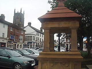
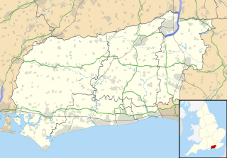
West Sussex is a county in South East England on the English Channel coast. The ceremonial county comprises the shire districts of Adur, Arun, Chichester, Horsham, and Mid Sussex, and the boroughs of Crawley and Worthing. Covering an area of 1,991 square kilometres, West Sussex borders Hampshire to the west, Surrey to the north, and East Sussex to the east. The county town and only city in West Sussex is Chichester, located in the south-west of the county. Administratively the ancient county of Sussex had been divided into 6 rapes with the 3 western rapes being administered separately from the eastern rapes. This was legally formalised with the establishment of West Sussex Council in 1888 but within the ceremonial Sussex. After the reorganisation of local government in 1974, the ceremonially fictions of the historic county of Sussex was divided into two separate counties, with the western half becoming West Sussex and the eastern half East Sussex. The existing East and West Sussex councils taking control respectively, with Mid Sussex and parts of Crawly being transferred to West Sussex administration from East Sussex. In the 2011 census, West Sussex recorded a population of 806,900.
East Grinstead is a town in West Sussex, England, near the East Sussex, Surrey, and Kent borders, 27 miles (43 km) south of London, 21 miles (34 km) northeast of Brighton, and 38 miles (61 km) northeast of the county town of Chichester. The civil parish has an area of 2,443.45 hectares. The population at the 2011 Census was 26,383.

Haywards Heath is a town and civil parish in the Mid Sussex District of West Sussex, within the historic county of Sussex, England.
Pease Pottage is a village in the Mid Sussex District of West Sussex, England. It lies on the southern edge of the Crawley built-up area, in the civil parish of Slaugham.
Pound Hill is a neighbourhood within the town of Crawley in West Sussex, England. Pound Hill is located on the east of Crawley. It is bordered by Three Bridges and Manor Royal to the west and Maidenbower to the south.
Worth, in the context of this article, refers to two separate, though historically linked, entities: a civil Parish in Mid Sussex District of West Sussex, and Worth village, an area within Crawley.

The Roman Catholic Diocese of Arundel and Brighton is a Latin Church Roman Catholic diocese in southern England covering the counties of Sussex and Surrey. The diocese was erected on 28 May 1965 by Pope Paul VI, having previously been a part of the larger Diocese of Southwark, which was elevated to an archdiocese with a new ecclesiastical province on the same date.

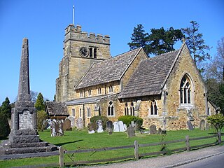
West Hoathly is a village and civil parish in the Mid Sussex District of West Sussex, England, located 3.5 miles (5.6 km) south west of East Grinstead. In the 2001 census 2,121 people, of whom 1,150 were economically active, lived in 813 households. At the 2011 Census the population increased to 2,181. The parish, which has a land area of 2,139 hectares, includes the hamlets of Highbrook, Selsfield Common and Sharpthorne. The mostly rural parish is centred on West Hoathly village, an ancient hilltop settlement in the High Weald between the North and South Downs.

Ashurst Wood is a village and civil parish in the Mid Sussex District of West Sussex, within the historic county of Sussex, England. It is 1 mile (2 km) to the southeast of East Grinstead, just off the A22 arterial road. In 2001, the population was 1,771, increasing to 1,833 at the 2011 Census. Ashurst Wood is within the High Weald Area of Natural Beauty and has an SSSI inside its boundaries. The village has a history of agriculture and farming, and contains a church, village hall, primary school, two public houses, a general shop, post office and several small business premises. There is an independent school on the boundary of the village, called Brambletye School, and a former one, Stoke Brunswick School, which closed in 2009. Bus routes run through the village with destinations of East Grinstead, Crawley and Tunbridge Wells.

Bolney is a village and civil parish in the Mid Sussex district of West Sussex, England. It lies 36 miles (58 km) south of London, 11 miles (18 km) north of Brighton, and 27 miles (43 km) east northeast of the county town of Chichester, near the junction of the A23 road with the A272 road. The parish has a land area of 1479.41 hectares (3654 acres). In the 2001 census there were 1209 people living in 455 households of whom 576 were economically active. At the 2011 Census the population had increased to 1,366. Nearby towns include Burgess Hill to the southeast and Haywards Heath to the east.

The Worth Way is a 7-mile (11 km) footpath and bridleway linking the West Sussex towns of Crawley and East Grinstead via the village of Crawley Down. Mostly following the trackbed of a disused railway the path is an important wildlife corridor. It is part of the National Cycle Network.
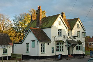
Crawley Down is a village in the Mid Sussex district of West Sussex, England. There is one church, one school, and a number of social groups. It lies seven miles from Gatwick Airport. The next nearest railway stations are Three Bridges and East Grinstead. Crawley Down lies in the northeast corner of West Sussex, just one mile from the border with Surrey.

Felbridge is a village and civil parish in the Tandridge district of Surrey with a playing field within its focal area, narrowly in West Sussex. Felbridge village forms a contiguous settlement with East Grinstead and had 829 homes and households at the time of the 2011 Census. Domewood is part of Felbridge civil parish, which was created in 1953.
Rusper is a village and civil parish in the Horsham District of West Sussex, England. It lies 4.1 miles (6.6 km) north of the town of Horsham and 4.2 miles (6.8 km) west of Crawley. Rusper is the centre of Rusper Parish which covers most of the northern area between Horsham and Crawley. Rusper is governed by the Horsham District Council based in Horsham. The parish population at the 2001 census was 1,389 people.

Colgate is a small village and civil parish in the Horsham district of West Sussex, England, about four miles (6 km) north east of Horsham.

The Rape of Bramber is one of the rapes, the traditional sub-divisions unique to the historic county of Sussex in England. It is the smallest Sussex rape by area. Bramber is a former barony whose original seat was the castle of Bramber and its village, overlooking the river Adur.

Imberdown is an electoral division of West Sussex in the United Kingdom, and returns one member to sit on West Sussex County Council.

West Street Baptist Church is a Baptist church in East Grinstead, a town in the district of Mid Sussex, one of seven local government districts in the English county of West Sussex. Founded in 1810 as a chapel linked to the Countess of Huntingdon's Connexion, it was the first Nonconformist place of worship in East Grinstead; the town's subsequent development made it a local centre of both Protestant Nonconformity and alternative religions. The red-brick building is still used by a Baptist community, and is protected as a Grade II listed building.

