Union City, Oklahoma

Last updated

Union City, Oklahoma
Town
Town Hall Union City Oklahoma 2022.jpg
Union City Town Hall
OKMap-doton-UnionCity.PNG
Location of Union City, Oklahoma
Coordinates: 35°24′05″N97°54′17″W / 35.40139°N 97.90472°W / 35.40139; -97.90472
CountryUnited States
State Oklahoma
County Canadian
Area
[1]
  Total56.59 sq mi (146.55 km2)
  Land56.12 sq mi (145.35 km2)
  Water0.47 sq mi (1.21 km2)
Elevation
[2]
1,316 ft (401 m)
Population
 (2020)
  Total1,794
  Density31.97/sq mi (12.34/km2)
Time zone UTC-6 (Central (CST))
  Summer (DST) UTC-5 (CDT)
ZIP code
73090 [3]
Area code(s) 405, exchange 483
FIPS code 40-75950 [4]
GNIS feature ID2413412 [2]
Website www.unioncityok.gov

Union City is a town in Canadian County, Oklahoma, United States. The population was 1,645 at the 2010 census, a 19.6 percent increase from 1,375 in 2000. [5] It is part of the Oklahoma City metropolitan statistical area.

Contents

History

In 1889, a post office opened for the community of Union. A townsite plat was filed during the following year. Union City began in 1890 with the arrival of the Chicago, Kansas and Nebraska Railway (acquired by the Chicago, Rock Island and Pacific Railroad in 1891). The local economy was based on agriculture, and within four years the town had three grain elevators and a farm machinery dealership. [6]

1973 tornado

On May 24, 1973, a tornado rated F4 struck the Union City area and was the first tornado widely documented by science as part of storm chasing field research. The National Severe Storms Laboratory placed numerous storm chasers around the tornado to capture the life cycle on film. [7]

Geography

Union City is located in southern Canadian County. It is bordered to the east by Oklahoma City, to the north in part by El Reno, and to the south by Grady County, including the town of Minco. The Canadian River forms the county line and the southern boundary of Union City.

U.S. Route 81 passes through the center of the town, leading north 7.5 miles (12.1 km) to Interstate 40 and 10 miles (16 km) to El Reno, while leading south 6 miles (10 km) to Minco. Oklahoma State Highway 152 leads east from Union City 12 miles (19 km) to Mustang. Downtown Oklahoma City is 28 miles (45 km) to the east.

According to the United States Census Bureau, the town of Union City has a total area of 57.1 square miles (147.8 km2), of which 56.6 square miles (146.6 km2) is land, and 0.46 square miles (1.2 km2) (0.83%) is water. [8]

Demographics

Historical population
CensusPop.Note
1950 301
1960 3299.3%
1970 300−8.8%
1980 55886.0%
1990 1,00079.2%
2000 1,37537.5%
2010 1,64519.6%
2020 1,7949.1%
[6]

As of the 2010 United States Census, there were 1,645 people living in the town. [9] The population density was 23.3 people per square mile (10/km2). There were 568 housing units at an average density of 12 per square mile (4/km2). [9] The racial makeup of the town was 91.49% White, 1.75% African American, 2.98% Native American, 0.07% Asian, 0.15% Pacific Islander, 0.65% from other races, and 2.91% from two or more races. Hispanic or Latino of any race were 2.33% of the population.

There were 483 households, out of which 36.9% had children under the age of 18 living with them, 65.0% were married couples living together, 8.1% had a female householder with no husband present, and 21.9% were non-families. 18.0% of all households were made up of individuals, and 6.8% had someone living alone who was 65 years of age or older. The average household size was 2.68 and the average family size was 3.05.

In the town, the population was spread out, with 30.8% under the age of 18, 8.5% from 18 to 24, 26.9% from 25 to 44, 24.9% from 45 to 64, and 8.9% who were 65 years of age or older. The median age was 35 years. For every 100 females, there were 118.6 males. For every 100 females aged 18 and over, there were 104.7 males.

The median income for a household in the town was $40,819, and the median income for a family was $47,417. Males had a median income of $33,646 versus $22,039 for females. The per capita income for the town was $17,020. About 7.4% of families and 8.3% of the population were below the poverty line, including 9.1% of those under age 18 and 9.5% of those age 65 or over.

The Union City Schools building Union City Schools Union City Oklahoma 2022.jpg
The Union City Schools building

Education

The majority of Union City is in the Union City Public Schoolsschool district, [10] which is composed of an elementary and a high school. [11]

Other districts including parts of Union City are Banner Public School and El Reno Public Schools. [10]

Economy

The city's economy is still supported by goods and services for the local agriculture industry. One grain elevator still operates. [6]

Related Research Articles

<span class="mw-page-title-main">Grady County, Oklahoma</span> County in Oklahoma, United States

Grady County is a county located in the U.S. state of Oklahoma. As of the 2020 census, the population was 54,795. Its county seat is Chickasha. It was named for Henry W. Grady, an editor of the Atlanta Constitution and southern orator.

<span class="mw-page-title-main">Canadian County, Oklahoma</span> County in Oklahoma, United States

Canadian County is a county located in the U.S. state of Oklahoma. As of the 2020 census, the population was 154,405, making it the fourth most populous county in Oklahoma. Its county seat is El Reno.

<span class="mw-page-title-main">Udall, Kansas</span> City in Cowley County, Kansas

Udall is a city in Cowley County, Kansas, United States. As of the 2020 census, the population of the city was 661.

<span class="mw-page-title-main">Bridgeport, Oklahoma</span> Town in Oklahoma, United States

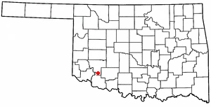
Bridgeport is a town in Caddo County, Oklahoma, United States. The population was 116 at the 2010 census.

<span class="mw-page-title-main">El Reno, Oklahoma</span> City in Oklahoma, United States

El Reno is a city in and county seat of Canadian County, Oklahoma, United States. As of the 2020 census, the city population was 16,989, marking a change of 1.55% from 16,729, recorded in the 2010 census. The city was begun shortly after the 1889 land rush and named for the nearby Fort Reno. It is located in Central Oklahoma, about 25 miles (40 km) west of downtown Oklahoma City.

<span class="mw-page-title-main">Lone Grove, Oklahoma</span> City in Oklahoma, United States

Lone Grove is a city in Carter County, Oklahoma, United States. The population was 5,054 at the 2010 census. It is part of the Micropolitan Statistical Area of Ardmore.

<span class="mw-page-title-main">Sawyer, Oklahoma</span> Town in Oklahoma, United States

Sawyer is a town in Choctaw County, Oklahoma, United States. The population was 321 at the 2010 census.

<span class="mw-page-title-main">Alex, Oklahoma</span> Town in Oklahoma, United States

Alex is a town in Grady County, Oklahoma, United States. The population was 482 at the 2020 census.

<span class="mw-page-title-main">Minco, Oklahoma</span> City in Oklahoma, United States

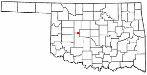
Minco is a city in Grady County, Oklahoma, United States. The population was 1,500 at the 2020 census, a 8.1% decrease from 2010.

<span class="mw-page-title-main">Pocasset, Oklahoma</span> Town in Oklahoma, United States

Pocasset is a town in Grady County, Oklahoma, United States. The population was 183 at the 2020 census, a 17.3% increase from 2010.

<span class="mw-page-title-main">Snyder, Oklahoma</span> City in Oklahoma, United States

Snyder is a city in Kiowa County, Oklahoma, United States. The population was 1,394 at the 2010 census. This figure represented a decline of 7.6 percent from 1,509 persons in 2000.

<span class="mw-page-title-main">Orlando, Oklahoma</span> Town in Oklahoma, United States

Orlando is a town in Logan and Payne counties in the U.S. state of Oklahoma. The population was 148 at the 2010 census, compared to the figure of 201 in 2000. It is part of the Oklahoma City Metropolitan Statistical Area.

<span class="mw-page-title-main">Madill, Oklahoma</span> City in Oklahoma, United States

Madill is a city in and the county seat of Marshall County, Oklahoma, United States. It was named in honor of George Alexander Madill, an attorney for the St. Louis-San Francisco Railway. The population at the 2010 census was 3,770, an increase of 10.8 percent from 3,410 at the 2000 census. It is best known as the site of the annual National Sand Bass Festival. It is part of the Texoma region.

<span class="mw-page-title-main">Newcastle, Oklahoma</span> City in Oklahoma, United States

Newcastle is a city in McClain County, Oklahoma, United States, and part of the Oklahoma City Metropolitan Area. The population was 10,984 at the 2020 census.

<span class="mw-page-title-main">Westport, Oklahoma</span> Town in Oklahoma, United States

Westport is a town in Pawnee County, Oklahoma, United States. The population was 298 at the 2010 census, a gain of 12.9 percent over the figure of 264 in 2000.

<span class="mw-page-title-main">Bethel Acres, Oklahoma</span> Town in Oklahoma, United States

Bethel Acres is a town in Pottawatomie County, Oklahoma, United States. The population was 2,895 at the time of the 2010 census, an increase of 5.9 percent from the figure of 2,735 in 2000. It is primarily a bedroom community for people who work in the three nearby larger cities of Shawnee, Tecumseh and Oklahoma City.

<span class="mw-page-title-main">Timber Lake, South Dakota</span> City in South Dakota, United States

Timber Lake is a city in and the county seat of Dewey County, South Dakota, United States. The population was 509 at the 2020 census.

<span class="mw-page-title-main">Gruver, Texas</span> City in Texas, United States

Gruver is a city in Hansford County, Texas, United States. The population was 1,130 at the 2020 census. Farwell, in the center of Hansford County, approximately three miles east of what became Gruver, was established in 1880 by the Canott family of Illinois, and was the first town in the county. Gruver was established shortly after, and Farwell rapidly fell into oblivion after 1889, when it lost a county seat election to Hansford.

<span class="mw-page-title-main">Geary, Oklahoma</span> City in Oklahoma, United States

Geary is a city in Blaine and Canadian counties in the U.S. state of Oklahoma. The population was 994 at the 2020 census. The town was named for Edmund Guerrier, a scout and an interpreter for the U.S. Army.

<span class="mw-page-title-main">Piedmont, Oklahoma</span> City in Oklahoma, United States

Piedmont is a city primarily in Canadian County, Oklahoma, United States, though a small part of it is in Kingfisher County. It is a part of the Oklahoma City Metropolitan Area. The population was 5,720 at the 2010 census, a 56.7 percent increase from 3,650 in 2000. Piedmont is a home rule city served by a council–manager government.

References

  1. "ArcGIS REST Services Directory". United States Census Bureau. Retrieved September 20, 2022.
  2. 1 2 U.S. Geological Survey Geographic Names Information System: Union City, Oklahoma
  3. United States Postal Service (2012). "USPS - Look Up a ZIP Code" . Retrieved February 15, 2012.
  4. "U.S. Census website". United States Census Bureau . Retrieved January 31, 2008.
  5. Census Viewer:Union City (corporate and RR name for Union), Oklahoma Population Retrieved October 10, 2013.
  6. 1 2 3 Savage, Cynthia. "Union City," Encyclopedia of Oklahoma History and Culture, Oklahoma Historical Society. Accessed April 18, 2015.
  7. Union City Tornado Makes History
  8. "Geographic Identifiers: 2010 Demographic Profile Data (G001): Union City town, Oklahoma". U.S. Census Bureau, American Factfinder. Archived from the original on February 10, 2015. Retrieved February 6, 2015.
  9. 1 2 "2010 City Population and Housing Occupancy Status". U.S. Census Bureau. Retrieved October 18, 2013.[ dead link ]
  10. 1 2 "2020 CENSUS - SCHOOL DISTRICT REFERENCE MAP: Canadian County, OK" (PDF). U.S. Census Bureau. pp. 7, 10-11 (PDF pp. 8, 11-12/13). Retrieved January 28, 2024. - Text list
  11. "Home". unioncity.k12.ok.us. Retrieved February 1, 2014.