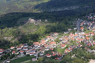
Flossenbürg is a municipality in the district of Neustadt an der Waldnaab in Bavaria in Germany. The state-approved leisure area is located in the Bavarian Forest and borders Bohemia in the east. During World War II, the Flossenbürg concentration camp was located here.

Altenstadt an der Waldnaab is a municipality in the district of Neustadt an der Waldnaab in Bavaria, Germany. It is situated on the river Waldnaab, 2 km (1.2 mi) southeast of Neustadt an der Waldnaab, and 5 km (3.1 mi) north of Weiden in der Oberpfalz. Bundesautobahn 93 passes west of Altenstadt. It has a railway station on the Weiden–Oberkotzau railway.

Baar is a municipality in Aichach-Friedberg district, in Bavaria, southern Germany.

Warngau is a municipality in the Miesbach District of Bavaria, Germany. It is located at 47°50′N11°44′E and has a population of 3,489.
Thurnau is a municipality in the district Kulmbach, Germany.

Karlsfeld is a municipality in the district of Dachau, in Bavaria, Germany. During World War II, it was the location of a subcamp of Dachau concentration camp.

Marktleuthen is a municipality in the district of Wunsiedel, in Bavaria, Germany. It is situated on the river Eger, 10 km north of Wunsiedel and 11 km southwest of Selb.

Oberdachstetten is a municipality in the district of Ansbach in Bavaria in Germany.

Dinkelscherben is a municipality in the district of Augsburg in Bavaria in Germany. Fleinhausen, Anried, Breitenbronn, Ettelried, Grünenbaindt, Häder, Lindach, Oberschöneberg and Ried are villages that make up the municipality of Dinkelscherben.

Weidenberg is a municipality in the district of Bayreuth in Bavaria in Germany. The Ölschnitz river discharges near Weidenberg-Neunkirchen into the Red Main.

Blaibach is a municipality in the district of Cham in Bavaria in Germany.
Spiegelau is a municipality in the district of Freyung-Grafenau in Bavaria in Germany. It lies in the heart of the Bavarian Forest.
Saulgrub is a municipality in the district of Garmisch-Partenkirchen, in Bavaria, Germany.

Dürrlauingen is a municipality in the district of Günzburg in Bavaria in Germany.

Mühlhausen is a municipality in the district of Neumarkt in Bavaria in Germany. It lies in the Sulz River valley.

Schwaig is a municipality in the district of Nürnberger Land in Bavaria in Germany.
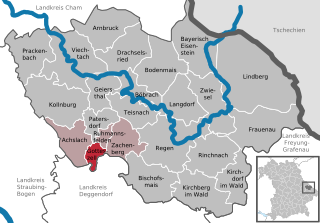
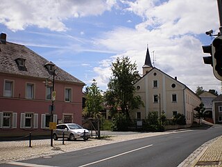
Gotteszell is a municipality in the district of Regen in Bavaria in Germany.
Schirnding is a municipality in the district of Wunsiedel in Bavaria in Germany. Schirnding station is a border station on the Nuremberg–Cheb railway.

Buxheim is a municipality in the district of Unterallgäu in Bavaria, Germany.

Stetten is a municipality in the district of Unterallgäu in Bavaria, Germany. The town has a municipal association with Dirlewang.


