A disaster is a serious problem that happens over a period of time and causes so much harm to people, things, economies, or the environment that the affected community or society cannot handle it on its own. In theory, natural disasters are those caused by natural hazards, whereas human-made disasters are those caused by human hazards. However, in modern times, the divide between natural, human-made or human-accelerated disasters is more and more difficult to draw. In fact, all disasters can be seen as human-made, due to human failure to introduce appropriate emergency management measures.

An earthquake – also called a quake, tremor, or temblor – is the shaking of the Earth's surface resulting from a sudden release of energy in the lithosphere that creates seismic waves. Earthquakes can range in intensity, from those so weak they cannot be felt, to those violent enough to propel objects and people into the air, damage critical infrastructure, and wreak destruction across entire cities. The seismic activity of an area is the frequency, type, and size of earthquakes experienced over a particular time. The seismicity at a particular location in the Earth is the average rate of seismic energy release per unit volume.

A natural disaster is the highly harmful impact on a society or community following a natural hazard event. Some examples of natural hazard events include: flooding, drought, earthquake, tropical cyclone, lightning, tsunami, volcanic activity, wildfire. A natural disaster can cause loss of life or damage property, and typically leaves economic damage in its wake. The severity of the damage depends on the affected population's resilience and on the infrastructure available. Scholars have been saying that the term natural disaster is unsuitable and should be abandoned. Instead, the simpler term disaster could be used, while also specifying the category of hazard. A disaster is a result of a natural or human-made hazard impacting a vulnerable community. It is the combination of the hazard along with exposure of a vulnerable society that results in a disaster.

A seismic hazard is the probability that an earthquake will occur in a given geographic area, within a given window of time, and with ground motion intensity exceeding a given threshold. With a hazard thus estimated, risk can be assessed and included in such areas as building codes for standard buildings, designing larger buildings and infrastructure projects, land use planning and determining insurance rates. The seismic hazard studies also may generate two standard measures of anticipated ground motion, both confusingly abbreviated MCE; the simpler probabilistic Maximum Considered Earthquake, used in standard building codes, and the more detailed and deterministic Maximum Credible Earthquake incorporated in the design of larger buildings and civil infrastructure like dams or bridges. It is important to clarify which MCE is being discussed.

Seismic risk or earthquake risk is the potential impact on the built environment and on people's well-being due to future earthquakes. Seismic risk has been defined, for most management purposes, as the potential economic, social and environmental consequences of hazardous events that may occur in a specified period of time. A building located in a region of high seismic hazard is at lower risk if it is built to sound seismic engineering principles. On the other hand, a building located in a region with a history of minor seismicity, in a brick building located on fill subject to liquefaction can be as high or higher risk.

Earthquake insurance is a form of property insurance that pays the policyholder in the event of an earthquake that causes damage to the property. Most ordinary homeowners insurance policies do not cover earthquake damage.
Peak ground acceleration (PGA) is equal to the maximum ground acceleration that occurred during earthquake shaking at a location. PGA is equal to the amplitude of the largest absolute acceleration recorded on an accelerogram at a site during a particular earthquake. Earthquake shaking generally occurs in all three directions. Therefore, PGA is often split into the horizontal and vertical components. Horizontal PGAs are generally larger than those in the vertical direction but this is not always true, especially close to large earthquakes. PGA is an important parameter for earthquake engineering, The design basis earthquake ground motion (DBEGM) is often defined in terms of PGA.
Induced seismicity is typically earthquakes and tremors that are caused by human activity that alters the stresses and strains on Earth's crust. Most induced seismicity is of a low magnitude. A few sites regularly have larger quakes, such as The Geysers geothermal plant in California which averaged two M4 events and 15 M3 events every year from 2004 to 2009. The Human-Induced Earthquake Database (HiQuake) documents all reported cases of induced seismicity proposed on scientific grounds and is the most complete compilation of its kind.

Architecture of Turkey or Turkish architecture in the republican period is the architecture practised in Turkey since the foundation of the republic in 1923. In the first years of the republic, Turkish architecture was influenced by Seljuk and Ottoman architecture, in particular during the First National Architectural Movement. However, starting from the 1930s, architectural styles began to differ from traditional architecture, also as a result of an increasing number of foreign architects being invited to work in the country, mostly from Germany and Austria. The Second World War was a period of isolation, during which the Second National Architectural Movement emerged. Similar to Fascist architecture, the movement aimed to create a modern but nationalistic architecture.

The 1999 İzmit earthquake was a magnitude 7.6 earthquake which struck the Kocaeli Province of Turkey on 17 August 1999. Between 17,127 and 18,373 people died as a result, and it caused an estimated US $6.5 billion in damage. It was named for the quake's proximity to the northwestern city of İzmit. The earthquake occurred at 03:01 local time at a shallow depth of 15 km. A maximum Mercalli intensity of X (Extreme) was observed. The earthquake lasted for 37 seconds, causing seismic damage, and is widely remembered as one of the deadliest natural disasters in modern Turkish history.

The architecture of Istanbul describes a large mixture of structures which reflect the many influences that have made an indelible mark in all districts of the city. The ancient part of the city is still partially surrounded by the Walls of Constantinople, erected in the 5th century by Emperor Theodosius II to protect the city from invasion. The architecture inside the city proper contains buildings and structures which came from Byzantine, Genoese, Ottoman, and modern Turkish sources. The city has many architecturally significant entities. Throughout its long history, Istanbul has acquired a reputation for being a cultural and ethnic melting pot. As a result, there are many historical mosques, churches, synagogues, palaces, castles and towers to visit in the city.

The following is a summary of significant earthquakes during the 21st century. In terms of fatalities, the 2004 Indian Ocean earthquake was the most destructive event with 227,898 confirmed fatalities, followed by the 2010 Haiti earthquake with about 160,000 fatalities, the 2008 Sichuan earthquake with 87,587 fatalities, the 2005 Kashmir earthquake with 87,351 fatalities, and the 2023 Turkey–Syria earthquakes with at least 59,488 fatalities.

The Global Earthquake Model (GEM) is a public–private partnership initiated in 2006 by the Global Science Forum of the OECD to develop global, open-source risk assessment software and tools. With committed backing from academia, governments and industry, GEM contributes to achieving profound, lasting reductions in earthquake risk worldwide by following the priorities of the Hyogo Framework for Action. From 2009 to 2013 GEM is constructing its first working global earthquake model and will provide an authoritative standard for calculating and communicating earthquake risk worldwide.

A hazard is a potential source of harm. Substances, events, or circumstances can constitute hazards when their nature would allow them, even just theoretically, to cause damage to health, life, property, or any other interest of value. The probability of that harm being realized in a specific incident, combined with the magnitude of potential harm, make up its risk, a term often used synonymously in colloquial speech.

A hazard map is a map that highlights areas that are affected by or are vulnerable to a particular hazard. They are typically created for natural hazards, such as earthquakes, volcanoes, landslides, flooding and tsunamis. Hazard maps help prevent serious damage and deaths.
Seismic codes or earthquake codes are building codes designed to protect property and life in buildings in case of earthquakes. The need for such codes is reflected in the saying, "Earthquakes don't kill people—buildings do." Or in expanded version, “Earthquakes do not injure or kill people. Poorly built manmade structures injure and kill people.”
GeoHazards International (GHI) is a 501(c)(3) non-profit organization dedicated to ending preventable death and suffering caused by natural disasters in the world's most vulnerable communities. Founded in 1991, GHI is the first non-profit, nongovernmental organization dedicated to mitigating earthquake, tsunami, and landslide risks in the world's poorest and most at-risk regions. Its solutions emphasize preparedness, mitigation, and building local capacity in order to manage risk.

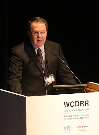
Omar-Darío Cardona Arboleda is a civil engineer, academic, and author. He is a Titular Professor of integrated disaster risk management and climate change adaptation in the Institute of Environment Studies at the National University of Colombia, Co-founder, and CEO of Ingeniar: Risk Intelligence.


