
The Cottian Alps are a mountain range in the southwestern part of the Alps. They form the border between France and Italy (Piedmont). The Fréjus Road Tunnel and Fréjus Rail Tunnel between Modane and Susa are important transportation arteries between France and Italy (Turin).

Col Agnel is a mountain pass in the Cottian Alps, west of Monte Viso between France and Italy which links the Queyras valley (Hautes-Alpes) with Pontechianale in the province of Cuneo, Piedmont.

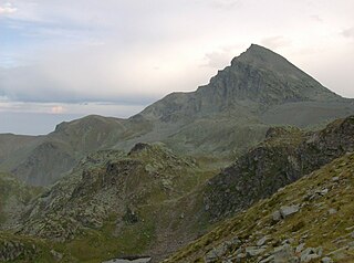
Monte Viso or Monviso is the highest mountain of the Cottian Alps. It is located in Italy close to the French border. Monte Viso is well known for its pyramid-like shape. Because it is higher than all its neighbouring peaks by about 500 m, it can be seen from a great distance, including from the Piedmontese plateau, the Langhe, the Theodulpass in the Zermatt ski area, the col du Galibier and the summits of the Mont Blanc massif. On a very clear day, it can be seen from the spires of Milan Cathedral.

Bellino is a comune (municipality) in the Province of Cuneo in the Italian region Piedmont, located about 80 kilometres (50 mi) southwest of Turin and about 45 kilometres (28 mi) northwest of Cuneo, on the border with France. It is located in the upper Varaita Valley.

The Varaita is a 75-kilometre (47 mi) river of the Province of Cuneo in northwest Italy. It is the first right tributary of the Po River.

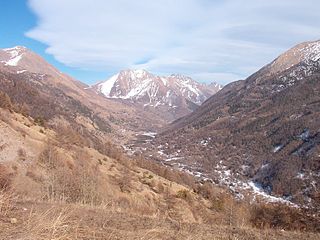
The Valle Po is a valley of the Cottian Alps in the province of Cuneo, Piedmont, Northern Italy.
The Val Chisone is one of the Occitan valleys of western Piedmont, situated in the Cottian Alps in the Metropolitan City of Turin in north-west Italy.
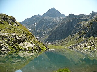
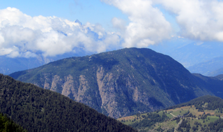
Monte Granero is a peak in the Cottian Alps, in western Piedmont, northern Italy. It has an elevation of 3,170 m. It is located between the Val Pellice and the Valle Po, not far from the boundary with France.

Monte Meidassa is a peak in the Cottian Alps, in western Piedmont, northern Italy. The slightly higher Monte Granero is located nearby.
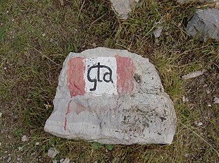
The Grande Traversata delle Alpi (GTA) is a long-distance hiking trail in the Italian region of Piedmont. In about 1,000 kilometres (620 mi) and 55 day hikes, it runs through the arc formed by the western Alps from the Pennine Alps through the Graian and Cottian Alps to the Maritime and Ligurian Alps. There are a number of transverse valleys along the route. Day hikes typically connect high-lying valley communities with each other via historic pass routes.

The Lanzo Valleys is a group of three valleys in the north-west of Piedmont in the Metropolitan City of Turin, Italy. They are located in the Graian Alps of Piedmont, between the Valle dell'Orco to the north and the Val di Susa to the south. Crossed by various streams which in each valley is called Stura and which flow into the river Stura di Lanzo, the valleys take their name from the town of Lanzo, located on an ancient glacial moraine at the end of the valleys.

Maira Valley is a valley in south-west of Piedmont in the Province of Cuneo, Italy.

The Stura di Demonte Valley is a valley in south-west of Piedmont in the Province of Cuneo, Italy.
The Viso Mozzo is a 3,019 metres high mountain on the Italian side of the Cottian Alps.

The Cima Mongioia or simply Mongioia or Bric de Rubren is a 3,340 metres high mountain of the Cottian Alps.

The Punta Nera is a mountain of Savoie (France) and of the Province of Turin (Italy). It lies in the Cottian Alps range. It has an elevation of 3,047 metres above sea level.
The Testa di Comagna is a 2,106 metres high peak on the Italian side of the Pennine Alps.

The Monte Birrone is a 2,131-metre (6,991 ft) high mountain in the Cottian Alps, belonging to the Italian province of Cuneo.

Visolotto is a 3,348 m high mountain in the Cottian Alps, located in Piedmont, north of Monviso.

Mount Ferra is a mountain in the Cottian Alps, rising in Italian territory in the upper Varaita Valley, in the province of Cuneo, between the towns of Bellino and Pontechianale.
This page is based on this
Wikipedia article Text is available under the
CC BY-SA 4.0 license; additional terms may apply.
Images, videos and audio are available under their respective licenses.

