Vauxhall, New Jersey

Last updated

Vauxhall, New Jersey
Location map of Union County, New Jersey.svg
Red pog.svg
Vauxhall
Location in Union County
USA New Jersey relief location map.svg
Red pog.svg
Vauxhall
Location in New Jersey
Usa edcp relief location map.png
Red pog.svg
Vauxhall
Location in the United States
Coordinates: 40°43′06″N74°17′03″W / 40.71833°N 74.28417°W / 40.71833; -74.28417
Country Flag of the United States.svg  United States
State Flag of New Jersey.svg  New Jersey
County Union
Township Union
Area
[1]
  Total0.59 sq mi (1.52 km2)
  Land0.59 sq mi (1.52 km2)
  Water0.00 sq mi (0.00 km2)
Elevation
190 ft (58 m)
Population
 (2020) [2]
  Total5,251
  Density8,915.11/sq mi (3,443.77/km2)
ZIP Code
07088 [3]
FIPS code 34-75590 [4]
GNIS feature ID0881436 [5]

Vauxhall is an unincorporated community and census-designated place (CDP) [6] located within Union Township in Union County, in the U.S. state of New Jersey. [7] Vauxhall borders Millburn, Maplewood and Springfield. The area is served as United States Postal Service ZIP Code 07088. [8]

Contents

As of the 2010 United States Census, the population for ZIP Code Tabulation Area 07088 was 3,606. [9]

Vauxhall is home to The Home Depot Superstore, that at 217,000 square feet (20,200 m2) was the chain's largest store in the world as of 2012. [10]

Demographics

Historical population
CensusPop.Note
2020 5,251
U.S. Decennial Census [11]

Notable people

People who were born in, residents of, or otherwise closely associated with Vauxhall include:

Related Research Articles

<span class="mw-page-title-main">Union Township, Union County, New Jersey</span> Township in Union County, New Jersey, United States

Union Township is a township in Union County, in the U.S. state of New Jersey. In the 18th century, the area that is now Union was then called Connecticut Farms. As of the 2020 United States census, the township's population was 59,728, an increase of 3,086 (+5.4%) from the 2010 census count of 56,642, which in turn reflected an increase of 2,237 (+4.1%) from the 54,405 counted in the 2000 census.

<span class="mw-page-title-main">Amalya Lyle Kearse</span> American judge

Amalya Lyle Kearse is a senior United States circuit judge of the United States Court of Appeals for the Second Circuit and a world-class bridge player.

<span class="mw-page-title-main">Cookstown, New Jersey</span> Place in Burlington County, New Jersey, United States

Cookstown is an unincorporated community and census-designated place (CDP) located within New Hanover Township in Burlington County, in the U.S. state of New Jersey. Located near Fort Dix, the area is served as United States Postal Service ZIP Code 08511.

<span class="mw-page-title-main">Newport, Cumberland County, New Jersey</span> Populated place in Cumberland County, New Jersey, US

Newport is an unincorporated community and census-designated place (CDP) located within Downe Township in Cumberland County, in the U.S. state of New Jersey. The area is served as United States Postal Service ZIP Code 08345.

Kirkwood is an unincorporated community located within Voorhees Township in Camden County, in the U.S. state of New Jersey. Kirkwood once had a post office assigned United States Postal Service ZIP Code 08043. The ZIP Code has been reassigned to a post office named Voorhees that serves the entire township. Kirkwood is still a valid city name for mailing purposes.

<span class="mw-page-title-main">Layton, New Jersey</span> Populated place in Sussex County, New Jersey, US

Layton is an unincorporated community and census-designated place (CDP) located within Sandyston Township in Sussex County, in the U.S. state of New Jersey. The area is served as United States Postal Service ZIP Code 07851.

<span class="mw-page-title-main">Towaco, New Jersey</span> Populated place in Morris County, New Jersey, US

Towaco is an unincorporated community and census-designated place (CDP) located within Montville Township in Morris County, in the U.S. state of New Jersey. The area is served as United States Postal Service ZIP Code 07082. Its name reflects the Native American history in the area, which identified the locale as TaWagh, meaning "hill", a reference to the terrain of Towaco.

<span class="mw-page-title-main">Stirling, New Jersey</span> Populated place in Morris County, New Jersey, US

Stirling is an unincorporated community and census-designated place (CDP) located within Long Hill Township in Morris County, in the U.S. state of New Jersey. The area is served as United States Postal Service ZIP Code 07980.

<span class="mw-page-title-main">Parlin, New Jersey</span> Place in Middlesex County, New Jersey, United States

Parlin is an unincorporated community located within Old Bridge Township and Sayreville Borough in Middlesex County, New Jersey, United States. The area is served as United States Postal Service ZIP Code 08859.

<span class="mw-page-title-main">Pittstown, New Jersey</span> Place in Hunterdon County, New Jersey, United States

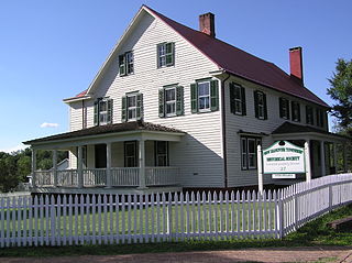
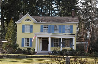
Pittstown is an unincorporated community located at the intersection of the boundaries of Alexandria, Franklin and Union townships in Hunterdon County, New Jersey. The area is named after William Pitt. The area is served as United States Postal Service ZIP Code 08867. The area was named Hofftown in the 18th century after landowner Lawrence Hoff. The Pittstown Historic District was listed on the state and national registers of historic places in 1990.

<span class="mw-page-title-main">Bayville, New Jersey</span> Place in Ocean County, New Jersey, United States

Bayville is an unincorporated community located within Berkeley Township in Ocean County, New Jersey, United States. The area is served as United States Postal Service ZIP Code 08721. As of the 2010 United States Census, the population for ZIP Code Tabulation Area (ZCTA) 08721 was 20,512. Central Regional High School is the local high school for the area.

New Gretna is an unincorporated community and census-designated place (CDP) located within Bass River Township in Burlington County, in the U.S. state of New Jersey. The area is served as United States Postal Service ZIP Code 08224.

West Berlin is an unincorporated community and census-designated place (CDP) located within Berlin Township in Camden County, in the U.S. state of New Jersey. The area is served as United States Postal Service ZIP Code 08091.

Dorothy is an unincorporated community and census-designated place located in Weymouth Township in Atlantic County, in the U.S. state of New Jersey. The area is served as United States Postal Service ZIP Code 08317.

Monroeville is an unincorporated community located within portions of Elk Township in Gloucester County and Upper Pittsgrove Township in Salem County, in the U.S. state of New Jersey. The area is served as United States Postal Service ZIP Code 08343. Monroeville is mostly filled with wooded areas and farms.

<span class="mw-page-title-main">Harrisonville, New Jersey</span> Populated place in Gloucester County, New Jersey, US

Harrisonville is an unincorporated community and census-designated place (CDP) located within South Harrison Township, in Gloucester County, in the U.S. state of New Jersey. The area is served as United States Postal Service ZIP Code 08039.

<span class="mw-page-title-main">West Allenhurst, New Jersey</span> Place in Monmouth County, New Jersey, United States

West Allenhurst is an unincorporated community located within Ocean Township in Monmouth County, New Jersey, United States. The area is served as United States Postal Service ZIP code 07711. As of the 2000 United States Census, the population for ZIP Code Tabulation Area 07711 was 1,934. West Allenhurst is bordered by Allenhurst to the east, Deal to the northeast, and Interlaken to the south. Major arterial roads in the community are the east-west Corlies Avenue and the north-south Monmouth Road.

<span class="mw-page-title-main">Birmingham, New Jersey</span> Populated place in Burlington County, New Jersey, US

Birmingham is an unincorporated community located within Pemberton Township in Burlington County, in the U.S. state of New Jersey. As of the 2010 United States Census, the ZIP Code Tabulation Area for ZIP Code 08011 had a population of 33. Though sparsely populated, it houses a post office and a Lanxess chemical facility.

Allaire is an unincorporated community located within Wall Township in Monmouth County, in the U.S. state of New Jersey. As of the 2010 United States Census, the ZIP Code Tabulation Area for ZIP Code 07727 had a population of 7,050.

<span class="mw-page-title-main">Myra Smith Kearse</span>

Myra Smith Kearse was an American physician and community leader in New Jersey.

References

  1. "ArcGIS REST Services Directory". United States Census Bureau. Retrieved October 11, 2022.
  2. "Census Population API". United States Census Bureau. Retrieved October 11, 2022.
  3. Look Up a ZIP Code for Vauxhall, NJ, United States Postal Service. Accessed January 12, 2013.
  4. Geographic Codes Lookup for New Jersey, Missouri Census Data Center. Accessed June 9, 2023.
  5. "Vauxhall". Geographic Names Information System . United States Geological Survey, United States Department of the Interior . Retrieved September 22, 2012.
  6. State of New Jersey Census Designated Places - BVP20 - Data as of January 1, 2020, United States Census Bureau. Accessed December 1, 2022.
  7. Locality Search, State of New Jersey. Accessed June 9, 2016. Listed as Vaux Hall.
  8. Look Up a ZIP Code for Vauxhall, NJ, United States Postal Service. Accessed April 23, 2012.
  9. DP-1 Profile of General Population and Housing Characteristics: 2010; 2010 Demographic Profile Data for ZCTA 07088 Archived 2020-02-12 at archive.today , United States Census Bureau. Accessed April 23, 2012.
  10. Liddane, Lisa. "The Home Depot opens its first Superstore in the West", The Orange County Register , April 5, 2012. Accessed March 8, 2022. "The store, called The Home Depot Superstore, was remodeled and expanded to 205,000 square feet – about one-third larger than a typical Home Depot. Those proportions make it the Atlanta-based home improvement chain’s largest store in the West and the second largest Home Depot in the nation. The Union, N.J., superstore is the largest at 217,000 square feet."
  11. "Census of Population and Housing". Census.gov. Retrieved June 4, 2016.
  12. Cryan, Kathy. "Union Native, Grammy Award Songwriter Nija Charles Comes Home; Surprised with Street Named Dedication", TAP into Union, October 28, 2020. Accessed October 6, 2022. "A surprise awaited 2015 Union High School graduate and two-time Grammy Award winner Nija Charles when she appeared with family and friends near her childhood home at the corner of Revere and Laurel Avenues in Vauxhall Tuesday afternoon."
  13. Goldstein, Tom. "Amalya Lyle Kearse; Woman in the News", The New York Times , June 25, 1979. Accessed February 23, 2012. "Amalya Lyle Kearse was born June 11, 1937, in Vauxhall, N.J. where her late father was postmaster and her mother first practiced medicine and then became an antipoverty official."
  14. The Women's Project of New Jersey. "Myra Smith Kearse" in Past and Promise: Lives of New Jersey Women, p. 336. Syracuse University Press, 1997. ISBN   9780815604181. Accessed June 13, 2020. "Kearse was active until February 14, 1982, when she died of cardiac arrest at her hem in Vauxhall at age 82."
  15. Kaplan, Ron. "Today I am a baseball bat." Archived 2017-11-23 at the Wayback Machine , New Jersey Jewish News , 2004. Accessed November 12, 2013. "'Once I started playing Little League, most of my friends were either Jewish or black,' said Maddox, who grew up in Vauxhall, a predominantly African-American section of Union."
  16. Colonel (Retired) Lawrence E. Roberts, Keesler Air Force Base. Accessed February 10, 2021. "Lawrence E. Roberts was born December 9, 1922 in Vauxhall, New Jersey."