Vaynor (Welsh: Y Faenor, meaning "The Manor") is a village and community (formerly a parish) in Merthyr Tydfil County Borough in Wales, United Kingdom. The population of the community at the 2011 census was 3,551. [1]
Contents

Vaynor (Welsh: Y Faenor, meaning "The Manor") is a village and community (formerly a parish) in Merthyr Tydfil County Borough in Wales, United Kingdom. The population of the community at the 2011 census was 3,551. [1]
It is about four miles north of the town of Merthyr Tydfil and is within the borders of the Brecon Beacons National Park.
The community includes the three villages of Cefn-coed-y-cymmer, Trefechan and Pontsticill as well as Pontsarn and Vaynor. To the west are Nant Glais Caves. It also includes the southern section of Pontsticill Reservoir and the eastern end of Llwyn-On Reservoir.
Until 1974, the village was a civil parish in the Vaynor and Penderyn Rural District of Brecknockshire. From 1974 to 1996, it was part of Merthyr Tydfil district in Mid Glamorgan. [2] It is notable for its connections with the Ironmaster Robert Crawshay, owner of the world's first ironworks at Cyfarthfa, who is buried in Vaynor churchyard.
Between 1973 and 1996 Vaynor was an electoral ward to Merthyr Tydfil District Council, initially electing three district councillors. [3] Subsequently, Vaynor became a ward to Merthyr Tydfil County Borough Council, electing two (generally Independent) county councillors. [4]

Until 1974, Brecknockshire, also formerly known as the County of Brecknock, Breconshire, or the County of Brecon, was an administrative county in the south of Wales, later classed as one of the thirteen historic counties of Wales. Named after its county town of Brecon, the county was mountainous and primarily rural.

Merthyr Tydfil is the main town in Merthyr Tydfil County Borough, Wales, administered by Merthyr Tydfil County Borough Council. It is about 23 miles (37 km) north of Cardiff. Often called just Merthyr, it is said to be named after Tydfil, daughter of King Brychan of Brycheiniog, who according to legend was slain at Merthyr by pagans about 480 CE. Merthyr generally means "martyr" in modern Welsh, but here closer to the Latin martyrium: a place of worship built over a martyr's relics. Similar place names in south Wales are Merthyr Cynog, Merthyr Dyfan and Merthyr Mawr.

Mid Glamorgan is a preserved county of Wales. From 1974 until 1996 it was also an administrative county with a county council.

Merthyr Tydfil and Rhymney is a constituency represented in the House of Commons of the UK Parliament since 2015 by Gerald Jones of the Welsh Labour Party. It was established for the 1983 general election.

Penywaun is a community, electoral ward and north-western suburb of Aberdare in the Cynon Valley within the county borough of Rhondda Cynon Taf, Wales. At the 2011 census, the population of the ward was registered as 3,063.

Troed-y-rhiw is a large community village in the county borough of Merthyr Tydfil, Wales. Its population at the 2011 census was 5,296. It features the Troed-y-rhiw railway station.

Treharris is a small town and community in the Taff Bargoed Valley in the south of Merthyr Tydfil County Borough, South Wales. It is located about 0.6 miles (1.0 km) west of Trelewis, from which it is separated by the Taff Bargoed river, and 0.9 miles (1.4 km) from Nelson in Caerphilly county borough and has a population of 6,356 from the 2011 Census. As a community, Treharris includes the villages of Quakers Yard and Edwardsville. Due to steepness and narrowness of both the Taff and Taff Bargoed valleys at Treharris several notable bridges and viaducts have been built in the area.

Gelligaer is a community in the County Borough of Caerphilly, Wales, in the Rhymney River valley. As well as the village of Gelligaer, the community also includes the small towns of Hengoed and Ystrad Mynach. The population of the community at the 2011 census was 18,408.
Merthyr Tydfil County Borough Council is the governing body for Merthyr Tydfil County Borough, one of the Principal Areas of Wales.

Dowlais is a village and community of the county borough of Merthyr Tydfil, in Wales. At the 2011 census the electoral ward had a population of 6,926, The population of the Community being 4,270 at the 2011 census having excluded Pant. Dowlais is notable within Wales and Britain for its historic association with ironworking; once employing, through the Dowlais Iron Company, over 7,000 people, the works being the largest in the world at one stage.
Penydarren is a community and electoral ward in Merthyr Tydfil County Borough in Wales.

Pontsticill is a village within the County Borough of Merthyr Tydfil in South Wales. It lies within the valley of the Taf Fechan on the southern edge of the Brecon Beacons National Park. The village lies within the community of Vaynor in an area that was, until the local government re-organisation of 1974, within the historic county of Brecknockshire.

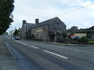
Cefn-coed-y-cymmer is a small community on the northwestern edge of Merthyr Tydfil County Borough in Wales. It is situated in the neck of land between the rivers Taf Fawr and Taf Fechan at their confluence. The village lies within the community of Vaynor. Immediately to the north of the village is the hill of Cefn Cil Sanws on the southern slopes of which is Merthyr Tydfil Golf Club. The village is bounded both to the north and the west by the Brecon Beacons National Park.
Park is a community and electoral ward of the county borough of Merthyr Tydfil, in Wales.
Laleston is a village and a community in Bridgend County Borough, south Wales, directly west of Bridgend town centre. The village takes its name from the Norman Lageles family who settled in the area. Buildings of note in the village include St David's Church, which still possesses features dating back to the 13th and 14th centuries, the Great House which was built in the early 16th century and Horeb Welsh Presbyterian Church (1831).

Merthyr Tydfil County Borough is a county borough in the south-east of Wales. In mid 2018, it had an estimated population of 60,183 making it the smallest local authority in Wales by both population and land area. It is located in the historic county of Glamorgan and takes its name from the town with the same name. The county borough consists of the northern part of the Taff Valley and the smaller neighbouring Taff Bargoed Valley. It borders the counties of Rhondda Cynon Taf to the west, Caerphilly County Borough to the east, and Powys to the north.
Town is the name of a local government community and electoral ward in the town of Merthyr Tydfil, in Merthyr Tydfil County Borough, Wales.

Plymouth is the name of an electoral ward of Merthyr Tydfil, in Wales. It is coterminous with the community of Troed-y-rhiw.
51°47′00″N3°22′48″W / 51.78325°N 3.38002°W
| Communities |  | |
|---|---|---|
| Towns and villages | ||
| Rivers | ||
| Topics | ||