Transport in Jersey is primarily through the motor vehicle. The island, which is the largest of the Channel Islands has 124,737 registered vehicles (2016). The island is committed to combatting climate change, having declared a climate emergency, and policy is focused on reducing dependence on the car. The island has a cycle network and bus service. The primary modes of transport for leaving the island are by air or sea.

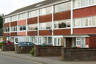
St Helier is one of the twelve parishes of Jersey, the largest of the Channel Islands in the English Channel. St Helier has a population of 35,822 – over one-third of the total population of Jersey – and is the capital of the island.

St Clement is one of the twelve parishes of Jersey in the Channel Islands. Its parish hall is around 3.6 kilometres (2.2 mi) south-east of St Helier. The parish has a population of 9,221 and is the second most densely populated.

Grouville is one of the twelve parishes of Jersey in the Channel Islands. The parish is around 3.9 kilometres (2.4 mi) east of St Helier. The parish covers a surface area of 4,354 vergées (7.8 km²). The parish includes the south-east portion of the main island of the Bailiwick of Jersey, as well as the Minquiers islets several miles to the south, and is dominated by the broad sweep of the Royal Bay of Grouville. It borders St. Clement, St. Saviour and St. Martin.

St Martin is one of the twelve parishes of Jersey in the Channel Islands. It is 5.5 kilometres (3.4 mi) north-east of St Helier. It has a population of 3,763. The parish covers 10.3 km2 (4.0 sq mi).

Trinity is one of the twelve parishes of Jersey in the Channel Islands. It is 5.8 kilometres (3.6 mi) north of St Helier. It has a population of 3,156. The parish covers 6,975 vergées. Les Platons in the north of the parish is the highest point in Jersey. The parish borders St John, St Helier, St Saviour and St Martin.

St John is one of the twelve parishes of Jersey and is around 7.3 kilometres (4.5 mi) north of St Helier on the north coast of the island. It has a surface area of 8.7 km2. St John's Village is also the name of the main village in the parish.
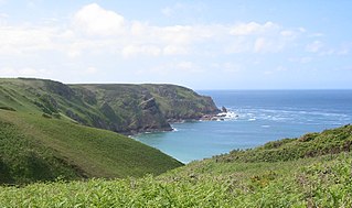
St Ouen is one of the twelve parishes of Jersey in the Channel Islands. It is around 8.8 kilometres (5.5 mi) north-west of St Helier. It has a population of 4,097. The parish is the largest parish by surface area, covering 8,525 vergées (15 km2), and is located in part on a peninsula.

St Peter is one of the twelve parishes of Jersey in the Channel Islands. It is around 6.5 kilometres (4.0 mi). The parish has a population of 5,003. It has a surface area of 10.6 square kilometres (4.1 sq mi).

St Lawrence is one of the twelve parishes of Jersey in the Channel Islands. It is located 8.0 kilometres (5.0 mi) west of St Helier. The parish covers 5,258 vergées (9.5 km2) and occupies the centre of the Island. St Lawrence Village is also the name of a village in the parish.
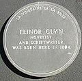
A vingtaine is a political subdivision of Jersey. They are subdivisions of the various parishes of Jersey, and one, La Vingtaine de la Ville, in Saint Helier is further divided into two cantons.

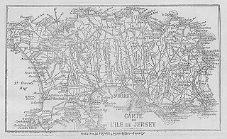
The parishes of Jersey are the civil and religious administrative districts of Jersey in the Channel Islands. Jersey has a unitary system of governance and all the powers and administration of the parishes are governed by laws enacted by the States Assembly. All have access to the sea and share a name with their ancient parish churches.

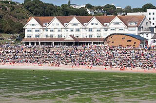
Elizabeth Castle is a castle and tourist attraction, on a tidal island within the parish of Saint Helier, Jersey. Construction was started in the 16th century when the power of cannon meant that the existing stronghold at Mont Orgueil was insufficient to defend the Island and the port of St. Helier was vulnerable to attack by ships armed with cannon.
Vingtaine des Quennevais is the largest of the four vingtaines of the Parish of St. Brélade in Jersey in the Channel Islands.
Vingtaine du Rouge Bouillon is one of the six vingtaines of St Helier in Jersey, Channel Islands.
The Vingtaine du Mont à l'Abbé is one of six vingtaines of the Parish of Saint Helier in the Channel Island of Jersey.
Vingtaine de Haut du Mont au Pretre is one of the five vingtaines of St. Helier Parish on the Channel Island of Jersey.
Vingtaine du Mont Cochon is one of the six vingtaines of the Parish of St. Helier, in the Channel Island of Jersey. It is close to St Lawrence.
A Parish Assembly in Jersey is the decision-making body of local government, comprising ratepayers and electors of the parish.

St Helier railway station was the terminus of the Jersey Eastern Railway (JER) in Saint Helier, the capital of Jersey in the Channel Islands. Opened in 1874, it was situated in a railway cutting at the base of Mont de la Ville below Fort Regent. The station was referred to as St. Helier to distinguish it from another railway terminus opened by the Jersey Railway in 1873 at the Weighbridge in St Helier. The station was in passenger operation until the line closed in 1929. Today the site is occupied by the Snow Hill car park.