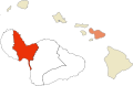
Wailuku is located just west of Kahului, at the mouth of the Iao Valley. In the early 20th century Wailuku was the main tourist destination on Maui, though it has since been eclipsed with the rise of the resort towns such as Kaanapali.
The town is situated at 249 feet (76m) above sea level, at the base of West Maui Volcano, known historically as Mauna Kahalawai and Hale Mahina, on the northern edge of the isthmus of East Maui (Haleakalā) and West Maui.
According to the United States Census Bureau, the CDP has a total area of 5.7 square miles (14.8km2), of which 5.3 square miles (13.8km2) is land and 0.42 square miles (1.1km2), or 7.16%, is water.[4]
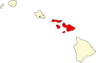
The three moku or districts of west Maui are Lāhaina, Kāʻanapali, and Wailuku. Wailuku is also known as Pūʻalikomohana, or Nā Wai ʻEhā which means the four waters. The four waters are the ahupuaʻa (smaller land division than district), which are Waikapū, Wailuku, Waiʻehu, and Waiheʻe.[citation needed]
Home to Maui's most famous Hawaiian rulers, site of Kamehameha's decisive 1790 victory at the Battle of Kepaniwai in the Iao Valley, location of the 19th century Mission Station and birthplace of the mighty sugar industry, Wailuku illustrates the powerful influences which shaped the town, the island and the state.
The area was a center of power and population in pre-historic Hawaii. In the mid-1800s it was irrevocably changed when New England missionaries brought their religious beliefs, western skills and implements and new agricultural methods. By the 1860s the Wailuku Sugar Company (owned by C. Brewer & Co.) and other plantations were busy growing and milling sugarcane. Miles of ditches were dug, bringing irrigation water from deep in the mountains to the vast fields of central Maui, and the sugar industry flourished, to the detriment of the native people.
Thousands of skilled and unskilled workers immigrated to Maui from all parts of the world to toil in the fields and factories. They came from China, Japan, Okinawa, Korea, the Philippines, Europe, America – bringing ethnic, cultural and religious diversity to their new home. Many settled in Wailuku, where houses, schools, churches, temples, shops, banks and community buildings were built to meet the needs of the thriving company town.
In 1905, Wailuku was designated Maui's County Seat, and it soon became a hub of government, business and entertainment, boasting vaudeville and movie theatres, bowling alley, hotels, poi factory, ice and soda works, and many markets and offices. Thus began the era of growth which continued until the late 1960s when the sugar industry, losing its economic prosperity, reduced operations and the development of alternative commercial centers drew business away from Wailuku's downtown streets.
Many private and public buildings have architectural and historical significance. Beyond this stylish neighborhood are the narrow lanes where modest bungalow, amidst colorful gardens, preserve the flavor of old Wailuku. On upper Main Street (the road to Iao Valley), are remnants of the missionary era. A tiny graveyard contains tombstones of Hawaiian Ali’i (royalty) and missionary families. Further uphill are the Alexander House and Bailey House, now an excellent museum displaying ancient Hawaiian artifacts and missionary period rooms, and office of the Maui Historical society. A turn on Ilina Street to the top of Vineyard Street brings you to an interesting cemetery with lovely views of the Iao Valley and West Maui Mountains.
Follow Vineyard downhill through a charming neighborhood clustered around the Iao Congregational Church. The mature trees, varied architecture and serene vistas recreate the atmosphere of bygone days. As you approach the center of town, new buildings mingle with old, and former residences or commercial buildings have been rehabilitated for modern uses, keeping the colorful appearance of the past. In the business district, where false fronts and art deco facades stand shoulder to shoulder, sidewalks are shaded by canopies, inviting you to stroll and explore the charms of Old Wailuku Town.[5]
In the Hawaiian tongue Wailuku means literally "destroying water." The Hawaiian god Kāne is considered to be the procreator and the provider of life. He is associated with wai (fresh water) as well as clouds, rain, streams and springs. Kanaloa, the Hawaiian god of the underworld, is represented by the phallic stone of the ʻĪao Needle.
Kapawa, the king of Hawaiʻi prior to Pili, was buried here. Maui's ruler Kakaʻe, in the late 15th century, designated ʻĪao Valley as an aliʻi burial ground. The remains were buried in secret places. In 1790, the Battle of Kepaniwai took place there, in which Kamehameha the Great defeated Kalanikūpule and the Maui army during his campaign to unify the islands. The battle was said to be so bloody that dead bodies blocked ʻĪao Stream, and the battle site was named Kepaniwai ("the damming of the waters").[6]
As of the census[8] of 2000, there were 12,296 people, 4,535 households, and 3,015 families residing in the CDP. The population density was 2,427.4 inhabitants per square mile (937.2/km2). There were 4,780 housing units at an average density of 943.6 per square mile (364.3/km2). The racial makeup of the CDP was 8.16% White, 0.24% African American, 0.36% Native American, 42.08% Asian, 11.70% Pacific Islander, 1.18% from other races, and 26.28% from two or more races. Hispanic or Latino of any race were 7.75% of the population.
There were 4,535 households, out of which 29.1% had children under the age of 18 living with them, 48.4% were married couples living together, 12.7% had a female householder with no husband present, and 33.5% were non-families. 25.7% of all households were made up of individuals, and 8.2% had someone living alone who was 65 years of age or older. The average household size was 2.71 and the average family size was 3.28.
In the CDP the population was spread out, with 23.7% under the age of 18, 7.1% from 18 to 24, 30.3% from 25 to 44, 23.9% from 45 to 64, and 15.1% who were 65 years of age or older. The median age was 38 years. For every 100 females, there were 99.4 males. For every 100 females age 18 and over, there were 97.0 males.
The median income for a household in the CDP was $45,587, and the median income for a family was $51,441. Males had a median income of $33,429 versus $26,487 for females. The per capita income for the CDP was $20,503. About 8.1% of families and 11.2% of the population were below the poverty line, including 14.7% of those under age 18 and 3.8% of those age 65 or over.
The Maui Bowling Center, which has hosted a strong number of local bowling leagues since its grand opening in 1948, is located in Wailuku. The alley utilized manual pin-setters from its opening until 1961, when it converted to automatic setting machines.
ʻĪao Valley is a lush, stream-cut valley in West Maui, Hawaii, located 3.1 miles (5 km) west of Wailuku. Because of its natural environment and history, it has become a tourist location. It was designated a National Natural Landmark in 1972.
The island of Maui is an island in the Hawaiian archipelago, its second-largest at 727.2 square miles (1,883 km2). It is the 17th-largest in the United States. Maui is one of Maui County's five islands, along with Molokaʻi, Lānaʻi, Kahoʻolawe, and Molokini.
Maui County, officially the County of Maui, is a county in the U.S. state of Hawaii. It consists of the islands of Maui, Lānaʻi, Molokaʻi, Kahoʻolawe, and Molokini. The latter two are uninhabited. As of the 2020 census, the population was 164,754. The county seat is Wailuku.
Hawi (Hawaiian: Hāwī; pronounced [hɐː'viː] is a census-designated place in Hawaiʻi County, Hawaii. The population was 2,268 at the time of the 2020 United States Census.
Hilo is the largest settlement in Hawaii County, Hawaii, United States, which encompasses the Island of Hawaii, and is a census-designated place (CDP). The population was 44,186 according to the 2020 census. It is the fourth-largest settlement in the state of Hawaii and largest settlement in the state outside of Oahu.
Laie is a census-designated place (CDP) located in the Koolauloa District on the island of Oahu in Honolulu County, Hawaii, United States. In Hawaiian, lāʻie means "ʻie leaf". The population was 5,963 at the 2020 census.
Punaluʻu is a census-designated place and rural community in the Koʻolauloa District on the island of Oʻahu, City & County of Honolulu, Hawaii, United States. In Hawaiian, punaluʻu means "coral dived for", or in the case of the fishpond once located here, possibly "spring dived for". There is a very small commercial center located beside Punaluʻu Stream, and several condominium projects, including a high-rise building, located at Haleaha Beach and Kaluanui Beach. At the 2020 census, the CDP had a population of 1,374.
Hana is a census-designated place (CDP) in Maui County, Hawaii, United States. The population was 1,526 at the 2020 census. Hana is located at the eastern end of the island of Maui and is one of the most isolated communities in the state. It is reached mainly via the Hana Highway, a long, winding, 52-mile-long (84 km) highway along Maui's northern shore, via boat, and with commercial air service to Hana Airport.
Kahului is an unincorporated community and a census-designated place (CDP) in Maui County in the U.S. state of Hawaii. It hosts the county's main airport, a deep-draft harbor, light industrial areas, and commercial shopping centers. The population was 28,219 at the 2020 census. Kahului is part of the Kahului-Wailuku-Lahaina Metropolitan Statistical Area which comprises all of Maui County, including nearby Wailuku and the West Maui town of Lahaina.
Kihei is a census-designated place (CDP) in Maui County, Hawaii, United States. The population was 21,423 at the 2020 census.
Mā'alaea is a census-designated place (CDP) in Maui County, Hawaii, United States. The population was 310 at the 2020 census. Mā‘alaea sits on the southern coast of the isthmus separating West Maui from the island’s Central Valley. Like other ahupua‘a, it widens as it descends from mountain slopes into the sea, occupying 5.4 square miles of land and 2.3 miles of ocean. For more than a millennium, Mā‘alaea has been a crossroads, a landing place for Hawaiian kings and armies, and in time, whalers and sailing ships. Highways follow the ancient trails that once branched north to Wailuku, west to Lahaina, and south to what are now the towns of Kīhei and Wailea. The name Mā‘alaea comes from the Hawaiian word ‘alae, the iron oxide from volcanic eruptions that gives the region its iron-rich red earth.
Napili-Honokowai is a census-designated place (CDP) in Maui County, Hawaii, United States. The population was 7,042 at the 2020 census.
Pā'ia is a census-designated place (CDP) in Maui County, Hawaii, United States, on the northern coast of the island of Maui. The population was 2,470 at the 2020 census. Pā'ia is home to several restaurants, art galleries, surf shops and other tourist-oriented businesses. It was formerly home to a Hawaiian Commercial & Sugar mill from 1880 to 2000.
Pukalani is a census-designated place (CDP) in Maui County, Hawaiʻi, United States. The population was 8,299 at the 2020 census. The western volcano-slope region of Haleakalā, including nearby Makawao and Kula, is referred to as Upcountry Maui by locals, and is one of the four major population centers on Maui.
Waihee-Waiehu is a census-designated place (CDP) in Maui County, Hawaii, United States. The population was 9,234 at the 2020 census.
Waikapu is a census-designated place (CDP) in Maui County, Hawaii, United States. The population was 3,437 at the 2020 census.
Waikāne or Waikane, also known as North Koʻolaupoko, is an area and census-designated place in the County of Honolulu, Hawaii, United States, on the island of Oʻahu. It had a population of 778 at the 2010 census. In Hawaiian, koʻolau poko means "short windward", referring to the fact that this is the shorter of the two windward districts on the island. Koʻolaupoko extends from Makapuʻu Point on the southeast to Kaʻōʻio Point on the north. Included within the district, south of North Koʻolaupoko, are the largest windward towns of Kāneʻohe, Kailua, and Waimānalo.
The Battle of Kepaniwai was fought in 1790 between the islands of Hawaiʻi and Maui. The forces of Hawaiʻi were led by Kamehameha I, while the forces of Maui were led by Kalanikūpule. It is known as one of the most bitter battles fought in Hawaiian history.
Halekiʻi-Pihana Heiau State Monument is a 10-acre (4.0 ha) park containing two important luakini heiau on a high ridge near the mouth of ʻIao Stream in Wailuku, Maui. Both Halekiʻi and Pihana were associated with important Hawaiian chiefs, have been closely studied by archaeologists, and overlook the fertile Nā Wai ʻEhā region irrigated by the Wailuku, Waikapu, Waiheʻe and Waiehu streams. The heiau complex was added to the National Register of Historic Places on 25 November 1985.
The island of Maui with a relatively central location has given it a pivotal role in the history of the Hawaiian Islands.
This page is based on this Wikipedia article Text is available under the CC BY-SA 4.0 license; additional terms may apply. Images, videos and audio are available under their respective licenses.