| Walterio Airport | |||||||||||
|---|---|---|---|---|---|---|---|---|---|---|---|
| Summary | |||||||||||
| Airport type | Public | ||||||||||
| Serves | Monte Cristi, Dominican Republic | ||||||||||
| Elevation AMSL | 33 ft / 10 m | ||||||||||
| Coordinates | 19°45′25″N71°37′30″W / 19.75694°N 71.62500°W Coordinates: 19°45′25″N71°37′30″W / 19.75694°N 71.62500°W | ||||||||||
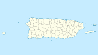
| Map | |||||||||||
 MDWO Location of the airport in the Dominican Republic | |||||||||||
| Runways | |||||||||||
| |||||||||||
Walterio Airport( ICAO : MDSP) is a rural airport 10 kilometres (6.2 mi) south of the coastal city of Monte Cristi, Dominican Republic. It serves private aviation and air sports. Now with the Osvaldo Virgil Airport replacing most of its operations, this airport has been reverted as only a runway.

The ICAOairport code or location indicator is a four-letter code designating aerodromes around the world. These codes, as defined by the International Civil Aviation Organization and published in ICAO Document 7910: Location Indicators, are used by air traffic control and airline operations such as flight planning.

The Dominican Republic is a country located in the island of Hispaniola, in the Greater Antilles archipelago of the Caribbean region. It occupies the eastern five-eighths of the island, which it shares with the nation of Haiti, making Hispaniola one of two Caribbean islands, along with Saint Martin, that are shared by two sovereign states. The Dominican Republic is the second-largest Caribbean nation by area at 48,671 square kilometers (18,792 sq mi), and third by population with approximately 10 million people, of which approximately three million live in the metropolitan area of Santo Domingo, the capital city.

Osvaldo Virgil National Airport serves the province of Monte Cristi on the north coast of the Dominican Republic. This airport was opened in 2006 for tourism with flights from other Dominican airports. The runway is just north of the city.
Contents
The Monte Cristi non-directional beacon (Ident: MTC) is located 6.5 nautical miles (12.0 km) north of the airport. The Cap Haitien VOR/DME (Ident: HCN) is located 32.4 nautical miles (60.0 km) west of Walterio Airport. [3] [4]

A non-directional (radio) beacon (NDB) is a radio transmitter at a known location, used as an aviation or marine navigational aid. As the name implies, the signal transmitted does not include inherent directional information, in contrast to other navigational aids such as low frequency radio range, VHF omnidirectional range (VOR) and TACAN. NDB signals follow the curvature of the Earth, so they can be received at much greater distances at lower altitudes, a major advantage over VOR. However, NDB signals are also affected more by atmospheric conditions, mountainous terrain, coastal refraction and electrical storms, particularly at long range.

VOR/DME refers to combined radio navigation station for aircraft, which consists of two radio beacons, placed together, a VHF omnidirectional range (VOR) and distance measuring equipment (DME). VOR produces an angle between the station and the receiver in the aircraft, while DME does the same for range. Together, they provide the two measurements needed to produce a navigational "fix" using a chart.