Watertown, South Dakota

Last updated

Watertown, South Dakota
City of Watertown Logo.png
Nickname: 
South Dakota's Rising Star
Codington County South Dakota Incorporated and Unincorporated areas Watertown Highlighted.svg
Location in Codington County and the state of South Dakota
Coordinates: 44°54′12″N97°7′14″W / 44.90333°N 97.12056°W / 44.90333; -97.12056
CountryUnited States
State South Dakota
County Codington
Founded1879 [1]
Incorporated 1885 [2]
Government
  Type Mayor–council
  BodyWatertown City Council
   Mayor Ried Holien
Area
[3]
   City 26.34 sq mi (68.23 km2)
  Land18.37 sq mi (47.57 km2)
  Water7.98 sq mi (20.66 km2)
Elevation
[4]
1,729 ft (527 m)
Population
 (2020) [5]
   City 22,655
  Estimate 
(2024) [6]
23,501
  Density1,233.46/sq mi (476.25/km2)
   Metro
35,073 (US: 374th)
Time zone UTC-6 (CST)
  Summer (DST) UTC-5 (CDT)
ZIP code
57201
Area code 605
FIPS code 46-69300
GNIS feature ID1267627 [4]
Website watertownsd.us

Watertown is a city in and the county seat of Codington County, South Dakota, United States. [7] Watertown is home to the Redlin Art Center, which houses many of the works of Terry Redlin, one of the nation's most popular wildlife artists. Watertown is between Pelican Lake and Lake Kampeska, from which Redlin derived inspiration for his artwork.

Contents

The population was 22,655 at the 2020 census, [5] making Watertown South Dakota's 5th-most populous city. It is also the principal city of the Watertown Micropolitan Statistical Area, which includes all of Codington and Hamlin counties. It is home to the Bramble Park Zoo. Watertown's residential real estate is considered the most expensive in South Dakota for cities of its size; the median price for a home in Watertown is approximately $200,000. [8]

Geography

Watertown is along the Big Sioux River. [9]

According to the United States Census Bureau, the city has an area of 25.04 square miles (64.85 km2), of which 17.45 square miles (45.20 km2) is land and 7.59 square miles (19.66 km2) is water. [10] Watertown sits on the Big Sioux River and two major lakes, Pelican Lake and Lake Kampeska. Most of Watertown also sits on a short plateau. Watertown Regional Airport's elevation is 1,745 feet.

History

An 1883 bird's eye illustration of Watertown Watertown, SD 1883.jpg
An 1883 bird's eye illustration of Watertown

Watertown was founded in 1879 as a rail terminus when the Chicago & Northwestern Railroad reactivated part of a line it had constructed to Lake Kampeska. [1] [11] The city was named after Watertown, New York, the hometown of brothers John E. and Oscar P. Kemp, two of the city's founders. The town was originally planned to be called Kampeska. [1]

During the 1880s, Watertown prospered as a transportation hub after the railroads had extended farther west. Along with several other cities, it had been a candidate for capital of the new state of South Dakota, [1] losing to the more centrally located Pierre. The city's newspaper, the Watertown Public Opinion , began publishing in 1887. [1]

In the mid-20th century, Interstate 29 was constructed through eastern South Dakota. [12] The route included a slight bend to bring it closer to Watertown. [12] Its construction was a major economic benefit to Watertown and the communities near it. [12]

Climate

In the last decades the climate is configured as hot-summer humid continental climate (Köppen: Dfa); it previously had a warm-summer (Dfb). Although it is a humid city, it is relatively dry for its climatic category, due to its position in the Great Plains, which still provides an even greater thermal amplitude, especially in the higher values. [13]

Climate data for Watertown Regional Airport, South Dakota (1991−2020 normals, extremes 1893−present)
MonthJanFebMarAprMayJunJulAugSepOctNovDecYear
Record high °F (°C)65
(18)
66
(19)
82
(28)
95
(35)
106
(41)
107
(42)
110
(43)
105
(41)
104
(40)
91
(33)
78
(26)
69
(21)
110
(43)
Mean daily maximum °F (°C)21.4
(−5.9)
25.9
(−3.4)
38.6
(3.7)
54.0
(12.2)
66.9
(19.4)
76.8
(24.9)
82.0
(27.8)
79.5
(26.4)
71.6
(22.0)
56.2
(13.4)
39.8
(4.3)
26.3
(−3.2)
53.2
(11.8)
Daily mean °F (°C)12.2
(−11.0)
16.3
(−8.7)
29.1
(−1.6)
42.8
(6.0)
55.7
(13.2)
66.1
(18.9)
71.0
(21.7)
68.5
(20.3)
60.1
(15.6)
45.7
(7.6)
30.6
(−0.8)
17.8
(−7.9)
43.0
(6.1)
Mean daily minimum °F (°C)3.1
(−16.1)
6.7
(−14.1)
19.6
(−6.9)
31.5
(−0.3)
44.5
(6.9)
55.4
(13.0)
60.0
(15.6)
57.5
(14.2)
48.6
(9.2)
35.2
(1.8)
21.3
(−5.9)
9.3
(−12.6)
32.7
(0.4)
Record low °F (°C)−40
(−40)
−38
(−39)
−27
(−33)
−10
(−23)
16
(−9)
25
(−4)
35
(2)
32
(0)
9
(−13)
−2
(−19)
−20
(−29)
−37
(−38)
−40
(−40)
Average precipitation inches (mm)0.58
(15)
0.65
(17)
1.00
(25)
2.06
(52)
2.87
(73)
3.85
(98)
3.05
(77)
2.89
(73)
2.45
(62)
1.95
(50)
0.68
(17)
0.68
(17)
22.71
(577)
Average snowfall inches (cm)6.7
(17)
8.9
(23)
5.4
(14)
5.2
(13)
0.1
(0.25)
0.0
(0.0)
0.0
(0.0)
0.0
(0.0)
0.0
(0.0)
1.4
(3.6)
4.5
(11)
8.9
(23)
41.1
(104)
Average precipitation days (≥ 0.01 in)5.96.06.98.911.411.49.58.68.57.55.46.396.3
Average snowy days (≥ 0.1 in)5.65.93.51.90.00.00.00.00.01.12.66.026.6
Source: NOAA [14] [15]

Demographics

Historical population
CensusPop.Note
1880 746
1890 2,672258.2%
1900 3,35225.4%
1910 7,010109.1%
1920 9,40034.1%
1930 10,2148.7%
1940 10,6173.9%
1950 12,69919.6%
1960 14,07710.9%
1970 13,388−4.9%
1980 15,64916.9%
1990 17,59212.4%
2000 20,23715.0%
2010 21,4826.2%
2020 22,6555.5%
2022 (est.)23,019 [6] 1.6%
U.S. Decennial Census [16]
2020 Census [5]

The per capita income for the city was $18,994. About 5.7% of families and 9.3% of the population were below the poverty line, including 8.5% of those under age 18 and 11.0% of those age 65 or over. [17]

2010 census

As of the census of 2010, there were 21,482 people, 9,278 households, and 5,563 families residing in the city. The population density was 1,231.3 inhabitants per square mile (475.4/km2). There were 10,050 housing units at an average density of 575.9 per square mile (222.4/km2). The racial makeup of the city was 94.8% White, 0.4% African American, 2.4% Native American, 0.5% Asian, 0.5% from other races, and 1.4% from two or more races. Hispanic or Latino of any race were 1.6% of the population.

There were 9,278 households, of which 29.6% had children under the age of 18 living with them, 45.7% were married couples living together, 10.0% had a female householder with no husband present, 4.3% had a male householder with no wife present, and 40.0% were non-families. 33.0% of all households were made up of individuals, and 12.4% had someone living alone who was 65 years of age or older. The average household size was 2.28 and the average family size was 2.90.

The median age in the city was 36.6 years. 24.2% of residents were under the age of 18; 10.3% were between the ages of 18 and 24; 24.9% were from 25 to 44; 25.2% were from 45 to 64; and 15.4% were 65 years of age or older. The gender makeup of the city was 49.2% male and 50.8% female.

2000 census

As of the census of 2000, there were 20,237 people, 8,385 households, and 5,290 families residing in the city. The population density was 1,328.9 inhabitants per square mile (513.1/km2). There were 9,193 housing units at an average density of 603.7 per square mile (233.1/km2). The racial makeup of the city was 96.25% White, 0.14% African American, 1.65% Native American, 0.33% Asian, 0.02% Pacific Islander, 0.71% from other races, and 0.90% from two or more races. Hispanic or Latino of any race were 1.28% of the population. 47.1% were of German, 19.8% Norwegian and 5.9% Irish ancestry. 96.5% spoke English, 1.7% Spanish and 1.1% German as their first language.

There were 8,385 households, out of which 31.9% had children under the age of 18 living with them, 50.6% were married couples living together, 8.8% had a female householder with no husband present, and 36.9% were non-families. 30.5% of all households were made up of individuals, and 11.8% had someone living alone who was 65 years of age or older. The average household size was 2.37 and the average family size was 2.98.

In the city, the population was spread out, with 25.9% under the age of 18, 11.3% from 18 to 24, 27.9% from 25 to 44, 19.9% from 45 to 64, and 15.0% who were 65 years of age or older. The median age was 35 years. For every 100 females, there were 96.6 males. For every 100 females age 18 and over, there were 93.9 males.

Education

Watertown has two institutions providing post-secondary education. Lake Area Technical College is a public technical school classified as a community college, offering degrees in areas such as agriculture, nursing, and welding. There is also a satellite campus of Mount Marty College, [18] a private Catholic school based in Yankton, South Dakota.

Lake Area Technical College received the 2017 Aspen Prize for Community College Excellence, following three previous Finalist-With-Distinction honors in 2011, 2013, and 2015. The Aspen Institute awarded the prize in March 2017 in Washington, D.C., after an intense data collection process that included a rigorous review of critical elements of student success, such as learning, completion, and employment after college.

Watertown has one public high school, Watertown High School, and one private boarding school, Great Plains Lutheran High School, of the Wisconsin Evangelical Lutheran Synod. [19]

Watertown Middle School (7th and 8th grades) is Watertown's only public middle school. Construction of the school was completed in 2015. The community's "Prairie Lakes Wellness Center" opened in 2017, adjacent to the middle school. When the middle school opened in 2015, the former middle school was renovated and became the Intermediate School (5th and 6th grades).

Watertown has multiple elementary schools. The five public elementary schools are Lincoln Elementary, Jefferson Elementary, Roosevelt Elementary, McKinnely Elementary, and Mellette Elementary. Immaculate Conception School is a private Catholic elementary school. St. Martin's Lutheran School is a private Lutheran elementary school of the WELS. Watertown Christian School is a private non-denominational Christian elementary school.

The Watertown Regional Library is the town's main library. It is on 6th St. NE and open every day of the week.

Harmony Hill High School was a Catholic girls' boarding school in Watertown from 1967 to 1974.

Points of interest

Sailboat on Lake Kampeska circa 1900. Sailboat on Kampeska circa 1900.png
Sailboat on Lake Kampeska circa 1900.

Local media

Television

Channel
(Digital)
Callsign NetworkOwner
3.1 KDLO-DT
(Satellite of KELO)
CBS Nexstar Media Group
3.2 KDLO-DT
(Satellite of KELO)
MyNetworkTV Nexstar Media Group
3.4 KDLO-DT
(Satellite of KELO)
The CW Plus Nexstar Media Group
13.1 K32DK-D
(Translator of KSFY)
ABC Gray Television
13.2 K32DK-D
(Translator of KSFY)
Outlaw Gray Television
13.3 K32DK-D
(Translator of KSFY)
MeTV Gray Television
13.4 K32DK-D
(Translator of KSFY)
True Crime Network Gray Television
13.5 K32DK-D
(Translator of KSFY)
TheGrio Gray Television
46.1 K28OE-D
(Translator of KDLT)
NBC Gray Television
46.2 K28OE-D
(Translator of KDLT)
FOX Gray Television
46.3 K28OE-D
(Translator of KDLT)
The365 Gray Television
46.4 K28OE-D
(Translator of KDLT)
Cozi TV Gray Television
46.5 K28OE-D
(Translator of KDLT)
Court TV Gray Television
46.6 K28OE-D
(Translator of KDLT)
Ion Mystery Gray Television

AM radio

AM radio stations
FrequencyCall signNameFormatOwnerCity
950 AM KWAT Full-service radio Alpha Media Watertown
1480 AM KSDR The Talk of Watertown Conservative talk radio Alpha Media Watertown

FM radio

FM radio stations
FrequencyCall signNameFormatOwnerTarget city/market City of license
89.1 FM KPGT Religious Church Planters of AmericaWatertownWatertown
90.1 FM K211EC Christian
WJFM-FM translator
Jimmy Swaggart MinistriesWatertownWatertown
90.3 FM KJSD South Dakota Public Broadcasting NPR South Dakota Bureau of Information and TelecommunicationWatertownWatertown
91.9 FM K220IT KNWC-FM Contemporary Christian University of Northwestern - St. Paul WatertownWatertown
92.9 FM KSDR-FM New Country KS93 Hot Country Alpha Media WatertownWatertown
96.1 FM KIXX The Best Mix Kicks 96 Hot AC Alpha Media WatertownWatertown
96.9 FM KDLO-FM 96.9 KDLO Country Classic Country Alpha Media WatertownWatertown
98.1 FM KPHR Star 98.1 Soft Adult Contemporary Prairie Winds BroadcastingWatertownOrtonville
99.1 FM KXLG Soft Adult Contemporary, News/Talk TMRG Broadcasting, LLCWatertownMilbank
103.5 FM K278BK Christian Radio VCY America WatertownWatertown
104.3 FM KKSD 104.3 KKSD Classic Hits Alpha Media WatertownMilbank
106.3 FM KPHR Power 106.3 Classic Rock Prairie Winds BroadcastingWatertownOrtonville

Transportation

Watertown also has one airport, Watertown Regional Airport, served by Denver Air Connection with flights to Denver and Chicago O'Hare, and local bus service provided by the Watertown Area Transit Corporation.

Jefferson Lines provides intercity bus service to Watertown. [20]

Notable people

Notable visitors

Former President Barack Obama has visited Watertown twice, in 2008 during his presidential campaign, and in 2015 to address the graduating class at Lake Area Technical College.

Major employers

According to the city's 2018 Comprehensive Annual Financial Report, [23] [24] Watertown's largest employers are:

EmployerSectorNumber of EmployeesAs ofNotes
Watertown School DistrictEducation776June 2018
Prairie Lakes Health SystemHealthcare683June 2018
Terex Utilities Manufacturing634June 2018
Hy-Vee Retail450June 2018Mostly part-time
Premier Bankcard Lending367June 2018
City of WatertownGovernment336June 2018
Worthington Industries Manufacturing309June 2018
Walmart Retail300July 2017
Dakota BodiesManufacturing285June 2018
Jenkins Living CenterHealthcare274June 2018
OEM Worldwide/SpartonManufacturing272May 2017
SpartronicsManufacturing253June 2018
Dakota Sioux CasinoEntertainment215November 2016
Lake Area Technical College Education211 [25] May 2017
Target Retail85July 2017

Related Research Articles

<span class="mw-page-title-main">Spink County, South Dakota</span> County in South Dakota, United States

Spink County is a county in the U.S. state of South Dakota. As of the 2020 census, the population was 6,361. Its county seat is Redfield. The county was created in 1873, and was organized in 1879 within Dakota Territory.

<span class="mw-page-title-main">Mellette County, South Dakota</span> County in South Dakota, United States

Mellette County is a county in the U.S. state of South Dakota. As of the 2020 census, the population was 1,918. Its county seat is White River. The county was created in 1909, and was organized in 1911. It was named for Arthur C. Mellette, the last Governor of the Dakota Territory and the first Governor of the state of South Dakota.

<span class="mw-page-title-main">Grant County, South Dakota</span> County in South Dakota, United States

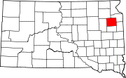
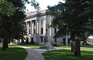
Grant County is a county in the U.S. state of South Dakota. As of the 2020 census, the population was 7,556. The county seat is Milbank. The county was founded in 1873 and organized in 1878. It is named for Ulysses S. Grant, 18th President of the United States.

<span class="mw-page-title-main">Day County, South Dakota</span> County in South Dakota, United States

Day County is a county in the U.S. state of South Dakota. As of the 2020 census, the population was 5,449. Its county seat is Webster. The county is named for Merritt H. Day, pioneer and 1879 Dakota Territory legislator.

<span class="mw-page-title-main">Codington County, South Dakota</span> County in South Dakota, United States

Codington County is a county in the U.S. state of South Dakota. As of the 2020 census, the population was 28,325, making it the 7th most populous county in South Dakota. Its county seat is Watertown. The county was created in 1877 and organized in 1878. It is named for Rev. George S. S. Codington, Dakota Territory legislator.

<span class="mw-page-title-main">Clark County, South Dakota</span> County in South Dakota, United States

Clark County is a county in the U.S. state of South Dakota. As of the 2020 census, the population was 3,837. Its county seat is Clark. The county was created in 1873 and organized in 1881. It was named for Newton Clark, a Dakota Territory legislator in 1873.

<span class="mw-page-title-main">Campbell County, South Dakota</span> County in South Dakota, United States

Campbell County is a county in the U.S. state of South Dakota. As of the 2020 census, the population was 1,377, making it the fourth-least populous county in South Dakota. Its county seat is Mound City. The county was created in 1873 and organized in 1884. It was named for Norman B. Campbell, a Dakota Territory legislator in 1873 and son of General Charles T. Campbell.

<span class="mw-page-title-main">Chamberlain, South Dakota</span> City in South Dakota, United States

Chamberlain is a city in Brule County, South Dakota, United States. It is located on the east bank of the Missouri River, at the dammed section of the Lake Francis Case, close to where it is crossed by Interstate 90.

<span class="mw-page-title-main">Florence, South Dakota</span> Town in South Dakota, United States

Florence is a town in northwestern Codington County, South Dakota, United States. It is part of the Watertown, South Dakota Micropolitan Statistical Area. The population was 337 at the 2020 census.

<span class="mw-page-title-main">Henry, South Dakota</span> Town in South Dakota, United States

Henry is a town in southwestern Codington County, South Dakota, United States. The population was 256 at the 2020 census. It is part of the Watertown, South Dakota Micropolitan Statistical Area.

<span class="mw-page-title-main">Kranzburg, South Dakota</span> Town in South Dakota, United States

Kranzburg is a town in Codington County, South Dakota, United States. The population was 163 at the 2020 census. It is part of the Watertown, South Dakota Micropolitan Statistical Area.

<span class="mw-page-title-main">South Shore, South Dakota</span> Town in South Dakota, United States

South Shore is a town in Codington County, South Dakota, United States. The population was 189 at the 2020 census. It is part of the Watertown, South Dakota Micropolitan Statistical Area.

<span class="mw-page-title-main">Wallace, South Dakota</span> Town in South Dakota, United States

Wallace is a town in Codington County, South Dakota, United States. The population was 91 at the 2020 census. It is part of the Watertown, South Dakota Micropolitan Statistical Area.

<span class="mw-page-title-main">Clear Lake, South Dakota</span> City in South Dakota, United States

Clear Lake is a city in and the county seat of Deuel County, South Dakota, United States. The population was 1,218 at the 2020 census.

<span class="mw-page-title-main">Timber Lake, South Dakota</span> City in South Dakota, United States

Timber Lake is a city in and the county seat of Dewey County, South Dakota, United States. The population was 509 at the 2020 census.

<span class="mw-page-title-main">Britton, South Dakota</span> City in South Dakota, United States

Britton is a city in and the county seat of Marshall County, South Dakota, United States. The population was 1,215 at the 2020 census.

<span class="mw-page-title-main">Howard, South Dakota</span> City in South Dakota, United States

Howard is a city in Miner County, South Dakota, United States. The population was 848 at the 2020 census. It is the county seat and most populous city in Miner County.

<span class="mw-page-title-main">Mellette, South Dakota</span> City in South Dakota, United States

Mellette is a city in Spink County, South Dakota, United States. The population was 199 at the 2020 census.

<span class="mw-page-title-main">Elk Point, South Dakota</span> City in South Dakota, United States

Elk Point is a city in and county seat of Union County, South Dakota, United States. The population was 2,149 as of the 2020 census.

<span class="mw-page-title-main">Lake Kampeska</span> Lake in the state of South Dakota, United States

Lake Kampeska is a 5,250-acre (21 km2) inland glacial lake in the U.S. state of South Dakota. It is located west-northwest of Watertown, South Dakota and lies entirely within Codington County and the Coteau des Prairies. The lake is naturally shaped and the most urban developed lake in South Dakota with approximately 13.5 miles (20 km) of residential shoreline. Lake Kampeska is connected to the Big Sioux River through a single inlet-outlet channel located on the northeast side. It is the third largest natural lake within the borders of South Dakota.

References

  1. 1 2 3 4 5 Hasselstrom, p. 29.
  2. "SD Towns" (PDF). South Dakota State Historical Society . Retrieved February 17, 2010.
  3. "ArcGIS REST Services Directory". United States Census Bureau. Retrieved October 15, 2022.
  4. 1 2 U.S. Geological Survey Geographic Names Information System: Watertown, South Dakota
  5. 1 2 3 "Explore Census Data". United States Census Bureau . Retrieved July 21, 2023.
  6. 1 2 "City and Town Population Totals: 2020-2022". United States Census Bureau. July 21, 2023. Retrieved July 21, 2023.
  7. "Find a County". National Association of Counties. Retrieved June 7, 2011.
  8. "South Dakota Homes For Sale By City". South Dakota Real Estate Trends. RealEstate.com. Retrieved January 28, 2013.
  9. DeLorme (2001),South Dakota Atlas & Gazetteer, Yarmouth, Maine: DeLorme, ISBN   0-89933-330-3
  10. "US Gazetteer files 2010". United States Census Bureau. Archived from the original on July 2, 2012. Retrieved June 21, 2012.
  11. Thompson (ed.), p. 173.
  12. 1 2 3 Schell, p. 333.
  13. "Watertown, South Dakota Köppen Climate Classification (Weatherbase)". Weatherbase. Retrieved July 19, 2019.
  14. "NowData - NOAA Online Weather Data". National Oceanic and Atmospheric Administration. Retrieved October 13, 2021.
  15. "Station: Watertown RGNL AP, SD". U.S. Climate Normals 2020: U.S. Monthly Climate Normals (1991-2020). National Oceanic and Atmospheric Administration. Retrieved October 13, 2021.
  16. United States Census Bureau. "Census of Population and Housing" . Retrieved September 23, 2013.
  17. Watertown, South Dakota: Now. Watertown Area Chamber of Commerce and Convention and Visitors Bureau, 2006
  18. "Watertown Campus" . Retrieved February 18, 2011.
  19. "Great Plains Lutheran High School".
  20. "South Dakota Bus Stops" . Retrieved July 20, 2023.
  21. "Retro Member details". Biographical Directory of the U.S. Congress. Retrieved November 17, 2021.
  22. "NOEM, Kristi". US House of Representatives: History, Art & Archives. Retrieved November 17, 2021.
  23. "City of Watertown 2018 Comprehensive Annual Financial Report" (PDF). August 16, 2022. p. 10.
  24. "Top Employers". Watertown Works. June 2018. Retrieved August 16, 2022.
  25. "LATI Staff" . Retrieved June 1, 2017.

Bibliography