Wattisfield

Last updated

Wattisfield
St Margaret's church, Wattisfield-geograph.org.uk-2128010.jpg
St Margaret's church
Suffolk UK location map.svg
Red pog.svg
Wattisfield
Location within Suffolk
Population440 (2005) [1]
475 (2011)
District
Shire county
Region
Country England
Sovereign state United Kingdom
Post town Diss
Postcode district IP22
Police Suffolk
Fire Suffolk
Ambulance East of England
List of places
UK
England
Suffolk
52°19′55″N0°57′00″E / 52.332°N 0.950°E / 52.332; 0.950

Wattisfield is a village and civil parish in the Mid Suffolk district of Suffolk in eastern England. Located on the A143 around seven miles south-west of Diss, in 2005 its population was 440, [1] increasing to 475 at the 2011 Census. [2]

Contents

The village name in Domesday Book is Watesfelda, derived from the Old English meaning Wastel's clearing. It is situated in the ancient hundred of Blackbourne.

Its Grade II* listed medieval church is dedicated to St. Margaret.

Due to the abundant source of mica clay the village has a tradition of pottery making going back to the Bronze Age and there is still a commercial pottery called Watsons which has a factory shop open to the public. A Romano-British or Anglo-Saxon cemetery was found in 1934 by Basil Brown, who later rose to fame for his discoveries at Sutton Hoo.

The village once had three licensed pubs but now it has none. The Royal Oak was part of Whitbread's pub estate but closed in 1968 and was sold on as a private dwelling, which it remains today directly opposite the church of St. Margaret's. The white post outside the building is a vestige of the old pub sign which used to hang from it. The White Swan was built in the 17th century and closed early 20th century; the building remains as a farmhouse to the north of the A143. The Black Swan closed in the 1920s but the building remains as a private dwelling on the south side of the A143 near its junction with Calkewood Lane.

A post-Medieval post mill stood near Manning's Lane; it was demolished circa 1965.

The Post Office and general store closed in 1997 and the building is currently occupied by a ladies hair stylist.

A stream which rises to the south of the village is called The Grundle and is one of the tributaries of the Little Ouse river which eventually joins the Great Ouse and discharges into The Wash.

Wattisfield Hall

Atop a hill south-west of the village centre, Grade II* listed Wattisfield Hall is an early 17th century timber-framed manor house, most recognizable by its towering, octagonal, Tudor-brick chimneys––twelve in all, grouped into four large stacks. [3] [4]

Crusade against the art world

From 1967 to 1971, it was occupied as both a home and art restoration studio by famous art forger Tom Keating, and his business partner and lover, Jane Kelly. [5] While running their picture cleaning and repair business, Keating secretly continued painting large numbers of Sexton Blakes––his rhyming slang for fakes [6] ––in the styles of Constable, Gainsborough, Rembrandt and many others, including the Samuel Palmer fakes that led to Kelly and him facing charges for art fraud at the Old Bailey in 1979. [7] [8]

In May 1977, Keating gave a national audience a tour of his former haunt, sharing fond memories of him and Kelly pretending to be Lord and Lady of the manor, in a BBC1 special called A Picture of Tom Keating: An exclusive study of a master forger. [9] [10]

Motocross

Several dates during the summer months see motocross scrambling action in the grounds of Wattisfield Hall. [11]

Related Research Articles

<span class="mw-page-title-main">River Waveney</span> River in east England

The River Waveney is a river which forms the boundary between Suffolk and Norfolk, England, for much of its length within The Broads. The "ey" part of the name means "river" thus the name is tautological.

<span class="mw-page-title-main">Cornelius Krieghoff</span> Dutch painter

Cornelius David Krieghoff was a Dutch-born Canadian-American painter of the 19th century. He is best known for his paintings of Canadian genre scenes involving landscapes and outdoor life, which were as sought after in his own time as they are today. He painted many winter scenes, some in several variants.

<span class="mw-page-title-main">Thornborough, Buckinghamshire</span> Village and civil parish in Buckinghamshire, England

Thornborough is a village and civil parish in north Buckinghamshire, England, around 2 miles (3.2 km) east of Buckingham.

<span class="mw-page-title-main">Tom Keating</span> English art restorer and forger

Thomas Patrick Keating (1917–1984) was an English artist, art restorer and art forger. Considered the most prolific and versatile art forger of the 20th century, he claimed to have faked more than 2,000 paintings by over 160 different artists of unprecedented scope—ranging from the Renaissance to Modernism, Expressionism and Fauvism —with heavy emphasis on English landscape Romanticists and the French Impressionists. Total estimated profits from his forgeries amount in today's value to more than $10 million.

<span class="mw-page-title-main">Samuel Palmer</span> English painter

Samuel Palmer Hon.RE was a British landscape painter, etcher and printmaker. He was also a prolific writer. Palmer was a key figure in Romanticism in Britain and produced visionary pastoral paintings.

<span class="mw-page-title-main">Swavesey</span> Human settlement in England

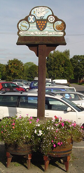
Swavesey is a village lying on the Prime Meridian in Cambridgeshire, England, with a population of 2,463. The village is situated 9 miles to the north west of Cambridge and 3 miles south east of St Ives.

<span class="mw-page-title-main">Ingham, Suffolk</span> Human settlement in England

Ingham is a village and civil parish in the West Suffolk district of Suffolk in eastern England, located about six miles north of Bury St Edmunds on the A143 to Thetford in Norfolk. The village boasts a single church, post office and a pub, the Cadogan Arms which was refurbished in 2006.

<span class="mw-page-title-main">Bildeston</span> Human settlement in England

Bildeston is a village and civil parish in the Babergh district of Suffolk, England. Located around 5 miles (8 km) north of Hadleigh. In 2005 it had a population of 960, increasing to 1,054 at the 2011 Census.

<span class="mw-page-title-main">Holbrook, Suffolk</span> Human settlement in England

Holbrook is a village situated close to the northern shore of the estuary of the River Stour, in Suffolk, England. It is located on the Shotley Peninsula in Babergh district, around 5 miles (8 km) south of the centre of Ipswich.

<span class="mw-page-title-main">Sotterley</span> Human settlement in England

Sotterley, originally Southern-lea from its situation south of the river, is a village and civil parish in the East Suffolk district, in the English county of Suffolk, located approximately 4 miles (6 km) south-east of Beccles and 1.5 miles (2 km) east of Willingham St Mary and Shadingfield. The parish is primarily agricultural with a dispersed population of 113 at the 2011 census. The parish council operates to administer jointly the parishes of Shadingfield, Willingham St Mary, Sotterley and Ellough.

<span class="mw-page-title-main">Cawood</span> Village and civil parish in North Yorkshire, England

Cawood is a village and civil parish in North Yorkshire, England that is notable as the location of the Cawood sword. It was historically part of the West Riding of Yorkshire until 1974.

<span class="mw-page-title-main">Dedham, Essex</span> Human settlement in England

Dedham is a village in the City of Colchester district of Essex, England. It is near the River Stour, which is the border of Essex and Suffolk. The nearest town to Dedham is the small market town of Manningtree.

Radwell is a hamlet in the Hundred of Willey in North Bedfordshire, England, on the River Great Ouse, about 7 miles (11 km) north west of Bedford. Administratively, it is often included with the neighbouring village of Felmersham, and the civil parish is sometimes known as Felmersham with Radwell.

<span class="mw-page-title-main">Ixworth</span> Village in Suffolk, England

Ixworth is a village and civil parish in the West Suffolk district of Suffolk, England, 6 miles (9.7 km) north-east of Bury St Edmunds on the A143 road to Diss and 9 miles (14 km) south-east of Thetford. The parish had a population of 2,365 at the 2011 Census.

<span class="mw-page-title-main">Hinderclay</span> Human settlement in England

Hinderclay is a village and civil parish in the Mid Suffolk district of Suffolk in eastern England. The village is located around 14 miles (23 km) - from Bury St Edmunds in an area of rolling arable land to the south of the Little Ouse river valley. Neighbouring villages include Thelnetham and Rickinghall. In 2005 its population was 340. The parish also contains the hamlet of Thorpe Street.

<span class="mw-page-title-main">Somersham, Suffolk</span> Human settlement in England

Somersham is a village and civil parish in the Mid Suffolk district of Suffolk in eastern England, approximately 5 miles (8.0 km) northwest of Ipswich, with a population of 710 (2005).

<span class="mw-page-title-main">Wickhambrook</span> Human settlement in England

Wickhambrook is a village and civil parish in the West Suffolk district of Suffolk in eastern England. It is about ten miles (16 km) south-west from Bury St Edmunds, halfway to Haverhill, off the A143 road. Wickhambrook is the largest village by area in the county of Suffolk with a population of 1170 in 2005.

<span class="mw-page-title-main">Pentney</span> Human settlement in England

Pentney is a village and civil parish in the English county of Norfolk, located about 8 miles (13 km) south east of King's Lynn placing it about halfway between King's Lynn and Swaffham on the A47 road. It covers an area of 10.39 km2 (4.01 sq mi) and had a population of 387 in 184 households at the 2001 census, increasing to 544 at the 2011 Census. For the purposes of local government, it falls within the district of King's Lynn and West Norfolk. It is in the valley of the River Nar, a tributary of the River Great Ouse.

<span class="mw-page-title-main">Shipmeadow</span> Village in Suffolk, England

Shipmeadow is a village and civil parish located in the north of the English county of Suffolk. It is in the East Suffolk district, 2.5 miles (4.0 km) east of Bungay and the same distance west of Beccles on the B1062 road. Norwich is 15 miles (24 km) to the north-west.

Geraldine Lucia Norman, OBE is an art journalist who made a special name for identifying fakes, moving on to work for the great Russian museum, the Hermitage in St. Petersburg.

References

  1. 1 2 Estimates of Total Population of Areas in Suffolk Suffolk County Council
  2. "Civil Parish population 2011". Neighbourhood Statistics. Office for National Statistics. Retrieved 29 August 2016.
  3. Taylor, Patrick (2008). "Wattisfield Conservation Area Appraisal" (PDF). babergh.gov.uk.
  4. "WATTISFIELD HALL, GARDEN WALLS AND GATE PIERS". Historic England. 15 November 1954.
  5. Norman, Geraldine (10 August 1976). "Samuel Palmer imitator who duped art world". The Times. p. 1.
  6. Ayto, John (2003). Oxford Dictionary of Rhyming Slang (Paperback ed.). Oxford University Press. pp. 112, 142. ISBN   0198607512.
  7. Norman, Geraldine (11 February 1977). "Tom Keating: Portrait of the artist about to give up his L-plates". The Times. p. 3.
  8. Rais, Guy (20 January 1979). "KEATING FAKED PAINTINGS IN LOCKED ROOM". The Times. p. 3.
  9. Hughes, Kenneth (3 May 1977). "ART OF A FAKER". Daily Mirror. p. 19.
  10. Bloomstein, Rex (director) (3 May 1977). A Picture of Tom Keating: An Exclusive Study of a Master Forger ((television)). Dedham, Essex: BBC1.
  11. "Southgate shines at Wattisfield! 2022 Eastern Motocross Championship Round 2 – Race Report & Results". dirthub.co.uk. 2022.

Commons-logo.svg Media related to Wattisfield at Wikimedia Commons