
Concord is the capital city of the U.S. state of New Hampshire and the seat of Merrimack County. As of the 2020 census the population was 43,976, making it the 3rd most populous city in New Hampshire after Manchester and Nashua. Governor Benning Wentworth gave the city its current name in 1765 following a boundary dispute with the neighboring town of Bow; the name was meant to signify the new concord, or harmony, between the two towns.

Hillsborough County is the most populous county in the U.S. state of New Hampshire. As of the 2020 census, the population was 422,937, almost one-third the population of the entire state. Its county seats are Manchester and Nashua, the state's two biggest cities. Hillsborough is northern New England's most populous county as well as its most densely populated.

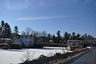
Goffstown is a town in Hillsborough County, New Hampshire, United States. The population was 18,577 at the 2020 census. The compact center of town, where 3,366 people resided at the 2020 census, is defined by the U.S. Census Bureau as the Goffstown census-designated place and is located at the junctions of New Hampshire routes 114 and 13. Goffstown also includes the villages of Grasmere and Pinardville. The town is home to Saint Anselm College, the Goffstown Giant Pumpkin Regatta, and was the location of the New Hampshire State Prison for Women, prior to the prison's relocation to Concord in 2018.

Manchester is the most populous city in the U.S. state of New Hampshire and in northern New England. At the 2020 census, it had a population of 115,644.

Pinardville is a census-designated place (CDP) in the town of Goffstown, Hillsborough County, New Hampshire, United States. It is a suburban neighborhood adjacent to the city of Manchester. The population was 5,034 at the 2020 census. Pinardville has existed since 1906.

New Hampshire Route 114 is a 60.433-mile-long (97.257 km) secondary north–south highway in central New Hampshire. The highway runs between Bedford in Hillsborough County and Grantham in Sullivan County.

The Amoskeag Manufacturing Company was a textile manufacturer which founded Manchester, New Hampshire, United States. From modest beginnings it grew throughout the 19th century into the largest cotton textile plant in the world. At its peak, Amoskeag had 17,000 employees and around 30 buildings.

District A is a historic worker housing district located in Manchester, New Hampshire, near the former Amoskeag Manufacturing Company millyard. It is bounded by Pleasant, State, Granite, and Bedford streets, and includes seven surviving tenement blocks built by Amoskeag between 1843 and 1852. The district was added to the National Register of Historic Places on November 12, 1982.

District D is a historic worker housing district located in Manchester, New Hampshire, near the former Amoskeag Manufacturing Company millyard. It is roughly bounded by Canal, Langdon, Elm, and West Brook streets, and was added to the National Register of Historic Places on November 12, 1982. It contains three residential buildings constructed in 1864 in an area of about 3 acres (1 ha).

District E is a historic worker housing district in Manchester, New Hampshire, near the former Amoskeag Manufacturing Company millyard, at 258-322 McGregor Street on the west bank of the Merrimack River. It consists of five single-family houses, built in 1882 for overseers at the mills. It was added to the National Register of Historic Places on November 12, 1982.

The Merrimack Valley is a bi-state region along the Merrimack River in the U.S. states of New Hampshire and Massachusetts. The Merrimack is one of the larger waterways in New England and has helped to define the livelihood and culture of those living along it for millennia.

Ste. Marie Church is a Roman Catholic church on the West Side of Manchester, New Hampshire, in the United States. The church was founded to serve the needs of French-Canadian Catholic immigrants to New Hampshire. The Gothic Revival church building is a prominent feature on the Manchester skyline, and dominates the West Side skyline. The building is perched atop the plateau that makes up Rimmon Heights, and forms one of the focal points of the Notre Dame neighborhood, along with Lafayette Park across the street.

Uptown is a PID and a dense neighborhood in Dallas, Texas. Uptown is north of and adjacent to downtown Dallas, and is bordered by US 75 on the east, N Haskell Avenue on the northeast, the Katy Trail on the northwest, Bookhout Street and Cedar Springs Road on the west, N Akard Street on the southwest and Spur 366 on the south.

Manchester, the largest city in New Hampshire, is made up of 25 neighborhoods, according to the Manchester Planning Board in its 2010 master plan. Recognition of particular neighborhoods varies, with some having neighborhood associations, but none have any legal or political authority.

2+1⁄2 Beacon Street, also known as the former New Hampshire State Prison Warehouse, is a historic commercial building at 2+1⁄2 Beacon Street in Concord, New Hampshire. Built in 1860 and enlarged in 1868, it is the only major surviving element of New Hampshire's first state prison complex, which was mostly torn down in the 1890s. The building was listed on the National Register of Historic Places in 1984.
The Goffstown Covered Railroad Bridge was a rare railroad covered bridge in Goffstown, New Hampshire. It was built in 1901 by the Boston and Maine Railroad, on the site of an earlier bridge built in 1850 by the New Hampshire Central Railroad, and carried its tracks across the Piscataquog River in the center of Goffstown. The bridge was listed on the National Register of Historic Places in 1975. It was destroyed by arson in 1976, as would later be the case with the Hillsborough Railroad Bridge in 1985.

Parker's Store is a historic retail building at 18 Parker Station Road in Goffstown, New Hampshire. The two-story wood-frame structure was built before 1804, and is one of the state's few surviving early retail structures. It has been home to the Goffstown Historical Society since 1973, when it was donated by the Parker family. The building was listed on the National Register of Historic Places in 1980.

Klondike Corner is a census-designated place (CDP) in the town of New Boston in Hillsborough County, New Hampshire, United States. As of the 2020 census the population was 652.

