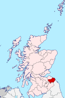
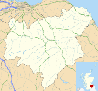
Berwickshire is a historic county, registration county and lieutenancy area in southeastern Scotland, on the English border. It takes its name from Berwick-upon-Tweed, which was part of the Kingdom of Northumbria at the time of the county's formation, but became part of England in 1482 after several centuries of swapping back and forth between the two kingdoms.

The former Royal Burgh of Lauder is a town in the Scottish Borders in the historic county of Berwickshire. On the Southern Upland Way, the burgh lies 27 miles (43 km) southeast of Edinburgh, on the western edge of the Lammermuir Hills.

The Lammermuirs are a range of hills in southern Scotland, forming a natural boundary between East Lothian and the Borders.

Greenlaw is a town and civil parish situated in the foothills of the Lammermuir Hills on Blackadder Water at the junction of the A697 and the A6105 in the Scottish Borders area of Scotland. At the 2001 census, the parish had a population of 661.

Dunglass is a hamlet in East Lothian, Scotland, lying east of the Lammermuir Hills on the North Sea coast, within the parish of Oldhamstocks. It has a 15th-century collegiate church, now in the care of Historic Scotland. Dunglass is the birthplace of Sir James Hall, an 18th-century Scottish geologist and geophysicist. The name Dunglass comes from the Brittonic for "grey-green hill".

Abbey St Bathans is a parish in the Lammermuir district of Berwickshire, in the eastern part of the Scottish Borders. Unique in its topography, it is situated in a long winding steep wooded valley that follows the Whiteadder Water. The parish had a population of 106 at the 2011 Census.

Cockburnspath is a village in the Scottish Borders area of Scotland. It lies near the North Sea coast between Berwick-upon-Tweed and Edinburgh. It is at the eastern extremity of the Southern Upland Way a long-distance footpath from the west to east coast of Scotland. It is also the termini of the Sir Walter Scott Way and the Berwickshire Coastal Path. At the nearby village of Cove, there is a small fishing harbour.
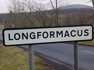
Longformacus is a small village in Berwickshire in the Scottish Borders area of Scotland. It is around 10 kilometres (6.2 mi) north-west of Duns, in the Lammermuir Hills. The Dye Water runs through the village, flowing east towards its confluence with the Whiteadder Water nearby.

Garvald is a village south-east of Haddington in East Lothian, Scotland. It lies on the Papana Water south of the B6370, east of Gifford. The combined parish of Garvald and Bara, borders Whittingehame to the East, Morham to the North, Yester to the West, and Lauder to the South. It is mainly an agricultural parish. The red freestone once constantly mined in this parish was well known throughout the whole country.

The River Leader, or Leader Water, is a small tributary of the River Tweed in Lauderdale in the Scottish Borders. It flows southwards from the Lammermuir Hills through the towns of Lauder and Earlston, joining the River Tweed at Leaderfoot.
Fogo is a village in the county of Berwickshire, in the Borders of Scotland, 3 miles south of Duns, on the Blackadder Water.
Preston is a small village in the ancient county of Berwickshire, now an administrative area of the Scottish Borders region of Scotland. It lies within the local Abbey St Bathans, Bonkyl & Preston Community Council area.
Leitholm is a village in the Scottish Borders area of Scotland, 4 miles (6.4 km) north-west of Coldstream, in the former county of Berwickshire.

Legerwood is a village by the Eden Water, in the Scottish Borders area of Scotland, near Lauder, near the Southern Upland Way.

Edrom is a parish and small village in the pre-1975 ancient county of Berwickshire, now an administrative area of the Scottish Borders region of Scotland.

Cranshaws is a village on the B6355 road, near Duns, in the Scottish Borders area of Scotland, in the former Berwickshire.
Bassendean is a village in the Scottish Borders area of Scotland, 4 kilometres (2.5 mi) south of Westruther and 3 kilometres (1.9 mi) north-west of Gordon. It is by the Eden Water in the former Berwickshire, immediately south of the hamlet of Houndslow.
William Notman (1809-1893) was a 19th-century Scottish architect. Early work assisting Playfair focussed on country houses, but his later independent work was more commercial in nature.


