Whetstone, Arizona

Last updated

Whetstone, Arizona
CDP
Cochise County Arizona Incorporated and Unincorporated areas Whetstone Highlighted 0482156.svg
Location of Whetstone in Cochise County, Arizona.
Usa edcp location map.svg
Red pog.svg
Whetstone, Arizona
Location in the United States
Coordinates: 31°43′34″N110°16′23″W / 31.72611°N 110.27306°W / 31.72611; -110.27306
CountryUnited States
State Arizona
County Cochise
Area
[1]
  Total93.96 sq mi (243.36 km2)
  Land93.96 sq mi (243.34 km2)
  Water0.01 sq mi (0.01 km2)
Elevation
[2]
4,193 ft (1,278 m)
Population
 (2020)
  Total3,236
  Density34.44/sq mi (13.30/km2)
Time zone UTC-7 (MST (no DST))
ZIP code
85616
Area code 520
FIPS code 04-82155
GNIS feature ID2409579 [2]

Whetstone is a census-designated place (CDP) in Cochise County, Arizona, United States, north of Sierra Vista. The population was 2,617 at the 2010 census. [3]

Contents

History

Whetstone was often referred to as the "Y" because the intersection of State routes 82 and 90 had an eastbound lane on 90 and a southbound lane on 82 that created a Y at the intersection. Highway 90 ended one to two miles further north and people traveling north had to go via highway 82 east or west and then north on either highway 83 or highway 80.[ citation needed ]

Geography

According to the United States Census Bureau, the CDP has a total area of 11.8 square miles (31 km2), all land.

Demographics

Historical population
CensusPop.Note
2020 3,236
U.S. Decennial Census [4]

As of the census [5] of 2000, there were 2,354 people, 904 households, and 664 families residing in the CDP. The population density was 199.5 inhabitants per square mile (77.0/km2). There were 1,056 housing units at an average density of 89.5 per square mile (34.6/km2). The racial makeup of the CDP was 84.0% White, 2.9% Black or African American, 1.2% Native American, 0.9% Asian, 6.5% from other races, and 4.5% from two or more races. 13.8% of the population were Hispanic or Latino of any race.

There were 904 households, out of which 32.7% had children under the age of 18 living with them, 57.2% were married couples living together, 10.7% had a female householder with no husband present, and 26.5% were non-families. 20.7% of all households were made up of individuals, and 6.9% had someone living alone who was 65 years of age or older. The average household size was 2.60 and the average family size was 3.02.

In the CDP, the age distribution of the population shows 27.4% under the age of 18, 5.6% from 18 to 24, 25.3% from 25 to 44, 28.0% from 45 to 64, and 13.7% who were 65 years of age or older. The median age was 40 years. For every 100 females, there were 97.3 males. For every 100 females age 18 and over, there were 95.0 males.

The median income for a household in the CDP was $34,507, and the median income for a family was $37,656. Males had a median income of $32,083 versus $25,424 for females. The per capita income for the CDP was $16,370. About 13.4% of families and 20.0% of the population were below the poverty line, including 32.3% of those under age 18 and 1.3% of those age 65 or over.

Related Research Articles

<span class="mw-page-title-main">Hill 'n Dale, Florida</span> Census-designated place in Florida, United States

Hill 'n Dale is a census-designated place (CDP) in Hernando County, Florida, United States. The population was 1,934 at the 2010 census.

<span class="mw-page-title-main">Northdale, Florida</span> Census-designated place in Florida, United States

Northdale is an unincorporated census-designated place in Hillsborough County, Florida, United States. Northdale was named by the combination of the words in North Dale Mabry, the main highway through the Northdale area. The population was 22,079 at the 2010 census.

<span class="mw-page-title-main">Beacon Square, Florida</span> CDP in Florida, United States

Beacon Square is a census-designated place (CDP) in Pasco County, Florida, United States. The population was 7,263 at the 2000 census.

<span class="mw-page-title-main">Cumberland Center, Maine</span> Census-designated place in Maine, United States

Cumberland Center is a census-designated place (CDP) within the town of Cumberland in Cumberland County, Maine, United States. The population was 2,499 at the 2010 census. It is part of the Portland – South Portland – Biddeford, Maine, Metropolitan Statistical Area.

<span class="mw-page-title-main">Wilson-Conococheague, Maryland</span> CDP in Maryland, United States

Wilson-Conococheague is a census-designated place (CDP) in Washington County, Maryland, United States. The population was 2,262 at the 2020 census.

<span class="mw-page-title-main">Four Corners, Montana</span> Census-designated place in Montana, United States

Four Corners is a census-designated place (CDP) in Gallatin County, Montana, United States. The population was 5,901 at the 2020 census, up from 3,146 in 2010. It is part of the Bozeman, MT Micropolitan Statistical Area.

<span class="mw-page-title-main">Wesley Chapel South, Florida</span> Unincorporated community in Florida, United States

Wesley Chapel South is an unincorporated community in Pasco County, Florida, United States. The population was 3,245 at the 2000 census.

<span class="mw-page-title-main">Granville South, Ohio</span> Census-designated place in Ohio, United States

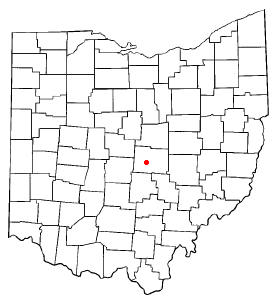
Granville South is a census-designated place (CDP) in Licking County, Ohio, United States. The population was 1,420 at the 2020 census.

<span class="mw-page-title-main">Dry Creek, Oklahoma</span> Census-designated place in Oklahoma, United States

Dry Creek is an unincorporated community and census-designated place (CDP) in Cherokee County, Oklahoma, United States. The population was 227 at the 2010 census.

<span class="mw-page-title-main">Hartstown, Pennsylvania</span> Census-designated place in Pennsylvania, United States

Hartstown is a census-designated place (CDP) in Crawford County, Pennsylvania, United States. The population was 201 at the 2010 census, down from 246 in 2000.

Timber Hills is an unincorporated community and census-designated place (CDP) in Lebanon County, Pennsylvania, United States. The population was 360 at the 2010 census.

Oneida is a census-designated place (CDP) in Schuylkill County, Pennsylvania. The population was 219 at the 2000 census.

<span class="mw-page-title-main">Centerville, South Carolina</span> CDP in South Carolina, United States

Centerville is a census-designated place (CDP) in Anderson County, South Carolina. The population was 7,185 at the 2020 census.

<span class="mw-page-title-main">Northlake, South Carolina</span> CDP in South Carolina, United States

Northlake is a census-designated place (CDP) in Anderson County, South Carolina. The population was 3,818 at the 2020 census.

Duncan is a census-designated place (CDP) in Greenville County, South Carolina, United States. The population was 3,671 at the 2010 census, down from 4,158 in 2000. It is part of the Greenville–Mauldin–Easley Metropolitan Statistical Area.

Judson is a census-designated place (CDP) in Greenville County, South Carolina, United States. The population was 2,050 at the 2010 census, down from 2,456 at the 2000 census. It is part of the Greenville–Mauldin–Easley Metropolitan Statistical Area.

Parker is a census-designated place (CDP) in Greenville County, South Carolina, United States. The population was 11,431 at the 2010 census, up from 10,760 in 2000. It is part of the Greenville–Mauldin–Easley Metropolitan Statistical Area.

Sans Souci is a census-designated place (CDP) in Greenville County, South Carolina, United States. The population was 7,869 at the 2010 census. It is part of the Greenville-Anderson-Mauldin, SC Metropolitan Statistical Area.

<span class="mw-page-title-main">Welcome, South Carolina</span> Census-designated place in South Carolina, United States

Welcome is a census-designated place (CDP) in Greenville County, South Carolina, United States. The population was 6,668 at the 2010 census. It is part of the Greenville–Mauldin–Easley Metropolitan Statistical Area. Welcome has been noted for its colorful place name.

<span class="mw-page-title-main">Eastchester (CDP), New York</span> CDP in New York, United States

Eastchester is a census-designated place (CDP) in Westchester County, New York, United States. The population was 19,554 at the 2010 census. The Eastchester CDP consists of the Town of Eastchester excluding the villages of Bronxville and Tuckahoe.

References

  1. "2020 U.S. Gazetteer Files". United States Census Bureau. Retrieved October 29, 2021.
  2. 1 2 U.S. Geological Survey Geographic Names Information System: Whetstone, Arizona
  3. Website Services & Coordination Staff(WSCS). "2010 Census Interactive Population Search". Archived from the original on March 30, 2014. Retrieved December 29, 2014.
  4. "Census of Population and Housing". Census.gov. Retrieved June 4, 2016.
  5. "U.S. Census website". United States Census Bureau . Retrieved January 31, 2008.