Whiteway, Bath

Last updated
Part of Haycombe Drive at Whiteway The beeches whiteway 2.jpg
Part of Haycombe Drive at Whiteway

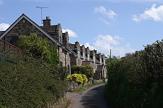
Whiteway is the name given to a housing estate contained within the Southdown and Twerton electoral wards of Bath, Somerset, England. The construction of the estate began shortly before the outbreak of the Second World War. [1] Whiteway falls within the parish of St Barnabas Church at Mount Road, Southdown. [2] Also close by is Southdown Methodist Centre at The Hollow, which provides a range of weekly support services. [3]

Housing estate group of homes and other buildings built together as a single development

A housing estate is a group of homes and other buildings built together as a single development. The exact form may vary from country to country. Accordingly, a housing estate is usually built by a single contractor, with only a few styles of house or building design, so they tend to be uniform in appearance. In the British Isles, the term is quite broad, and can include anything from high rise government-subsidised housing, right through to more upmarket, developer-led suburban tract housing.

Twerton suburb of Bath in Somerset

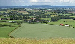
Twerton is a suburb of the city of Bath, Somerset, England, situated to the west of the city, and home to the city's football club, Bath City.

Bath, Somerset City in Somerset, England

Bath is the largest city in the ceremonial county of Somerset, England, known for its Roman-built baths. In 2011, the population was 88,859. Bath is in the valley of the River Avon, 97 miles (156 km) west of London and 11 miles (18 km) south-east of Bristol. The city became a World Heritage site in 1987.

A number of community resources are situated in Whiteway. The Southside Youth Centre at Kelston View offers activities for teenagers and is home to a boxing club for youth. [4] Also at Kelston View is the entrance to Bath City Farm, which is open to the public and organises the Roots and Shoots pre-school group. [5] The Community Playrangers run play sessions for older children at Bath City Farm. An elderly person's group called Golden-Oldies sings hit songs of the 50s, 60s and 70s in the Blagdon Park community room. [6] The Southside Family Project has an office at St Michael's Road and offers extensive services in the areas of counselling and advice. [7]

Goats at Bath City Farm, Kelston View Goats bath city farm.jpg
Goats at Bath City Farm, Kelston View

In December some Whiteway households decorate the exterior of their homes with Christmas lights. Other residents of Bath visit Whiteway to view the display.

A PACT (Partners and Communities Together) meeting is held four times a year in the Southdown Ward. This enables residents of Whiteway and Southdown to discuss local issues with Councillors, the police and representatives from other agencies. The time and venue for the PACT meetings are available from a section of the Avon and Somerset Constabulary website. [8] A website called Proud of Twerton, Whiteway and Southdown provides information pertinent to Whiteway, including regular news, articles, and information about local community groups. [9]

In August 2010 a resident-led group called Changes organised its first community event in Rosewarn Field, Whiteway. [10] Then in November 2010 the group created a website giving details of its projects and philosophy of community action. [11]

Related Research Articles

Bath Spa University university based in, and around, Bath, England

Bath Spa University is a public university in Bath, England, with its main campus based at Newton Park on Duchy of Cornwall land. The University has other campuses in the city of Bath, and one at Corsham Court in Wiltshire.

Gipton human settlement in United Kingdom

Gipton is a suburb of east Leeds, West Yorkshire, England, between the A58 to the north and the A64 to the south.

Midsomer Norton town in Somerset, England

Midsomer Norton is a town near the Mendip Hills in Bath & North East Somerset, England, 10 miles (16 km) south-west of Bath, 10 miles (16 km) north-east of Wells, 10 miles (16 km) north-west of Frome, and 16 miles (26 km) south-east of Bristol. It has a population of 10,997. Along with Radstock and Westfield it used to be part of the conurbation and large civil parish of Norton Radstock, but is now a town council in its own right. It is also part of the unitary authority of Bath and North East Somerset.

Avon Valley Railway

The Avon Valley Railway (AVR) is a three-mile-long heritage railway based at Bitton station in South Gloucestershire, England, not far from Bristol and is run by a local group: The Avon Valley Railway Company Ltd. The railway follows the Avon Valley south-east from Oldland Common, through Bitton and alongside the River Avon towards Kelston and Bath. The railway shares its route with the Sustrans cycleway and footpath, the Bristol & Bath Railway Path.

Bath City F.C. association football club

Bath City Football Club is a semi-professional association football club based in Bath, Somerset, England. The club participates in the National League South, the sixth tier of English football and are managed by former player Jerry Gill.

Bathampton village in the United Kingdom

Bathampton is a village and civil parish 2 miles (3 km) east of Bath, England on the south bank of the River Avon. The parish has a population of 1,603.

Kelston village in the United Kingdom

Kelston is a small village and civil parish in Somerset, 4 miles (6.4 km) north west of Bath, and 8 miles (12.9 km) east of Bristol, on the A431 road. It is situated just north of the River Avon, close to the Kelston and Saltford locks. The parish has a population of 248.

Bishop Sutton village in the United Kingdom

Bishop Sutton is a small village within the Chew Valley in Somerset. It lies south of Chew Valley Lake and north of the Mendip Hills, approximately ten miles south of Bristol on the A368, Weston-super-Mare to Bath road. Bishop Sutton and the neighbouring village of Stowey form the civil parish of Stowey Sutton.

Stowey-Sutton

Stowey-Sutton is a civil parish in the Bath and North East Somerset District of Somerset, England within the Chew Valley. The parish contains the villages of Stowey and Bishop Sutton having a population of 1,361.

Twerton-on-Avon railway station

Twerton on Avon railway station is a former railway station in Bath, Somerset.

Corsley village in United Kingdom

Corsley is a hamlet and civil parish 3 miles (5 km) west of Warminster in Wiltshire, England. The parish is on the county border with Somerset; the Somerset town of Frome is about 3 miles (5 km) to the northwest. The largest settlement in the parish is Corsley Heath, which is on the A362 Warminster-Frome road.

The A431 is an A road running from Bristol to Bath in England. It runs parallel to, and about 3 miles (4.8 km) to the north of, the A4, the principal route between Bristol and Bath on the south side of the River Avon.

Bear Flat neighbourhood of Bath, England

Bear Flat is a neighbourhood within the city of Bath, Somerset, England, to the south of the city centre and to the west of Beechen Cliff. It forms the northern part of Lyncombe electoral ward. The Wellsway road (A367) to Shepton Mallet, runs through Bear Flat, forming part of the ancient British Roman Fosse Way. This was originally the main pilgrimage route from Bath and its abbey, to the nearby ecclesiastical centres of Wells and Glastonbury.

Two Tunnels Greenway

The Two Tunnels Greenway is a shared use path for walking and cycling in Bath, Somerset, England. The route is National Cycle Route 244. The route joins National Cycle Route 24 south of Bath, with National Cycle Route 4 which runs through Bath.

North Stoke, Somerset village in the United Kingdom

North Stoke is a village within the civil parish of Kelston in the Bath and North East Somerset (BANES) unitary authority within the historic county of Somerset, England, and close to the border with South Gloucestershire. The parish has a population of 72.

Winsley village in the United Kingdom

Winsley is a large village and civil parish about 2 miles (3 km) west of Bradford on Avon in Wiltshire, England.

Kelston Park

Kelston Park is located in the village of Kelston, approximately 3 miles from Bath in North East Somerset, England. Altogether the house and gardens of Kelston Park cover an area of approximately 75 hectares. The house has been designated as a Grade II* listed building. The garden is Grade II* listed in the National Register of Historic Parks and Gardens.

Wessex Bus

Wessex Bus was a bus operator in the West of England that operated from June 2007 until September 2018.

References

Whiteway house decorated for Christmas Christmas display whiteway.jpg
Whiteway house decorated for Christmas

Coordinates: 51°22′29″N2°24′17″W / 51.37472°N 2.40472°W / 51.37472; -2.40472

Geographic coordinate system Coordinate system

A geographic coordinate system is a coordinate system that enables every location on Earth to be specified by a set of numbers, letters or symbols. The coordinates are often chosen such that one of the numbers represents a vertical position and two or three of the numbers represent a horizontal position; alternatively, a geographic position may be expressed in a combined three-dimensional Cartesian vector. A common choice of coordinates is latitude, longitude and elevation. To specify a location on a plane requires a map projection.