Whitmore Lake, Michigan

Last updated

Whitmore Lake, Michigan
Whitmore Lake, MI (July 2023).jpg
Looking north along Main Street
Whitmore Lake, MI location.png
Location within Washtenaw County (bottom) and Livingston County (top)
USA Michigan location map.svg
Red pog.svg
Whitmore Lake
Location within the state of Michigan
Usa edcp location map.svg
Red pog.svg
Whitmore Lake
Whitmore Lake (the United States)
Coordinates: 42°26′23″N83°44′38″W / 42.43972°N 83.74389°W / 42.43972; -83.74389
CountryUnited States
State Michigan
Counties Livingston and Washtenaw
Townships Green Oak and Northfield
Settled1825
Area
[1]
  Total6.01 sq mi (15.56 km2)
  Land4.79 sq mi (12.42 km2)
  Water1.21 sq mi (3.14 km2)  20.37%
Elevation
928 ft (283 m)
Population
 (2020)
  Total7,584
  Density1,583.30/sq mi (611.32/km2)
Time zone UTC-5 (EST)
  Summer (DST) UTC-4 (EDT)
ZIP code(s)
48178 (South Lyon)
48189
Area code 734
FIPS code 26-87060 [2]
GNIS feature ID1616386 [3]

Whitmore Lake is a census-designated place (CDP) and unincorporated community in the U.S. state of Michigan. The community spans the boundary between Green Oak Township in Livingston County and Northfield Township in Washtenaw County. The population of the CDP was 7,584 at the 2020 census. [4]

Contents

History

Former railroad depot Ann Arbor Railroad Depot at Whitmore Lake, Michigan.jpg
Former railroad depot

The area was first settled by land surveyors Johnathon Stratton and Luke Whitmore, who came here from nearby Ann Arbor settlement in 1825. Stratton suggested the name of the new area and the surrounding lake as Whitmore, and it became mapped under that name. In 1829, Whitmore owned land in the area and became the first county treasurer. A post office began operating here on June 9, 1834, with George Dexter serving as the first postmaster. The post office was first named Northfield after its northern location in Northfield Township, but it was changed to Whitmore Lake on December 27, 1854. [5]

Geography

According to the United States Census Bureau, the CDP has a total area of 5.3 square miles (13.7 km2), of which 4.2 square miles (10.9 km2) is land and 1.1 square miles (2.8 km2), or 20.37%, is water. [6]

The community is located about 9 miles (14 km) north of Ann Arbor and about 9 miles (14 km) south of Brighton. It is situated around the shores of Whitmore Lake, and the CDP also includes the area around the smaller Horseshoe Lake to the south, Lawton Lake to the east and Monahan Lake to the northeast.

Major highways

Demographics

Historical population
CensusPop.Note
1990 3,251
2000 6,574102.2%
2010 6,423−2.3%
2020 7,58418.1%
U.S. Decennial Census [7]

As of the census [2] of 2000, there were 6,574 people, 2,663 households, and 1,741 families residing in the CDP. The population density was 1,508.5 inhabitants per square mile (582.4/km2). There were 2,960 housing units at an average density of 679.2 per square mile (262.2/km2). The racial makeup of the CDP was 96.05% White, 0.93% African American, 0.46% Native American, 0.47% Asian, 0.12% Pacific Islander, 0.23% from other races, and 1.75% from two or more races. Hispanic or Latino of any race were 1.46% of the population.

There were 2,663 households, out of which 32.7% had children under the age of 18 living with them, 51.7% were married couples living together, 9.4% had a female householder with no husband present, and 34.6% were non-families. 25.8% of all households were made up of individuals, and 4.1% had someone living alone who was 65 years of age or older. The average household size was 2.42 and the average family size was 2.94.

In the CDP, 24.5% of the population was under the age of 18, 7.7% was from 18 to 24, 39.2% from 25 to 44, 20.9% from 45 to 64, and 7.7% were 65 years of age or older. The median age was 34 years. For every 100 females, there were 102.6 males. For every 100 females age 18 and over, there were 98.7 males.

The median income for a household in the CDP was $51,504, and the median income for a family was $63,113. Males had a median income of $42,174 versus $28,865 for females. The per capita income for the CDP was $26,066. About 3.5% of families and 5.2% of the population were below the poverty line, including 5.8% of those under age 18 and 2.2% of those age 65 or over.

Arts and culture

Whitmore Lake Whitmore Lake Michigan.JPG
Whitmore Lake

Fourth of July celebration

4th of July parade, 2011 Whitmore Lake. 4th of July, 2011.jpg
4th of July parade, 2011

Each year Whitmore Lake hosts a weekend-long celebration for Independence Day. In 2011 it marked its 52nd year with the theme "Ignite the Spirit of America". Typical events include a fireworks display over the lake, a boat parade, a ski show performed by the Whitmore Lake Water Ski Club, a running / swimming race, and many other events. [8]

Harvest Festival

The Whitmore Lake Harvest Festival is a two-day event that occurs annually at the end of September, and was first established in 2007. The primary function of the 2009 Harvest Festival was to adopt a pet or donate money towards that cause.[ citation needed ]

Michigan Pond Hockey Classic

The Michigan Pond Hockey Classic is an annual adult pond hockey tournament held on Whitmore Lake. Established in 2008, the event raises funds for families and schools to support youth participation in athletics. [9]

Education

The community is served by Whitmore Lake Public Schools. The Whitmore Lake High School Trojans are members of the Tri-County Conference.

Notable people

Related Research Articles

<span class="mw-page-title-main">Washtenaw County, Michigan</span> County in Michigan, United States

Washtenaw County is a county located in the U.S. state of Michigan. At the 2020 census, the population was 372,258. The county seat and largest city is Ann Arbor. The county was authorized by legislation in 1822 and organized as a county in 1826. Washtenaw County comprises the Ann Arbor Metropolitan Statistical Area. The county is home to the University of Michigan, Eastern Michigan University, Washtenaw Community College, and Concordia University Ann Arbor.

<span class="mw-page-title-main">Livingston County, Michigan</span> County in Michigan, United States

Livingston County is a county in the U.S. state of Michigan. As of the 2020 Census, the population was 193,866. It is part of the Detroit-Warren-Dearborn, MI Metropolitan Statistical Area. The county seat and most populous city is Howell. The county was platted in 1833, but for three years remained assigned to Shiawassee and Washtenaw counties for revenue, taxation and judicial matters. It was formally organized in 1836. As one of Michigan's "Cabinet counties", a group of ten counties whose names honor members of President Andrew Jackson's Cabinet, it is named after former US Secretary of State Edward Livingston. Livingston County's location in Southeast Michigan offers residents relatively convenient access to the metropolitan centers of Detroit, Lansing, Ann Arbor, and Flint. Livingston County residents regularly commute to those centers, using the three major expressways which pass through the county: I-96, US 23, and M-59. Although continuing to be composed largely of bedroom communities, the county is experiencing and maintaining significant growth in both the service and industrial economic sectors. Major employers include Tribar, PepsiCo, Citizens Insurance, and ThaiSummit. The Brighton Recreation Area is in the county.

<span class="mw-page-title-main">Fish Hawk, Florida</span> Census-designated place in Florida, United States

Fish Hawk is an unincorporated area and census-designated place (CDP) in Hillsborough County, Florida, United States. It is a suburb of Tampa, and includes a portion of the community of Lithia. As of the 2020 census, the CDP had a population of 24,625. The place name is derived from Little Fishhawk Creek, a tributary of the Alafia River that joins the Alafia just west of Lithia Springs.

<span class="mw-page-title-main">Whitmore Village, Hawaii</span> Census-designated place in Hawaii, United States

Whitmore Village is a census-designated place (CDP) in Honolulu County, Hawaiʻi, United States. The population was 4,887 at the 2020 census.

<span class="mw-page-title-main">Lake Arbor, Maryland</span> Census-designated place in Maryland, United States

Lake Arbor is an unincorporated area and census-designated place (CDP) in Prince George's County, Maryland, United States. The population was 14,541 at the 2020 census. It is one of the nation's most affluent African-American communities. The ZIP Codes encompassing the CDP area are 20721 and 20774.

<span class="mw-page-title-main">Cochituate, Massachusetts</span> Census-designated place in Massachusetts, United States

Cochituate is a census-designated place (CDP) in the town of Wayland in Middlesex County, Massachusetts, United States. The population was 6,927 at the 2020 census, out of 13,943 in the entire town of Wayland.

<span class="mw-page-title-main">Elberta, Michigan</span> Village in Michigan, United States

Elberta is a village in Benzie County in the U.S. state of Michigan. The population was 329 at the 2020 census. Located in Gilmore Township, Elberta overlooks Lake Michigan and lies across Betsie Lake from Frankfort. Elberta is part of Northern Michigan.

<span class="mw-page-title-main">Inland Township, Michigan</span> Civil township in Michigan, United States

Inland Township is a civil township of Benzie County in the U.S. state of Michigan. The population was 2,386 at the 2020 census. The township is located in the east of the county, and shares a border with Grand Traverse County. The Platte River flows through the north of the township.

<span class="mw-page-title-main">Lake Michigan Beach, Michigan</span> Census-designated place & unincorporated community in Michigan, United States

Lake Michigan Beach is an unincorporated community in Berrien County in the U.S. state of Michigan. It is a census-designated place (CDP) for statistical purposes, without any legal status as a municipality. The population was 1,101 at the 2020 census.

<span class="mw-page-title-main">Argentine, Michigan</span> Census-designated place & unincorporated community in Michigan, United States

Argentine is an unincorporated community and census-designated place (CDP) in Argentine Township, Genesee County, in the U.S. state of Michigan. The population was 2,685 as of the 2020 census, up from 2,525 at the 2010 census. It was first settled in 1836.

<span class="mw-page-title-main">Lake Fenton, Michigan</span> Census-designated place & unincorporated community in Michigan, United States

Lake Fenton is a census-designated place (CDP) in Fenton Charter Township, Genesee County in the U.S. state of Michigan. As of the 2010 census the population was 5,559, up from 4,876 at the 2000 census. The CDP includes the unincorporated communities of Bayport Park and Lakeside.

<span class="mw-page-title-main">Weidman, Michigan</span> Census-designated place & unincorporated community in Michigan, United States

Weidman is an unincorporated community in Isabella County, Michigan, United States. It is a census-designated place (CDP) for statistical purposes, but has no independent municipal authority. The population of the CDP was 959 at the 2010 census, up from 879 at the 2000 census.

<span class="mw-page-title-main">Cascade Township, Michigan</span> Charter township in Michigan, United States

Cascade Charter Township is a charter township of Kent County in the U.S. state of Michigan. The population was 19,667 at the 2020 census.

<span class="mw-page-title-main">Hamburg Township, Michigan</span> Civil township in Michigan, United States

Hamburg Township is a civil township of Livingston County in the U.S. state of Michigan. As of the 2020 census, the township population was 21,259. It is the most populated municipality in Livingston County.

<span class="mw-page-title-main">Stony Point, Michigan</span> Census-designated place & unincorporated community in Michigan, United States

Stony Point is an unincorporated community and census-designated place (CDP) in Monroe County in the U.S. state of Michigan. The population was 1,784 at the 2020 census. The CDP is located within Frenchtown Charter Township.

<span class="mw-page-title-main">Ann Arbor Charter Township, Michigan</span> Charter township in Michigan, United States

Ann Arbor Charter Township is a charter township of Washtenaw County in the U.S. state of Michigan. The population was 4,673 at the 2020 census. The township borders the city of Ann Arbor and contains numerous exclaves, but the two are administered autonomously.

<span class="mw-page-title-main">Webster Township, Michigan</span> Civil township in Michigan, United States

Webster Township is a civil township of Washtenaw County in the U.S. state of Michigan. The population was 6,575 at the 2020 census.

<span class="mw-page-title-main">Northfield Township, Michigan</span> Civil township in Michigan, United States

Northfield Township is a civil township of Washtenaw County in the U.S. state of Michigan. The population was 8,514 at the 2020 census.

<span class="mw-page-title-main">Tilton Northfield, New Hampshire</span> Census-designated place in New Hampshire, United States

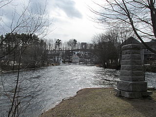
Tilton Northfield is a census-designated place (CDP) representing two adjacent villages in the towns of Tilton in Belknap County and Northfield in Merrimack County in the U.S. state of New Hampshire. The CDP encompasses the town centers of both Tilton and Northfield, located on either side of the Winnipesaukee River. The population was 3,324 at the 2020 census.

<span class="mw-page-title-main">Spring Arbor, Michigan</span> Census-designated place & unincorporated community in Michigan, United States

Spring Arbor is an unincorporated community and census-designated place (CDP) in Jackson County in the U.S. state of Michigan. The population of the CDP was 2,881 at the 2010 census, up from 2,188 at the 2000 census. The CDP is located within Spring Arbor Township.

References

  1. "2020 U.S. Gazetteer Files". United States Census Bureau. Retrieved May 21, 2022.
  2. 1 2 "U.S. Census website". United States Census Bureau . Retrieved January 31, 2008.
  3. U.S. Geological Survey Geographic Names Information System: Whitmore Lake, Michigan
  4. "Profile of General Population and Housing Characteristics: 2020 Demographic Profile Data (DP-1): Whitmore Lake CDP, Michigan". United States Census Bureau . Retrieved January 24, 2023.
  5. Romig, Walter (October 1, 1986) [1973]. Michigan Place Names: The History of the Founding and the Naming of More Than Five Thousand Past and Present Michigan Communities (Paperback). Detroit, Michigan: Wayne State University Press. p. 602. ISBN   978-0-8143-1838-6.{{cite book}}: |work= ignored (help)
  6. "Geographic Identifiers: 2010 Demographic Profile Data (G001): Whitmore Lake CDP, Michigan". United States Census Bureau . Retrieved July 10, 2012.
  7. "Census of Population and Housing". Census.gov. Retrieved June 4, 2016.
  8. "Whitmore Lake 4th of July Celebration". Ann Arbor Events Calendar. AnnArbor.com.
  9. "Michigan Pond Hockey Classic". Michigan Pond Hockey Sports Charities. Retrieved March 26, 2020.