Winona Lake, Indiana

Last updated

Winona Lake, Indiana
Winona Lake - panoramio (3).jpg
Kosciusko County Indiana Incorporated and Unincorporated areas Winona Lake Highlighted 1884950.svg
Location of Winona Lake in Kosciusko County, Indiana.
Coordinates: 41°12′57″N85°48′33″W / 41.21583°N 85.80917°W / 41.21583; -85.80917
Country United States
State Indiana
County Kosciusko
Township Wayne
Area
[1]
  Total3.43 sq mi (8.89 km2)
  Land2.94 sq mi (7.61 km2)
  Water0.49 sq mi (1.28 km2)
Elevation
[2]
866 ft (264 m)
Population
 (2020)
  Total5,053
  Density1,720.46/sq mi (664.29/km2)
Time zone UTC-5 (Eastern (EST))
  Summer (DST) UTC-4 (EDT)
ZIP code
46590
Area code 574
FIPS code 18-84950 [3]
GNIS feature ID2397751 [2]
Website http://www.winonalake.net/

Winona Lake is a town in Wayne Township, Kosciusko County, in the U.S. state of Indiana, and the major suburb of Warsaw. [2] The population was 4,908 at the 2010 census.

Contents

Geography

Winona Lake is now contiguous to Warsaw, the two towns having run into each other as they have expanded.

According to the 2010 census, Winona Lake has a total area of 3.25 square miles (8.42 km2), of which 2.76 square miles (7.15 km2) (or 84.92%) is land and 0.49 square miles (1.27 km2) (or 15.08%) is water. [4]

History

Winona Lake is best known for the lake it is named after and built on, although the lake was originally known as Eagle Lake. Located along the eastern shore of the lake, the Winona Lake Historic District includes various historic homes and other buildings that attest to the area's history as a Chautauqua and Bible conference hotspot. It is also the home of Grace College and Grace Theological Seminary and was the home of famed preacher and professional baseball player Billy Sunday who died in 1935. The Billy Sunday Home has been preserved as a museum. Christian musician and preacher Homer Rodeheaver also made Winona Lake his home from 1912 until his death in 1955. The Winona School of Professional Photography was started there in 1912 (as the Indiana School of Photography) and was operated by the Professional Photographers of America (PPA) until its move to Chicago (Mount Prospect) in 1988. Famous photographers from around the world taught there during summer-only classes. The now defunct Winona College was founded here, [5] and the Winona Lake School of Theology was located here from 1920 to 1970. Winona Lake was also home to the headquarters of The Free Methodist Church until it moved its offices to Indianapolis in 1990.

The Winona Lake Historic District was listed on the National Register of Historic Places in 1993. [6]

Demographics

Historical population
CensusPop.Note
1920 300
1930 45451.3%
1940 74363.7%
1950 1,36683.8%
1960 1,92841.1%
1970 2,81145.8%
1980 2,8270.6%
1990 4,05343.4%
2000 3,987−1.6%
2010 4,90823.1%
2020 5,0533.0%
U.S. Decennial Census [7]

2010 census

At the 2010 census there were 4,908 people, 1,569 households, and 1,098 families living in the town. The population density was 1,778.3 inhabitants per square mile (686.6/km2). There were 1,786 housing units at an average density of 647.1 per square mile (249.8/km2). The racial makup of the town was 92.2% White, 1.5% African American, 0.1% Native American, 1.0% Asian, 4.0% from other races, and 1.2% from two or more races. Hispanic or Latino of any race were 7.4%. [8]

Of the 1,569 households 35.2% had children under the age of 18 living with them, 57.9% were married couples living together, 8.2% had a female householder with no husband present, 4.0% had a male householder with no wife present, and 30.0% were non-families. 25.0% of households were one person and 11.1% were one person aged 65 or older. The average household size was 2.62 and the average family size was 3.13.

The median age in the town was 28.3 years. 23.7% of residents were under the age of 18; 22.3% were between the ages of 18 and 24; 21.3% were from 25 to 44; 19.9% were from 45 to 64; and 12.7% were 65 or older. The gender makeup of the town was 46.6% male and 53.4% female.

2000 census

At the 2000 census there were 3,987 people, 1,371 households, and 972 families living in the town. The population density was 1,375.7 inhabitants per square mile (531.2/km2). There were 1,513 housing units at an average density of 522.0 per square mile (201.5/km2). The racial makup of the town was 91.15% White, 0.75% African American, 0.03% Native American, 0.85% Asian, 0.03% Pacific Islander, 5.74% from other races, and 1.45% from two or more races. Hispanic or Latino of any race were 8.28%. [3]

Of the 1,371 households 39.4% had children under the age of 18 living with them, 58.8% were married couples living together, 8.5% had a female householder with no husband present, and 29.1% were non-families. 23.3% of households were one person and 5.3% were one person aged 65 or older. The average household size was 2.73 and the average family size was 3.25.

The age distribution was 28.8% under the age of 18, 10.2% from 18 to 24, 29.2% from 25 to 44, 18.8% from 45 to 64, and 12.9% 65 or older. The median age was 32 years. For every 100 females, there were 95.6 males. For every 100 females age 18 and over, there were 91.9 males.

The median household income was $42,454 and the median family income was $50,817. Males had a median income of $35,313 versus $25,769 for females. The per capita income for the town was $19,025. About 3.6% of families and 6.7% of the population were below the poverty line, including 5.3% of those under age 18 and 7.0% of those age 65 or over.

Related Research Articles

<span class="mw-page-title-main">Oldtown, Idaho</span> City in Idaho, United States

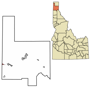
Oldtown is a city in Bonner County, Idaho and suburb of Newport, Washington, with a population of 184 at the 2010 census. It is located on the Pend Oreille River, just east of Newport. There are no natural or physical barriers, and it is strictly a political division, separated by the straight-line state boundary. Oldtown is squeezed between this boundary to the west and the river to the east, leaving the main business district on U.S. Route 2 with only 700 feet of space in which to operate on the Idaho side. Many homes are located in the south end on the other side of the railroad, as the Pend Oreille is somewhat further away here.

<span class="mw-page-title-main">Grabill, Indiana</span> Town in Indiana, United States

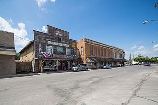
Grabill is a town in Cedar Creek Township, Allen County, Indiana, United States. The population was 1,053 at the 2010 census. Today it is known for the presence of antique stores and Amish farms. An incorporated town, Grabill has two community parks within the corporate limits.

<span class="mw-page-title-main">Ulen, Indiana</span> Town in Indiana, United States

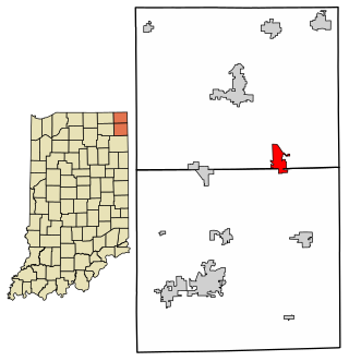
Ulen is a town in Center Township, Boone County, in the U.S. state of Indiana. The population was 117 at the 2010 census. The town is surrounded by the city of Lebanon.

<span class="mw-page-title-main">Hamilton, Indiana</span> Town in Indiana, United States

Hamilton is a town located on the border of Steuben County, Indiana and DeKalb County, Indiana. In Steuben County, it is in Otsego Township, and in DeKalb County it is in Franklin Township. The population was 1,532 at the 2010 census.

<span class="mw-page-title-main">Silver Lake, Indiana</span> Town in Indiana, United States

Silver Lake is a town in Lake Township, Kosciusko County, in the U.S. state of Indiana. The population was 915 at the 2010 census.

<span class="mw-page-title-main">Syracuse, Indiana</span> Town in Indiana, United States

Syracuse is a town in Turkey Creek Township, Kosciusko County, in the U.S. state of Indiana. The population was 3,079 at the 2020 census. Syracuse is the location of Lake Syracuse and the nearby, larger Lake Wawasee, in addition to several other lakes in the region. The National Weather Service operates a Weather Forecast Office South of town, toward North Webster. It serves Northern Indiana.

<span class="mw-page-title-main">Clear Lake, Indiana</span> Town in Indiana, United States

Clear Lake is a town located in the northeast corner of Steuben County, Indiana, in Clear Lake Township. As such, is the northeasternmost community in the State of Indiana. The population was 339 at the 2010 census.

<span class="mw-page-title-main">Monticello, Indiana</span> City in Indiana, United States

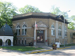
Monticello is a city in and the county seat of White County, Indiana, United States. The population was 5,508 at the 2020 census. Monticello is known as a tourist destination in north-central Indiana and is home to the Indiana Beach amusement park on Lake Shafer, and Lake Freeman.

<span class="mw-page-title-main">Larwill, Indiana</span> Town in Indiana, United States

Larwill is a town in Richland Township, Whitley County, in the U.S. state of Indiana. The population was 283 at the 2010 census.

<span class="mw-page-title-main">Macksburg, Iowa</span> City in Iowa, United States

Macksburg is a city in Madison County, Iowa, United States. The population was 97 at the time of the 2020 census. It is part of the Des Moines–West Des Moines Metropolitan Statistical Area.

<span class="mw-page-title-main">Gilman, Iowa</span> City in Iowa, United States

Gilman is a city in the southeastern corner of Marshall County, Iowa, United States. The population was 542 at the time of the 2020 census.

<span class="mw-page-title-main">Ruthven, Iowa</span> City in Iowa, United States

Ruthven is a city in Palo Alto County, Iowa, United States. The population was 725 at the time of the 2020 census.

<span class="mw-page-title-main">Birmingham, Iowa</span> City in Iowa, United States

Birmingham is a city in Van Buren County, Iowa, United States. The population was 367 at the 2020 census.

<span class="mw-page-title-main">Minnesota City, Minnesota</span> City in Minnesota, United States

Minnesota City is a city in Winona County, Minnesota, United States. The population was 202 at the 2020 census.

<span class="mw-page-title-main">Stockton, Minnesota</span> City in Minnesota, United States

Stockton is a city in Winona County, Minnesota, United States. The population was 809 at the 2020 census.

<span class="mw-page-title-main">Wheatland, Missouri</span> City in Missouri, United States

Wheatland is a city in Hickory County, Missouri, United States. The population was 277 at the 2020 census.

<span class="mw-page-title-main">Winfield, Missouri</span> City in Missouri, United States

Winfield is a city in Lincoln County, Missouri, United States. The population was 1,404 at the 2010 census.

<span class="mw-page-title-main">Clearwater, Nebraska</span> Village in Antelope County, Nebraska, United States

Clearwater is a village in Antelope County, Nebraska, United States. The population was 419 at the 2010 census.

<span class="mw-page-title-main">Milligan, Nebraska</span> Village in Nebraska, United States

Milligan is a village in Fillmore County, Nebraska, United States. The population was 241 at the 2020 census.

<span class="mw-page-title-main">Readstown, Wisconsin</span> Village in Wisconsin, United States

Readstown is a village in Vernon County, Wisconsin, United States. The population was 376 at the 2020 census.

References

  1. "2020 U.S. Gazetteer Files". United States Census Bureau. Retrieved March 16, 2022.
  2. 1 2 3 U.S. Geological Survey Geographic Names Information System: Winona Lake, Indiana
  3. 1 2 "U.S. Census website". United States Census Bureau . Retrieved January 31, 2008.
  4. "G001 - Geographic Identifiers - 2010 Census Summary File 1". United States Census Bureau. Archived from the original on February 13, 2020. Retrieved July 25, 2015.
  5. The History of The Village at Winona
  6. "National Register Information System". National Register of Historic Places . National Park Service. July 9, 2010.
  7. "Census of Population and Housing". Census.gov. Retrieved June 4, 2015.
  8. "U.S. Census website". United States Census Bureau . Retrieved December 11, 2012.