Yarrow, Scottish Borders

Last updated

Yarrow
Scottish Borders UK location map.svg
Red pog.svg
Yarrow
Location within the Scottish Borders
OS grid reference NT357277
Council area
Country Scotland
Sovereign state United Kingdom
Post town Selkirk
Postcode district TD
Police Scotland
Fire Scottish
Ambulance Scottish
UK Parliament
Scottish Parliament
List of places
UK
Scotland
55°32′21″N3°01′09″W / 55.53917°N 3.01917°W / 55.53917; -3.01917
The Yarrow Valley at Yarrowford Yarrowford.jpg
The Yarrow Valley at Yarrowford

Yarrow is a place and parish in the Scottish Borders area of Scotland and in the former county of Selkirkshire.The name "Yarrow" may derive from the Celtic word garw meaning "rough" or possibly share a derivation with the English name "Jarrow". [1] [2]

Contents

The parish mainly corresponds with the river valley of Yarrow Water from its source in the west at St. Mary's Loch until its passes into the parish of Selkirk between Yarrowford and Broadmeadows, just upstream from Foulshiels. [3] [4] It has an area of 48,851 acres. [5]

It is bordered on the west and north by the parishes of Tweedsmuir, Peebles, Traquair and Innerleithen in Peeblesshire. On the east by Caddonfoot and Selkirk and on the south by Kirkhope and Ettrick in Selkirkshire. [3] [6]

St Mary's Loch is the principal loch of southern Scotland, being 3½ miles long and in some places thirty fathoms deep. [4]

The parish includes the settlements of Yarrow Feus and Yarrowford, as well as Yarrow itself, which is the site of the Kirk, Manse and former school. The Kirk has a central location in the parish and is about 10 miles distant from the furthermost boundaries. [4]

Yarrow parish now comes within the area of Ettrick and Yarrow Community Council [7]

The ecclesiastical parish (Church of Scotland) is now Ettrick and Yarrow parish, which includes the parishes of Yarrow, Kirkhope and Ettrick, all of whose churches are still used for services [8]

History of the parish

In the foundation charter of Selkirk Abbey, granted by King David in the twelfth century, the native name is translated as Garua in Latin, which in later documents mutated into Zarof, Yharrow and Yara, before assuming its present form of Yarrow. [4]

Yarrow Parish Kirk Yarrow Parish Kirk in February - geograph.org.uk - 693854.jpg
Yarrow Parish Kirk

The old name of the parish was St. Mary's or, in some records, St Mary of the Lowes, from its vicinity to two considerable lochs (Loch of the Lowes and St. Mary's Loch). In the year 1640, the parish church was moved from the vicinity of St. Mary's Loch to the banks of the Yarrow, which henceforth imparted its name to the parish. [4] This site was adjacent to a pre-reformation chapel at Deuchar. [6] However, the glebe remained on the north side of the loch, the same that was attached to St Mary's Chapel, now eight miles to the west of the kirk to which it belonged. [4] The kirk was renovated in 1826, 1876 and 1906. However its interior was destroyed by fire in 1922, but restored following year. [9]

The area of the parish of Yarrow was formerly one of the most extensive in the south of Scotland, encompassing most of the valley of the Yarrow and a considerable part of that of the Ettrick. The shape was very irregular and, although the population was low (1,264 in 1841), it was difficult for the minister of the parish to reach many of them, both as regards distance and the want of roads and bridges.

To ameliorate this problem, the Duke of Buccleuch in 1851 instigated proceedings to have the southern part, in the Ettrick valley, disjoined from the parish and erected into a separate parish. The duke proposed to make over the chapel at Ettrickbridge, which he had built in 1839, to be the church of the new parish, to erect a suitable manse for the minister, and to bear the expense of the judicial separation proceedings. The new parish would extend to 9 miles in length up the river Ettrick, be about 6 miles wide, with an area of about 50 square miles, population 600. The remaining portion of the parish of Yarrow would contain a population of about 670, extending in length to about 19 miles, and in breadth. The new parish was created and named Kirkhope, an old name for the Ettrickbridge area [10]

Thus the population of Yarrow Parish had reduced from 1,270 to 600 by this separation and it would fall further to 500 in 1901 [5] and 402 in 1951. [11]

In 1891 the Boundary Commissioners transferred the Megget district from the Peeblesshire parish of Lyne and Megget to Yarrow (while Yarrow lost some detached and outlying parts to Peeblesshire parishes). [6] The Megget valley lies to the west of St. Mary's Loch and Megget Water feeds into that loch. Much of the valley was flooded by Megget reservoir which was opened in September 1983.

See also

Related Research Articles

<span class="mw-page-title-main">Scottish Borders</span> Council area of Scotland

The Scottish Borders is one of 32 council areas of Scotland. It is bordered by West Lothian, Edinburgh, Midlothian, and East Lothian to the north, the North Sea to the east, Dumfries and Galloway to the south-west, South Lanarkshire to the west, and the English ceremonial counties of Cumbria and Northumberland to the south. The largest settlement is Galashiels, and the administrative centre is Newtown St Boswells.

<span class="mw-page-title-main">Yarrow Water</span> River in Scotland

The Yarrow Water is a river in the Borders in the south east of Scotland. It is a tributary of the Ettrick Water and renowned for its high quality trout and salmon fishing. The name "Yarrow" may derive from the Celtic word garw meaning "rough" or possibly share a derivation with the English name "Jarrow".

<span class="mw-page-title-main">Peeblesshire</span> Historic county in Scotland

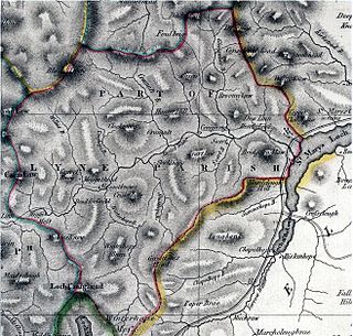
Peeblesshire, the County of Peebles or Tweeddale is a historic county of Scotland. Its county town is Peebles, and it borders Midlothian to the north, Selkirkshire to the east, Dumfriesshire to the south, and Lanarkshire to the west.

<span class="mw-page-title-main">Selkirkshire</span> Historic county and registration county in Scotland

Selkirkshire or the County of Selkirk is a historic county and registration county of Scotland. It borders Peeblesshire to the west, Midlothian to the north, Roxburghshire to the east, and Dumfriesshire to the south. It derives its name from its county town, the royal burgh of Selkirk. The county was historically also known as Ettrick Forest.

<span class="mw-page-title-main">Ettrick, Scotland</span> Human settlement in Scotland

Ettrick is a small village and civil parish in the Scottish Borders area of Scotland. It is located on the B709, around 17 miles (28 km) south-west of the town of Selkirk.

<span class="mw-page-title-main">Kilbucho</span> Village in Scotland

Kilbucho is a small settlement in the parish of Broughton, Glenholm and Kilbucho in the Scottish Borders area of Scotland in Peeblesshire and near Biggar and Broughton.

<span class="mw-page-title-main">Broad Law</span>

Broad Law is a hill in the Manor Hills range, part of the Southern Uplands of Scotland. The second-highest point in the Southern Uplands and the highest point in the Scottish Borders, it has an elevation of 840 metres, a prominence of 653 metres and an isolation of 81 kilometres. It is only 3 m (10 ft) lower than its parent, Merrick. Like many of its neighbours it is smooth, rounded and grassy, although the surrounding glens have very steep sides — country somewhat akin to the Cheviots or the Howgill Fells. The hill is most easily climbed from the Megget Stane to the south, beginning at an elevation of 452 m (1,483 ft), but is also frequently climbed from the villages near its base, or as part of a long, 50 km (30 mi) trek across the local area between the towns of Peebles and Moffat. On the summit is the highest VOR beacon in the UK, and also a radio tower.

<span class="mw-page-title-main">St Mary's Loch</span> Freshwater loch in Borders

St Mary's Loch is the largest natural loch in the Scottish Borders, and is situated on the south side of the A708 road between Selkirk and Moffat, about 72 kilometres (45 mi) south of Edinburgh.

<span class="mw-page-title-main">Ettrickbridge</span> Human settlement in Scotland

Ettrickbridge is a village situated in the Scottish Borders region of Scotland, 7 miles (11 km) from the nearby town of Selkirk.

<span class="mw-page-title-main">Ashkirk</span> Village in Scottish Borders, Scotland, UK

Ashkirk is a small village on the Ale Water, in the Scottish Borders area of Scotland. It is located just off the A7 road, approximately 6 miles each way between Selkirk to the north and Hawick to the south.

<span class="mw-page-title-main">Dryhope Tower</span> Castle in Scottish Borders, Scotland

Dryhope Tower is a ruined Scottish peel tower in the valley of the Yarrow Water, in the historic county of Selkirkshire, now part of the Scottish Borders. It lies approximately equidistant between the burghs of Moffat and Selkirk, and defended the north eastern end of St Mary's Loch. The site itself was protected on two sides, to the east by the Dryhope Burn and to the west by the Kirkstead Burn.

<span class="mw-page-title-main">Caddonfoot</span> Village in Scottish Borders, Scotland, UK

Caddonfoot is a village on the River Tweed, in the Scottish Borders area of Scotland, on the A707, near Galashiels.

<span class="mw-page-title-main">Yarrowford</span> Village in Scottish Borders, Scotland, UK

Yarrowford is a village on the A708, in the Scottish Borders area of Scotland, 4 miles north-west of Selkirk, in the Ettrick Forest.

<span class="mw-page-title-main">Cappercleuch</span> Village in Scottish Borders, Scotland, UK

Cappercleuch is a settlement on the A708, at St. Mary's Loch in the Scottish Borders area of Scotland, in the historic county of Selkirkshire.

<span class="mw-page-title-main">Megget Water</span>

Megget Water is a river in the parish of Yarrow, Selkirkshire in the Scottish Borders area of Scotland. The Water rises at Broad Law (2,760 ft), passes through Megget Reservoir and empties into St Mary's Loch. Places in the vicinity include Cappercleuch, Craigierig, Cramalt Tower, the Glengaber Burn, Meggethead Farm.

Manor is a parish in Peeblesshire in the Scottish Borders, whose church lies on the west bank of Manor Water 3 miles south-west of Peebles.

<span class="mw-page-title-main">Kirkurd</span> Human settlement in Scotland

Kirkurd is a parish in Peeblesshire in the Scottish Borders situated 3 miles south-east of Dolphinton and 6 miles north-east of Broughton. Tarth Water, a tributary of Lyne Water forms the northern boundary, with the parishes of Linton and Newlands on the north bank. The parish of Stobo lies to the east and south, the parish of Broughton, Glenholm and Kilbucho to the south, Skirling and Dolphinton (Lanarkshire) to the east.

<span class="mw-page-title-main">Broughton, Glenholm and Kilbucho</span> Human settlement in Scotland

Broughton, Glenholm and Kilbucho is a parish in Peeblesshire in the Scottish Borders, 11 miles south-west of Peebles, lying in the upper part of the valley of the River Tweed in the Southern Uplands. It is a union of three former parishes of bearing these names and the united parish is bound by Kirkurd on the north, Stobo on the east, Drumelzier on the south-east, Culter and Biggar, South Lanarkshire on the west and by Skirling in the north-west. For 4½ miles the eastern border of the parish follows the northward flowing Tweed. It is 9½ miles long north-to-south and 3½ miles wide. The only village is Broughton.

<span class="mw-page-title-main">Megget</span> Human settlement in Scotland

Megget is a former chapelry or parish containing the valley of Megget Water, now forming the westernmost part of the parish of Yarrow, Selkirkshire in the Scottish Borders area of Scotland. The centre of the valley is 19 miles west of Selkirk.

References

  1. Words & places: illustrations of history, ethnology and geography, by Isaac Taylor, publ. Kessinger, 1921, p. 131.
  2. History of the Celtic Place-names of Scotland, by W.J. Watson; first published 1926; reprinted 2004 with introduction by Simon Taylor. Edinburgh. Birlinn. ISBN   1-84158-323-5, p. 522. Contains the note "Yarrow is Gierua c. 1120, Gierwa, Gieruua c. 1150 (Lawrie). This, like Gala,, is an Anglo-Saxon name and may be compared with Jarrow, in Bede 'In Gyruum'."
  3. 1 2 Ordnance Survey one inch to one mile map, Selkirk sheet, publ. 1961
  4. 1 2 3 4 5 6 New Statistical Account of Scotland, Vol III Roxburgh, Peebles, Selkirk, publ.William Blackwood, 1845, pp.29-54 (Selkirkshire section)
  5. 1 2 Survey Gazetteer of the British Isles, by J. Bartholomew, 1905
  6. 1 2 3 Ordnance Gazetteer of Scotland, by Francis Groome, publ.1896, article on Yarrow
  7. Scottish Borders council web site on Community Councils http://www.scotborders.gov.uk/downloads/file/7941/ettrick_and_yarrow_community_council retrieved Feb 2016
  8. See Selkirk Weekly Advertiser http://www.selkirkweekendadvertiser.co.uk/news/local-news/wheely-good-luck-sam-1-1622046 Retrieved Feb 2016, leaflet published by the parish church at http://yackety.co.uk/press/wp-content/uploads/delightful-downloads/2016/01/Web-info-Church.pdf retrieved Feb 2016 and ‘’Church of Scotland Yearbook’’ publ.by Church of Scotland
  9. Historic Environment Scotland. "YARROW PARISH CHURCH YARROW KIRK (Category B Listed Building) (LB17128)" . Retrieved 21 February 2019.
  10. Statistical History Of Scotland, by James Hooper Dawson,Edinburgh 1857 (article on Yarrow parish)
  11. 1951 Census of Great Britain