Zangezur uezd

Last updated
Zangezur uezd
Зангезурскій уѣздъ
Coat of Arms of Yelizavetpol Governorate.png
Zangezur Uyezd of Elisabethpol Governorate.png
Location in the Elizavetpol Governorate
Country Russian Empire
Viceroyalty Caucasus
Governorate Elizavetpol
Established1868
Abolished1921
CapitalGerusy
(present-day Goris)
Area
  Total7,673.86 km2 (2,962.89 sq mi)
Population
 (1916)
  Total226,398
  Density30/km2 (76/sq mi)
   Urban
0.97%
   Rural
99.03%

The Zangezur uezd [lower-alpha 1] was a county ( uezd ) of the Elizavetpol Governorate of the Russian Empire with its administrative center in Gerusy (present-day Goris) from 1868 until its formal abolition and partition between the Soviet republics of Armenia and Azerbaijan in 1921. [1] The area of the Zangezur uezd corresponded to most of the contemporary Syunik province of Armenia, and Lachin, Gubadly, Zangilan, and Shusha districts of Azerbaijan.

Contents

Geography

Almost the entirety of the area is mountainous with many gorges and valleys of the Lesser Caucasus mountain range. The altitude ranges from 10,000–12,855 feet at Mount Kaputjugh, a mountain range which forms the natural boundary between the governorates of Elizavetpol and Erivan. The rivers of the Zangezur uezd are located within the Aras River basin—The Bargushad, Chaundurchay, Basitchay  [ az ], and Megrichay rivers played important roles in the irrigation system of the uezd. [2]

History

Historically, the Zangezur region was part of the Syunik province of Armenian kingdoms and polities. In 1748, Zangezur was joined to the Karabakh Khanate which stretched into the lowland steppes of Karabakh and before that, it was part of numerous Turkic states and polities. Following the Russian Empire's annexation of the region from Qajar Iran, the Karabakh Khanate was dissolved and divided into uezdsElizavetpol, Ordubad, and Shusha. Between the 1770s and 1813, the Zangezur uezd was mostly a part of the Shemakha Governorate (later known as the Baku Governorate). With the establishment of the Elizavetpol Governorate on 25 February 1868, the Zangezur uezd was also formed. [2]

1918

The 1918 independence of Armenia and Azerbaijan birthed an era of ethnic-conflict that spread over the highland districts of the Elizavetpol Governorate, including Zangezur. Thus, both states included these lands in memorandums of their claimed national borders to the Paris Peace Conference. [3] In the central subdistricts (Goris, Kapan, Meghri, and Sisian), Armenians formed the majority of the population, whereas Tatars [lower-alpha 2] and Kurds were mainly concentrated in the "peripheral southeastern slopes". Without the predominantly Muslim-inhabited southeastern slopes, Zangezur consisted of 88,000 Armenians, 2,000 other Christians, and 46,000 Muslims. [4]

It was with this ethnography that it was possible for fedayi Andranik Ozanian to establish control over the west of the uezd (modern-day Syunik). In addition to 30–40 thousand refugees from the Mush and Baghesh (present-day Muş and Bitlis, respectively) regions of Turkey, Andranik also brought with him 3–5 or 12 thousand fighters. [5] [6] By early 1918, Andranik had overseen the destruction of 18 Muslim villages in Zangezur and killed 500 women. [7] As a result of his activities of "transforming Zangezur into a solidly Armenian land", [6] over 100 Muslim villages were devastated, 10,000 Muslims were killed, and 40,000 were displaced to the Jebrail and Jevanshir uezds. [7] As these clashes occurred at the height of Ottoman dominance in the South Caucasus, General Halil Bey threatened the Armenian government, however, the latter claimed they had no control over Andranik. The Armenian government's reply referenced the declaration of Nuri Pasha that the whole Elizavetpol Governorate belonged to Azerbaijan and that accordingly, Armenian military units were restricted from Zangezur. [8]

As a result of Andranik's successes in maintaining control of Zangezur, the Armenians of Nagorno-Karabakh appealed for protection from Azerbaijani–Turkish intrusion, leading to him concentrating his forces along the eastern boundary of Zangezur in late October in preparation to march into Karabakh. The advance was delayed until 29 November as Andranik waited to obtain "written guarantees of support" from Nagorno-Karabakh's leaders. 20 Muslim villages were on the road between Armenian-controlled Zangezur and Shusha, the capital of Karabakh, Avdallar (present-day Lachin) and Zabukh the most important of these. The battle for Avdallar and its surrounds raged for 3 days, eventually resulting in the defeat of the local Tatars and Kurds led by Sultan bey Sultanov  [ az ]. By this time however, the British had supplanted the Ottoman forces in the South Caucasus by virtue of the Mudros Armistice, therefore, Andranik was stopped from proceeding to Nagorno-Karabakh by Major-General William M. Thomson. As Andranik's forces on 4 December withdrew to Goris, the last 3 Armenian villages between Zangezur and Nagorno-Karabakh were destroyed. [9]

1919

On 22 March 1919, Andranik left Zangezur through Daralayaz (modern-day Vayots Dzor). [10] In April 1919, the British command in Baku by appointing Khosrov bey Sultanov the Governor-General of Karabakh and Zangezur provisionally recognised the region as part of Azerbaijan pending the decision of the Paris Peace Conference. [11] Shortly after, the British pressured the Armenians of Zangezur to recognise Azerbaijani authority, eventually leading to General Digby Shuttleworth in late April unsuccessfully threatening the Armenians with force. [12] On the other hand, Nagorno-Karabakh was successfully subjugated to Azerbaijani authority on 22 August 1919, owing to Azerbaijani threats of massacre as demonstrated by the Khaibalikend massacre. [13] Without Andranik's forces, Zangezur demanded support from Armenia to protect itself from Azerbaijan. The Armenian government answered their request by dispatching Colonel Arsen Shahmazyan with the instructions to secretly incorporate the region into the Republic of Armenia. [14] Eventually, the Armenian defiance in Zangezur led to the British command permitting Zangezur to remain within Armenian jurisdiction, contrary to their initial stance—in what Major General G.N. Cory described as a "major concession". [15]

The destruction of Muslim settlements in Zangezur and the Armenian restriction on 10,000 Muslim shepherds taking 150,000 of their livestock into the highlands served as the casus belli for Azerbaijan to prepare to takeover the district. [16] Following the British withdrawal from the South Caucasus, the Azerbaijani army and Kurdish local forces led by Sultan bey Sultanov and some Turkish officers launched a full-scale invasion into Zangezur on 4 November, confident in their ability owing to their victories over the Mughan Soviet Republic and subjugating the Karabakh Council. [17] Despite meeting success on all fronts and routing the local Armenians, the Azerbaijanis suffered heavy casualties and withdrew on 7 November. [18] With combined British and American pressure, on 23 November in Tiflis (present-day Tbilisi) prime ministers Alexander Khatisian and Nasib bey Yusifbeyli signed a peace agreement and ineffectually committed to revolve their territorial disputes exclusively by peaceful means. [19] Despite the signing of the peace agreement, fighting continued: Halil Bey from the direction of Nakhichevan unsuccessfully attacked Keshishkend (present-day Yeghegnadzor) in Daralayaz, whilst forces under Garegin Nzhdeh attacked the remaining Muslim villages in the valley between Tatev and Kapan—On 7 December 1919, the last Muslim village, Adjibadj (located near Geghi) was burned and its inhabitants fled to Nakhichevan. [20] On 24 January 1920, British Chief Commissioner of Transcaucasia Oliver Wardrop notified Prime Minister Khatisian that he had evidence that the Armenian army was involved in attacks on 24 Muslim settlements in Zangezur. [21] To placate Wardrop's complaints, Armenia recalled Colonel Shahmazian from Zangezur, replacing him with General H. Kazarov with instructions to investigate the Azerbaijani allegations of massacres against the Muslim population. [22]

1920

As the Armenian–Azerbaijani peace talks hosted in Baku on 14–21 December 1919 did not lead to any progress on a settlement, Azerbaijan again moved its troops towards Zangezur. Furthermore, as the Paris Peace Conference was inconclusive on the issue of the Karabakh, Khosrov Bey Sultanov issued an ultimatum to the Karabakh Council to permanently accept incorporation into Azerbaijan. With the Karabakh ultimatum looming and the Azerbaijani army positioned to attack Zangezur again, [23] the Armenian government dispatched Arsen Mikayelyan to Nagorno-Karabakh to take measures to unite the region to Armenia. [24] The abortive uprising beginning on 23 March 1920 though resulting in the massacre and expulsion of Shusha's Armenian population was successful in ousting the Azerbaijani administration from the rest of Nagorno-Karabakh. [25] However, as a direct result of the Sovietization of Azerbaijan, Armenian forces in late May were forced out from Nagorno-Karabakh by the 11th Army of Soviet Russia. [26] In July 1920, a Soviet ultimatum was issued to Armenia to leave the south of Zangezur and Nakhichevan so that they could join with Turkey. Without awaiting an answer, the Red Army captured the city of Nakhichevan (present-day Nakhchivan) on 17 July, however, they were unsuccessful in seizing control of southern Zangezur due to the efforts of Nzhdeh. [27]

After the completion of the establishment of Soviet rule in Armenia and Azerbaijan, Zangezur was initially to join Soviet Azerbaijan as it was considered practically necessary for connecting the protectorate of Nakhichevan to mainland Azerbaijan. However, Zangezur was officially "transferred" to Armenia as a "symbol of socialist friendship" in 1921, in accordance with Garegin Nzhdeh's demands to the Soviet government during the February Uprising. [28] During the Caucasian Bureau of the Central Committee of the Russian Communist Party's arbitration of borders in July 1921, the eastern Kurdish and Azerbaijani populated areas of the Zangezur uezd were reattached to Azerbaijan, forming the Lachin, Zangilan, Gubadly districts and a small southwestern part of the Shusha District of the Nagorno-Karabakh Autonomous Oblast. In Armenia, the districts of Goris, Kapan, Meghri, and Sisian were formed in place of the abolished uezd.

Administrative divisions

The subcounties ( uchastoks ) of the Zangezur uezd in 1912 were as follows: [29]

Name1912 population
1-y uchastok (1-й участокъ)32,368
2-y uchastok (2-й участокъ)56,585
3-y uchastok (3-й участокъ)54,663
4-y uchastok (4-й участокъ)39,222
5-y uchastok (5-й участокъ)34,009

Economy

There were 326 villages. The population was engaged primarily in agricultural farming, gardening, sericulture, cotton-growing, cattle-breeding and development of copper fields. The lowland area was used for growing cotton, which produced 20,000 pounds of cotton per year. Vineyards covered as much as 4,494 desyatinas of land, producing 106,860 lbs of grape. Nearly 3,728 lbs of silk pods were being collected in 1890. According to statistical data from 1891, there were 9,784 horses, 83,000 of cattle, 780 buffalos, 133,648 sheep, 4,600 goats, 7,008 donkeys and 1,505 mules in the uezd. [2]

Demographics

Russian Empire Census

According to the Russian Empire Census, the Zangezur uezd had a population of 137,871 on 28 January [ O.S. 15 January] 1897, including 72,592 men and 65,279 women. The majority of the population indicated Tatar [lower-alpha 2] to be their mother tongue, with significant Armenian and Kurdish speaking minorities. [32]

Linguistic composition of the Zangezur uezd in 1897 [32]
LanguageNative speakers%
Tatar [lower-alpha 2] 71,20651.65
Armenian 63,62246.15
Kurdish 1,8071.31
Russian 8410.61
Ukrainian 1540.11
Greek 1430.10
Persian 260.02
Polish 180.01
Romanian 160.01
Belarusian 110.01
German 90.01
Kyurin 70.01
Avar-Andean 30.00
Georgian 20.00
Other60.00
TOTAL137,871100.00

Kavkazskiy kalendar

According to the 1917 publication of Kavkazskiy kalendar , the Zangezur uezd had a population of 226,398 on 14 January [ O.S. 1 January] 1916, including 113,973 men and 112,425 women, 225,469 of whom were the permanent population, and 929 were temporary residents. The statistics indicate an overall Muslim majority with a Shia Muslim plurality in the district, followed closely by an Armenian minority which was the overwhelming population of the town of Gerusy: [33]

Nationality Urban Rural TOTAL
Number%Number%Number%
Shia Muslims [lower-alpha 3] 2029.18110,51449.29110,71648.90
Armenians 1,72478.3399,33144.31101,05544.64
Sunni Muslims [lower-alpha 4] 231.048,9664.008,9893.97
Kurds 00.003,6281.623,6281.60
Russians 1968.911,6170.721,8130.80
North Caucasians 221.00960.041180.05
Georgians 271.23350.02620.03
Other Europeans 60.2700.0060.00
Jews 10.0500.0010.00
TOTAL2,201100.00224,197100.00226,398100.00

Notes

    • Russian: Зангезу́рскій уѣ́здъ, romanized: Zangezúrsky uyézd
    • Armenian: Զանգեզուրի գավառ, romanized: Zangezowri gavaṙ
    • Azerbaijani: زنگزور قضاسی, romanized: Zangazūr qaz̤āsı
  1. 1 2 3 Before 1918, Azerbaijanis were generally known as "Tatars". This term, employed by the Russians, referred to Turkic-speaking Muslims of the South Caucasus. After 1918, with the establishment of the Azerbaijan Democratic Republic and "especially during the Soviet era", the Tatar group identified itself as "Azerbaijani". [30] [31]
  2. Primarily Tatars. [34]
  3. Primarily Turco-Tatars. [34]

Related Research Articles

<span class="mw-page-title-main">First Republic of Armenia</span> 1918–1920 former country in Western Asia

The First Republic of Armenia, officially known at the time of its existence as the Republic of Armenia, was an independent Armenian state that existed from May 1918 to 2 December 1920 in the Armenian-populated territories of the former Russian Empire known as Eastern or Russian Armenia. The republic was established in May 1918, with its capital in the city of Yerevan, after the dissolution of the short-lived Transcaucasian Democratic Federative Republic. It was the first Armenian state since the Middle Ages.

<span class="mw-page-title-main">Baku Governorate</span> 1846–1917 governorate of the Russian Empire

The Baku Governorate, known before 1859 as the Shemakha Governorate, was a province (guberniya) of the Caucasus Viceroyalty of the Russian Empire, with its center in the booming metropolis and Caspian Sea port of Baku. Area (1897): 34,400 sq. versts, population (1897): 789,659. The Baku Governorate bordered Persia to the south, the Elizavetpol Governorate to the west, the Dagestan Oblast to the north, and the Baku gradonachalstvo to the east on the Absheron Peninsula.

<span class="mw-page-title-main">Armenian–Azerbaijani war (1918–1920)</span> 1918–20 conflict between Armenia and Azerbaijan

The Armenian-Azerbaijani war (1918–1920) was a conflict that took place in the South Caucasus in regions with a mixed Armenian-Azerbaijani population, broadly encompassing what are now modern-day Azerbaijan and Armenia. It began during the final months of World War I and ended with the establishment of Soviet rule.

<span class="mw-page-title-main">Elizavetpol Governorate</span> Governorate of the Russian Empire

The Elizavetpol Governorate, also known after 1918 as the Ganja Governorate, was a province (guberniya) of the Caucasus Viceroyalty of the Russian Empire, with its capital in Yelisavetpol. The area of the governorate stretched 38,922.43 square versts and was composed of 1,275,131 inhabitants in 1916. The Elizavetpol Governorate bordered the Erivan Governorate to the west, the Tiflis Governorate and Zakatal Okrug to the north, the Dagestan Oblast to the northeast, the Baku Governorate to the east, and Iran to the south.

<span class="mw-page-title-main">Shusha massacre</span> 1920 mass killing of Armenian civilians by Azerbaijani forces in Nagorno-Karabakh

The Shusha or Shushi massacre, also known as the Shusha pogrom, was the mass killing of the Armenian population of Shusha from 22–26 March 1920 and the destruction and process of "cultural de-Armenianization" of Nagorno-Karabakh. The number of deaths vary across sources, with the most conservative estimate being 500, and the highest estimates reaching 20,000.

Armenians in Azerbaijan are the Armenians who lived in great numbers in the modern state of Azerbaijan and its precursor, Soviet Azerbaijan. According to the statistics, about 500,000 Armenians lived in Soviet Azerbaijan prior to the outbreak of the First Nagorno-Karabakh War in 1988. Most of the Armenians in Azerbaijan had to flee the republic, like Azerbaijanis in Armenia, in the events leading up to the First Nagorno-Karabakh War, a result of the ongoing Armenian-Azerbaijani conflict. Atrocities directed against the Armenian population took place in Sumgait, Ganja and Baku. Armenians continued to live in large numbers in the region of Nagorno-Karabakh, which was controlled by the break-away state known as the Nagorno-Karabakh Republic from 1991 until the region was forcibly retaken by Azerbaijan in 2023. After the Azerbaijani takeover, almost all Armenians living in Nagorno-Karabakh left the region.

<span class="mw-page-title-main">Tiflis Governorate</span> Governorate of the Russian Empire

Tiflis Governorate was a province (guberniya) of the Caucasus Viceroyalty of the Russian Empire with its administrative centre in Tiflis. In 1897, it constituted 44,607 square kilometres (17,223 sq mi) in area and had a population of 1,051,032 inhabitants. Tiflis Governorate bordered Elizavetpol Governorate to the southeast, Erivan Governorate to the south, Kars Oblast to the southwest, Batum Oblast to the west, Kutaisi Governorate to the northwest, Terek Oblast to the north, Dagestan Oblast to the northeast, and after 1905, the Zakatal Okrug to the east. The governorate covered areas of central and southeastern Georgia, the partially recognised state of South Ossetia, most of the Lori Province of Armenia, small parts of northwestern Azerbaijan, and a minuscule southern part of Ingushetia of Russia.

<span class="mw-page-title-main">Khosrov bey Sultanov</span>

Khosrov bey Alipasha bey oghlu Sultanov, also spelled as Khosrow Sultanov, was an Azerbaijani statesman, General Governor of Karabakh and Minister of Defense of the Azerbaijani Democratic Republic.

Jevanshir <i>uezd</i> Uezd in Caucasus, Russian Empire

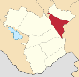
The Jevanshir uezd was a county (uezd) of the Elizavetpol Governorate of the Russian Empire, with its center in Terter.

Shusha <i>uezd</i> Uezd in Caucasus, Russian Empire

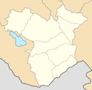
The Shusha uezd was a county (uezd) of the Elizavetpol Governorate of the Russian Empire, and then of the Ganja Governorate of Azerbaijan Democratic Republic with its center in Shusha in 1840–1921.

Jebrail <i>uezd</i> Uezd in Caucasus, Russian Empire

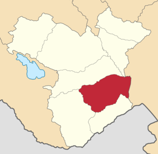
The Jebrail uezd, also known after 1905 as the Karyagino uezd, was a county (uezd) of the Elizavetpol Governorate of the Russian Empire with its center in Jebrail (Jabrayil) from 1873 until its formal abolition in 1921 by the Soviet authorities.

Kazakh <i>uezd</i> Uezd in Caucasus, Russian Empire

The Kazakh uezd was a county (uezd) of the Elizavetpol Governorate of the Russian Empire and later of the Azerbaijan Democratic Republic with its center in Kazakh from 1868 until its formal abolition in 1929 by the Soviet authorities of the Azerbaijan SSR. The area of the Kazakh uezd forms a large part of the modern-day Tavush Province and a small northeastern part of the Gegharkunik Province of Armenia, also forming most of the area of the Agstafa, Tovuz and Qazax districts of Azerbaijan.

Aresh <i>uezd</i> Uezd in Caucasus, Russian Empire

The Aresh uezd, later known as the Agdash uezd, was a county (uezd) of the Elizavetpol Governorate of the Russian Empire and later of the Azerbaijan Democratic Republic with its center in Aresh from 1874 until its formal abolition in 1929 by Soviet authorities.

Nukha <i>uezd</i> Uezd in Caucasus, Russian Empire

The Nukha uezd was a county (uezd) of the Elizavetpol Governorate of the Russian Empire and later of the Azerbaijan Democratic Republic with its center in Nukha from 1868 until its formal abolition in 1921 by the Soviet authorities of the Azerbaijan SSR.

Elizavetpol <i>uezd</i> Uezd in Caucasus, Russian Empire

The Elizavetpol uezd, also known as the Ganja uezd after 1918, was a county (uezd) of the Elizavetpol Governorate of the Russian Empire, and later of the Azerbaijan Democratic Republic and Azerbaijan SSR until its formal abolition in 1929. The area of the Elizavetpol uezd corresponds to the modern-day Gadabay, Shamkir, Dashkasan, Goygol, and Samukh districts of Azerbaijan.

Sharur-Daralayaz <i>uezd</i> Uezd in Caucasus, Russian Empire

The Sharur-Daralayaz uezd was a county (uezd) of the Erivan Governorate of the Caucasus Viceroyalty of the Russian Empire. It bordered the governorate's Erivan and Nor Bayazet uezds to the north, the Nakhichevan uezd to the south, the Zangezur and Jevanshir uezds of the Elizavetpol Governorate to the east, and Persia to the southwest. It included most of the Vayots Dzor Province of present-day Armenia and the Sharur District of the Nakhchivan exclave of present-day Azerbaijan. The administrative centre of the county was Bashnorashen.

Nakhichevan <i>uezd</i> Uezd in Caucasus, Russian Empire

The Nakhichevan uezd was a county (uezd) of the Erivan Governorate of the Caucasus Viceroyalty of the Russian Empire. It bordered the governorate's Sharur-Daralayaz uezd to the north, the Zangezur uezd of the Elizavetpol Governorate to the east, and Iran to the south. The uezd's administrative center was the city of Nakhichevan.

Nor Bayazet <i>uezd</i> Uezd in Caucasus, Russian Empire

The Nor Bayazet or Novobayazet uezd was a county (uezd) of the Erivan Governorate of the Caucasus Viceroyalty of the Russian Empire. The uezd bordered the Alexandropol uezd to the north, the Etchmiadzin and Erivan uezds to the west, the Sharur-Daralayaz uezd to the south, and the Kazakh, Elizavetpol, and Jevanshir uezds of the Elizavetpol Governorate to the east. Centered on Lake Sevan, the Nor Bayazet uezd included most of the contemporary province of Gegharkunik and northern parts of the Kotayk Province of Armenia. The administrative center of the uezd was the city Novobayazet for which the district was eponymously named.

Tiflis <i>uezd</i> Uezd in Caucasus, Russian Empire

The Tiflis uezd was a county (uezd) of the Tiflis Governorate of the Caucasus Viceroyalty of the Russian Empire, and then of Democratic Republic of Georgia, with its administrative centre in Tiflis. The area of the uezd roughly corresponded to the contemporary Kvemo Kartli region of Georgia. The district bordered the Telavi uezd to the northeast, the Tionety and Dusheti uezds to the north, the Gori uezd to the northwest, the Borchaly uezd to the west, the Kazakh uezd of the Elizavetpol Governorate to the south, and the Signakh uezd to the east.

<i>Agreement between Armenia and Azerbaijan respecting the District of Zanghezour</i> Agreement between Armenia and Azerbaijan during the Armenian–Azerbaijani war (1918–1920)

The Agreement between Armenia and Azerbaijan respecting the District of Zanghezour was a peace agreement between the short-lived Armenian and Azerbaijani republics signed on 23 November 1919 in Tiflis and brokered by Georgia. The peace treaty came as a result of an unsuccessful Azerbaijani military campaign to absorb the Zangezur region controlled by local Armenians, in order to reach and support the Azerbaijanis in control of neighbouring Nakhchivan.

References

  1. Tsutsiev 2014, p. 34.
  2. 1 2 3 Энциклопедический Словарь. Зангезурский уезд [Encyclopedia dictionary. Zangezur uyezd] (in Russian). Retrieved 2011-08-03.
  3. Drobizheva, Leokadia; Gottemoeller, Rose; McArdle Kelleher, Catherine (1998). Ethnic conflict in the post-Soviet world: case studies and analysis. USA: M.E. Sharpe. p. 230. ISBN   1-56324-741-0 . Retrieved 2011-08-03.
  4. Hovannisian 1971, p. 86.
  5. Hovannisian 1971, p. 87.
  6. 1 2 Donald Bloxham (2005). The Great Game of Genocide: Imperialism, Nationalism, and the Destruction of the Ottoman Armenians. Oxford: Oxford University Press. pp. 103–105. 9780199226887.
  7. 1 2 Baberovski 2010, p. 166.
  8. Hovannisian 1971, pp. 87–88.
  9. Hovannisian 1971, pp. 88–89.
  10. Hovannisian 1971, pp. 190–191.
  11. Broers, Laurence (5 August 2021). "Augmented Azerbaijan? The return of Azerbaijani irredentism". Eurasianet . Archived from the original on 17 November 2022. Retrieved 16 May 2022.
  12. Hovannisian 1971, pp. 192–193.
  13. Hovannisian 1971, pp. 176–177.
  14. Hovannisian 1971, p. 192.
  15. Hovannisian 1971, p. 181.
  16. Hovannisian 1982, p. 213.
  17. Hovannisian 1982, pp. 210–211.
  18. Hovannisian 1982, pp. 217–221.
  19. Hovannisian 1982, p. 223.
  20. Hovannisian 1982, pp. 225–226.
  21. Hovannisian 1982, pp. 519–520.
  22. Hovannisian 1982, pp. 228–229.
  23. Hovannisian 1996a, p. 133.
  24. Hovannisian 1996a, p. 135.
  25. Hovannisian 1996a, pp. 150–152.
  26. Hovannisian 1996a, pp. 198–199.
  27. Kadishev, Arnold (1960). Интервенция и гражданская война в Закавказье[Intervention and Civil War in Transcaucasia] (in Russian). p. 296.
  28. Raymond Duncan, Walter; Holman (Jr.), G. Paul (1994). Ethnic nationalism and regional conflict: the former Soviet Union and Yugoslavia . USA: Westview Press. pp.  109–112. ISBN   0-231-07068-3.
  29. Кавказский календарь на 1913 год, pp. 152–159.
  30. Bournoutian 2018, p. 35 (note 25).
  31. Tsutsiev 2014, p. 50.
  32. 1 2 "Демоскоп Weekly - Приложение. Справочник статистических показателей". www.demoscope.ru. Retrieved 2022-06-28.
  33. Кавказский календарь на 1917 год, pp. 190–197.
  34. 1 2 Hovannisian 1971, p. 67.

Bibliography

39°30′28″N46°20′19″E / 39.50778°N 46.33861°E / 39.50778; 46.33861