Ujar District is one of the 66 districts of Azerbaijan. It is located in the centre of the country and belongs to the Central Aran Economic Region. The district borders the districts of Agdash, Goychay, Kurdamir, and Zardab. Its capital and largest city is Ujar. As of 2020, the district had a population of 89,500.

Hajigabul District is one of the 66 districts of Azerbaijan. It is located in the east of the country and belongs to the Shirvan-Salyan Economic Region. The district borders the districts of Kurdamir, Agsu, Shamakhi, Gobustan, Absheron, Baku, Salyan, Sabirabad and the city of Shirvan. Its capital and largest city is Hajigabul. As of 2020, the district had a population of 76,600.

Shamakhi District is one of the 66 districts of Azerbaijan. It is located in the east of the country and belongs to the Mountainous Shirvan Economic Region. The district borders the districts of Quba, Khizi, Gobustan, Hajigabul, Agsu, and Ismayilli. Its capital and largest city is Shamakhi. As of 2020, the district had a population of 106,400.
Shamakhi is a city in Azerbaijan and the administrative centre of the Shamakhi District. The city's estimated population as of 2010 was 31,704. It is famous for its traditional dancers, the Shamakhi Dancers, and also for perhaps giving its name to the Soumak rugs.

Aghasadyg Aghaali oglu Garaybeyli was a Soviet and Azerbaijani actor.
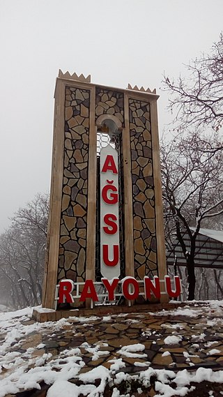
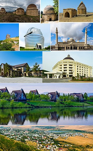
Agsu is a city in and capital of the Agsu District of Azerbaijan.

Meysəri is a village and municipality in the Shamakhi District of Azerbaijan. It has a population of 624. The village had an Armenian population before the exodus of Armenians from Azerbaijan after the outbreak of the Nagorno-Karabakh conflict.
Shirvan and until 1994 as Khoylu, is a village in the Shamakhi District of Azerbaijan. This village had a generally homogeneous Armenian population in 1918 and maintained an Armenian majority up until the forced exodus of Armenians from Azerbaijan in 1988.

The geology of Azerbaijan forms a constituent geological part of the Alpine fold belt. Sedimentary deposits embracing the southwestern parts of the Major and Minor Caucasus, including the intermountain Kur River trough, as well as the Mid- and South Caspian basins consist of diversity fold systems. The Earth's crust thickness in Azerbaijan varies in the range from 38 to 55 km. Its maximum thickness is observed in the Minor Caucasus area, while its minimum thickness is typical for the Talysh foothills. The geological setting of the area consists of sedimentary, volcanic-sedimentary, volcanic and terrestrial deposits embracing almost the entire stratigraphic range beginning from Pre-Cambrian through Holocene time.

The Shemakha Governorate was a province (guberniya) of the Caucasus Viceroyalty of the Russian Empire, with its administrative center in the city of Shemakha. Following the earthquake of 1859, the capital was transferred and the province became known as the Baku Governorate.

Shirvan Domes or Shamakhi mausoleum is a 15th-century mausoleum and graveyard in Shamakhi, Azerbaijan. It is located at the foot of Gulistan Fortress.
The 1667 Shamakhi earthquake occurred on 25 November 1667 with an epicenter close to the city of Shamakhi, Azerbaijan. It had an estimated surface wave magnitude of 6.9 and a maximum felt intensity of X (Extreme) on the Mercalli intensity scale. An estimated 80,000 people died.
Xankəndi is a village in the Shamakhi Rayon of Azerbaijan.

Juma Mosque of Shamakhi or Juma Mosque of Shamakhi is a mosque in the city of Shamakhi, Azerbaijan.

Gasim bey Hajibababeyov – was an Azerbaijani architect.
Armeno-Tats are a distinct group of Christian Tat-speaking Armenians that historically populated eastern parts of the South Caucasus, in what constitutes the modern-day Republic of Azerbaijan. Most scholars researching the Tat language, such as Boris Miller and Igrar Aliyev, agree that Armeno-Tats are ethnic Armenians who underwent a language shift and adopted Tat as their first language. This is explained on one hand by the self-identification of Armeno-Tats who stated during Miller's research that they consider themselves Armenian as well as by some linguistic features of their dialect. The Armeno-Tats formerly lived in Madrasa and Kilvar in Azerbaijan, but have almost entirely moved to Armenia and Russia.

Mahammad Hadi or Agha-Mahammad Haji-Abdulsalim oglu Abdulsalimzade was an Azerbaijani romanticist poet.

The Baku uezd was a county (uezd) within the Baku Governorate of the Russian Empire and then of Azerbaijan Democratic Republic and Azerbaijan SSR until its formal abolishment in 1929. The uezd was located in eastern part of the Baku Governorate, bordering Caspian sea to the east, Shemakha uezd to the west, Kuba uezd to the north and Lenkoran uezd to the south. The administrative center of the uezd was the village Sarai.

The Lenkoran uezd was a county (uezd) within the Baku Governorate of the Russian Empire, and then of the Azerbaijan Democratic Republic and the Azerbaijan SSR until its formal abolishment in 1929. The uezd was located on the southern part of the governorate, bordering Caspian sea to the east, Javad uezd to the north, and Iran to the southwest. The administrative center of the uezd was the city of Lenkoran.

The 1902 Shamakhi earthquake occurred on 13 February with a surface-wave magnitude of 6.9 and a maximum felt Modified Mercalli intensity of IX (Violent). Up to 2,000 people died and thousands more were injured in the Shemakha uezd within the Baku Governorate of the Russian Empire. About 7,439 buildings were damaged or destroyed in the city and surrounding villages. Shamakhi had been devastated by earlier earthquakes in 1806, 1859 and 1872. It is one of the most destructive earthquakes in Azerbaijan.