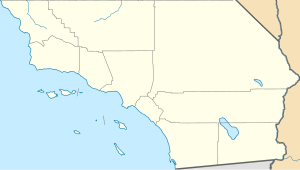
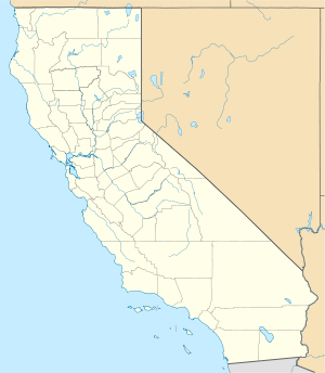
Imperial County is a county located on the southeast border of the U.S. state of California. As of the 2020 census, the population was 179,702, making it the least populous county in Southern California. The county seat and largest city is El Centro. Imperial is the most recent California county to be established, as it was created in 1907 out of portions of San Diego County.

Calexico is a city in southern Imperial County, California. Situated on the Mexican border, it is linked economically with the much larger city of Mexicali, the capital of the Mexican state of Baja California. It is about 122 miles (196 km) east of San Diego and 62 miles (100 km) west of Yuma, Arizona. Calexico, along with six other incorporated Imperial County cities, forms part of the larger populated area known as the Imperial Valley.

Holtville is a city in Imperial County, California. Holtville is located 10.5 miles (17 km) east of El Centro. The population was 5,939 at the 2010 census, up from 5,612 in 2000.

The Imperial Valley of Southern California lies in Imperial and Riverside counties, with an urban area centered on the city of El Centro. The Valley is bordered by the Colorado River to the east and, in part, the Salton Sea to the west. Farther west lies the San Diego and Imperial County border. To the north is the Coachella Valley region of Riverside County, which together with Imperial Valley form the Salton Trough, or the Cahuilla Basin, also the county line of Imperial and Riverside counties, and to the south the international boundary with Mexico.

The United States border with Mexico is one of the world's "most lethal land borders". Hundreds of migrants die per year as they attempt to cross into the United States from Mexico illegally. The US Border Patrol reported 251 migrant deaths in the fiscal year 2015, which was lower than any year during the period 2000–2014, and reported 247 migrant deaths in fiscal year 2020, lower than any year since 1998. Poverty, gang violence, poor governance, etc. are the main factors as to why migrants cross the US border. US Border Patrol recorded 557 southwest border deaths during fiscal year 2021 and 748 in the first 11 months of fiscal year 2022, the most deaths ever recorded.

State Route 111 is a state highway in the U.S. state of California. It is the main north-south route and retail corridor through the Coachella Valley, a part of the Colorado Desert in the southeastern corner of the state and a famous resort destination. It also runs through the Imperial Valley, and along the eastern shore of the Salton Sea. Its southern terminus is at Imperial Avenue and 1st Street in Calexico, at the former entrance to the Calexico West Port of Entry. SR 111's northern terminus is at Interstate 10 at the northwestern corner of the Palm Springs city limits, near the unincorporated community of Whitewater.

The All-American Canal is an 82-mile (132 km) long aqueduct, located in southeastern California. It conveys water from the Colorado River into the Yuma Project, the Imperial Valley, and to nine cities. It is the Imperial Valley's only water source, and replaced the Alamo Canal, which was located mostly in Mexico. The Imperial Dam, about 30 miles (48 km) northeast of Yuma, Arizona on the Colorado River, diverts water into the All-American Canal, which runs to just west of Calexico, California before its last branch heads mostly north into the Imperial Valley. Smaller canals branching off the All-American Canal move water into the Yuma Valley and the Imperial Valley. These canal systems irrigate up to 630,000 acres (250,000 ha) of crop land and have made possible a greatly increased crop yield in this area, originally one of the driest on earth. It is the largest irrigation canal in the world, carrying a maximum of 26,155 cubic feet per second (740.6 m3/s). Agricultural runoff from the All-American Canal drains into the Salton Sea.

State Route 7 is a state highway in the U.S. state of California, running from the Calexico East Port of Entry on the U.S.-Mexico border east of Calexico north to its terminus at Interstate 8 (I-8), where Orchard Road continues the route north towards Holtville. The route provides convenient access to the country of Mexico from I-8. The southern portion of the route opened in 1996, and the rest of the route connecting to I-8 opened in 2005.

State Route 98 is a state highway in the U.S. state of California. It is a loop of Interstate 8 (I-8) running west to east south of the Interstate through the border city of Calexico. It passes through the city of Calexico and ends east of Holtville. The highway was added to the state highway system in 1933, and signed as Route 98 by 1938. The highway was paved and rerouted to its current path during the 1950s.

Foreign nationals (aliens) can violate US immigration laws by entering the United States unlawfully or lawfully entering but then remaining after the expiration of their visas, parole, or temporary protected status. Illegal immigration has been a matter of intense debate in the United States since the 1980s.
Illegal immigration is the migration of people into a country in violation of that country's immigration laws, or the continuous residence in a country without the legal right to. Illegal immigration tends to be financially upward, from poorer to richer countries. Illegal residence in another country creates the risk of detention, deportation, and/or other persecutions.

Bonds Corner is an unincorporated community in Imperial County, California a short distance east of Calexico on California State Route 98 and north of the international border with Baja California. A United States port of entry for trucks entering and exiting the country is located along nearby California State Route 7. Bonds Corner is located 9 miles (14 km) east of Calexico, at an elevation of 33 feet.

Colloquially, a coyote is a person who smuggles immigrants across the Mexico–United States border. The word "coyote" is a loanword from Mexican Spanish that usually refers to a species of North American wild dog (Canis latrans).

The Calexico East Port of Entry is a border crossing point between the United States and Mexico. It connects the cities of Calexico, California and Mexicali, Baja California. It connects directly to California State Route 7.
Jacumba Valley is a valley in San Diego and Imperial Counties, California. Its head is at 32°37′00″N116°10′07″W Carrizo Creek has its source in Jacumba Valley, 1.2 miles north of the California-Mexico State boundary, at 32°38′09″N116°07′05″W at an elevation of 3,210 feet, on the west side of the divide between Jacumba Valley and the valley of upper Boulder Creek. Carrizo Creek flows west then north northwest through Jacumba Valley to its mouth at the head of Carrizo Gorge. Just south of the Jacumba and In-ko-pah Mountains, the terrain consists of large, flat desert plains and hills of granite boulders. The wider region, including the Jacumba Wilderness, which sits just east of the valley, has been greatly affected by the construction of the US/Mexico border and has become a site of great numbers of migrations along migrant paths.
Border Angels is a San Diego-based 501(c)(3) tax-exempt nonprofit charitable organization that is focused on migrant rights, immigration reform, and the prevention of immigrant deaths along the border. Border Angels, along with its more than 2000 volunteers serves San Diego County's immigrant population through various migrant outreach programs such as day laborer outreach and legal assistance, and provides life-saving assistance for migrants by placing bottled water in remote mountain and desert border regions of the San Diego and Imperial counties, California.
The Smuggler's Gulch is part of a steep walled canyon about 2 miles (3.2 km) inland of the Pacific Ocean. The canyon crosses the Mexico–United States border, between Tijuana, Baja California, and San Diego, California, and Smuggler's Gulch is the part of the canyon on the US side of the border. It may also be called Cañón del Matadero or Valle Montezuma in Spanish, but these names apply more generally to the whole canyon. Smuggling activities within Smuggler's Gulch have occurred since the 19th century, giving this part of the canyon its name.
On December 9, 2021, a traffic accident occurred in the Mexican state of Chiapas when a freight truck smuggling over 180 migrants overturned and hit a bridge. At least 55 people were killed, and over a hundred were injured.
On June 27, 2022, 53 migrants were found dead in and around a tractor-trailer near Lackland Air Force Base in San Antonio, Texas, United States. The deaths, caused by heat exposure and asphyxiation, reportedly occurred during an apparent illegal migrant smuggling attempt across the U.S.–Mexico border. It is the deadliest smuggling incident of its kind in United States history.