
Artsakh, officially the Republic of Artsakh or the Republic of Nagorno-Karabakh, was a breakaway state in the South Caucasus whose territory was internationally recognised as part of Azerbaijan. Between 1991 and 2023, Artsakh controlled parts of the former Nagorno-Karabakh Autonomous Oblast of the Azerbaijani Soviet Socialist Republic, including its capital Stepanakert. It had been an enclave within Azerbaijan from the 2020 Nagorno-Karabakh war until the 2023 Azerbaijani offensive, when the Azerbaijani military took control over the remaining territory controlled by Artsakh. Its only overland access route to Armenia after the 2020 war was via the 5 km (3.1 mi) wide Lachin corridor, which was placed under the supervision of Russian peacekeeping forces.

Jabrayil District is one of the 66 districts of Azerbaijan. It is located in the south-west of the country and belongs to the East Zangezur Economic Region. The district borders the districts of Khojavend, Fuzuli, Qubadli, Zangilan, and the Islamic Republic of Iran.

Kalbajar District is one of the 66 districts of Azerbaijan. It is located in the west of the country and belongs to the East Zangezur Economic Region. The district borders the districts of Lachin, Khojaly, Agdam, Tartar, Goranboy, Goygol and Dashkasan districts of Azerbaijan, as well as the Gegharkunik and Vayots Dzor provinces of Armenia. Its capital and largest city is Kalbajar. As of 2020, the district had a nominal population of 94,100.

Qubadli District is one of the 66 districts of Azerbaijan. It is located in the south-west of the country and belongs to the East Zangezur Economic Region. The district borders the districts of Lachin, Khojavend, Jabrayil, Zangilan, and the Syunik Province of Armenia.

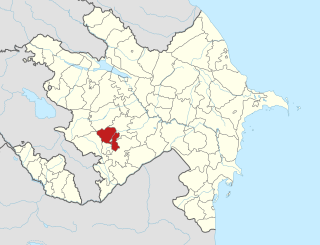
Khojavend District is one of the 66 districts of Azerbaijan. It is located in the west of the country and belongs to the Karabakh Economic Region. The district borders the districts of Lachin, Shusha, Khojaly, Aghdam, Aghjabadi, Fuzuli, Jabrayil, and Qubadli. Its capital and largest city is Khojavend. As of 2020, the district had a nominal population of 44,100.
Khojaly District is one of the 66 districts of Azerbaijan. It is located in the west of the country and belongs to the Karabakh Economic Region. The district borders the districts of Kalbajar, Lachin, Shusha, Agdam and Khojavend. Its capital and largest city is Khojaly. As of 2020, the district had a nominal population of 28,800.

Fuzuli District is one of the 66 districts of Azerbaijan. It is located in the south-west of the country and belongs to the Karabakh Economic Region. The district borders the districts of Khojavend, Aghjabadi, Beylagan, Jabrayil, and the Ardabil Province of Iran.
The 1993 Summer Offensives of the First Nagorno-Karabakh War saw the capture of several Azerbaijani regions by Armenian military units in a series of battles from June to October 1993.

Dashbashy or Karaglukh is a village in the Khojavend District of Azerbaijan, in the disputed region of Nagorno-Karabakh. The village had an ethnic Armenian-majority population prior to the 2020 Nagorno-Karabakh war, and also had an Armenian majority in 1989.
Qaracallı is a village in the Qubadli District of Azerbaijan.

Gunashli or Norashen is a village in the Khojavend District of Azerbaijan, in the disputed region of Nagorno-Karabakh. The village had an ethnic Armenian-majority population prior to the 2020 Nagorno-Karabakh war, and also had an Armenian majority in 1989.
Mulkudara or Jraberd is a village in the Khojavend District of Azerbaijan, in the disputed region of Nagorno-Karabakh. The village had an ethnic Armenian-majority population prior to the 2020 Nagorno-Karabakh war, and also had an Armenian majority in 1989.

Chinarly or Vank is a village in the Khojavend District of Azerbaijan, in the disputed region of Nagorno-Karabakh. The village is located close to the town of Hadrut. The village had an ethnic Armenian-majority population prior to the 2020 Nagorno-Karabakh war, and also had an Armenian majority in 1989.

The Armenian-occupied territories surrounding Nagorno-Karabakh were areas of Azerbaijan, situated around the former Nagorno-Karabakh Autonomous Oblast (NKAO), which were occupied by the ethnic Armenian military forces of the breakaway Republic of Artsakh with military support from Armenia, from the end of the First Nagorno-Karabakh War (1988–1994) to 2020, when the territories were returned to Azerbaijani control by military force or handed over in accordance to the 2020 Nagorno-Karabakh ceasefire agreement. The surrounding regions were seized by Armenians under the justification of a "security belt" which was to be traded for recognition of autonomous status from Azerbaijan.
Kalbajar-Lachin was one of formerly ten economic regions of Azerbaijan.
This is an account of engagements which occurred during the Second Nagorno-Karabakh War, primarily based on announcements from the belligerents. The war has been characterized by the use of armoured warfare; drone warfare, especially the use of Turkish-made Bayraktar TB2 and Israeli loitering munition Harop drones; heavy artillery; rocket attacks; and trench warfare. It has also featured the deployment of cluster munitions, which are banned by the majority of the international community but not by Armenia or Azerbaijan: Azerbaijan states that Armenia has deployed cluster munitions against civilians, and international third parties have confirmed evidence of Azerbaijan's use of cluster munitions against civilian areas of Nagorno-Karabakh. A series of ballistic missile attacks have inflicted mass civilian casualties in Ganja, Azerbaijan, while civilian residences and infrastructure in Stepanakert, and elsewhere have been targeted, inflicting casualties and causing extensive damage.

Aras Valley campaign was a military operation launched by Azerbaijan against the breakaway Republic of Artsakh along the Aras River in the Azerbaijan–Iran border during the Second Nagorno-Karabakh War.
The Lachin offensive was a military operation launched by Azerbaijan against the unrecognized Republic of Artsakh and their Armenian allies along the Armenia–Azerbaijan border during the Second Nagorno-Karabakh War, with the suspected goal of taking control of the Lachin corridor. The offensive began in mid-October, when the Azerbaijani forces advanced into Qubadlı and Laçın Districts after capturing Zəngilan. On 25 October, the Azerbaijani forces seized control of the city of Qubadlı.

The bombardment of Martuni was the bombardment of the cities, towns, and villages in the Martuni Province of the self-proclaimed Republic of Artsakh, which is de jure a part of Azerbaijan. It was carried out by Azerbaijani Armed Forces during the Second Nagorno-Karabakh War. The city Martuni, along with the de facto capital Stepanakert, were badly damaged as a result of shelling. The shelling resulted in the deaths of five civilians. 1,203 buildings were damaged in the province as a result of the bombardment, according to Artsakh Urban Development Ministry. Victoria Gevorgyan, a resident of the Martuni Province of Nagorno-Karabakh, became the first child killed on the very first day of the war.
Following the Second Nagorno-Karabakh War, and in accordance with 2020 Nagorno-Karabakh ceasefire agreement, Republic of Azerbaijan re-established authority on the part of the territories, previously de facto controlled by the breakaway Republic of Artsakh, which allowed Azerbaijan to begin construction projects and rehabilitation in areas of the Karabakh, many of which had been practically leveled since Azerbaijan lost control of them in the 1990s.


