Aitape

Last updated

Aitape
Aitape.png
Aitape from space
Location map Sandaun Province.png
Red pog.svg
Aitape
Location within Sandaun Province
Coordinates: 3°8′S142°21′E / 3.133°S 142.350°E / -3.133; 142.350
Country Papua New Guinea
Province Sandaun Province (West Sepik)
Established1905
Elevation
4 m (12 ft)
Population
  Total18,000
  Rank 10th
Time zone UTC+10 (AEST)
Location
  • 126 km (78 mi) ESE of Vanimo
  • 148 km (92 mi) WNW of Wewak
Climate Af
Aitape Beach Aitape Beach.JPG
Aitape Beach
Sergeant Siffleet's execution at Aitape, 1943 Beheading of Leonard George Siffleet.jpg
Sergeant Siffleet's execution at Aitape, 1943

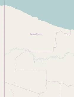
Aitape is a small town of about 18,000 people on the north coast of Papua New Guinea in the Sandaun Province. It is a coastal settlement that is almost equidistant from the provincial capitals of Wewak and Vanimo, and marks the midpoint of the highway between these two capitals. Aitape has 240 V power (in general 24 hours), telephone, a bank, a post-office, a courthouse and a police station, a supermarket and many tradestores, a petrol station, two airstrips, two secondary schools, a mission office and a hospital. [1]

Contents

Aitape was established as a train station by German colonists in 1905 as part of German New Guinea. During the Second World War the town was occupied by the Imperial Japanese Army.

Transport

Aitape can be reached by logging road from Vanimo and Wewak (180 km). Boats also leave Aitape Harbor to Vanimo and Wewak.

There are two airstrips: Tadji (TAJ), where most flights land, and Aitape (ATP). Tadji airstrip is located 10 km east of town.

History

First contact between the Aitape (Eitape) area and the outside world is believed to have occurred during the 15th century when large sailing expeditions arrived from China. It is certain that Malay fishing fleets were active along the Sepik coastline from the early 17th century when island inhabitants were recruited as navigators for these Malay fishing vessels. The first Christian missionary arrived in the Aitape area in 1896. It was Societatis Verbi Divini (the Society of the Divine Word or SVD) from Germany and Holland. The first mission station was established on Tumleo Island in 1896. A second station was set up at Pro on the mainland the following year. The inhabitants of Pro requested that the mission station be established to protect them from raids by much larger settlements. The major native settlements at the time were at Sissano, Malol, and Arop (the Siau group). The island settlements of Tumleo, Ali, and Seleo (the Bakla) made up the next group of main settlements. Both the Siau and Bakla would band together annually for major trading expeditions taking in the Aitape coastline to the south east areas around Wewak.

German authorities found it difficult to colonize the Siau and Bakla of the Aitape area. The Aitape area was officially described as uncontrolled during the German colonial period. Still, the Germans built a solid prison at Aitape and installed a powerful radio station which maintained quality communication with Europe.

In 1908, the Aitape coastline was struck by a major tsunami event resulting in the collapse of an area of coastline between Arop and Sissano creating the Sissano Lagoon. (A second tsunami struck in 1935 with most recent occurring in 1998 also hitting Sissano.)

By 1914 there were 68 missionaries and 6 new stations established along the coast. The town along with the rest of German New Guinea passed to Australian control after the First World War and became part of the Territory of New Guinea.

Second World War

During the Second World War the town was occupied, along with the rest of the Territory of New Guinea, by the Imperial Japanese Army.

During the recapture American forces bypassed the Japanese 18th Army based at Wewak, taking Aitape on 22 April 1944. A base was developed here and repulsed a major Japanese counter-attack. The Americans were content to hold Aitape and not advance far towards Wewak. In fact, Aitape was captured as part of a 3-pronged invasion by the Allies (Aitape, and landings on either side of Hollandia). There was little or no strategic gain to be had in doing so as the Japanese force based at Wewak no longer posed a real threat – cut off, short of supplies, and weakened from battle and diseases. In mid-1944, General Douglas MacArthur, the American Commander-in-Chief of Allied forces in the South-West Pacific Area, secured an agreement from the Australian government for Australian forces to take over at Aitape. MacArthur then continued island hopping in preparation for the re-capture of the Philippines.

The Aitape-Wewak campaign was the final Australian military campaign on mainland New Guinea. It ran from November 1944 to the war's end in August 1945. It was fought by the 6th Division, Australian Imperial Force (AIF) with air and naval support. The US Navy built a camp at Aitape as a remote post for Naval Base Hollandia. [2] [3]

Australian intelligence soldier Leonard Siffleet was beheaded by the Japanese on Aitape beach on 24 October 1943. [4]

Tsunami

In July 1998, the area surrounding the town suffered from a destructive tsunami that killed over 2,000 people. A magnitude 7.0 earthquake occurred offshore and triggered a large undersea landslide that generated the tsunami. The area worst hit was Warapu village about 8 km west of Aitape. The village was situated on a narrow spit between the coast and a large lagoon. It is estimated that waves with an average height of 10.5 metres passed over the spit into the lagoon.

Climate

Aitape has a tropical rainforest climate (Af) with heavy rainfall year-round.

Climate data for Aitape
MonthJanFebMarAprMayJunJulAugSepOctNovDecYear
Mean daily maximum °C (°F)30.1
(86.2)
29.9
(85.8)
30.1
(86.2)
30.6
(87.1)
30.7
(87.3)
30.1
(86.2)
29.9
(85.8)
30.3
(86.5)
30.3
(86.5)
30.3
(86.5)
30.4
(86.7)
29.9
(85.8)
30.2
(86.4)
Daily mean °C (°F)26.5
(79.7)
26.5
(79.7)
26.5
(79.7)
26.8
(80.2)
26.8
(80.2)
26.3
(79.3)
26.2
(79.2)
26.3
(79.3)
26.5
(79.7)
26.5
(79.7)
26.6
(79.9)
26.2
(79.2)
26.5
(79.7)
Mean daily minimum °C (°F)23.0
(73.4)
23.1
(73.6)
23.0
(73.4)
23.1
(73.6)
23.0
(73.4)
22.5
(72.5)
22.5
(72.5)
22.4
(72.3)
22.7
(72.9)
22.8
(73.0)
22.9
(73.2)
22.6
(72.7)
22.8
(73.0)
Average precipitation mm (inches)260
(10.2)
262
(10.3)
289
(11.4)
236
(9.3)
199
(7.8)
188
(7.4)
173
(6.8)
130
(5.1)
161
(6.3)
179
(7.0)
205
(8.1)
281
(11.1)
2,563
(100.8)
Source: Climate-Data.org [5]

See also

Related Research Articles

<span class="mw-page-title-main">Sandaun Province</span> Place in Papua New Guinea

Sandaun Province is the northwesternmost mainland province of Papua New Guinea. It covers an area of 35,920 km2 and has a population of 248,411. The capital is Vanimo. In July 1998 the area surrounding the town Aitape was hit by an enormous tsunami caused by a Magnitude 7.0 earthquake which killed over 2,000 people. The five villages along the west coast of Vanimo towards the International Border are namely; Lido, Waromo, Yako, Musu and Wutung.

<span class="mw-page-title-main">Wewak</span> Place in East Sepik Province, Papua New Guinea

Wewak is the capital of the East Sepik province of Papua New Guinea. It is on the northern coast of the island of New Guinea. It is the largest town between Madang and Jayapura. It is the see city (seat) of the Roman Catholic Diocese of Wewak.

Kokoda is a station town in the Oro Province of Papua New Guinea. It is famous as the northern end of the Kokoda Track, site of the eponymous Kokoda Track campaign of World War II. In that campaign, it had strategic significance because it had the only airfield along the Track. In the decades preceding, it had been a foothills settlement near the gold fields.

<span class="mw-page-title-main">Madang</span> Capital of Madang Province, Papua New Guinea

Madang is the capital of Madang Province and is a town with a population of 27,420 on the north coast of Papua New Guinea. It was first settled by the Germans in the 19th century.

The Schouten languages are a linkage of Austronesian languages in northern Papua New Guinea. They are in contact with various North Papuan languages, particularly the Skou and some Torricelli languages.

<span class="mw-page-title-main">2/7th Battalion (Australia)</span> Former infantry battalion of the Australian Army

The 2/7th Battalion was an infantry battalion of the Australian Army raised for service during World War II. Formed as part of the 6th Division shortly after the outbreak of the war as part of the all-volunteer Second Australian Imperial Force, the 2/7th Battalion's initial personnel were recruited primarily from the state of Victoria, although later reinforcements were drawn from most other Australian states. Basic training was completed in Australia, after which the battalion embarked for the Middle East as part of the first batch of Australian troops to deploy overseas. Further training was undertaken in Palestine before the battalion went into action against the Italians in January 1941. After participating in the successful capture of Bardia and Tobruk, it was committed to the disastrous Battles of Greece and Crete, where the battalion was essentially destroyed after the majority of its personnel were captured.

<span class="mw-page-title-main">Battle of Driniumor River</span> World War II battle in New Guinea

The Battle of Driniumor River, also known as the Battle of Aitape, 10 July – 25 August 1944, was part of the Western New Guinea campaign of World War II. During the fighting, Japanese forces launched several attacks on United States forces on the Driniumor River, near Aitape in New Guinea, over the course of several weeks with the intention of retaking Aitape. After making some initial gains, the Japanese attack was contained and eventually turned back having suffered heavy casualties. The battle should not be confused with Operation Persecution, which included amphibious landings near Aitape in April 1944, or the Aitape–Wewak campaign, which began in November that year.

<span class="mw-page-title-main">Western New Guinea campaign</span> 1944–1945 campaign of World War II

The Western New Guinea campaign was a series of actions in the New Guinea campaign of World War II. Dutch East Indies KNIL, United States and Australian forces assaulted Japanese bases and positions in the northwest coastal areas of Netherlands New Guinea and adjoining parts of the Australian Territory of New Guinea. The campaign began with Operations Reckless and Persecution, which were amphibious landings by the U.S. I Corps at Hollandia and Aitape on 22 April 1944. Fighting in western New Guinea continued until the end of the war.

<span class="mw-page-title-main">Battle of Hollandia</span> 1944 battle between American and Japanese forces during World War II

The Battle of Hollandia was an engagement between Allies of World War II and Japanese forces during World War II. The majority of the Allied force was provided by the United States, with the bulk of two United States Army infantry divisions being committed on the ground. Air and naval support consisted largely of U.S. assets, although Australia also provided air support during preliminary operations and a naval bombardment force.

<span class="mw-page-title-main">Landing at Aitape</span> Battle of the Western New Guinea campaign of World War II

The Landing at Aitape was a battle of the Western New Guinea campaign of World War II. American and Allied forces undertook an amphibious landing on 22 April 1944 at Aitape on northern coast of Papua New Guinea. The amphibious landing was undertaken simultaneously with the landings at Humboldt and Tanahmerah Bays to secure Hollandia to isolate the Japanese 18th Army at Wewak. Operations in the area to consolidate the landing continued until 4 May, although US and Japanese forces fought further actions in western New Guinea following a Japanese counter-offensive that lasted until early August 1944. Aitape was subsequently developed into an Allied base of operations and was used by Australian forces throughout late 1944 and into 1945 during the Aitape–Wewak campaign.

The 1998 Papua New Guinea earthquake occurred on July 17 with a moment magnitude of 7.0 and a maximum Mercalli intensity of VIII (Severe). The event occurred on a reverse fault near the north coast region of Papua New Guinea, 25 kilometers (16 mi) from the coast near Aitape, and caused a large undersea landslide which caused a tsunami that hit the coast, killing between at least 2,183 and 2,700 people and injuring thousands.

<span class="mw-page-title-main">Aitape–Wewak campaign</span> Campaign on the Pacific Theatre of WWII

The Aitape–Wewak campaign was one of the final campaigns of the Pacific Theatre of World War II. Between November 1944 and the end of the war in August 1945, the Australian 6th Division, with air and naval support, fought the Imperial Japanese 18th Army in northern New Guinea. Considered a "mopping up" operation by the Australians, and although ultimately successful for them with the Japanese forces cleared from the coastal areas and driven inland, amidst difficult jungle conditions, casualties from combat and disease were high. With Japan on the verge of defeat, such casualties later led to the strategic necessity of the campaign being called into question.

<span class="mw-page-title-main">Sepik</span> River on New Guinea

The Sepik is the longest river on the island of New Guinea, and the second largest in Oceania by discharge volume after the Fly River. The majority of the river flows through the Papua New Guinea (PNG) provinces of Sandaun and East Sepik, with a small section flowing through the Indonesian province of Papua.

Tadji is a small town on the north coast of Papua New Guinea in Aitape Urban ward of East Aitape Rural LLG, Sandaun Province. Tadji is located to the east of Aitape. The town is home to Tadji Airport, which was built by the Japanese in 1942 during the World War II. The liberation of Tadji was the focus of Operation Persecution during April 1944, when the Allies captured the airstrip.

Operation Whiting was a military operation by Dutch and Australian forces during World War II in New Guinea by M Special Unit. It ran in conjunction with Operation Locust, and resulted in the capture and execution of Leonard Siffleet in October 1943, producing one of the most famous photographs of the war.

The Piore River or Lagoon languages form a branch of Skou languages. Historically most have been lumped together as a single Warapu language, with Nouri variously classified. They are spoken in the Sissano Lagoon area of West Aitape Rural LLG, Sandaun Province, Papua New Guinea. The Piore River runs to the west of all the languages, and so speakers do not find it an acceptable name. However, it is not clear which name would be better, as the name of the lagoon, 'Sissano', is used for different neighboring languages.

Aitape West Rural LLG is a local-level government (LLG) of Aitape in Sandaun Province, Papua New Guinea.

<span class="mw-page-title-main">Sissano Lagoon</span> Lagoon in Papua New Guinea

Sissano Lagoon is a lagoon located in West Aitape Rural LLG, Sandaun Province, Papua New Guinea.

<span class="mw-page-title-main">2002 Sandaun earthquake</span> Earthquake in Papua New Guinea

On September 9, 2002, a magnitude 7.6 earthquake struck off the coast of Wewak, Sandaun Province, Papua New Guinea. The shallow reverse earthquake triggered a local tsunami measuring 5 meters high. The disaster resulted in at least 6 deaths, 70 injuries and building damage.

<span class="mw-page-title-main">US Naval Base New Guinea</span> Major World War 2 bases in Papua New Guinea

US Naval Base New Guinea was number of United States Navy bases on the island of New Guinea during World War II. Australia entered World War II on 3 September 1939, being a self-governing nation within the British Empire. The United States formally entered the war on 7 December 1941, following the attack on Pearl Harbor by the Empire of Japan. Following the attack on Pearl Harbor, Japan quickly took over much of the South Pacific Ocean. The United States lost key naval bases in the South Pacific, including Naval Base Manila and Naval Base Subic Bay, both lost in the 1941–42 invasion of the Philippines. Also lost were Naval Base Guam and Wake Atoll. As such, the United States Armed Forces needed new bases in the South West Pacific for staging attacks on Japan's southern empire. The United States built bases first in Australia, then in New Guinea.

References

  1. Diocese of Aitape
  2. "Building the Navy's Bases, vol. 2 (part III, chapter 26)". US Navy.
  3. Humboldt Bay, pacificwrecks.com
  4. "Australian War Memorial - 101099". cas.awm.gov.au. Archived from the original on 15 March 2011. Retrieved 12 January 2022.
  5. "Climate: Aitape". Climate-Data.org. Retrieved 19 October 2020.