Alaska Route 1 | ||||
---|---|---|---|---|
Route information | ||||
Maintained by Alaska DOT&PF | ||||
Length | 545.92 mi [1] (878.57 km) | |||
Major junctions | ||||
West end | Alaska Marine Highway in Homer | |||
| ||||
East end | AK-2 at Tok | |||
Location | ||||
Country | United States | |||
State | Alaska | |||
Boroughs | Kenai Peninsula, Municipality of Anchorage, Matanuska-Susitna, Unorganized | |||
Highway system | ||||
|
Alaska Route 1 (AK-1) is a state highway in the southern part of the U.S. state of Alaska. It runs from Homer northeast and east to Tok by way of Anchorage. It is one of two routes in Alaska to contain significant portions of freeway: the Seward Highway in south Anchorage and the Glenn Highway between Anchorage and Palmer.
AK-1 is also known by the named highways it traverses:
AK-1 begins at the Alaska Marine Highway's Homer Ferry Terminal at the tip of Homer Spit just south of the end of the Sterling Highway in Homer. It follows the entire Sterling Highway through Soldotna to the junction with the Seward Highway north of Seward, where it meets the north end of AK-9. There it turns north and follows the Seward Highway to its end in Anchorage, and follows the one-way pairs of Ingra and Gambell Streets and 6th and 5th Avenues, continuing east on 5th Avenue to the beginning of the Glenn Highway. AK-1 follows the entire length of the Glenn Highway, passing the south end of the George Parks Highway (AK-3) near Wasilla and meeting the Richardson Highway (AK-4) near Glennallen. A short concurrency north along AK-4 takes AK-1 to the Tok Cut-Off, which it follows northeast to its end at the Alaska Highway (AK-2) at Tok. [2] [3]
The majority of AK-1 is part of the Interstate Highway System; only the route between Homer and Soldotna does not carry an unsigned Interstate designation. The entire length of A-3 follows AK-1 from the Kenai Spur Highway in Soldotna to the turn in downtown Anchorage; there A-1 begins, running to Tok along AK-1. (A-1 continues to the Yukon border along AK-2, the Alaska Highway.) [4] [5] Only a short portion of the Seward Highway south of downtown Anchorage and a longer portion of the Glenn Highway northeast to AK-3 are built to freeway standards; the proposed Highway to Highway Connection would link these through downtown.
All exits are unnumbered.
Borough | Location | mi [1] | km | Destinations | Notes |
---|---|---|---|---|---|
Kenai Peninsula | Homer | 0.00 | 0.00 | Land's End Resort | Dead end |
0.09 | 0.14 | Homer Ferry Terminal | To Alaska Marine Highway | ||
Heath Street | Southern terminus of Sterling Highway | ||||
Soldotna | 81.03 | 130.41 | Kenai Spur Highway north – Kenai | Southern terminus of Interstate A3 | |
Chugach National Forest | 138.18 | 222.38 | AK-9 south (Seward Highway) – Seward | Northern terminus of AK-9; AK-1 transitions to Seward Highway | |
Hope Highway north – Hope | |||||
Municipality of Anchorage | 179.72 | 289.23 | Portage Glacier Road east – Whittier, Portage Glacier | ||
Old Seward Highway north | |||||
218.39 | 351.46 | Southern terminus of freeway section | |||
218.81 | 352.14 | Old Seward Highway / Rabbit Creek Road | |||
219.37 | 353.04 | DeArmoun Road | Southbound exit and northbound entrance | ||
220.48 | 354.83 | Huffman Road | |||
221.45 | 356.39 | O'Malley Road | To Ted Stevens Anchorage International Airport | ||
222.96 | 358.82 | Dimond Boulevard | |||
223.66 | 359.95 | 76th Avenue | Southbound exit and northbound entrance | ||
224.46 | 361.23 | Dowling Road | Dumbbell interchange | ||
225.46 | 362.84 | Tudor Road | |||
226.01 | 363.73 | ||||
Old Seward Highway south | Interchange; southbound exit only | ||||
Northern terminus of freeway section | |||||
20th Avenue | Northern terminus of Seward Highway | ||||
Mountain View Drive | Southern terminus of Glenn Highway | ||||
Southern terminus of freeway section | |||||
230.04 | 370.21 | Bragaw Street | |||
231.08 | 371.89 | Boniface Parkway / Mountain View Drive – JBER-Elmendorf | |||
231.84 | 373.11 | Turpin Street | Northbound exit and entrance | ||
232.66 | 374.43 | Muldoon Road | DDI interchange | ||
234.22 | 376.94 | Arctic Valley Road | Northbound exit and southbound entrance | ||
235.71 | 379.34 | JBER-Richardson, Arctic Valley | Via D Street | ||
239.70 | 385.76 | Eagle River Loop Road / Hiland Road | |||
241.45 | 388.58 | Eagle River | Via Old Glenn Highway | ||
243.30 | 391.55 | North Eagle River | Via North Eagle River Access Road | ||
245.31 | 394.79 | South Birchwood | Via South Birchwood Loop Road | ||
248.73 | 400.29 | North Birchwood | Via Birchwood Loop Road | ||
249.73 | 401.90 | Peters Creek | Via Voyles Boulevard | ||
250.75 | 403.54 | North Peters Creek | Via Lake Hill Drive | ||
252.03 | 405.60 | Mirror Lake | Via Old Glenn Highway and Paradis Lane | ||
253.17 | 407.44 | Thunderbird Falls | Via Old Glenn Highway; northbound exit and entrance | ||
254.05 | 408.85 | Eklutna | Via Eklutna Village Road | ||
257.57 | 414.52 | Old Glenn Highway | |||
Knik River | SFC James Bondsteel Bridge of Honor | ||||
Matanuska-Susitna | | 259.06 | 416.92 | Knik River Access | |
Palmer | 263.32 | 423.77 | AK-3 north – Wasilla, Fairbanks | Southern terminus of AK-3 (George Parks Highway) | |
Northern terminus of freeway section | |||||
Palmer-Wasilla Highway / Evergreen Avenue | |||||
Unorganized | Glennallen | 409.54 | 659.09 | AK-4 south (Richardson Highway) – Valdez | Southern terminus of AK-4 concurrency; northern terminus of Glenn Highway and Interstate A3 |
Gakona | 423.54 | 681.62 | AK-4 north (Richardson Highway) – Fairbanks | Northern terminus of AK-4 concurrency; southern terminus of Tok Cutoff Highway | |
Tok | 545.92 | 878.57 | AK-2 (Alaska Highway) – Fairbanks, Canadian Border | ||
1.000 mi = 1.609 km; 1.000 km = 0.621 mi
|
Location | Gakona—Tok |
---|---|
Length | 125 mi (201 km) |
Existed | c. 1940–present |
The Tok Cut-Off is a highway in the U.S. state of Alaska, running 125 miles (201 km) from Gakona (on the Richardson Highway, 14 miles (23 km) north of Glennallen), to Tok on the Alaska Highway which had been constructed from Montana through Calgary, Alberta, through Whitehorse, Canada by Army engineers to move supplies and equipment, and to build airbases, to service the requirements of the Pacific theater, including transport of Lend Lease aircraft to the Soviet Union after its invasion by Germany.
The road was built in the 1940s through challenging terrain, largely by battalions of Black engineers, including the 97th Engineer Battallion. [6] in order to facilitate transport of World War II materiel in particular from ports such as Valdez and Anchorage to the interior. It was upgraded in the 1950s to better connect the Richardson Highway more directly with Tok. It was called a "cut-off" because it allowed motor traffic coming to and from Canada on the Alaska Highway, to drive directly northeast or southwest connect to or from Southcentral Alaska communities without driving all the way to or from the terminus of the Alaska highway in Delta Junction, then traveling northwest or southeast by the Richardson Highway, reducing 120 miles (190 km) from the trip.
The 2002 Denali earthquake caused significant damage to the Cut-Off, particularly between mileposts 75 and 83 where major cracks and embankment slumping left the roadway fundamentally destroyed. [7] [8]
Tok is a census-designated place (CDP) in Southeast Fairbanks Census Area, Alaska, United States. The population was 1,243 at the 2020 census, slightly down from 1,258 in 2010.
Gakona is a census-designated place (CDP) in the Copper River Census Area in the U.S. state of Alaska. As of the 2020 census, the population of the CDP was 169, down from 218 in 2010.
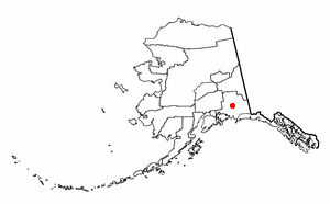
Glennallen is a census-designated place (CDP) in the Copper River Census Area in the Unorganized Borough of the U.S. state of Alaska. As of the 2020 census, the population of the CDP was 439, down from 483 in 2010. It is the most populated community in the census area.
The Richardson Highway is a highway in the U.S. state of Alaska, running 368 miles (562 km) and connecting Valdez to Fairbanks. It is marked as Alaska Route 4 from Valdez to Delta Junction and as Alaska Route 2 from there to Fairbanks. It also connects segments of Alaska Route 1 between the Glenn Highway and the Tok Cut-Off. The Richardson Highway was the first major road built in Alaska.
The Glenn Highway is a highway in the U.S. state of Alaska, extending 179 miles (288 km) from Anchorage near Merrill Field to Glennallen on the Richardson Highway. The Tok Cut-Off is often considered part of the Glenn Highway, for a total length of 328 miles (528 km).
The George Parks Highway, usually called simply the Parks Highway, runs 323 miles (520 km) from the Glenn Highway 35 miles (56 km) north of Anchorage to Fairbanks in the Alaska Interior. The highway, originally known as the Anchorage-Fairbanks Highway, was completed in 1971, and given its current name in 1975.
The Sterling Highway is a 138-mile-long (222 km) state highway in the south-central region of the U.S. state of Alaska, leading from the Seward Highway at Tern Lake Junction, 90 miles (140 km) south of Anchorage, to Homer.
The Seward Highway is a highway in the U.S. state of Alaska that extends 125 miles (201 km) from Seward to Anchorage. It was completed in 1951 and runs through the scenic Kenai Peninsula, Chugach National Forest, Turnagain Arm, and Kenai Mountains. The Seward Highway is numbered Alaska Route 9 (AK-9) for the first 37 miles (60 km) from Seward to the Sterling Highway and AK-1 for the remaining distance to Anchorage. At the junction with the Sterling Highway, AK-1 turns west towards Sterling and Homer. About eight miles (13 km) of the Seward Highway leading into Anchorage is built to freeway standards. In Anchorage, the Seward Highway terminates at an intersection with 5th Avenue, which AK-1 is routed to, and which then leads to the Glenn Highway freeway.
The Port of Alaska (POA) is a deep-water port located in Anchorage, Alaska with 3 bulk carrier berths, two petroleum berths, and one barge berth. It is an enterprise department of the Municipality of Anchorage. The name was changed from "Port of Anchorage" to the "Port of Alaska" in 2017. As such, the Port is distinguished from other types of municipal departments largely because it generates enough revenue to support its operations without being a burden to Anchorage property tax payers, and it also pays a fee-in-lieu of taxes to help run city government.
Denali Highway is a lightly traveled, mostly gravel highway in the U.S. state of Alaska. It leads from Paxson on the Richardson Highway to Cantwell on the Parks Highway. Opened in 1957, it was the first road access to Denali National Park. Since 1971, primary park access has been via the Parks Highway, which incorporated a section of the Denali Highway from Cantwell to the present-day park entrance. The Denali Highway is 135 miles (217 km) in length.
Alaska Route 2 is a state highway in the central and east-central portions of the U.S. state of Alaska. It runs from Manley Hot Springs to the Canada-United States border, passing through Fairbanks and Delta Junction. Alaska Route 2 includes the entire length of the Alaska Highway in the state, the remainder of the highway being in the Yukon Territory and British Columbia, Canada.
The Alaska Department of Transportation & Public Facilities (DOT&PF) is a department within the government of Alaska. Its headquarters are in Alaska's capital city, Juneau. The mission of Alaska DOT&PF is to "Keep Alaska Moving through service and infrastructure."
The Portage Glacier Highway, or Portage Glacier Road, is a highway located in the U.S. state of Alaska. The highway is made up of a series of roads, bridges, and tunnels that connect the Portage Glacier area of the Chugach National Forest and the city of Whittier to the Seward Highway. Most of the highway travels through mainly rural areas just north of the Kenai Peninsula, with the Anton Anderson Memorial Tunnel passing under Maynard Mountain, part of the Chugach Mountain Range. Parts of the route were first constructed in the early 1900s, and the entire highway was completed on June 7, 2000, as part of the Whittier Access Project. The main portion of the highway traveling from the western terminus to the Begich, Boggs visitors center is designated as National Forest Highway 35 by the United States Forest Service (USFS).
The Minnesota Drive Expressway is a 7.560-mile-long (12.167 km) south–north expressway located in the city of Anchorage, Alaska, United States. The expressway includes a small portion of O'Malley Road, which is also built to expressway standards. The highway travels from the southern region of Anchorage northward to North Star neighborhood area, and bisects the community of Spenard. The first section of the highway was constructed around 1950, and the entire highway was upgraded to expressway standards by the year of 1985. The entire length of the expressway is listed on the National Highway System, a network of roads important to the country's economy, defense, and mobility.
The Kenai Spur Highway is a 39-mile-long (63 km) highway on the Kenai Peninsula in Alaska. The road begins at a junction with the Sterling Highway in Soldotna and provides access to the towns of Kenai and Nikiski, dead-ending at the entrance to the Captain Cook State Recreation Area. Visitors traveling between the Homer area and these areas can bypass Soldotna and access the Spur Highway via Kalifornsky Beach Road. The highway is a four-lane undivided road inside of the cities of Soldotna and Kenai, and a two-lane road elsewhere. The northern section of the road is also known as the North Kenai Road. In 2018 the Federal Highway Administration approved a plan to extend the road by eight miles to improve access to remote homes in the area.
Fairview is a neighborhood in Anchorage, Alaska just east of Downtown Anchorage and west of the Merrill Field Airport. The area is a working-class neighborhood of approximately 7,200 residents, with a median household income of approximately $55,000 and a poverty rate of approximately 21%.
Route map: