Amboavory

Last updated
Amboavory
Madagascar location map.svg
Red pog.svg
Amboavory
Location in Madagascar
Coordinates: 17°18′S48°30′E / 17.300°S 48.500°E / -17.300; 48.500
CountryFlag of Madagascar.svg  Madagascar
Region Alaotra-Mangoro
District Amparafaravola
Elevation [1] 790 m (2,590 ft)
Population (2001) [2]
  Total 23,000
Time zone EAT (UTC3)

Amboavory is a town and commune (Malagasy : kaominina) in Madagascar. It belongs to the district of Amparafaravola, which is a part of Alaotra-Mangoro Region. It is situated on the northern banks of Lake Alaotra. The population of the commune was estimated to be approximately 23,000 in 2001 commune census. [2]

Malagasy is an Austronesian language and the national language of Madagascar. Most people in Madagascar speak it as a first language as do some people of Malagasy descent elsewhere.

Madagascar island nation off the coast of Southeast Africa, in the Indian Ocean

Madagascar, officially the Republic of Madagascar, and previously known as the Malagasy Republic, is an island country in the Indian Ocean, approximately 400 kilometres off the coast of East Africa. The nation comprises the island of Madagascar and numerous smaller peripheral islands. Following the prehistoric breakup of the supercontinent Gondwana, Madagascar split from the Indian subcontinent around 88 million years ago, allowing native plants and animals to evolve in relative isolation. Consequently, Madagascar is a biodiversity hotspot; over 90% of its wildlife is found nowhere else on Earth. The island's diverse ecosystems and unique wildlife are threatened by the encroachment of the rapidly growing human population and other environmental threats.

Districts of Madagascar

Districts are second-level administrative divisions of Madagascar below the regions. There are 114 districts in Madagascar. Districts are in their turn divided into communes; while some of the districts in urban areas and offshore islands each consist of only one commune, most of the districts are divided typically into 5–20 communes.

Primary and junior level secondary education are available in town. The majority 90% of the population of the commune are farmers. The most important crop is rice, while other important products are sugarcane and cassava. Industry and services provide both employment for 2% of the population. Additionally fishing employs 6% of the population. [2]

Rice cereal grain and seed of Oryza sativa

Rice is the seed of the grass species Oryza sativa or Oryza glaberrima. As a cereal grain, it is the most widely consumed staple food for a large part of the world's human population, especially in Asia. It is the agricultural commodity with the third-highest worldwide production, after sugarcane and maize.

Sugarcane group of cultivated plants

Sugarcane, or sugar cane, are several species of tall perennial true grasses of the genus Saccharum, tribe Andropogoneae, native to the warm temperate to tropical regions of South, Southeast Asia, and New Guinea, and used for sugar production. It has stout, jointed, fibrous stalks that are rich in the sugar sucrose, which accumulates in the stalk internodes. The plant is two to six metres tall. All sugar cane species can interbreed and the major commercial cultivars are complex hybrids. Sugarcane belongs to the grass family Poaceae, an economically important seed plant family that includes maize, wheat, rice, and sorghum, and many forage crops.

Cassava Species of plant

Manihot esculenta, commonly called cassava, manioc, yuca, macaxeira, mandioca, aipim and Brazilian arrowroot, is a woody shrub native to South America of the spurge family, Euphorbiaceae. It is extensively cultivated as an annual crop in tropical and subtropical regions for its edible starchy tuberous root, a major source of carbohydrates. Though it is often called yuca in Spanish and in the United States, it is not related to yucca, a shrub in the family Asparagaceae. Cassava, when dried to a powdery extract, is called tapioca; its fried, granular form is named garri.

Transport

The district is linked to Moramanga by the Route nationale 44 (Moramanga - Ambatondrazaka - Imerimandroso - Amboavory (228 km)).

Moramanga

Moramanga is a city in Madagascar.

Route nationale 44 (RN44) is a secondary highway in Madagascar, running from Moramanga to Amboavory along the eastern banks of Lake Alaotra until its junction with the RN 3a.

Ambatondrazaka Place in Alaotra-Mangoro, Madagascar

Ambatondrazaka[amˌbatuɳɖʐaˈzakə̥] is a city in Madagascar

References and notes

  1. Estimated based on DEM data from Shuttle Radar Topography Mission
  2. 1 2 3 "ILO census data". Cornell University. 2002. Retrieved 2008-03-24.

Coordinates: 17°18′S48°30′E / 17.300°S 48.500°E / -17.300; 48.500

Geographic coordinate system Coordinate system

A geographic coordinate system is a coordinate system that enables every location on Earth to be specified by a set of numbers, letters or symbols. The coordinates are often chosen such that one of the numbers represents a vertical position and two or three of the numbers represent a horizontal position; alternatively, a geographic position may be expressed in a combined three-dimensional Cartesian vector. A common choice of coordinates is latitude, longitude and elevation. To specify a location on a plane requires a map projection.


Related Research Articles

Alaotra-Mangoro Region in Madagascar

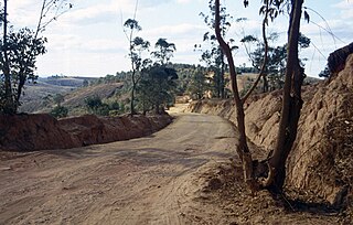
Alaotra-Mangoro is a region in eastern Madagascar. It borders Sofia Region in north, Analanjirofo in northeast, Atsinanana in east, Vakinankaratra in southwest, Analamanga in west and Betsiboka in northwest. The capital of the region is Ambatondrazaka, and the population was estimated to be 1,027,110 in 2013. The area of the region is 31,948 km2 (12,335 sq mi).

Imerimandroso Place in Alaotra-Mangoro, Madagascar

Imerimandroso is a town and commune in Madagascar. It belongs to the district of Ambatondrazaka, which is a part of Alaotra-Mangoro Region. The population of the commune was estimated to be approximately 11,000 in 2001 commune census.

Ambatovola Place in Alaotra-Mangoro, Madagascar

Ambatovola is a town and commune in Madagascar. It belongs to the district of Moramanga, which is a part of Alaotra-Mangoro Region. The population of the commune was estimated to be approximately 8,000 in 2001 commune census.

Amboasary Gara Place in Alaotra-Mangoro, Madagascar

Amboasary is a town and commune in Madagascar. It belongs to the district of Moramanga, which is a part of Alaotra-Mangoro Region. The population of the commune was estimated to be approximately 12,000 in 2001 commune census.

Ambohidronono Place in Alaotra-Mangoro, Madagascar

Ambohidronono is a town and commune in Madagascar. It belongs to the district of Moramanga, which is a part of Alaotra-Mangoro Region. The population of the commune was estimated to be approximately 8,000 in 2001 commune census.

Ampasipotsy Gare Place in Alaotra-Mangoro, Madagascar

Ampasipotsy Gare is a town and commune in Madagascar. It belongs to the district of Moramanga, which is a part of Alaotra-Mangoro Region. The population of the commune was estimated to be approximately 7,000 in 2001 commune census.

Andaingo Place in Alaotra-Mangoro, Madagascar

Andaingo is a town and commune in Madagascar. It belongs to the district of Moramanga, which is a part of Alaotra-Mangoro Region. The population of the commune was estimated to be approximately 15,000 in 2001 commune census.

Andasibe, Moramanga Place in Alaotra-Mangoro, Madagascar

Andasibe is a town and commune in Madagascar. It belongs to the district of Moramanga, which is a part of Alaotra-Mangoro Region. The population of the commune was estimated to be approximately 12,000 in 2001 commune census.

Anosibe Ifody Place in Alaotra-Mangoro, Madagascar

Anosibe Ifody is a town and commune in Madagascar. It belongs to the district of Moramanga, which is a part of Alaotra-Mangoro Region. The population of the commune was estimated to be approximately 6,000 in 2001 commune census.

Antaniditra Place in Alaotra-Mangoro, Madagascar

Antaniditra is a town and commune in Madagascar. It belongs to the district of Moramanga, which is a part of Alaotra-Mangoro Region. The population of the commune was estimated to be approximately 6,000 in 2001 commune census.

Beforona Place in Alaotra-Mangoro, Madagascar

Beforona is a town and commune in Madagascar. It belongs to the district of Moramanga, which is a part of Alaotra-Mangoro Region. The population of the commune was estimated to be approximately 13,000 in 2001 commune census.

Belavabary Place in Alaotra-Mangoro, Madagascar

Belavabary is a town and commune in Madagascar. It belongs to the district of Moramanga, which is a part of Alaotra-Mangoro Region. The population of the commune was estimated to be approximately 10,000 in 2001 commune census.

Fierenana, Moramanga Place in Alaotra-Mangoro, Madagascar

Fierenana is a town and commune in Madagascar. It belongs to the district of Moramanga, which is a part of Alaotra-Mangoro Region. The population of the commune was estimated to be approximately 9,000 in 2001 commune census.

Lakato Place in Alaotra-Mangoro, Madagascar

Lakato is a town and commune in Madagascar. It belongs to the district of Moramanga, which is a part of Alaotra-Mangoro Region. The population of the commune was estimated to be approximately 15,000 in 2001 commune census.

Mandialaza Place in Alaotra-Mangoro, Madagascar

Mandialaza is a town and commune in Madagascar. It belongs to the district of Moramanga, which is a part of Alaotra-Mangoro Region. The population of the commune was estimated to be approximately 11,000 in 2001 commune census.

Moramanga Suburbaine is a town and commune in Madagascar. It belongs to the district of Moramanga, which is a part of Alaotra-Mangoro Region. The population of the commune was estimated to be approximately 17,000 in 2001 commune census.

Morarano Gare is a town and commune in Madagascar. It belongs to the district of Moramanga, which is a part of Alaotra-Mangoro Region. The population of the commune was estimated to be approximately 11,000 in 2001 commune census.

Vodiriana Place in Alaotra-Mangoro, Madagascar

Vodiriana is a town and commune in Madagascar. It belongs to the district of Moramanga, which is a part of Alaotra-Mangoro Region. The population of the commune was estimated to be approximately 10,000 in 2001 commune census.

The Ambatondrazaka District is a district in the Alaotra-Mangoro Region of Madagascar. Its capital is the town of Ambatondrazaka. The district has an area of 5,540.25 km2 (2,139.10 sq mi), and the estimated population in 2013 was 324,610.