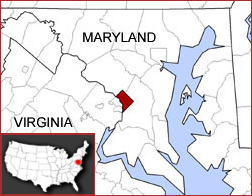
The District of Columbia statehood movement is a political movement that advocates making the District of Columbia a U.S. state, to provide the residents of the District of Columbia with voting representation in the Congress and full control over local affairs.

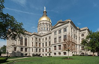
The Georgia State Capitol is an architecturally and historically significant building in Atlanta, Georgia, United States. The building has been named a National Historic Landmark which is listed on the National Register of Historic Places. As the primary office building of Georgia's government, the capitol houses the offices of the governor, lieutenant governor, and secretary of state on the second floor, chambers in which the General Assembly, consisting of the Georgia State Senate and Georgia House of Representatives, meets annually from January to April. The fourth floor houses visitors' galleries overlooking the legislative chambers and a museum located near the rotunda in which a statue of Miss Freedom caps the dome.

The Washington State Legislature is the state legislature of the U.S. state of Washington. It is a bicameral body, composed of the lower Washington House of Representatives, composed of 98 Representatives, and the upper Washington State Senate, with 49 Senators plus the Lieutenant Governor acting as president. The state is divided into 49 legislative districts, each of which elect one senator and two representatives.

The Colorado State Capitol Building, located at 200 East Colfax Avenue in Denver, Colorado, United States, is the home of the Colorado General Assembly and the offices of the Governor of Colorado and Lieutenant Governor of Colorado.
The Washington meridians are four meridians that were used as prime meridians in the United States and pass through Washington, D.C. The four which have been specified are:
- through the Capitol
- through the White House
- through the old Naval Observatory
- through the new Naval Observatory.

The Washington State Capitol or Legislative Building in Olympia is the home of the government of the state of Washington. It contains chambers for the Washington State Legislature and offices for the governor, lieutenant governor, secretary of state and treasurer and is part of a campus consisting of several buildings. Buildings for the Washington Supreme Court, executive agencies and the Washington Governor's Mansion are part of the capitol campus.

Capitol Lake is a 3 kilometer long, 260-acre (1.1 km2) artificial lake at the mouth of Deschutes River in Tumwater/Olympia, Washington. The Olympia Brewery sits on Capitol Lake in Tumwater, just downstream from where the Tumwater Falls meet the artificial lake. The Washington State Department of Enterprise Services (DES) manages the lake, as part of The Washington State Capitol Campus.

The Constitution of the State of Washington is the document that describes the structure and function of the government of the U.S. State of Washington. The constitution was adopted as part of Washington Territory's path to statehood in 1889. An earlier constitution was drafted and ratified in 1878, but it was never officially adopted.

Jefferson Pier, Jefferson Stone, or the Jefferson Pier Stone, in Washington, D.C., marks the second prime meridian of the United States even though it was never officially recognized, either by presidential proclamation or by a resolution or act of Congress.

The seal of the District of Columbia consists of a circular design with the words “DISTRICT OF COLUMBIA” stretched across the top inside portion in an arc. The Seal includes two human figures which are the likeness of George Washington and a blindfolded female figure holding a wreath in her right hand and a stone tablet with the word "CONSTITUTION" in her left hand. The Seal also contains a depiction of the United States Capitol, several agricultural products, an eagle in a war stance, a train locomotive crossing the Potomac River, emblazoned by a radiating sun and trailed by several rail cars. The seal reads the motto of the District of Columbia, "JUSTITIA OMNIBUS" ; and "1871". The official seal is always presented in black and white. The Secretary of the District of Columbia is the official custodian of the Seal.

Columbus Circle, also known as Union Station Plaza or Columbus Plaza, is a traffic circle at the intersection of Delaware, Louisiana and Massachusetts Avenues and E and First Streets, Northeast in Washington, D.C. It is located in front of Union Station right next to the grounds of the United States Capitol. Union Station and its access roads interrupt this circle on one side, forming an arc.

The Corydon Historic District is a national historic district located in Corydon, Indiana, United States. The town of Corydon is also known as Indiana's First State Capital and as Historic Corydon. The district was added to the National Register of Historic Places in 1973, but the listing was amended in 1988 to expand the district's geographical boundaries and include additional sites. The district includes numerous historical structures, most notably the Old Capitol, the Old Treasury Building, Governor Hendricks' Headquarters, the Constitution Elm Memorial, the Posey House, the Kintner-McGrain House, and The Kintner House Inn, as well as other residential and commercial sites.

The following is a list of articles related to the District of Columbia, commonly known as Washington, D.C.

Apotheosis of Democracy is a public artwork by American sculptor Paul Wayland Bartlett, located on the United States Capitol House of Representatives portico's east front in Washington, D.C., United States. This sculpture was surveyed in 1993 as part of the Smithsonian's Save Outdoor Sculpture! program.

Southern Avenue is one of three boundary streets between Washington, D.C., and the state of Maryland. Following a southwest-to-northeast line, Southern Avenue begins at the intersection of South Capitol Street in Southeast, Washington, D.C., and Indian Head Highway on the Maryland side. It runs for approximately 7 miles (11 km) to its other end at Eastern Avenue in Northeast, Washington, D.C., with an uncompleted gap between Naylor Road SE and Branch Avenue SE.

The L'Enfant Plan for the city of Washington is the urban plan developed in 1791 by Major Pierre (Peter) Charles L'Enfant for George Washington, the first president of the United States.

Territories of the United States on stamps discusses commemorative postal issues devoted to lands that have been ceded to the nation or purchased by treaty in conjunction with both war and peace. Thirteen states have been created from colonial territories, two from independent republics, four from previous states in the Union, and an additional thirty-one from United States territories.
The Mississippi Writers Trail is a series of historical markers which celebrate the literary, social, historical, and cultural contributions of Mississippi's most acclaimed and influential writers. An advisory committee of state cultural agencies oversees the process of installing historical markers in places of significance to an author's life. To emphasize the literary focus of the trail, the markers are cast in the shape of an open book and display information about the author's life with the goal of educating the public about the legacy of Mississippi writers.

The Washington, D.C. Admission Act, often referred to simply as the D.C. Admission Act, is a bill introduced during the 116th United States Congress. The intention of the bill is to grant Washington, D.C., admission into the Union as a state and hence make it the country's first and only city-state. The bill was originally introduced in the 116th Congress on January 3, 2019, and was reintroduced on January 4, 2021, in the 117th Congress. It passed on April 22, 2021 in the House of Representatives.

The 1992 Shadow Representative election in the District of Columbia took place on November 3, 1992, to elect a shadow member to the United States House of Representatives to represent the District of Columbia. Unlike non-voting delegates, the Shadow Representative is only recognized by the District of Columbia and is not officially sworn or seated. One-term incumbent and inaugural office-holder Charles Moreland ran for reelection and won.


