Aromas, California

Last updated

Aromas, California
Aromas, California.JPG
Downtown Aromas
Monterey County California Incorporated and Unincorporated areas Aromas Highlighted.svg
Location in Monterey County and the state of California
San Benito County California Incorporated and Unincorporated areas Aromas Highlighted.svg
Location in San Benito County and the state of California
Usa edcp relief location map.png
Red pog.svg
Aromas
Location in the United States
Coordinates: 36°53′13″N121°38′29″W / 36.88694°N 121.64139°W / 36.88694; -121.64139
Country United States
State California
Counties Monterey, San Benito
Government
   State Senators Shannon Grove (R) and John Laird (D) [1]
   Assembly Members Robert Rivas (D) and Dawn Addis (D) [1]
   U. S. Rep. Zoe Lofgren (D) [2]
Area
[3]
  Total4.75 sq mi (12.3 km2)
  Land4.74 sq mi (12.3 km2)
  Water0.01 sq mi (0.03 km2)  0.22%
Elevation
131 ft (40 m)
Population
 (2020) [4]
  Total2,708
  Density571.91/sq mi (220.82/km2)
Time zone UTC-8 (PST)
  Summer (DST) UTC-7 (PDT)
ZIP code
95004
Area code 831
FIPS code 06-02812
GNIS feature ID 1657949

Aromas (Spanish for "Aromas ") is an unincorporated community and census-designated place (CDP) in Monterey County and San Benito County, California, United States. The population was 2,708 at the 2020 census. [4]

Contents

The CDP straddles the border of the two counties, with Monterey County to the west and San Benito County to the east. The Santa Cruz County line is less than a mile to the northwest, and Santa Clara County is about 2 miles (3 km) to the north. Its population was almost equally distributed between the two counties with 1,358 in Monterey County and 1,292 in San Benito County; this was down from a population of 2,797 during the 2000 census (1,427 in Monterey County and 1,370 in San Benito County). Aromas is one of four CDPs in California that are divided between two or more counties. The others are Kingvale (divided between Placer County and Nevada County), Kirkwood (divided between Alpine County and Amador County), and Tahoma (divided between Placer County and El Dorado County). [5]

History

The settlement was originally known as "Sand Cut", named from the Southern Pacific Railroad tunnel constructed nearby in 1871. [6] The settlement was renamed Aromas, after Rancho Las Aromitas y Agua Caliente, around 1895. [7]

Geography

Aromas is located in northern Monterey County and northwestern San Benito County at 36°53′13″N121°38′29″W / 36.88694°N 121.64139°W / 36.88694; -121.64139 (36.886988, -121.641396). [8] Is it bordered to the south by Prunedale. U.S. Route 101 runs along the southeastern edge of the community, leading north 13 miles (21 km) to Gilroy and south 14 miles (23 km) to Salinas.

According to the United States Census Bureau, the Aromas CDP has a total area of 4.75 square miles (12.3 km2). 4.74 square miles (12.3 km2) of it are land and 0.01 square miles (0.026 km2), or 0.22%, are water. [3] The center of town is on the south side of the valley of the Pajaro River, about 1 mile (1.6 km) southwest of where the river cuts through Pajaro Gap (Chittenden Pass) at the south end of the Santa Cruz Mountains.

Demographics

Historical population
CensusPop.Note
2000 2,797
2010 2,650−5.3%
2020 2,7082.2%
U.S. Decennial Census [9]

2010

The 2010 United States Census [10] reported that Aromas had a population of 2,650. The population density was 558.3 inhabitants per square mile (215.6/km2). The racial makeup of Aromas was 1,987 (75.0%) White, 16 (0.6%) African American, 37 (1.4%) Native American, 49 (1.8%) Asian, 4 (0.2%) Pacific Islander, 401 (15.1%) from other races, and 156 (5.9%) from two or more races. Hispanic or Latino of any race were 924 persons (34.9%).

The Census reported that 2,650 people (100% of the population) lived in households, 0 (0%) lived in non-institutionalized group quarters, and 0 (0%) were institutionalized.

There were 884 households, out of which 328 (37.1%) had children under the age of 18 living in them, 558 (63.1%) were opposite-sex married couples living together, 93 (10.5%) had a female householder with no husband present, 45 (5.1%) had a male householder with no wife present. There were 36 (4.1%) unmarried opposite-sex partnerships, and 11 (1.2%) same-sex married couples or partnerships. 143 households (16.2%) were made up of individuals, and 49 (5.5%) had someone living alone who was 65 years of age or older. The average household size was 3.00. There were 696 families (78.7% of all households); the average family size was 3.36.

The population was spread out, with 619 people (23.4%) under the age of 18, 244 people (9.2%) aged 18 to 24, 552 people (20.8%) aged 25 to 44, 956 people (36.1%) aged 45 to 64, and 279 people (10.5%) who were 65 years of age or older. The median age was 42.2 years. For every 100 females, there were 102.0 males. For every 100 females age 18 and over, there were 100.3 males.

There were 923 housing units at an average density of 194.5 per square mile (75.1/km2), of which 680 (76.9%) were owner-occupied, and 204 (23.1%) were occupied by renters. The homeowner vacancy rate was 1.2%; the rental vacancy rate was 2.3%. 2,022 people (76.3% of the population) lived in owner-occupied housing units and 628 people (23.7%) lived in rental housing units.

2000

As of the census [11] of 2000, there were 2,797 people, 889 households, and 731 families residing in the CDP. The population density was 589.2 inhabitants per square mile (227.5/km2). There were 915 housing units at an average density of 192.7 per square mile (74.4/km2). The racial makeup of the CDP was 79.23% White, 0.18% Black or African American, 1.32% Native American, 2.61% Asian, 0.07% Pacific Islander, 11.01% from other races, and 5.58% from two or more races. 22.92% of the population were Hispanic or Latino of any race.

There were 889 households, out of which 45.0% had children under the age of 18 living with them, 68.6% were married couples living together, 7.9% had a female householder with no husband present, and 17.7% were non-families. 11.8% of all households were made up of individuals, and 4.4% had someone living alone who was 65 years of age or older. The average household size was 3.15 and the average family size was 3.42.

In the CDP, the population was spread out, with 30.3% under the age of 18, 6.5% from 18 to 24, 29.1% from 25 to 44, 26.5% from 45 to 64, and 7.7% who were 65 years of age or older. The median age was 37 years. For every 100 females, there were 100.6 males. For every 100 females age 18 and over, there were 98.2 males.

The median income for a household in the CDP was $69,145, and the median income for a family was $70,000. Males had a median income of $51,771 versus $41,875 for females. The per capita income for the CDP was $25,220. About 5.7% of families and 6.2% of the population were below the poverty line, including 7.2% of those under age 18 and 10.2% of those age 65 or over.

Schools

The Aromas-San Juan School District has three schools – Aromas Elementary School, San Juan School and Anzar High School. Aromas has one K-8 school, Aromas Elementary School with less than 400 students, (in 2000). Heather Howell is the current principal of Aromas School. [12] Anzar High School, which opened in 1994, was named after early area pioneers.

Economy

Aromas is home to a Graniterock quarry.

Since 1986, Fireclay Tile has been manufacturing architectural tile in Aromas. [13]

Notes

  1. 1 2 "Statewide Database". UC Regents. Archived from the original on February 1, 2015. Retrieved October 10, 2014.
  2. "California's 18th Congressional District - Representatives & District Map". Civic Impulse, LLC. Retrieved January 18, 2023.
  3. 1 2 "2022 U.S. Gazetteer Files: California". United States Census Bureau. Retrieved November 14, 2022.
  4. 1 2 "P1. Race – Aromas CDP, California: 2020 DEC Redistricting Data (PL 94-171)". U.S. Census Bureau. Retrieved November 14, 2022.
  5. U.S. Census Bureau
  6. "Aromas, California". mtycounty.com. Archived from the original on May 24, 2015. Retrieved September 24, 2014.
  7. "Untitled news item". Pajaronian. March 14, 1895. p. 3.
  8. "US Gazetteer files: 2010, 2000, and 1990". United States Census Bureau. February 12, 2011. Retrieved April 23, 2011.
  9. "Census of Population and Housing". Census.gov. Retrieved June 4, 2016.
  10. "2010 Census Interactive Population Search: CA - Aromas CDP". U.S. Census Bureau. Archived from the original on July 15, 2014. Retrieved July 12, 2014.
  11. "U.S. Census website". United States Census Bureau . Retrieved January 31, 2008.
  12. "Aromas - School Directory Details (CA Dept of Education)". www.cde.ca.gov. Retrieved August 7, 2019.
  13. "San Jose tile maker reclaims porcelain destined for landfill". The Mercury News. September 30, 2010. Retrieved December 24, 2020.

Related Research Articles

<span class="mw-page-title-main">South San Gabriel, California</span> Census-designated place in California, United States

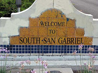
South San Gabriel is a census-designated place (CDP) in Los Angeles County, California, United States. The population was 8,070 at the 2010 census, up from 7,595 at the 2000 census.

<span class="mw-page-title-main">Boronda, California</span> Census-designated place in California, United States

Boronda is an unincorporated community and census-designated place (CDP) in Monterey County, California, United States. The population was 1,760 at the 2020 census. Boronda is located directly west of Salinas and is named after José Eusebio Boronda, a Californio ranchero, and located on the lands of his Rancho Rincón del Sanjón.

<span class="mw-page-title-main">Bradley, California</span> Unincorporated community in California, United States

Bradley is an unincorporated community and census-designated place (CDP) in Monterey County, California, on the Salinas River 14 miles (23 km) south-southeast of San Ardo and 20 miles (32 km) north of Paso Robles. Bradley sits at an elevation of 548 feet (167 m). The population was 69 at the 2020 census, down from 93 at the 2010 census.

<span class="mw-page-title-main">Chualar, California</span> Unincorporated community in California, United States

Chualar is an unincorporated community and census-designated place (CDP) in the Salinas Valley of Monterey County, California, United States. Chualar is located 10 miles (16 km) southeast of Salinas, at an elevation of 115 feet (35 m). The population was 1,185 at the 2020 census.

<span class="mw-page-title-main">Elkhorn, California</span> Census-designated place in California, United States

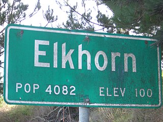
Elkhorn is an unincorporated community and census-designated place (CDP) in Monterey County, California, United States.

<span class="mw-page-title-main">Prunedale, California</span> Place in California, United States

Prunedale is a unincorporated community in Monterey County, California, United States. It is located 8 miles (13 km) north of Salinas at an elevation of 92 feet (28 m). The population was 18,885 as of the 2020 census, up from 17,560 in 2010. For statistical purposes, the United States Census Bureau has defined Prunedale as a census-designated place (CDP). Plum trees were grown in Prunedale in the early days of its founding, but the trees died soon after due to poor irrigation and fertilizer.

<span class="mw-page-title-main">San Lucas, California</span> Census-designated place in California, United States

San Lucas is an unincorporated community and census-designated place (CDP) in Monterey County, California, United States. It was founded in 1886 and named after the Rancho San Lucas, which was granted in 1842. The post office was first established in 1892.

<span class="mw-page-title-main">Del Monte Forest, California</span> Census-designated place in California, United States

Del Monte Forest is a census-designated place (CDP) in Monterey County, California, United States. As of the 2020 census, the CDP had a total population of 4,204, down from 4,514 at the 2010 census. The census area includes the separate well-known community of Pebble Beach.

<span class="mw-page-title-main">Flora Vista, New Mexico</span> CDP in New Mexico, United States

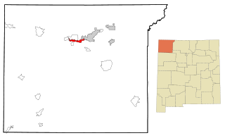
Flora Vista is a census-designated place (CDP) in San Juan County, New Mexico, United States. The population was 1,383 at the 2000 census. It is part of the Farmington Metropolitan Statistical Area. Flora Vista was founded in 1877 by settlers from Colorado who built cabins along the Animas River. A post office was established the following year. The name derived from the view of wildflowers in the valley.

Napi Headquarters is a census-designated place (CDP) in San Juan County, New Mexico, United States. The population was 706 at the 2000 census.

<span class="mw-page-title-main">Naschitti, New Mexico</span> CDP in New Mexico, United States

Naschitti is a census-designated place (CDP) in San Juan County, New Mexico, United States. The population was 360 at the 2000 census. It is part of the Farmington Metropolitan Statistical Area. The town was established in 1886, when Tom Bryan set up a trading post east of the Chuska Mountains. With a Navajo name, Naschitti means "badger springs."

<span class="mw-page-title-main">Nenahnezad, New Mexico</span> CDP in New Mexico, United States

Nenahnezad is a census-designated place (CDP) in San Juan County, New Mexico, United States. The population was 726 at the 2000 census. Nenahnezad is a Chapter community just to the south of Fruitland, between the towns of Farmington and Shiprock. It is part of the Farmington Metropolitan Statistical Area.

<span class="mw-page-title-main">Ojo Amarillo, New Mexico</span> CDP in New Mexico, United States

Ojo Amarillo is a census-designated place (CDP) in San Juan County, New Mexico, United States. The population was 829 at the 2000 census. It is part of the Farmington Metropolitan Statistical Area.

<span class="mw-page-title-main">Sanostee, New Mexico</span> CDP in New Mexico, United States

Sanostee is a census-designated place (CDP) in San Juan County, New Mexico, United States. The population was 429 at the 2000 census. It is part of the Farmington Metropolitan Statistical Area.

<span class="mw-page-title-main">Sheep Springs, New Mexico</span> CDP in New Mexico, United States

Sheep Springs is a census-designated place (CDP) in San Juan County, New Mexico, United States. The population was 237 at the 2000 census. It is part of the Farmington Metropolitan Statistical Area.

<span class="mw-page-title-main">Upper Fruitland, New Mexico</span> CDP in New Mexico, United States

Upper Fruitland is a census-designated place (CDP) in San Juan County, New Mexico, United States. The population was 1,664 at the 2000 census. It is part of the Farmington Metropolitan Statistical Area.

<span class="mw-page-title-main">El Camino Angosto, Texas</span> Census-designated place in Texas, United States

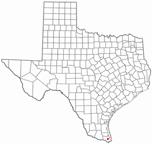
El Camino Angosto is a census-designated place (CDP) in Cameron County, Texas, United States. The population was 186 at the 2020 census. It is part of the Brownsville–Harlingen Metropolitan Statistical Area.

<span class="mw-page-title-main">Encantada-Ranchito-El Calaboz, Texas</span> Census-designated place in Texas, United States

Encantada-Ranchito-El Calaboz, also known as El Calaboz Rancheria in the San Pedro de Carricitos Land Grant, is a census-designated place (CDP) in Cameron County, Texas, United States. The population was 1,981 at the 2020 census. It is part of the Brownsville–Harlingen Metropolitan Statistical Area.

<span class="mw-page-title-main">Lago, Texas</span> Census-designated place in Texas, United States

Lago is a census-designated place (CDP) in Cameron County, Texas, United States. The population was 204 at the 2010 census. It is part of the Brownsville–Harlingen Metropolitan Statistical Area.

<span class="mw-page-title-main">Laureles, Texas</span> CDP in Texas, United States

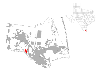
Laureles is a census-designated place (CDP) in Cameron County, Texas, United States. The population was 4,111 at the 2020 census. It is part of the Brownsville–Harlingen Metropolitan Statistical Area. Laureles is an area between Los Fresnos and San Benito.

References