Trinidad and Tobago, a country that relies heavily on industrialisation and tourism, has various transport systems.

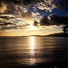
Port of Spain, officially the City of Port of Spain, is the capital of Trinidad and Tobago and the third largest municipality, after Chaguanas and San Fernando. The city has a municipal population of 49,031, an urban population of 544,949 and a transient daily population of 250,000. It is located on the Gulf of Paria, on the northwest coast of the island of Trinidad and is part of a larger conurbation stretching from Chaguaramas in the west to Arima in the east with an estimated population of 600,000.

San Fernando, officially the City of San Fernando, is the most populous city and second most populous municipality in Trinidad and Tobago, after Chaguanas. Sando, as it is known to many local Trinidadians, occupies 19 km² and is located in the southwestern part of the island of Trinidad. It is bounded to the north by the Guaracara River, the south by the Oropouche River, the east by the Sir Solomon Hochoy Highway, and the west by the Gulf of Paria. The former borough was elevated to the status of a city corporation on 18 November 1988. The motto of San Fernando is: "Sanitas Fortis" - In a Healthy Environment We Will Find Strength. San Fernando is called Trinidad and Tobago's "industrial capital" because of its proximity to the Pointe-à-Pierre oil refinery and many other petrochemical, LNG, iron and steel and aluminium smelters in places such as Point Lisas in Couva, Point Fortin, and La Brea.

The Borough of Chaguanas is the largest municipality and fastest-growing town in Trinidad and Tobago. Located in west-central Trinidad, south of Port of Spain, north of Couva and San Fernando, and named after the indigenous tribe who originally settled there, it grew in size due to its proximity to the Woodford Lodge sugar refinery. It remained a minor town until the 1980s when it began to grow rapidly as it drew people for its bargain shopping and moderately priced housing. Its rapid growth has seen property values increase dramatically, however.

Arima, officially The Royal Chartered Borough of Arima is the easternmost and second largest in area of the three boroughs of Trinidad and Tobago. It is geographically adjacent to Sangre Grande and Arouca at the south central foothills of the Northern Range. To the south is the Caroni–Arena Dam. Coterminous with Town of Arima since 1888, the borough of Arima is the fourth-largest municipality in population in the country. The census estimated it had 33,606 residents in 2011.

Barataria is a neighbourhood in Trinidad and Tobago located in San Juan. It is east of Port of Spain and Laventille and west of the San Juan town centre. It is part of the East–West Corridor.

The Sir Solomon Hochoy Highway, sometimes referred to as SHH, is the major north–south highway on the island of Trinidad, in Trinidad and Tobago. It runs for 51.2 km.
The Uriah Butler Highway, sometimes referred to as UBH, is one of the major north–south highways on Trinidad in Trinidad and Tobago.
The Churchill–Roosevelt Highway, sometimes refers to as CRH, is the major east–west highway on Trinidad island in Trinidad and Tobago.
The Beetham Highway is a major highway in Trinidad and Tobago. It runs from downtown Port of Spain where it meets Wrightson Road to Barataria. It was constructed between 1955 and 1956.

Diego Martin is a Borough of Trinidad and Tobago. The region has a land area of 127.53 km². Urban areas within the region include Carenage, Diego Martin, Maraval and parts of Saint James. The local government body is the Diego Martin Regional Corporation.
Wrightson Road links downtown Port of Spain, Trinidad and Tobago with the Audrey Jeffers Highway. It runs from the area of the Eric Williams Financial Complex to meet the Audrey Jeffers Highway near the Hasely Crawford Stadium. It runs past the fire headquarters, the old post office, central police station, Powergen power station, Capital Plaza hotel, the cruise ship terminal and the National Flour Mills. The street lights were unique of the hat top design then were replaced by standard oval type this is also removed during the process of road improvement and better lighting. It has been proposed that the western segment of the proposed light rail system will run along Wrightson Road.
Audrey Layne Jeffers CM, OBE was a Trinidadian social worker and the first female member of the Legislative Council of Trinidad and Tobago.

The Southern Main Road is a major road in Trinidad and Tobago running from Curepe in the north through Chaguanas, Couva, San Fernando, and Point Fortin to Icacos in the southwest, over a now discontinuous length of 120 km.
Chinese Trinidadians and Tobagonians are Trinidadians and Tobagonians of Han Chinese ancestry. The group includes people from Mainland China, Hong Kong, and Overseas Chinese who have immigrated to Trinidad and Tobago and their descendants, including those who have emigrated to other countries. The term is usually applied both to people of mixed and unmixed Chinese ancestry, although the former usually appear as mixed race in census figures. Chinese settlement began in 1806. Between 1853 and 1866 2,645 Chinese immigrants arrived in Trinidad as indentured labour for the sugar and cacao plantations. Immigration peaked in the first half of the twentieth century, but was dramatically lowered after the Chinese Communist Revolution in 1949. After peaking at 8,361 in 1960, the unmixed Chinese population in Trinidad declined to 3,800 in 2000, however slightly increased to 3,984 in 2011.
The Claude Noel Highway, sometimes referred to as CNH, is one of the major west–east highways in Trinidad and Tobago, named after Claude Noel, it is the only highway in Tobago. It runs from Canaan to Scarborough.
The Diego Martin Highway is a highway in Trinidad and Tobago. It runs west from Cocorite to Diamond Vale. The highway meets the Audrey Jeffers Highway in Cocorite and runs north–south to Wendy Fitzwillliam Boulevard in Diamond Vale.
The Coterie of Social Workers is a women's organization, established in 1921 in Trinidad and Tobago, British West Indies to engage in empowering women as well as providing benevolent assistance to the poor and disadvantaged. It was the first organization to target for membership, middle-class women of colour and focus on the needs of working class women, regardless of their marital status and was the leading women's organization in the country from its establishment through the 1940s. Though it has branches throughout the country, its headquarters is located at 3 Longden Street in Port of Spain.