Baldwin, Georgia

Last updated

Baldwin, Georgia
City of Baldwin
Baldwin, Georgia City Hall.JPG
Baldwin City Hall
Seal of Baldwin, Georgia.png
Motto: 
"The Hub of Development in Northeast Georgia"
Banks County Georgia Incorporated and Unincorporated areas Baldwin Highlighted.svg
Location in Banks County and the state of Georgia
Coordinates: 34°29′27″N83°33′10″W / 34.49083°N 83.55278°W / 34.49083; -83.55278
Country United States
State Georgia
Counties Habersham, Banks
Area
[1]
  Total5.04 sq mi (13.05 km2)
  Land5.03 sq mi (13.02 km2)
  Water0.01 sq mi (0.03 km2)
Elevation
[2]
1,490 ft (450 m)
Population
 (2020)
  Total3,629
  Density721.76/sq mi (278.68/km2)
Time zone UTC-5 (Eastern (EST))
  Summer (DST) UTC-4 (EDT)
ZIP code
30511
Area code 706
FIPS code 13-04980 [3]
GNIS feature ID2403149 [2]
Website cityofbaldwin.org

Baldwin is a city in Banks and Habersham counties in the U.S. state of Georgia. As of the 2010 census, the city had a population of 3,279, [4] up from 2,425 at the 2000 census.

Contents

Baldwin is located on U.S. Route 441 just south of Georgia State Route 365. Baldwin sits astride the Eastern Continental Divide, which separates waters flowing southeastward toward the Savannah River and the Atlantic Ocean from waters flowing southwestward toward the Chattahoochee River and the Gulf of Mexico. City Hall sits in Habersham County. Baldwin borders the slightly larger city of Cornelia, which houses the Habersham Chamber of Commerce. Nearby in Demorest is Piedmont University. Also nearby is Lake Russell, a recreation area in Chattahoochee National Forest. The Habersham County airport is in Baldwin. The largest employer is Fieldale Corporation, a chicken processing company.

Geography

Baldwin is located in northeastern Georgia and is split between Banks and Habersham County. It is located along two major arterial routes: U.S. Highway 441 and U.S. Highway 23/Georgia State Highway 365, both of which are divided four-lane highways. Highway 23/365 becomes Interstate 985 in Gainesville, 17 miles (27 km) southwest of the Baldwin limits.

According to the United States Census Bureau, the city has a total area of 4.9 square miles (12.7 km2), all land. [4]

Baldwin is home to the Habersham County Airport, located on the north side of town. The airport offers a 5,500-foot (1,700 m) paved runway at 1,447 feet (441 m) above sea level. It serves as the gateway airport to the Georgia mountains with its central location in the foothills of the Blue Ridge Mountains.

Demographics

Historical population
CensusPop.Note
1900 130
1910 280115.4%
1920 193−31.1%
1930 31965.3%
1940 40226.0%
1950 49021.9%
1960 69842.4%
1970 77210.6%
1980 1,08039.9%
1990 1,43933.2%
2000 2,42568.5%
2010 3,27935.2%
2020 3,62910.7%
U.S. Decennial Census [5]

2020 census

Baldwin Racial Composition [6]
RaceNum.Perc.
White 1,83650.59%
Black or African American 1363.75%
Native American 30.08%
Asian 782.15%
Other/Mixed 792.18%
Hispanic or Latino 1,49741.25%

As of the 2020 United States Census, there were 3,629 people, 984 households, and 772 families residing in the city.

2010 census

According to the 2010 census, the population of Baldwin was 3,279, representing a population growth in the previous decade of 35.2%.

2000 census

As of the census [3] of 2000, there were 2,425 people, 845 households, and 583 families residing in the city. The population density was 674.9 inhabitants per square mile (260.6/km2). There were 912 housing units at an average density of 253.8 per square mile (98.0/km2). The racial makeup of the city was 83.22% White, 3.71% African American, 0.33% Native American, 2.43% Asian, 0.82% Pacific Islander, 6.89% from other races, and 2.60% from two or more races. Hispanic or Latino of any race were 25.86% of the population.

There were 845 households, out of which 36.6% had children under the age of 18 living with them, 51.2% were married couples living together, 12.4% had a female householder with no husband present, and 30.9% were non-families. 26.2% of all households were made up of individuals, and 8.6% had someone living alone who was 65 years of age or older. The average household size was 2.71 and the average family size was 3.26.

In the city, the population was spread out, with 26.2% under the age of 18, 13.5% from 18 to 24, 29.4% from 25 to 44, 16.3% from 45 to 64, and 14.6% who were 65 years of age or older. The median age was 30 years. For every 100 females, there were 97.3 males. For every 100 females age 18 and over, there were 90.1 males.

The median income for a household in the city was $29,299, and the median income for a family was $33,011. Males had a median income of $25,409 versus $21,823 for females. The per capita income for the city was $14,059. About 20.0% of families and 26.4% of the population were below the poverty line, including 32.5% of those under age 18 and 33.8% of those age 65 or over.

Just over sixty percent of Baldwin's population is a high school graduate or higher. Twelve and half percent have a bachelor's degree or higher. [7]

21.3% of Baldwin's workforce are in management, professional and related occupations, 15.7% are in service occupations, 19.2% are in sales and office occupations, 1.5% are in agricultural occupations, 12.1% are in construction, extraction and maintenance occupations, and 30.2% are in production, transportation and material moving occupations.[ citation needed ]

Baldwin has a cost of living index of 82.9 against a U.S. average of 100.0. Crime rates in Baldwin have decreased 53% since 2003, with zero violent crimes in 2009 (the latest reported figures). Baldwin's crime index for 2009 was 77.0 against the U.S. average of 319.1. (A higher number equates to more crimes committed.)[ citation needed ]

History

Baldwin was incorporated by an act of the Georgia General Assembly on December 17, 1896. [8] The city was named in honor of Joseph A. Baldwin, a railroad official. [9]

Education

The portion in Banks County is in the Banks County School District. [10] Students there are zoned to Banks County High School.

The portion in Habersham County is in the Habersham County School District. [11]

Notable people

Nearby institutions

The closest hospital is Habersham County Medical Center in Demorest. Stephens County Hospital is to the northeast in Toccoa, and Northeast Georgia Medical Center is to the southwest in Gainesville.

Colleges and universities in the region include:

Comprehensive plan update

In 2007, the city of Baldwin began efforts to develop its Comprehensive Plan Update. This document provides three key planning elements: a Community Assessment with supporting data, a Community Participation Plan and a Community Agenda. The Assessment provides an overview of current conditions in the city and identifies key challenges being faced by our community.

The Community Participation Plan establishes a process for ensuring active public participation and involvement in developing a community vision, setting goals for the future and establishing the community's agenda for the next decade. Finally, the Community Agenda serves as the city's action plan for carrying out this new vision, achieving the goals and objectives as defined in the plan and it serves as a tool for measuring our success during the implementation phase.

Related Research Articles

<span class="mw-page-title-main">Columbia County, Florida</span> County in Florida, United States

Columbia County is a county located in the north central portion of the U.S. state of Florida. As of the 2020 census, the population was 69,698, up from 67,531 at the 2010 census. Its county seat is Lake City.

<span class="mw-page-title-main">White County, Georgia</span> County in Georgia, United States

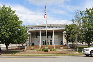
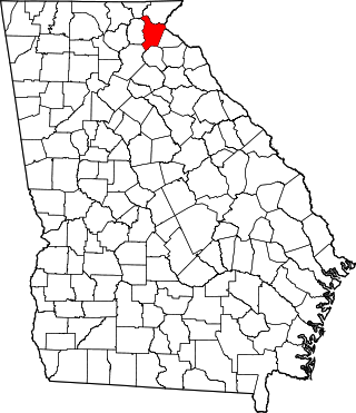
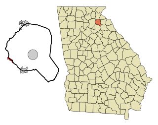
White County is a county located in the northeastern part of the U.S. state of Georgia. As of the 2020 census, the population was 28,003. The county seat is Cleveland. The county was created on December 22, 1857, formerly a part of Habersham County and most likely was named for Newton County Representative David T. White, who helped a Habersham representative successfully attain passage of an act creating the new county.

<span class="mw-page-title-main">Stephens County, Georgia</span> County in Georgia, United States

Stephens County is a county in the northeastern part of the U.S. state of Georgia, in the Piedmont and near the foothills of the Blue Ridge Mountains. It is bounded by the Tugaloo River and Lake Hartwell on the east. As of the 2020 census, the population was 26,784. The county seat is Toccoa.

<span class="mw-page-title-main">Hall County, Georgia</span> County in Georgia, United States

Hall County is a county located in the northeast portion of the U.S. state of Georgia. As of the 2020 census, the population was 203,136, up from 179,684 at the 2010 census. The county seat is Gainesville. The entirety of Hall County comprises the Gainesville, Georgia, Metropolitan Statistical Area, which is also part of the Atlanta-Athens-Clarke County-Sandy Springs, Combined Statistical Area.

<span class="mw-page-title-main">Habersham County, Georgia</span> County in Georgia, United States

Habersham County is a county located in the northeastern part of the U.S. state of Georgia. As of the 2020 census, the population was 46,031. The county seat is Clarkesville. The county was created on December 15, 1818, and named for Colonel Joseph Habersham of the Continental Army in the Revolutionary War.

<span class="mw-page-title-main">Banks County, Georgia</span> County in Georgia, United States

Banks County is a county located in the northeastern part of the U.S. state of Georgia. As of the 2020 census, the population was 18,035, down from 18,395 in 2010. The county seat is Homer. The Old Banks County Courthouse is located in Homer and listed on the National Register of Historic Places. A new county courthouse was constructed adjacent to the old one in 1983.

<span class="mw-page-title-main">Alto, Georgia</span> Town in Georgia, United States

Alto is a town in Banks and Habersham counties in the U.S. state of Georgia. As of the 2010 census, the town had a population of 1,172, up from 876 at the 2000 census.

<span class="mw-page-title-main">Gillsville, Georgia</span> City in Georgia, United States

Gillsville is a city in Banks and Hall counties in the U.S. state of Georgia. The population was 235 at the 2010 census.

<span class="mw-page-title-main">Lula, Georgia</span> City in Georgia, United States

Lula is a city in Hall and Banks counties in the U.S. state of Georgia. Most of the city is in Hall County, with a small eastern portion of the city located in Banks County. The population was 2,822 at the 2020 census. The Hall County portion of Lula is part of the Gainesville, GA Metropolitan Statistical Area. Lula is the home of RailRoad Days, a yearly festival held usually every May. Lula is the railroad junction between the Atlanta northeast line and the Athens north line of Norfolk Southern Railway.

<span class="mw-page-title-main">Clarkesville, Georgia</span> City in Georgia, United States

Clarkesville is a city that is the county seat of Habersham County, Georgia, United States. As of the 2020 census, it had a population of 1,911, up from the 2010 census population of 1,733, up from 1,248 at the 2000 census.

<span class="mw-page-title-main">Cornelia, Georgia</span> City in Georgia, United States

Cornelia is a city in Habersham County, Georgia, United States. The population was 4,160 at the 2010 census, up from 3,674 at the 2000 census. It is home to one of the world's largest apple sculptures, which is displayed on top of an obelisk-shaped monument. Cornelia was the retirement home of baseball legend Ty Cobb who was born nearby, and was a base of operation for production of the 1956 Disney film The Great Locomotive Chase that was filmed along the Tallulah Falls Railway that ran from Cornelia northward along the rim of Tallulah Gorge to Franklin, North Carolina.

<span class="mw-page-title-main">Demorest, Georgia</span> City in Georgia, United States

Demorest is a city in Habersham County, Georgia, United States. The population was 2,022 at the 2020 census, up from 1,823 at the 2010 census, and 1,465 at the 2000 census. It is the home of Piedmont University.

<span class="mw-page-title-main">Mount Airy, Georgia</span> Town in Georgia, United States

Mount Airy is a town in Habersham County, Georgia, United States. The population was 1,284 at the 2010 census, up from 604 at the 2000 census.

<span class="mw-page-title-main">Raoul, Georgia</span> Place in Georgia, United States

Raoul is an unincorporated community and census-designated place (CDP) in Habersham County, Georgia, United States. As of the 2010 census, the CDP had a population of 2,558, up from 1,816 at the 2000 census.

<span class="mw-page-title-main">Tallulah Falls, Georgia</span> Town in Georgia, United States

Tallulah Falls is a town in Habersham and Rabun counties in the U.S. state of Georgia near the Tallulah River. The population was 199 at the 2020 census.

<span class="mw-page-title-main">Gainesville, Georgia</span> City in Georgia, United States

Gainesville is a city and the county seat of Hall County, Georgia, United States. As of the 2020 census, the city had a population of 42,296. Because of its large number of poultry processing plants, it has been called the "Poultry Capital of the World." Gainesville is the principal city of the Gainesville, Georgia Metropolitan Statistical Area, which is included in the Atlanta–Sandy Springs–Gainesville, Georgia Combined Statistical Area.

<span class="mw-page-title-main">Oakwood, Georgia</span> City in Georgia, United States

Oakwood is a city in Hall County, Georgia, United States. It is part of the Gainesville, Georgia Metropolitan Statistical Area. The population was 4,822 at the 2020 census, up from 3,970 in 2010. Oakwood is home to the University of North Georgia Gainesville Campus and Wayne Farms.

<span class="mw-page-title-main">Commerce, Georgia</span> City in Georgia, United States

Commerce is a city in Jackson County and Banks County, Georgia, 70 miles (110 km) northeast of Atlanta. As of the 2020 census, the city had a population of 7,387.

<span class="mw-page-title-main">Hayward (town), Wisconsin</span> Town in Wisconsin, United States

Hayward is a town in Sawyer County, Wisconsin, United States. The population was 3,279 at the 2000 census. The town is located near the City of Hayward. The census-designated place of Chief Lake is located in the town.

<span class="mw-page-title-main">Georgia State Route 15</span> State highway in eastern Georgia

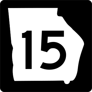
State Route 15 (SR 15) is a 346-mile-long (557 km) state highway that travels south-to-north across the entire length of the U.S. state of Georgia, east of its centerline. This route is part of a multi two-state route 15 that begins at Florida and ends at Georgia at the North Carolina state line. It connects the Florida state line, south-southeast of Folkston with the North Carolina state line, in Dillard, via Folkston, Vidalia, Sandersville, Athens, Demorest, and Clayton.

References

  1. "2020 U.S. Gazetteer Files". United States Census Bureau. Retrieved December 18, 2021.
  2. 1 2 U.S. Geological Survey Geographic Names Information System: Baldwin, Georgia
  3. 1 2 "U.S. Census website". United States Census Bureau . Retrieved January 31, 2008.
  4. 1 2 "Geographic Identifiers: 2010 Demographic Profile Data (G001): Baldwin city, Georgia". American Factfinder. U.S. Census Bureau. Archived from the original on February 12, 2020. Retrieved May 15, 2017.
  5. "Census of Population and Housing". Census.gov. Retrieved June 4, 2015.
  6. "Explore Census Data". data.census.gov. Retrieved December 9, 2021.
  7. U.S. Census Bureau (January 1, 2010). "Bachelor's Degree or Higher (5-year estimate) in Baldwin County, AL". FRED, Federal Reserve Bank of St. Louis. Retrieved February 4, 2022.
  8. Krakow, Kenneth K. (1975). Georgia Place-Names: Their History and Origins (PDF). Macon, GA: Winship Press. p. 13. ISBN   0-915430-00-2.
  9. "Habersham County". New Georgia Encyclopedia. Retrieved April 1, 2018.
  10. "2020 CENSUS - SCHOOL DISTRICT REFERENCE MAP: Banks County, GA" (PDF). U.S. Census Bureau . Retrieved May 7, 2023. - Text list
  11. "2020 CENSUS - SCHOOL DISTRICT REFERENCE MAP: Habersham County, GA" (PDF). U.S. Census Bureau . Retrieved May 7, 2023. - Text list