Kempe Gowda I locally venerated as Nadaprabhu Kempe Gowda, or commonly known as Kempe Gowda, was a governor under the Vijayanagara Empire in early-modern India. He is famous for the development of Bangalore Town in the 16th century. Kempegowda erected many Kannada inscriptions across the region. He also authored Ganga-gauri-vilasa, a yakshagana (verse-play) in Telugu. He is commemorated with various statues and memorials and many places are named after him in Bangalore.

Basaveshwaranagara, also known as Basaveshwaranagar, Basaveshnagara or Basaveshnagar is a largely residential neighbourhood in the west of Bengaluru, Karnataka, India. It is located to the west of Rajajinagara and is sandwiched between the localities of Mahalakshmi Layout to the north and Vijayanagara to the south, spread across multiple sub-localities, three assembly constituencies and seven Bruhat Bengaluru Mahanagara Palike (BBMP) wards. The area of Basaveshwaranagara is often considered West of Chord Road as it lies to the west of Chord Road, an arterial road in the western part of Bengaluru.

Hebbala, is a neighbourhood in Bengaluru, Karnataka, India, which was once indicative of the north endpoint of the city. Though originally famous for Hebbala Lake, it is now better known for the serpentine maze of flyovers that network the Outer Ring Road and Airport Road on NH 44. The flyover spans a length of 5.23 kilometres (3.2 mi) over all the loops combined. The flyover was built by Gammon India. The lake area in Hebbala is well-known for its picnic spots, a well-maintained park, boating facilities and for the bird watching opportunities.

Yalahanka is a suburb and Taluk of Bangalore Urban district in the Indian state of Karnataka. One of the zones of BBMP. It is the oldest part of present Municipal Bengaluru (Bangalore) city and the northern end of the city. It is Nadaprabhu Kempegowda I, of the Yelahanka Prabhu clans, who laid the foundation of present-day Bengaluru through the creation of a "mud fort town" in 1537 CE
Vivek Nagar, Viveknagar or Viveka Nagar is a neighborhood in central Bangalore, South India. It is situated in between M G Road and Koramangala. Viveknagar is part of Bangalore Central Lok Sabha constituency and Shanti Nagar Assembly constituency. The closest metro station is the Trinity metro station.

Devanahalli, also called "Devandahalli", "Dyaavandalli", Devanadoddi, and Devanapura, is a town and Town Municipal Council in Bengaluru Rural district in the state of Karnataka in India. The town is located 40 kilometres (25 mi) to the north-east of Bengaluru. Devanahalli is the site of Kempegowda International Airport. A multibillion-dollar Devanahalli Business Park with two IT Parks are coming up on nearly 400 acres (1.6 km2) adjoining the airport. An Aerospace Park, Science Park and a ₹10 billion (US$130 million) Financial City are also coming up. A new satellite ring road will connect the city with Doddaballapur. Devanahalli is situated near the upcoming ₹1,500 billion (US$19 billion), 12,000-acre (49 km2) BIAL IT Investment Region, to be the largest IT region in India.
Begur is a town in the Indian state of Karnataka. It is located off Bengaluru-Hosur highway. It is said to have been a prominent place during the rule of the Western Ganga Dynasty and later the Chola Kingdom.
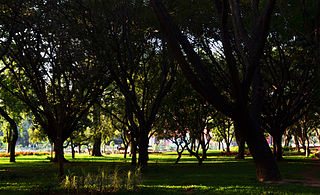
Cubbon Park, officially Sri Chamarajendra Park, is a landmark park in Bengaluru, located in the heart of the city in the Central Administrative Area. Originally created in 1870 under Major General Richard Sankey, then British Chief Engineer of Mysore State, it covered an area of 100 acres (0.40 km2). Subsequent expansion has since taken place and the park's area is now reported to be 300 acres (1.2 km2). It has a rich recorded history of abundant flora and fauna plantations coupled with numerous impressive and aesthetically located buildings and statues of famous personages, in its precincts.

Vimanapura or Baiyyappanahalli Vimanapura is an eastern suburb of Bangalore in Karnataka in India. It is so called because it is near Bangalore HAL airport. Vimanapura houses many of the HAL offices and the HAL hospital. The busy Old Airport Road goes through it.

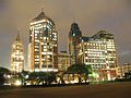
UB City is a business district in Bengaluru, India. It consists of 6 blocks with a total built up area of over 16 lakh sq ft. Pioneered by the UB Group in Joint Venture with Prestige Group, it is built on 13 acres (53,000 m2) of land and hosts 1,000,000 sq ft (93,000 m2) of high-end commercial, retail and service apartment space.
Bangalore (Bengaluru), the capital of Karnataka state, India, reflects its multireligious and cosmopolitan character by its more than 1000 temples, 400 mosques, 100 churches, 40 Jain derasars, three Sikh gurdwaras, two Buddhist viharas and one Parsi fire temple located in an area of 741 km2 of the metropolis. The religious places are further represented to include the few members of the Jewish community who are making their presence known through the Chabad that they propose to establish in Bangalore and the fairly large number of the Baháʼí Faith whose presence is registered with a society called the Baháʼí Centre. In the demographically diverse, major economic hub and India's fastest-growing major metropolis of Bangalore, the number of religious places of each religion reported reflects growth in proportion to the population growth. According to the 2001 census of India, 79.37% of Bangalore's population is Hindu, roughly the same as the national average. Muslims comprise 13.37% of the population, which again is roughly the same as the national average, while Christians and Jains account for 5.79% and 1.05% of the population, respectively, double that of their national averages. Anglo-Indians also form a substantial group within the city.
Bharathnagar is a well planned residential layout in the city of Bangalore, India. Located off the arterial Magadi Road and approximately 13 km (8.1 mi) from the Bangalore Central Railway station, this layout was primarily created for the employees of the public sector giant Bharat Electronics Limited. Bharathnagar is divided into Phase 1 & 2. Phase 2 is the larger of the two and has the capacity to accommodate 4000 independent homes, whereas Phase 1 can accommodate 2,000 homes. Bharathnagar was carved out of the larger village of Byadarahalli.

Cubbon Park is an underground metro station on the East-West corridor of the Purple Line of Namma Metro in Bangalore, India. It was opened to the public on 30 April 2016. The station is located a few metres away from one of the entrances to Cubbon Park.
Lavelle Road is an upmarket residential and commercial street in the city of Bangalore, Karnataka in India. It is an important connection between Mahatma Gandhi Square and Richmond Circle. The road starts from the Queens Road end of the M. Chinnaswamy Stadium and after curving in a serpentine manner meets the junction of Bangalore Club with Richmond Circle. Lavelle Road was named after Michael F Lavelle, an Irish soldier who later made his money in the Kolar Gold Fields.

Bangalore, officially Bengaluru, is the capital and largest city of the southern Indian state of Karnataka. It has a population of more than 8 million and a metropolitan population of around 15 million, making it India's third most populous city and fourth most populous urban agglomeration. It is the most populous city and largest urban agglomeration in South India, and is the 27th largest city in the world. Located on the Deccan Plateau, at a height of over 900 m (3,000 ft) above sea level, Bangalore has a pleasant climate throughout the year, with its parks and green spaces earning it the reputation of India's "Garden City". Its elevation is the highest of India's major cities.
Kasturba Road is a street in Bangalore, the capital of Karnataka, India, which is connected to M G Road to the north and J C Road to the south. Some important landmarks situated along Kasturba Road are Sree Kanteerava Stadium, Kanteerava Indoor Stadium, Cubbon Park, Government Museum, Venkatappa Art Gallery, Visvesvaraya Industrial and Technological Museum and UB City. A 600-year-old Ganesha temple is also situated on Kasturba Road.
Vasanth Nagar is an upscale neighbourhood located in the heart of the city of Bangalore. A small neighbourhood in the affluent High Grounds residing many retired government bureaucrats, MLA's and Police officials. It is bounded by Bengaluru Golf Club, Palace Grounds, Shivajinagar and Bangalore Cantonment. Surrounded by major roads, landmarks, offices and hotels, this area is commercially very active now.

Hanumanthanagara, is a locality in the Banashankari suburb of South Bangalore. It gets its name from the Ramanjaneya Temple near the Kengal Hanumanthaiah Kalaa Soudha, which was built during the time of Kengal Hanumanthaiah, the then chief minister of Karnataka.
The Blue Line or ORR-Airport Metro Line is part of the Namma Metro rail network for the city of Bangalore, Karnataka, India. It consists of two sections - Phase-2A and Phase-2B. Construction of Phase-2A began in August 2021. Construction of Phase-2B began in February 2022. The 58.19 km line connects Central Silk Board with the Kempegowda International Airport. The Line is mostly elevated but also has an at-grade (surface) section close to the Airport and 2 short underground sections where it passes the Jakkur Aerodrome and Yelahanka AFB. There are 30 stations on the line of which the two station/s at the Airport may be at surface level or underground. Blue Line will have interchanges with the Yellow Line at Central Silk Board, Purple Line at KR Pura, Pink Line at Nagawara and with the future /proposed Orange Line at Hebbal.