Battle Creek, Iowa

Last updated

Battle Creek, Iowa
Ida County Iowa Incorporated and Unincorporated areas Battle Creek Highlighted.svg
Location of Battle Creek, Iowa
Coordinates: 42°19′1″N95°35′58″W / 42.31694°N 95.59944°W / 42.31694; -95.59944
Country Flag of the United States.svg  United States
State Flag of Iowa.svg  Iowa
County Ida
Area
[1]
  Total0.57 sq mi (1.48 km2)
  Land0.57 sq mi (1.48 km2)
  Water0.00 sq mi (0.00 km2)
Elevation
1,198 ft (365 m)
Population
 (2020)
  Total700
  Density1,223.78/sq mi (472.66/km2)
Time zone UTC-6 (Central (CST))
  Summer (DST) UTC-5 (CDT)
ZIP code
51006
Area code 712
FIPS code 19-04870
GNIS feature ID0454386

Battle Creek is a city in Ida County, Iowa, United States. The population was 700 at the 2020 census. [2]

Contents

History

Battle Creek got its start in the year 1877, following construction of the Chicago and North Western Railway through that territory. [3] It was named after nearby Battle Creek. [4] The town was incorporated in 1880. [3] It is referenced in the 2011 film Butter as the birthplace of fictional character, Bob Pickler.

Celebrations

Battle Creek holds a Fourth of July celebration every year from July 3 through July 5. In 2015 Battle Creek celebrated its sesquicentennial (150 years) over the July 4th holiday, even though it doesn't reach that milestone until 2027. The slogan for their 150th celebration is Small In Size, Big In Heart which shows how much pride this small town takes in this event. During the celebration there is a parade, fireworks, the Fireman's dance, and you can even enter in the frog jumping contest. [5]

Geography

Battle Creek is located at 42°19′1″N95°35′58″W / 42.31694°N 95.59944°W / 42.31694; -95.59944 (42.316842, -95.599583). [6] It is situated on the Maple River.

According to the United States Census Bureau, the city has a total area of 0.50 square miles (1.29 km2), all land. [7]

Demographics

Historical populations
YearPop.±%
1880 205    
1890 387+88.8%
1900 542+40.1%
1910 527−2.8%
1920 785+49.0%
1930 804+2.4%
1940 827+2.9%
1950 873+5.6%
1960 786−10.0%
1970 837+6.5%
1980 919+9.8%
1990 818−11.0%
2000 743−9.2%
2010 713−4.0%
2020 700−1.8%
Source: "U.S. Census website". United States Census Bureau . Retrieved March 28, 2020. and Iowa Data Center
Source:
U.S. Decennial Census [8] [2]
The population of Battle Creek, Iowa from US census data Battle CreekIowaPopPlot.png
The population of Battle Creek, Iowa from US census data

2010 census

As of the census [9] of 2010, there were 713 people, 325 households, and 178 families residing in the city. The population density was 1,426.0 inhabitants per square mile (550.6/km2). There were 368 housing units at an average density of 736.0 per square mile (284.2/km2). The racial makeup of the city was 98.2% White, 0.6% African American, 0.8% Asian, 0.3% from other races, and 0.1% from two or more races. Hispanic or Latino of any race were 1.7% of the population.

There were 325 households, of which 24.9% had children under the age of 18 living with them, 45.8% were married couples living together, 4.6% had a female householder with no husband present, 4.3% had a male householder with no wife present, and 45.2% were non-families. 42.2% of all households were made up of individuals, and 23.3% had someone living alone who was 65 years of age or older. The average household size was 2.11 and the average family size was 2.85.

The median age in the city was 46.3 years. 23% of residents were under the age of 18; 5.6% were between the ages of 18 and 24; 19.9% were from 25 to 44; 24.6% were from 45 to 64; and 26.9% were 65 years of age or older. The gender makeup of the city was 48.1% male and 51.9% female.

2000 census

As of the census [10] of 2000, there were 743 people, 325 households, and 195 families residing in the city. The population density was 1,490.5 inhabitants per square mile (575.5/km2). There were 358 housing units at an average density of 718.2 per square mile (277.3/km2). The racial makeup of the city was 99.33% White, 0.13% Asian, 0.13% from other races, and 0.40% from two or more races. Hispanic or Latino of any race were 0.67% of the population.

There were 325 households, out of which 21.2% had children under the age of 18 living with them, 52.9% were married couples living together, 5.2% had a female householder with no husband present, and 39.7% were non-families. 36.9% of all households were made up of individuals, and 23.4% had someone living alone who was 65 years of age or older. The average household size was 2.15 and the average family size was 2.83.

In the city, the population was spread out, with 19.8% under the age of 18, 5.8% from 18 to 24, 18.8% from 25 to 44, 24.0% from 45 to 64, and 31.6% who were 65 years of age or older. The median age was 49 years. For every 100 females, there were 87.6 males. For every 100 females age 18 and over, there were 85.7 males.

The median income for a household in the city was $31,029, and the median income for a family was $39,479. Males had a median income of $25,400 versus $19,931 for females. The per capita income for the city was $16,106. About 3.0% of families and 7.3% of the population were below the poverty line, including 4.8% of those under age 18 and 6.0% of those age 65 or over.

Education

Battle Creek is a part of the Odebolt–Arthur–Battle Creek–Ida Grove Community School District.

It was formerly a part of the Battle Creek–Ida Grove Community School District, [11] which was established in 1994, [12] until its merger with the Odebolt–Arthur Community School District on July 1, 2018. Schools serving the community include OABCIG Elementary Ida Grove in Ida Grove, OABCIG Middle School in Odebolt, and OABCIG High School in Ida Grove. [13]

Notable person

Related Research Articles

<span class="mw-page-title-main">Sac County, Iowa</span> County in Iowa, United States

Sac County is a county located in the U.S. state of Iowa. As of the 2020 census, the population was 9,814. The county seat is Sac City. Both were named for the Sauk people, a local American Indian tribe.

<span class="mw-page-title-main">Ida County, Iowa</span> County in Iowa, United States

Ida County is a county located in the U.S. state of Iowa. As of the 2020 census the population was 7,005, making it the state's eighth-least populous county. The county seat is Ida Grove. The county was authorized by the Iowa Legislature in January 1851 as a packet of projected counties in unorganized territory of western Iowa. It was named after Ida Smith, the first child of European immigrants to be born in this region.

<span class="mw-page-title-main">Crawford County, Iowa</span> County in Iowa, United States

Crawford County is a county located in the U.S. state of Iowa. As of the 2020 census, the population was 16,525. Its county seat is Denison. The county was named for William Harris Crawford, U.S. senator from Georgia and United States Secretary of the Treasury.

<span class="mw-page-title-main">Bremer County, Iowa</span> County in Iowa, United States

Bremer County is a county in the northeastern part of the U.S. state of Iowa. As of the 2020 census, the population was 24,988. Its county seat is Waverly. The county was named for Fredrika Bremer, a Swedish feminist writer.

<span class="mw-page-title-main">Beaver, Iowa</span> City in Iowa, United States

Beaver is a city in Amaqua Township, Boone County, Iowa, United States. The population was 46 at the 2020 census. It is part of the 'Boone, Iowa Micropolitan Statistical Area', which is a part of the larger Ames-Boone, Iowa Combined Statistical Area.

<span class="mw-page-title-main">Pilot Mound, Iowa</span> City in Iowa, United States

Pilot Mound is a city in Pilot Mound Township, Boone County, Iowa, United States. The population was 163 at the time of the 2020 census. It is part of the Boone, Iowa Micropolitan Statistical Area, which is a part of the larger Ames-Boone, Iowa Combined Statistical Area.

<span class="mw-page-title-main">Clarence, Iowa</span> City in Iowa, United States

Clarence is a city in Cedar County, Iowa, United States. The population was 1,039 at the time of the 2020 census.

<span class="mw-page-title-main">Rockwell, Iowa</span> City in Iowa, United States

Rockwell is a city in Cerro Gordo County, Iowa, United States. The population was 1,071 at the time of the 2020 census. It is part of the Mason City Micropolitan Statistical Area.

<span class="mw-page-title-main">Kanawha, Iowa</span> City in Iowa, United States

Kanawha is a city in Hancock County, Iowa, United States. The population was 658 at the time of the 2020 census.

<span class="mw-page-title-main">Thor, Iowa</span> Town in Iowa, United States

Thor is a town in Norway Township, Humboldt County, Iowa, United States. The population was 181 at the time of the 2020 census.

<span class="mw-page-title-main">Arthur, Iowa</span> City in Iowa, United States

Arthur is an urban settlement in Ida County, Iowa, United States. The population was 222 at the 2020 census.

<span class="mw-page-title-main">Ida Grove, Iowa</span> City in Iowa, United States

Ida Grove is a city in Ida County, Iowa, United States. The population was 2,051 at the time of the 2020 census. It is the county seat of Ida County.

<span class="mw-page-title-main">St. Donatus, Iowa</span> City in Iowa, United States

St. Donatus is a city in Jackson County, Iowa, United States. The population was 120 at the time of the 2020 census. St. Donatus is known for its status as a Luxembourger village, with historic architecture and views along U.S. Route 52. It is the home of a historic Catholic church, which is dedicated to Saint Donatus of Muenstereifel, the town's namesake. It was formerly named Tete Des Morts, which is the name of a creek that flows through the village.

<span class="mw-page-title-main">Lambs Grove, Iowa</span> City in Iowa, United States

Lambs Grove is a city in Jasper County, Iowa, United States. The population was 174 as of the 2020 Census, down from 225 recorded in 2000.

<span class="mw-page-title-main">Palo, Iowa</span> City in Iowa, United States

Palo is a city in Linn County, Iowa, United States. The population was 1,407 at the time of the 2020 census. It is part of the Cedar Rapids Metropolitan Statistical Area.

<span class="mw-page-title-main">Walnut, Iowa</span> City in Iowa, United States

Walnut is a city in Pottawattamie County, Iowa, United States. The population was 747 at the time of the 2020 census. Walnut is located on Interstate 80 and is famous for its many antique stores. In recent years Walnut has become a regional center of wind turbine electrical generation.

<span class="mw-page-title-main">Odebolt, Iowa</span> City in Iowa, United States

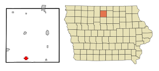
Odebolt is a city in Sac County, Iowa, United States. The population was 994 at the time of the 2020 census.

<span class="mw-page-title-main">Vincent, Iowa</span> City in Iowa, United States

Vincent is a city in Webster County, Iowa, United States. The population was 130 at the time of the 2020 census.

<span class="mw-page-title-main">Clay Township, Michigan</span> Civil township in Michigan, United States

Clay Township is a civil township of St. Clair County in the U.S. state of Michigan. The population was 9,066 at the 2010 Census.

References

  1. "2020 U.S. Gazetteer Files". United States Census Bureau. Retrieved March 16, 2022.
  2. 1 2 "2020 Census State Redistricting Data". census.gov. United states Census Bureau. Retrieved August 12, 2021.
  3. 1 2 History of Western Iowa, Its Settlement and Growth. Western Publishing Company. 1882. pp.  563.
  4. Chicago and North Western Railway Company (1908). A History of the Origin of the Place Names Connected with the Chicago & North Western and Chicago, St. Paul, Minneapolis & Omaha Railways. p. 42.
  5. "Bc150th".
  6. "US Gazetteer files: 2010, 2000, and 1990". United States Census Bureau. February 12, 2011. Retrieved April 23, 2011.
  7. "US Gazetteer files 2010". United States Census Bureau. Archived from the original on January 25, 2012. Retrieved May 11, 2012.
  8. "Census of Population and Housing". Census.gov. Retrieved June 4, 2015.
  9. "U.S. Census website". United States Census Bureau . Retrieved May 11, 2012.
  10. "U.S. Census website". United States Census Bureau . Retrieved January 31, 2008.
  11. "Battle Creek-Ida Grove." Iowa Department of Education. Retrieved on June 20, 2018. Alternate link Archived 2018-04-27 at the Wayback Machine
  12. "REORGANIZATION & DISSOLUTION ACTIONS SINCE 1965-66 Archived 2019-02-09 at the Wayback Machine ." Iowa Department of Education. Retrieved on July 20, 2018.
  13. "Home." Odebolt-Arthur-Battle Creek-Ida Grove Community School District. Retrieved on June 20, 2018. "OABCIG Central Office 900 John Montgomery Drive Ida Grove, IA 51445".