
Victoria is the capital city of the Canadian province of British Columbia, on the southern tip of Vancouver Island off Canada's Pacific coast. The city has a population of 91,867, and the Greater Victoria area has a population of 397,237. The city of Victoria is the 7th most densely populated city in Canada with 4,405.8 inhabitants per square kilometre (11,411/sq mi).

Totem poles are monumental carvings found in western Canada and the northwestern United States. They are a type of Northwest Coast art, consisting of poles, posts or pillars, carved with symbols or figures. They are usually made from large trees, mostly western red cedar, by First Nations and Indigenous peoples of the Pacific Northwest Coast including northern Northwest Coast Haida, Tlingit, and Tsimshian communities in Southeast Alaska and British Columbia, Kwakwaka'wakw and Nuu-chah-nulth communities in southern British Columbia, and the Coast Salish communities in Washington and British Columbia.

Emily Carr was a Canadian artist and writer who was inspired by the Indigenous peoples of the Pacific Northwest Coast. One of the painters in Canada to adopt a Modernist and Post-Impressionist style, Carr did not receive widespread recognition for her 1929 work, The Indian Church, which is now her best known, until she changed her subject matter from Aboriginal themes to landscapes — forest scenes in particular, evoking primeval grandeur in British Columbia. As a writer Carr was one of the earliest chroniclers of life in her surroundings. The Canadian Encyclopedia describes her as a Canadian icon.
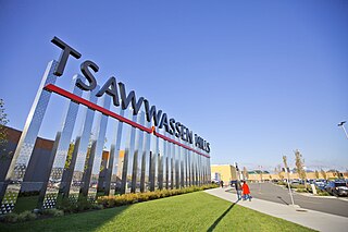
Tsawwassen is a suburban, mostly residential community on a peninsula in the southwestern corner of the City of Delta in British Columbia, Canada. It provides the only road access to the American territory on the southern tip of the peninsula, the community of Point Roberts, Washington, via 56th Street. It is also the location of Tsawwassen Ferry Terminal, part of the BC Ferries, built in 1959 to provide foot-passenger and motor vehicle access from the Lower Mainland to the southern part of Vancouver Island and the southern Gulf Islands. Because Tsawwassen touches a shallow bank, the ferry terminal is built at the southwestern end of a 3 km (1.9 mi) causeway that juts into the Strait of Georgia. Boundary Bay Airport, a major training hub for local and international pilots which also provides local airplane and helicopter service, is ten minutes away. The Roberts Bank Superport is also nearby.
Lincoln Park is a 1,208-acre (489-hectare) park along Lake Michigan on the North Side of Chicago, Illinois. Named after US President Abraham Lincoln, it is the city's largest public park and stretches for seven miles (11 km) from Grand Avenue, on the south, to near Ardmore Avenue on the north, just north of the Lake Shore Drive terminus at Hollywood Avenue. Two museums and a zoo are located in the oldest part of the park between North Avenue and Diversey Parkway in the eponymous neighborhood. Further to the north, the park is characterized by parkland, beaches, recreational areas, nature reserves, and harbors. To the south, there is a more narrow strip of beaches east of Lake Shore Drive, almost to downtown. With 20 million visitors per year, Lincoln Park is the second-most-visited city park in the United States, behind Central Park.
Victoria Park is a 9-hectare (22-acre) urban park situated on the corner of Parramatta Road and City Road, Camperdown, in the City of Sydney, New South Wales, Australia. The park is located adjacent to The University of Sydney and the Broadway Shopping Centre.

VanDusen Botanical Garden is a botanical garden situated in Vancouver, British Columbia, in the Shaughnessy neighborhood. It is located at the northwest corner of 37th Avenue and Oak Street. It is named for local lumberman and philanthropist Whitford Julian VanDusen.
The Albany Parks & Recreation is a city agency in AlbanyAlbany, Oregon, United States responsible for maintaining the local city parks as well as organizing cultural events. Its headquarters are at City Hall, 333 Broadalbin Street SW. One goal of the City of Albany is to have all residents live within 2 miles (3 km) of a park.

Forest Park is a park in the New York City borough of Queens, spanning 538 acres (218 ha). It is the tenth-largest park in New York City and the third-largest in Queens. Created on August 9, 1895, it was originally referred to as Brooklyn Forest Park, as the area was part of Brooklyn at the time.
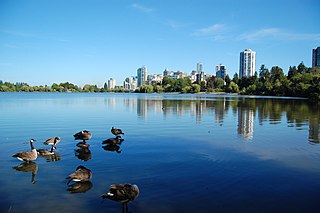
Lost Lagoon is an artificial, captive 16.6-hectare body of water, west of Georgia Street, near the entrance to Stanley Park in Vancouver, British Columbia, Canada. Surrounding the lake is a 1.75 km (1.09 mi) trail. The lake features a lit fountain that was erected by Robert Harold Williams to commemorate the city's golden jubilee. It is a nesting ground to many species of birds, including non-native mute swan, Canada geese, numerous species of ducks, such as mallard ducks, and great blue herons. Also many turtles are usually resident on the northern shore.
Saanich Peninsula is located north of Victoria, British Columbia, Canada. It is bounded by Saanich Inlet on the west, Satellite Channel on the north, the small Colburne Passage on the northeast, and Haro Strait on the east. The exact southern boundary of what is referred to as the "Saanich Peninsula" is somewhat fluid in local parlance.
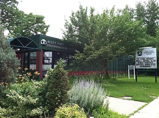
Alley Pond Park is the second-largest public park in Queens, New York City, occupying 655.3 acres (265.2 ha). The park is bordered to the east by Douglaston, to the west by Bayside, to the north by Little Neck Bay, and to the south by Union Turnpike. The Cross Island Parkway travels north-south through the park, while the Long Island Expressway and Grand Central Parkway travel east-west through the park. The park primarily consists of woodlands south of the Long Island Expressway and meadowlands north of the expressway. It is run and operated by the New York City Department of Parks and Recreation.

Thunderbird Park is a park in Victoria, British Columbia next to the Royal British Columbia Museum. The park is home to many totem poles and other First Nation monuments. The park takes its name from the mythological Thunderbird of Indigenous North American cultures which is depicted on many totem poles.
Fairfield is a neighbourhood of Victoria, British Columbia. It is bounded by the James Bay, Downtown, Harris Green, Fernwood, Rockland, and Gonzales neighbourhoods, and meets the Strait of Juan de Fuca to the south.

James Bay is a high density neighbourhood of Victoria, British Columbia, Canada. It is the oldest residential neighbourhood on the west coast of North America that is north of San Francisco. It occupies the south side of the Inner Harbour close to downtown. Access to the neighbourhood is along Belleville Street, Government Street, Douglas Street and Dallas Road.
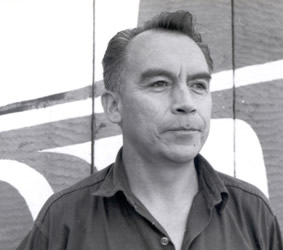
Henry Hunt was a First Nations woodcarver and artist from the Kwakwaka'wakw people of coastal British Columbia. He carved a number of totem poles which are on public display in Canada and internationally.

The Elk/Beaver Regional Park is a 1,072-acre (434 ha) park in Saanich, British Columbia, containing Elk Lake and Beaver Lake.
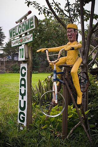
Cayuga Park is a neighborhood park and playground in San Francisco, at the edge of the Cayuga Terrace neighborhood. Its history, location and aesthetics make it unique among the parks of San Francisco.

Central Park is a 90-hectare (220-acre) urban park in Burnaby, British Columbia, founded in 1891.
Estabrook Park is a Milwaukee County park in the village of Shorewood, Wisconsin and is home to the 1,081 ft (329 m) WITI TV Tower and the historic Benjamin Church House. It was named for Charles E. Estabrook, a distinguished Wisconsin lawyer and politician, and is located on a nearly 125 acre, strip of land between the Milwaukee River and the former Chicago and Northwestern Railroad, now converted into part of the Oak Leaf Trail.

