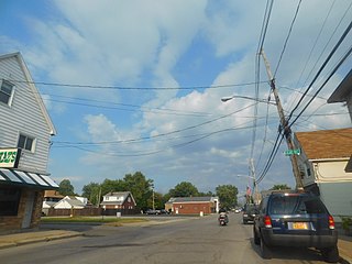
Blasdell is a village in Erie County, New York, United States. The population was 2,553 according to the 2010 Census. The name is derived from Herman Blasdell, the first station master of the Erie and Pennsylvania railroad depot. It is part of the Buffalo–Niagara Falls Metropolitan Statistical Area.

Niagara Falls is a city in Niagara County, New York, United States. As of the 2020 census, the city had a total population of 48,671. It is adjacent to the Niagara River, across from the city of Niagara Falls, Ontario, and named after the famed Niagara Falls which they share. The city is within the Buffalo–Niagara Falls metropolitan area and the Western New York region.
Tonawanda is a town in Erie County, New York, United States. As of the 2020 census, the town had a population of 72,636. The town is at the north border of the county and is the northern inner ring suburb of Buffalo. It is sometimes referred to, along with its constituent village of Kenmore, as "Ken-Ton". The town was established in 1836, and up to 1903 it included what is now the city of Tonawanda.
The Queen Elizabeth Way (QEW) is a 400-series highway in the Canadian province of Ontario linking Toronto with the Niagara Peninsula and Buffalo, New York. The freeway begins at the Peace Bridge in Fort Erie and travels 139.1 kilometres (86.4 mi) around the western end of Lake Ontario, ending at Highway 427 as the physical highway continues as the Gardiner Expressway into downtown Toronto. The QEW is one of Ontario's busiest highways, with an average of close to 200,000 vehicles per day on some sections. Major highway junctions are at Highway 420 in Niagara Falls, Highway 405 in Niagara-on-the-Lake, Highway 406 in St. Catharines, the Red Hill Valley Parkway in Hamilton, Highway 403 and Highway 407 in Burlington, Highway 403 at the Oakville–Mississauga boundary, and Highway 427 in Etobicoke. Within the Regional Municipality of Halton the QEW is signed concurrently with Highway 403. The speed limit is 100 km/h (62 mph) throughout most of its length, with the exceptions being between Hamilton and St. Catharines where the posted limit is 110 km/h (68 mph).
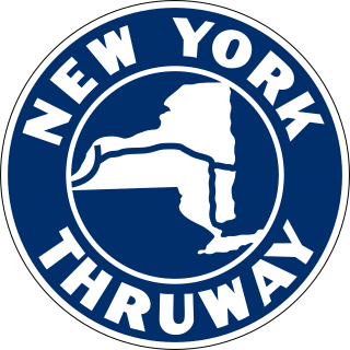
The New York State Thruway is a system of controlled-access toll roads spanning 569.83 miles (917.05 km) within the U.S. state of New York. It is operated by the New York State Thruway Authority (NYSTA), a New York State public-benefit corporation. The 496.00-mile (798.23 km) mainline is a freeway that extends from the New York City line at Yonkers to the Pennsylvania state line at Ripley by way of I-87 and I-90 through Albany, Syracuse, and Buffalo. According to the International Bridge, Tunnel and Turnpike Association, the Thruway is the fifth-busiest toll road in the United States. The toll road is also a major route for long distance travelers linking the cities of Toronto and Buffalo with Boston and New York City.

Interstate 990 (I-990) is an auxiliary Interstate Highway located entirely within the town of Amherst in Erie County, New York, in the United States. It runs in a roughly north–south direction for 6.35 miles (10.22 km) through the southwestern and central parts of Amherst from an interchange with I-290 north of Buffalo to an intersection with New York Route 263 south of Lockport. The highway serves as a connection between Buffalo, the University at Buffalo, and Lockport. Like I-590 in nearby Rochester, I-990 does not physically meet I-90, its parent Interstate Highway; instead, the highway makes the connection by way of a "sibling" highway (I-290). I-990 is the highest numbered Interstate Highway in the US.
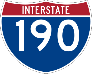
Interstate 190 is a north–south auxiliary Interstate Highway in the United States that connects I-90 in Buffalo, New York, with the Canada–United States border at Lewiston, New York, near Niagara Falls. Officially, I-190 from I-90 north to New York State Route 384 (NY 384) is named the Niagara Thruway and is part of the New York State Thruway system. The remainder, from NY 384 to Lewiston, is known as the Niagara Expressway and is maintained by the New York State Department of Transportation (NYSDOT).

Interstate 290 (I-290) is a 9.8-mile-long (15.8 km) auxiliary Interstate Highway in the Buffalo–Niagara Falls metropolitan area. It connects I-190 in Tonawanda with I-90 in Williamsville, via Amherst. It provides a route to Niagara Falls and Canada from the east that bypasses the city of Buffalo. I-290 also connects to I-990 and, through this connection, provides access to the Amherst campus of the University at Buffalo. Its official name is the Youngmann Memorial Highway, but, locally, it is colloquially referred to as "the 290" and "the Youngmann". The highway provides the fastest road link between Toronto and the heavily populated Northeastern US via I-90.
New York State Route 198 (NY 198) is an expressway located entirely within the city of Buffalo, New York, in the United States. It is named the Scajaquada Expressway for Scajaquada Creek, which it covers as it heads across northern Buffalo. NY 198 connects the Niagara Thruway in the Black Rock neighborhood to the Kensington Expressway (NY 33) on Buffalo's east side, dividing the city's premier public park in half.

New York State Route 18 (NY 18) is an east–west state highway in western New York in the United States. It runs parallel to the south shore of Lake Ontario for most of its length between Niagara County and Monroe County. NY 18, which also passes through Orleans County, acts as a northerly alternate to NY 104, another east–west route that parallels NY 18 to the south on Ridge Road. The western terminus of NY 18 is at a complex grade-separated interchange with NY 104 outside the village of Lewiston. Its eastern terminus is at a junction with NY 104 in an area of Rochester known as Eastman Business Park.

The Niagara Scenic Parkway is a 16.4-mile (26.39 km) north–south parkway in western Niagara County, New York, in the United States. Its southern terminus is at the LaSalle Expressway on the east bank of the Niagara River in Niagara Falls. The northern terminus is at New York State Route 18 (NY 18) at Four Mile Creek State Park in Porter near Lake Ontario. Originally, the parkway was one continuous road; however, due to low usage, a portion of the parkway near Niagara Falls was removed, separating the parkway into two sections. The length of the parkway is designated as New York State Route 957A by the New York State Department of Transportation (NYSDOT). A 1.16-mile (1.87 km) long spur connecting the Niagara Scenic Parkway to Fort Niagara State Park near Youngstown is designated as New York State Route 958A. Both reference route designations are unsigned.
New York State Route 265 (NY 265) is a 19.75-mile (31.78 km) long state highway located in the western part of New York in the United States. NY 265 is a north–south route that roughly parallels the western parts of the Niagara River in Erie County and Niagara County. For much of its southern course, it is more frequently referred to by its longtime name, Military Road, which dates back to 1801 as a road to connect the city of Black Rock and Fort Niagara near Lake Ontario.

New York State Route 384 (NY 384) is a state highway in Western New York in the United States. It is a north–south route extending from the city of Buffalo, Erie County to the city of Niagara Falls, Niagara County, and is one of several routes directly connecting the two cities. The southern terminus of the route is at NY 5 in downtown Buffalo. NY 384's northern terminus is at the Rainbow Bridge in downtown Niagara Falls. Through its entire course in Erie County, it is known as Delaware Avenue for the street it follows in the city. In Niagara County, NY 384 follows the Niagara River and is named River Road and Buffalo Avenue.
The LaSalle Expressway is a 2.62-mile-long (4.22 km) freeway in Niagara County, New York, in the United States. It begins near the North Grand Island Bridge at an interchange with Interstate 190 (I-190) in Niagara Falls and ends just south of the Niagara Falls International Airport at Williams Road (NY 952V) in Wheatfield. The LaSalle Expressway is part of New York State Route 951A (NY 951A), an unsigned reference route; the other, 0.42-mile (0.68 km) portion is located along Niagara Street between the Rainbow Bridge and Fifth Street in downtown Niagara Falls. Most of this portion, which is not connected to the LaSalle Expressway, is also part of the signed NY 384.

New York State Route 179 (NY 179) is a short 4.40-mile (7.08 km) long state highway located south of Buffalo in Erie County, New York, in the United States. It is a four-lane divided highway for most of its length. It is known as Mile Strip Road. A small section between U.S. Route 62 (US 62) and NY 5 in Blasdell, however, is an expressway known as the Mile Strip Expressway. It connects to two major freeways, the New York State Thruway and the Southern Expressway (US 219), by way of interchanges. It serves as a connector road between them and three other major routes, NY 5, US 62, and US 20. Thus it is very busy not only at rush hours, but also after Buffalo Bills' home football games due to its proximity to Highmark Stadium.

Since the Buffalo Metro Rail light rail was proposed in the 1970s, there have been multiple proposals for expanding the system, which is currently a single 6.4-mile (10.3 km) long line. Public officials, agencies and advocacy groups have created plans, with the most recent and extensive being an extension to the town of Amherst. Groups have formed on both sides of the issue.
Transportation in New York is made up of some of the most extensive and one of the oldest transportation infrastructures in the country. Engineering difficulties because of the terrain of the State of New York and the unique issues of New York City brought on by urban crowding have had to be overcome since the state was young. Population expansion of the state generally followed the path of the early waterways, first the Hudson River and then the Erie Canal. Today, railroad lines and the New York State Thruway follow the same general route.

U.S. Route 62 is a part of the U.S. Highway System that travels from the United States–Mexico border at El Paso, Texas, to Niagara Falls, New York. In the U.S. state of New York, US 62 extends 102.77 miles (165.39 km) from the New York–Pennsylvania border south of Jamestown to an intersection with New York State Route 104 in downtown Niagara Falls, bypassing the city of Jamestown and serves the cities of Buffalo and Niagara Falls, along with several villages. It is the only north–south mainline U.S. highway in Western New York. US 62 was extended into New York c. 1932 and originally was concurrent with the state highways that had previously been designated along its routing—namely NY 18, NY 60, NY 83 and NY 241. These concurrencies were eliminated individually during the 1940s and 1960s. The last of the four concurrencies, with NY 18 from Dayton to Niagara Falls, was removed c. 1962. US 62 has one special route, US 62 Business, located in Niagara Falls. US 62 Business is a former routing of US 62 within the city and was once NY 62A.

Transportation in Buffalo, New York is dominated by automobile use, but other modes of transportation exist in the city.