Benjamin Banneker: SW-9 Intermediate Boundary Stone

Last updated

Benjamin Banneker: SW 9 Intermediate Boundary Stone
DC Boundary stone SW9 (Banneker), 21 Oct 2012.JPG
SW9 Boundary Stone (2012)
USA Virginia Northern location map.svg
Red pog.svg
USA Virginia location map.svg
Red pog.svg
Usa edcp location map.svg
Red pog.svg
Location18th and Van Buren Sts., Arlington and Falls Church, Virginia
Coordinates 38°52′58.6″N77°9′32.6″W / 38.882944°N 77.159056°W / 38.882944; -77.159056
Built1792
NRHP reference No. 76002094
Significant dates
Added to NRHPMay 11, 1976 [1]
Designated NHLMay 11, 1976 [2]

Benjamin Banneker: SW 9 Intermediate Boundary Stone, also known as an Intermediate Stone of the District of Columbia, is a surveyors' boundary marker stone. The stone is located on the original boundary of the District of Columbia (see: Boundary markers of the original District of Columbia and History of Washington, D.C.) The stone is now on the boundary of Arlington County, Virginia and the City of Falls Church. It is within the two jurisdiction's Benjamin Banneker Park at 6620 18th Street North, Arlington. [3] [4]

Contents

The marker stone was named and declared a National Historic Landmark in 1976 at the instigation of the Afro-American Bicentennial Corporation. The name of the marker honors Benjamin Banneker, a free African American astronomer who in 1792 assisted in the early part of the survey that established the original boundaries of the District of Columbia. [1] [2] [5] The stone was the first of the District of Columbia boundary markers to be listed on the National Register of Historic Places.

Description and history

The Virginia side of the marker DC SW9 Milestone 2017b.jpg
The Virginia side of the marker

The boundary stone is a sandstone block about 1 foot (0.30 m) square in cross section, extending about 15 inches (38 cm) above ground and probably about 2 feet (0.61 m) below ground. [5] The top is rounded and worn. [5] Standardized inscriptions placed on each side of the stone are only partially visible, due in part to the stone's sinking over time. [3] [5]

The words "Jurisdiction of the United States" are inscribed on the northeast side, which faced the federal territory (once the District of Columbia; now Arlington County). The opposite side now facing the City of Falls Church contains the remnant of the word "Virginia". Between those two sides, one side contains the year "1791", while the opposite side contains the remnant of an inscription recording the variation of the compass needle at the stone's location (indicated as "Var."). [6] A brass marker was once mounted top of the stone, placed in early 1900s by the Daughters of the American Revolution; it has since been removed. [5]

Benjamin Banneker (1731-1806) was a free African American mathematician and astronomer who assisted Andrew Ellicott during the first three months of the 1792 — 1793 survey of the District of Columbia's original boundaries. [7] The stone is one of 40 markers that once lined the District's boundaries. [3] [4] Banneker had left the survey before Ellicott's team laid this and most of the other boundary marker stones. [8]

See also

Related Research Articles

<span class="mw-page-title-main">Benjamin Banneker</span> Free African-American scientist, surveyor, almanac author and farmer

Benjamin Banneker was an African-American naturalist, mathematician, astronomer and almanac author. A landowner, he also worked as a surveyor and farmer.

<span class="mw-page-title-main">L'Enfant Plaza</span> Building complex in Washington, D.C.

L'Enfant Plaza is a complex of four commercial buildings grouped around a large plaza in the Southwest section of Washington, D.C., United States. Immediately below the plaza and the buildings is La Promenade shopping mall.

<span class="mw-page-title-main">History of Washington, D.C.</span>

The history of Washington, D.C., is tied to its role as the capital of the United States. The site of the District of Columbia along the Potomac River was first selected by President George Washington. The city came under attack during the War of 1812 in an episode known as the Burning of Washington. Upon the government's return to the capital, it had to manage the reconstruction of numerous public buildings, including the White House and the United States Capitol. The McMillan Plan of 1901 helped restore and beautify the downtown core area, including establishing the National Mall, along with numerous monuments and museums.
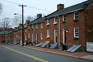
<span class="mw-page-title-main">Oella, Maryland</span> Historic district in Maryland, United States

Oella is a mill town on the Patapsco River in western Baltimore County, Maryland, United States, located between Catonsville and Ellicott City. It is a 19th-century village of millworkers' homes.

<span class="mw-page-title-main">Andrew Ellicott</span> American surveyor

Andrew Ellicott was an American land surveyor who helped map many of the territories west of the Appalachians, surveyed the boundaries of the District of Columbia, continued and completed Pierre (Peter) Charles L'Enfant's work on the plan for Washington, D.C., and served as a teacher in survey methods for Meriwether Lewis.

<span class="mw-page-title-main">Ellicott's Stone</span> Historic boundary marker in Mobile County, Alabama, US

Ellicott's Stone, also known as the Ellicott Stone, is a boundary marker in northern Mobile County, Alabama. It was placed on April 10, 1799, by a joint U.S.-Spanish survey party headed by Andrew Ellicott. It was designated by the American Society of Civil Engineers as a Historic Civil Engineering Landmark in 1968 and was added to the National Register of Historic Places on April 11, 1973.

<span class="mw-page-title-main">National Register of Historic Places listings in Virginia</span>

Buildings, sites, districts, and objects in Virginia listed on the National Register of Historic Places:

<span class="mw-page-title-main">Jefferson Pier</span>

Jefferson Pier, Jefferson Stone, or the Jefferson Pier Stone, in Washington, D.C., marks the second prime meridian of the United States even though it was never officially recognized, either by presidential proclamation or by a resolution or act of Congress.

<span class="mw-page-title-main">Silvio Bedini</span> American historian

Silvio A. Bedini was an American historian, specialising in early scientific instruments. He was Historian Emeritus of the Smithsonian Institution, where he served on the professional staff for twenty-five years, retiring in 1987.
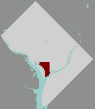
<span class="mw-page-title-main">Southwest Waterfront</span> Neighborhood in Washington, D.C., United States

The Southwest Waterfront is a neighborhood in Southwest Washington, D.C. The Southwest quadrant is the smallest of Washington's four quadrants, and the Southwest Waterfront is one of only two residential neighborhoods in the quadrant; the other is Bellevue, which, being east of the Anacostia River, is frequently, if mistakenly, regarded as being in Southeast

<span class="mw-page-title-main">Boundary markers of the original District of Columbia</span> Markers that marked the District of Columbias original boundary

The boundary markers of the original District of Columbia are the 40 milestones that marked the four lines forming the boundaries between the states of Maryland and Virginia and the square of 100 square miles (259 km2) of federal territory that became the District of Columbia in 1801. Working under the supervision of three commissioners that President George Washington had appointed in 1790 in accordance with the federal Residence Act, a surveying team led by Major Andrew Ellicott placed these markers in 1791 and 1792. Among Ellicott's assistants were his brothers Joseph and Benjamin Ellicott, Isaac Roberdeau, George Fenwick, Isaac Briggs and an African American astronomer, Benjamin Banneker.

<span class="mw-page-title-main">Benjamin Ellicott</span> American politician

Benjamin Ellicott was a surveyor, a county judge and a member of the United States House of Representatives from the State of New York.

<span class="mw-page-title-main">Mount Gilboa Chapel</span> Historic church in Maryland, United States

Mount Gilboa Chapel is a historic African Methodist Episcopal Church located in Oella, Maryland, United States. It is a small stone church measuring 28 feet by 42 feet, built about 1859 by free African Americans. The front façade is ashlar masonry, but the sides and rear are of rubble.

<i>The Washington Family</i>

The Washington Family by Edward Savage is a life-sized group portrait of the Washington family, including U.S. President George Washington, First Lady Martha Washington, two of her grandchildren and a black servant, most likely an enslaved man whose identity was not recorded. The National Gallery of Art in Washington, D.C., presently displays the large painting.
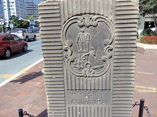
<span class="mw-page-title-main">Garden Club of America Entrance Markers in Washington, D.C.</span> United States historic place

The Garden Club of America Entrance Markers in Washington, D.C., are carven stone pylons installed along the border of the District of Columbia in 1932 and 1933 by local Garden Club of America chapters. Originally about five feet tall, the markers were placed at important entrance points to the national capital. Seven survive: sets of two markers in Westmoreland Circle, Friendship Heights, and Chevy Chase Circle; and a single marker along Georgia Avenue. These surviving markers are listed on the National Register of Historic Places.

According to accounts that began to appear during the 1960s or earlier, a substantial mythology has exaggerated the accomplishments of Benjamin Banneker (1731–1806), an African-American naturalist, mathematician, astronomer and almanac author who also worked as a surveyor and farmer.

<span class="mw-page-title-main">Martha Ellicott Tyson</span> American activist (1795-1873)

Martha Ellicott Tyson was an Elder of the Quaker Meeting in Baltimore, an anti-slavery and women's rights advocate, historian, and a co-founder of Swarthmore College. She was married to Nathan Tyson, a merchant whose father was the emancipator and abolitionist Elisha Tyson. She was the great-great grandmother of Maryland state senator James A. Clark Jr. (1918–2006). She was inducted into the Maryland Women's Hall of Fame in 1988.

George Ellicott (1760–1832) was a son of Andrew Ellicott, who with his two brothers founded Ellicott's Mills, Maryland. He was a mathematician, an amateur astronomer, a younger cousin of surveyor Major Andrew Ellicott and a friend of Benjamin Banneker. He was the father of Martha Ellicott Tyson, who became an Elder of the Quaker Meeting in Baltimore, an anti-slavery and women's rights advocate, the author of a biography of Benjamin Banneker, a founder of Swarthmore College and an inductee to the Maryland Women's Hall of Fame.

A United States postage stamp and the names of a number of recreational and cultural facilities, schools, streets and other facilities and institutions throughout the United States have commemorated Benjamin Banneker's documented and mythical accomplishments throughout the years since he lived (1731–1806). Among such memorializations of this free African American almanac author, surveyor, landowner and farmer who had knowledge of mathematics, astronomy and natural history was a biographical verse that Rita Dove, a future Poet Laureate of the United States, wrote in 1983 while on the faculty of Arizona State University.

References

  1. 1 2 (1) "SW-9 Intermediate Boundary Stone (milestone) of the District of Columbia". NPGallery Digital Asset Management System. National Park Service . Retrieved April 20, 2019.
    (2) "Benjamin Banneker: SW 9 Intermediate Boundary Stone". VIRGINIA - Arlington County. National Register of Historic Places.com. p. 1. Archived from the original on July 21, 2010. Retrieved January 5, 2013.
    (3) "Benjamin Banneker. SW-9 Intermediate Boundary Stone (United States Department of the Interior: National Park Service: Annual Listing of Historic Properties: National Park Service: Notices)" (PDF). Federal Register . National Archives. 24 (26, Part 2): 7612. February 6, 1979. Virginia ... Arlington. BENJAMIN BANNEKER. SW-9 INTERMEDIATE BOUNDARY STONE, 18th and Van Buren Sts., N., (5-11-76) NHL
  2. 1 2 "Banneker (Benjamin) SW-9 Intermediate Boundary Stone". National Historic Landmarks Program. National Park Service. Archived from the original on May 1, 2015. Retrieved January 29, 2017.
  3. 1 2 3 "The Banneker Stone (SW #9)". The Boundary Stones Project. Falls Church Chapter of the Daughters of the American Revolution. October 11, 2017. Archived from the original on October 11, 2017. Retrieved June 1, 2017.
  4. 1 2 "Benjamin Banneker Park". Department of Parks and Recreation, Arlington County, Virginia. Archived from the original on October 10, 2017. Retrieved October 10, 2017.
  5. 1 2 3 4 5 Graves, Lynne Gomez, Historical Projects Director, Afro-American Bicentennial Corporation, Washington, D.C. (February 3, 1976). "Benjamin Banneker: SW-9 Intermediate Boundary Stone (milestone) of the District of Columbia" (PDF). United States Department of the Interior: National Park Service: National Register of Historic Places Inventory––Nomination Form. Richmond, Virginia: Virginia Department of Historic Resources. Archived from the original (PDF) on April 20, 2019. Retrieved April 20, 2019.{{cite web}}: CS1 maint: multiple names: authors list (link) and "Accompanying three photos (undated)". Archived from the original on April 20, 2019.
  6. (1) National Capital Planning Commission (1976). Boundary markers of the Nation's Capital: a proposal for their preservation & protection: a National Capital Planning Commission Bicentennial report. Washington, D.C.: National Capital Planning Commission; For sale by the Superintendent of Documents, United States Government Printing Office. p. 9. OCLC   3772302 . Retrieved February 22, 2016.At HathiTrust Digital Library
    (2) "SW9". Boundary Stones of the District of Columbia. boundarystones.org. Archived from the original on October 15, 2016. Retrieved January 29, 2017.
  7. (1) Bedini, Silvio A. (1999). The Life of Benjamin Banneker: The First African-American Man of Science (2nd ed.). Baltimore: Maryland Historical Society. ISBN   0-938420-59-3. LCCN   98022848. OCLC   39024784 . Retrieved May 31, 2017 via Internet Archive.
    (2) Bedini, Silvio A. (2008). "Banneker, Benjamin". Complete Dictionary of Scientific Biography . Charles Scribner's Sons. Archived from the original on February 23, 2018. Retrieved February 23, 2018 via Encyclopedia.com.
  8. Boyd, Julian P., ed. (1974). "Locating the Federal District: Editorial Note: Footnote number 119". The Papers of Thomas Jefferson: 24 January–31 March 1791. Vol. 19. Princeton, New Jersey: Princeton University Press. pp. 41–43. ISBN   9780691185255. LCCN   50007486. OCLC   1045069058 . Retrieved March 27, 2019 via Google Books.