Berkeley is a city on the eastern shore of San Francisco Bay in northern Alameda County, California, United States. It is named after the 18th-century Irish bishop and philosopher George Berkeley. It borders the cities of Oakland and Emeryville to the south and the city of Albany and the unincorporated community of Kensington to the north. Its eastern border with Contra Costa County generally follows the ridge of the Berkeley Hills. The 2020 census recorded a population of 124,321.

The Cincinnati Subway was a partially completed rapid transit system beneath the streets of Cincinnati, Ohio. Although the system only grew to a little over 2 miles (3.2 km) in length, its derelict tunnels and stations make up the largest abandoned subway tunnel system in the United States. Construction began in the early 1900s as an upgrade to the Cincinnati streetcar system, but was abandoned due to escalating costs, the collapse of funding amidst political bickering, and the Great Depression during the 1920s and 1930s.

The Park Avenue Tunnel, also called the Murray Hill Tunnel, is a 1,600-foot-long (488 m) tunnel that passes under seven blocks of Park Avenue in Murray Hill, in the New York City borough of Manhattan. Traffic currently goes northbound from 33rd Street toward the Park Avenue Viaduct. The tunnel is under the jurisdiction of the New York City Department of Transportation, and carries one lane of northbound car traffic from East 33rd Street to East 40th Street; from 40th Street north, traffic must follow the Park Avenue Viaduct around Grand Central Terminal to 46th Street. The vertical clearance is 8 ft 11 in (2.72 m).

Montclair is a hillside neighborhood in Oakland, California, United States. Montclair is located along the western slope of the Oakland Hills from a valley formed by the Hayward Fault to the upper ridge of the hills.

Connecticut Avenue is a major thoroughfare in the Northwest quadrant of Washington, D.C., and suburban Montgomery County, Maryland. It is one of the diagonal avenues radiating from the White House, and the segment south of Florida Avenue was one of the original streets in Pierre (Peter) Charles L'Enfant's plan for Washington. A five-mile segment north of Rock Creek was built in the 1890s by a real-estate developer.

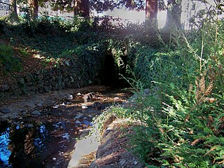
Strawberry Creek is the principal watercourse running through the city of Berkeley, California. Two forks rise in the Berkeley Hills of the California Coast Ranges, and form a confluence at the campus of the University of California, Berkeley. The creek then flows westward across the city to discharge into San Francisco Bay.

Temescal Creek (Temescal, Mexican Spanish for "sweat lodge", is one of the principal watercourses in the city of Oakland, California, United States.
La Loma Park is a tract of land located in the Berkeley Hills section of the city of Berkeley, California in the San Francisco Bay Area. The Spanish word loma means "rise/low hill". It was the property of Captain Richard Parks Thomas, a veteran of the Civil War and Berkeley businessman. Today, it is entirely a residential area. Although hilly throughout, its average elevation is about 614 feet (187 m).

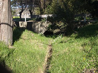
Codornices Creek, 2.0 miles (3.2 km) long, is one of the principal creeks which runs out of the Berkeley Hills in the East Bay area of the San Francisco Bay Area in California. In its upper stretch, it passes entirely within the city limits of Berkeley, and marks the city limit with the adjacent city of Albany in its lower section. Before European settlement, Codornices probably had no direct, permanent connection to San Francisco Bay. Like many other small creeks, it filtered through what early maps show as grassland to a large, northward-running salt marsh and slough that also carried waters from Marin Creek and Schoolhouse Creek. A channel was cut through in the 19th Century, and Codornices flows directly to San Francisco Bay by way of a narrow remnant slough adjacent to Golden Gate Fields racetrack.
The Cragmont area of Berkeley is a residential district located in the northeastern section of the city, occupying most of the hill area north of Codornices Creek. It lies at an elevation of 755 feet.

Schoolhouse Creek is a creek which flows through the city of Berkeley, California in the San Francisco Bay Area.

Streetcars and interurbans operated in the Maryland suburbs of Washington, D.C., between 1890 and 1962. Lines in Maryland were established as separate legal entities, but eventually they were all owned or leased by DC Transit. Unlike the Virginia lines, the Washington and Maryland lines were scheduled as a single system. Most of the streetcar lines were built with grand plans in mind, but none succeeded financially. A combination of the rise of the automobile, various economic downturns and bustitution eventually spelled the end of streetcars in southern Maryland.

Mill Creek Ravine is located in Edmonton, Alberta, Canada and is a part of the River Valley parks and trail system. It contains the last stretch of Mill Creek, before it flows into a culvert for its end run to the North Saskatchewan River. The ravine ends where the land opens onto the North Saskatchewan River valley near the west end of Cloverdale on the opposite bank from downtown.
The Capital Traction Company was the smaller of the two major street railway companies in Washington, D.C., in the early 20th century. It was formed in 1895 through a merger of the Rock Creek Railway and the Washington and Georgetown Railroad Company. The company's streetcars connected the Washington, D.C., neighborhoods of Georgetown, Capitol Hill, the Armory, and Mount Pleasant; and the suburb of Chevy Chase, Maryland. In 1933, it merged with its major competitor, the Washington Railway and Electric Company, to form the Capital Transit Company.

Marin Creek is a creek tributary of Codornices Creek in northwestern Alameda County, California. The lower stretch of Marin Creek is also known as Village Creek.

The Northbrae Tunnel, also referred to as the Solano Avenue Tunnel, was built as a commuter electric railroad tunnel in the northern part of Berkeley, California, and was later converted to street use.
South River City is a community located in Austin, Texas. Also frequently called Travis Heights, the neighborhood is located south of the city's urban core, just below Lake Lady Bird in South Austin. The area encompasses a portion of ZIP code 78704.

Shattuck Avenue is a major city street running north–south through Berkeley, California, and Oakland, California. At its southern end, the street branches from Telegraph Avenue in Oakland's Temescal district, then ends at Indian Rock Park in the Berkeley Hills to the north. Shattuck Avenue is the main street of Berkeley, forming the spine of that city's downtown, and the site of the Gourmet Ghetto in North Berkeley. The street was named for Francis Kittredge Shattuck, an early landowner and booster who later served as Mayor of Oakland. Shattuck was largely responsible for the original construction of the road as well as for a railroad built along its route.

Live Oak Park is a public park and recreation area of the city of Berkeley, California, it lies in the center of several North Berkeley neighborhoods, 5.5 acres of nature juxtaposed with facilities that form the beating heart of the area. It's a place where play areas, basketball and tennis courts, an indoor theater and the Berkeley Art Center share space with native oaks and California Bay Laurels, quiet shady picnic areas, a spacious grassy knoll and the lovely Codornices Creek, which flows through the park. Live Oak Park is one of Berkeley's oldest and most naturalistic public parks.


