Bevata

Last updated
Bevata
Madagascar location map.svg
Red pog.svg
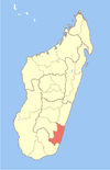
Bevata
Location in Madagascar
Coordinates: 23°17′S47°17′E / 23.283°S 47.283°E / -23.283; 47.283
CountryFlag of Madagascar.svg  Madagascar
Region Atsimo-Atsinanana
District Vangaindrano
Elevation [1] 136 m (446 ft)
Population (2001) [2]
  Total 11,000
Time zone EAT (UTC3)

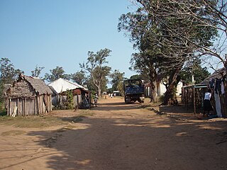
Bevata is a town and commune in Madagascar. It belongs to the district of Vangaindrano, which is a part of Atsimo-Atsinanana Region. The population of the commune was estimated to be approximately 11,000 in 2001 commune census. [2]

Madagascar island nation off the coast of Southeast Africa, in the Indian Ocean

Madagascar, officially the Republic of Madagascar, and previously known as the Malagasy Republic, is an island country in the Indian Ocean, approximately 400 kilometres off the coast of East Africa. The nation comprises the island of Madagascar and numerous smaller peripheral islands. Following the prehistoric breakup of the supercontinent Gondwana, Madagascar split from the Indian subcontinent around 88 million years ago, allowing native plants and animals to evolve in relative isolation. Consequently, Madagascar is a biodiversity hotspot; over 90% of its wildlife is found nowhere else on Earth. The island's diverse ecosystems and unique wildlife are threatened by the encroachment of the rapidly growing human population and other environmental threats.

Districts of Madagascar

Districts are second-level administrative divisions of Madagascar below the regions. There are 114 districts in Madagascar. Districts are in their turn divided into communes; while some of the districts in urban areas and offshore islands each consist of only one commune, most of the districts are divided typically into 5–20 communes.

Census Acquiring and recording information about the members of a given population

A census is the procedure of systematically acquiring and recording information about the members of a given population. The term is used mostly in connection with national population and housing censuses; other common censuses include agriculture, business, and traffic censuses. The United Nations defines the essential features of population and housing censuses as "individual enumeration, universality within a defined territory, simultaneity and defined periodicity", and recommends that population censuses be taken at least every 10 years. United Nations recommendations also cover census topics to be collected, official definitions, classifications and other useful information to co-ordinate international practice.

Only primary schooling is available. It is also a site of industrial-scale mining. The majority 94% of the population of the commune are farmers, while an additional 1% receives their livelihood from raising livestock. The most important crops are rice and coffee, while other important agricultural products are bananas, cassava and pepper. Industry and services provide employment for 1% and 4% of the population, respectively. [2]

Rice cereal grain and seed of Oryza sativa

Rice is the seed of the grass species Oryza sativa or Oryza glaberrima. As a cereal grain, it is the most widely consumed staple food for a large part of the world's human population, especially in Asia. It is the agricultural commodity with the third-highest worldwide production, after sugarcane and maize.

Coffee Brewed beverage

Coffee is a brewed drink prepared from roasted coffee beans, the seeds of berries from certain Coffea species. The genus Coffea is native to tropical Africa and Madagascar, the Comoros, Mauritius, and Réunion in the Indian Ocean. Coffee plants are now cultivated in over 70 countries, primarily in the equatorial regions of the Americas, Southeast Asia, Indian subcontinent, and Africa. The two most commonly grown are C. arabica and C. robusta. Once ripe, coffee berries are picked, processed, and dried. Dried coffee seeds are roasted to varying degrees, depending on the desired flavor. Roasted beans are ground and then brewed with near-boiling water to produce the beverage known as coffee.

Banana edible fruit

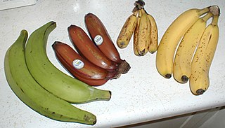
A banana is an edible fruit – botanically a berry – produced by several kinds of large herbaceous flowering plants in the genus Musa. In some countries, bananas used for cooking may be called "plantains", distinguishing them from dessert bananas. The fruit is variable in size, color, and firmness, but is usually elongated and curved, with soft flesh rich in starch covered with a rind, which may be green, yellow, red, purple, or brown when ripe. The fruits grow in clusters hanging from the top of the plant. Almost all modern edible seedless (parthenocarp) bananas come from two wild species – Musa acuminata and Musa balbisiana. The scientific names of most cultivated bananas are Musa acuminata, Musa balbisiana, and Musa × paradisiaca for the hybrid Musa acuminata × M. balbisiana, depending on their genomic constitution. The old scientific name for this hybrid, Musa sapientum, is no longer used.

References and notes

  1. Estimated based on DEM data from Shuttle Radar Topography Mission
  2. 1 2 3 "ILO census data". Cornell University. 2002. Retrieved 2008-05-05.

Coordinates: 23°17′S47°17′E / 23.283°S 47.283°E / -23.283; 47.283

Geographic coordinate system Coordinate system

A geographic coordinate system is a coordinate system that enables every location on Earth to be specified by a set of numbers, letters or symbols. The coordinates are often chosen such that one of the numbers represents a vertical position and two or three of the numbers represent a horizontal position; alternatively, a geographic position may be expressed in a combined three-dimensional Cartesian vector. A common choice of coordinates is latitude, longitude and elevation. To specify a location on a plane requires a map projection.


Related Research Articles

Manerinerina Place in Boeny, Madagascar

Manerinerina is a town and commune in Madagascar. It belongs to the district of Ambato-Boeni, which is a part of Boeny Region. The population of the commune was estimated to be approximately 16,000 in 2001 commune census.

Maria, Maevatanana Place in Betsiboka, Madagascar

Maria is a town and commune in Madagascar. It belongs to the district of Maevatanana, which is a part of Betsiboka Region. The population of the commune was estimated to be approximately 7,000 in 2001 commune census.

Belalanda Place in Atsimo-Andrefana, Madagascar

Belalanda is a town and commune in Madagascar. It belongs to the district of Toliara II, which is a part of Atsimo-Andrefana Region. The population of the commune was estimated to be approximately 7,000 in 2001 commune census.

Ambatolahy, Antanifotsy Place in Vakinankaratra, Madagascar

Ambatolahy is a town and commune in Madagascar. It belongs to the district of Antanifotsy, which is a part of Vakinankaratra Region. The population of the commune was estimated to be approximately 9,000 in 2001 commune census.

Mahatsinjo Est Place in Itasy, Madagascar

Mahatsinjo Est is a town and commune in Madagascar. It belongs to the district of Arivonimamo, which is a part of Itasy Region. The population of the commune was estimated to be approximately 3,000 in 2001 commune census.

Ambatosoa Place in Haute Matsiatra, Madagascar

Ambatosoa is a town and commune in Madagascar. It belongs to the district of Ambohimahasoa, which is a part of Haute Matsiatra Region. The population of the commune was estimated to be approximately 12,000 in 2001 commune census.

Morafeno, Ambohimahasoa Place in Haute Matsiatra, Madagascar

Morafeno is a town and commune in Madagascar. It belongs to the district of Ambohimahasoa, which is a part of Haute Matsiatra Region. The population of the commune was estimated to be approximately 10,000 in 2001 commune census.

Sahambavy Place in Haute Matsiatra, Madagascar

Sahambavy is a town and commune in Madagascar. It belongs to the district of Fianarantsoa II, which is a part of Haute Matsiatra Region. The population of the commune was estimated to be approximately 17,000 in 2001 commune census.

Erada Place in Androy, Madagascar

Erada is a town and commune in Madagascar. It belongs to the district of Ambovombe, which is a part of Androy Region. The population of the commune was estimated to be approximately 10,000 in 2001 commune census.

Mangatsiotra Place in Vatovavy-Fitovinany, Madagascar

Mangatsiotra is a town and commune in Madagascar. It belongs to the district of Manakara, which is a part of Vatovavy-Fitovinany Region. The population of the commune was estimated to be approximately 4,000 in 2001 commune census.

Kelilalina Place in Vatovavy-Fitovinany, Madagascar

Kelilalina is a town and commune in Madagascar. It belongs to the district of Ifanadiana, which is a part of Vatovavy-Fitovinany Region. The population of the commune was estimated to be approximately 9,000 in 2001 commune census.

Kalafotsy Place in Vatovavy-Fitovinany, Madagascar

Kalafotsy is a town and commune in Madagascar. It belongs to the district of Ikongo, which is a part of Vatovavy-Fitovinany Region. The population of the commune was estimated to be approximately 11,000 in 2001 commune census.

Lanivo Place in Vatovavy-Fitovinany, Madagascar

Lanivo is a town and commune in Madagascar in the district of Vohipeno, which is a part of Vatovavy-Fitovinany Region. The population of the commune was estimated to be approximately 9,000 in the 2001 commune census.

Manantenina Place in Anosy, Madagascar

Manantenina is a town and commune in Madagascar. It belongs to the district of Taolanaro, which is a part of Anosy Region.

Soamanova Place in Atsimo-Atsinanana, Madagascar

Soamanova is a town and commune in Madagascar. It belongs to the district of Vangaindrano, which is a part of Atsimo-Atsinanana Region. The population of the commune was estimated to be approximately 11,000 in 2001 commune census.

Vatanato Place in Atsimo-Atsinanana, Madagascar

Vatanato is a town and commune in Madagascar. It belongs to the district of Vangaindrano, which is a part of Atsimo-Atsinanana Region. The population of the commune was estimated to be approximately 9,000 in 2001 commune census.

Mahazoarivo, Vondrozo Place in Atsimo-Atsinanana, Madagascar

Mahazoarivo is a town and commune in Madagascar. It belongs to the district of Vondrozo, which is a part of Atsimo-Atsinanana Region. The population of the commune was estimated to be approximately 7,000 in 2001 commune census.

Vohiboreka Place in Atsimo-Atsinanana, Madagascar

Vohiboreka is a town and commune in Madagascar. It belongs to the district of Vondrozo, which is a part of Atsimo-Atsinanana Region. The population of the commune was estimated to be approximately 4,000 in 2001 commune census.

Vohimary Place in Atsimo-Atsinanana, Madagascar

Vohimary is a town and commune in Madagascar. It belongs to the district of Vondrozo, which is a part of Atsimo-Atsinanana Region. The population of the commune was estimated to be approximately 5,000 in 2001 commune census.

Vondrozo Place in Atsimo-Atsinanana, Madagascar

Vondrozo is a town and commune in Madagascar. It belongs to the district of Vondrozo, which is a part of Atsimo-Atsinanana Region. The population of the commune was estimated to be approximately 10,000 in 2001 commune census.