
Van Nuys is a neighborhood in the central San Fernando Valley region of Los Angeles, California. Home to Van Nuys Airport and the Valley Municipal Building, it is the most populous neighborhood in the San Fernando Valley.

The San Fernando Valley, known locally as the Valley, is an urbanized valley in Los Angeles County, California. Situated to the north of the Los Angeles Basin, it contains a large portion of the city of Los Angeles, as well as several unincorporated areas; and the incorporated cities of Burbank, Calabasas, Glendale, Hidden Hills, and San Fernando. The valley is well known for its film studios such as Warner Bros. Studios and Walt Disney Studios. In addition, it is home to the Universal Studios Hollywood theme park.
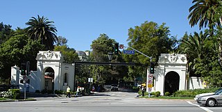
Bel Air is a residential neighborhood on the Los Angeles Westside, in the foothills of the Santa Monica Mountains in the U.S. state of California. Founded in 1923, it is the home of the Hannah Carter Japanese Garden and the American Jewish University.
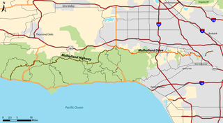
Mulholland Drive is a street and road in the eastern Santa Monica Mountains of Southern California. It is named after pioneering Los Angeles civil engineer William Mulholland. The western rural portion in Los Angeles and Ventura Counties is named Mulholland Highway. The road is featured in a significant number of films, songs, and novels. David Lynch, who wrote and directed a film named after Mulholland Drive, has said that one can feel "the history of Hollywood" on it. Jack Nicholson has lived on Mulholland Drive for many years, and still did so as of 2009.
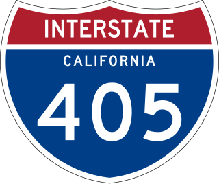
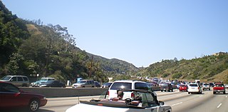
Interstate 405 is a major north–south auxiliary Interstate Highway in Southern California. The entire route is known as the northern segment of the San Diego Freeway. I-405 is a bypass auxiliary route of I-5, running along the southern and western parts of the Greater Los Angeles urban area from Irvine in the south to Sylmar in the north.
The Los Angeles Westside is an urban region in western Los Angeles County, California, United States. It has no official definition, but sources like LA Weekly and the Mapping L.A. survey of the Los Angeles Times place the region on the western side of the Los Angeles Basin south of the Santa Monica Mountains.
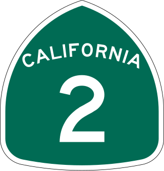
State Route 2 (SR 2) is a state highway in the U.S. state of California. It connects the Los Angeles Basin with the San Gabriel Mountains and the Victor Valley in the Mojave Desert. The highway's southwestern end is at the intersection of Centinela Avenue at the Santa Monica-Los Angeles border and its northeastern end is at SR 138 east of Wrightwood. The SR 2 is divided into four segments, and it briefly runs concurrently with U.S. Route 101 (US 101) and Interstate 210 (I-210). The southwestern section of SR 2 runs along a segment of the east–west Santa Monica Boulevard, an old routing of US 66, to US 101 in East Hollywood; the second section runs along segments of both the north–south Alvarado Street and Glendale Boulevard in Echo Park; the third section to I-210 in Glendale is known as the north–south Glendale Freeway; and the northeastern portion from I-210 in La Cañada Flintridge to SR 138 is designated as the Angeles Crest Highway.

Los Angeles has a complex multimodal transportation infrastructure, which serves as a regional, national and international hub for passenger and freight traffic. The system includes the United States' largest port complex; an extensive freight and passenger rail infrastructure, including light rail lines and rapid transit lines; numerous airports and bus lines; vehicle for hire companies; and an extensive freeway and road system. People in Los Angeles rely on cars as the dominant mode of transportation, but since 1990 the Los Angeles County Metropolitan Transportation Authority has built over one hundred miles (160 km) of light and heavy rail serving more and more parts of Los Angeles and the greater area of Los Angeles County. As a result, Los Angeles was the last major city in the United States to get a permanent rail system installed.
Sepulveda Pass is a low mountain pass through the Santa Monica Mountains in Los Angeles. It is named after the Sepúlveda family of California, a prominent Californio family that owned the land where the pass lies.

Sepulveda Boulevard is a major street and transportation corridor in the City of Los Angeles and several other cities in western Los Angeles County, California. The street parallels Interstate 405 for much of its route. Portions of Sepulveda Boulevard between Manhattan Beach and Los Angeles International Airport (LAX) are designated as part of State Route 1.

Santa Monica Boulevard is a major west–east thoroughfare in Los Angeles County, California, United States. It runs from Ocean Avenue in Santa Monica near the Pacific Ocean to Sunset Boulevard at Sunset Junction in Los Angeles. It passes through Beverly Hills and West Hollywood. A portion of it is designated as California State Route 2.

Laurel Canyon Boulevard is a major street in the city of Los Angeles. It starts off at Polk Street in Sylmar in the northern San Fernando Valley near the junction of the San Diego and the Golden State (I-5)) freeways. Laurel Canyon Boulevard bypasses the city of San Fernando to the west, running parallel to I-5 in the vicinity of Pacoima and Arleta. The portion through Sun Valley passes through rock quarries and a great deal of open space.

Vermont Avenue is one of the longest running north–south streets in City of Los Angeles and Los Angeles County, California. With a length of 23.3 miles (37.5 km), is the third longest of the north–south thoroughfares in the region. For most of its length between its southern end in San Pedro and south of Downtown Los Angeles, it runs parallel to the west of the Harbor Freeway (I-110).
Beverly Glen is a neighborhood in the Santa Monica Mountains region of Los Angeles, California, located around Beverly Glen Boulevard north of Sunset Boulevard and south of Mulholland Drive. Stone Canyon Reservoir lies in the neighborhood.
Brentwood Glen is a neighborhood in the Brentwood area of Los Angeles, California.
Victory Boulevard is a major east–west arterial road that runs for 25 miles (40 km) traversing the entire length of the San Fernando Valley in Los Angeles County, California.

Los Angeles's 2nd City Council district is one of the fifteen districts in the Los Angeles City Council. It is currently represented by Democrat Paul Krekorian since 2009, after he won the special election to finish Wendy Greuel's term.

Coldwater Canyon Avenue is a street, primarily within the City of Los Angeles, in Los Angeles County, California. It runs 10.3 miles (16.6 km) from North Beverly Drive at Coldwater Canyon Park in Beverly Hills, north up Coldwater Canyon, including a short stretch shared with Mulholland Drive, ending at a crossroad intersection with Roscoe Boulevard in Sun Valley, where the Coldwater Canyon Avenue changes into Sheldon Street.

