Big Rapids Township, Michigan

Last updated

Big Rapids Charter Township
USA Michigan location map.svg
Red pog.svg
Big Rapids Township
Usa edcp location map.svg
Red pog.svg
Big Rapids Township
Coordinates: 43°40′50″N85°29′28″W / 43.68056°N 85.49111°W / 43.68056; -85.49111
Country United States
State Michigan
County Mecosta
Area
[1]
  Total30.90 sq mi (80.0 km2)
  Land30.47 sq mi (78.9 km2)
  Water0.43 sq mi (1.1 km2)
Elevation
1,020 ft (311 m)
Population
 (2020) [2]
  Total3,917
  Density128.5/sq mi (49.6/km2)
Time zone UTC-5 (Eastern (EST))
  Summer (DST) UTC-4 (EDT)
ZIP code
49307 (Big Rapids)
Area code 231
FIPS code 26-107-08320 [3]
GNIS feature ID1625935 [4]
Website bigrapidstownshipmi.gov

Big Rapids Township is a charter township [4] of Mecosta County in the U.S. state of Michigan. As of the 2020 census, the township population was 3,917. [2]

Contents

The city of Big Rapids is surrounded by the charter township but, like all cities in Michigan, is a completely separate jurisdiction from any townships adjacent to it. But whereas cities, as municipal corporations, can cross county lines, civil and charter townships, as administrative divisions of a county, cannot.

History

In February 1858, the Newaygo County Supervisors approved the organization of Green and Leonard townships in the unorganized "paper" county of Mecosta. [5] The Mecosta county government was organized on February 11, 1859, with the village of Leonard as its seat. [5] The Leonard post office changed its name to Big Rapids on September 29, 1859. [5] Thus the June 1, 1860, U.S. Federal Census lists inhabitants of Leonard Township, with their post office as "Big Rapids". [6]

In 1865, by act of the Michigan Legislature, the name of Leonard Township was changed to Big Rapids Township. [7]

Geography

The township is in western Mecosta County and is bordered to the west by Newaygo County. According to the United States Census Bureau, the township has a total area of 30.9 square miles (80 km2), of which 30.5 square miles (79 km2) are land and 0.4 square miles (1.0 km2), or 1.40%, are water. [1] The Muskegon River, a tributary of Lake Michigan, flows southward through the eastern part of the township.

U.S. Route 131, a four-lane freeway, crosses the township, leading north 41 miles (66 km) to Cadillac and south 54 miles (87 km) to Grand Rapids.

Demographics

Historical population
CensusPop.Note
1870 465
1880 54918.1%
1890 65519.3%
1900 6834.3%
1910 668−2.2%
1920 601−10.0%
1930 509−15.3%
1940 60719.3%
1950 69815.0%
1960 78913.0%
1970 1,687113.8%
1980 2,47146.5%
1990 3,10025.5%
2000 3,2494.8%
2010 4,20829.5%
2020 3,917−6.9%
U.S. Decennial Census [8]

As of the census [3] of 2000, there were 3,249 people, 1,200 households, and 813 families residing in the township. The population density was 105.9 inhabitants per square mile (40.9/km2). There were 1,287 housing units at an average density of 42.0 per square mile (16.2/km2). The racial makeup of the township was 94.06% White, 2.06% African American, 0.40% Native American, 1.91% Asian, 0.03% Pacific Islander, 0.37% from other races, and 1.17% from two or more races. Hispanic or Latino residents of any race were 1.02% of the population.

There were 1,200 households, out of which 31.6% had children under the age of 18 living with them, 57.7% were married couples living together, 7.3% had a female householder with no husband present, and 32.3% were non-families. 19.3% of all households were made up of individuals, and 5.7% had someone living alone who was 65 years of age or older. The average household size was 2.61 and the average family size was 3.02.

In the township, 23.0% of the population was under the age of 18, 15.3% was from 18 to 24, 24.7% from 25 to 44, 23.9% from 45 to 64, and 13.1% was 65 years of age or older. The median age was 36 years. For every 100 females, there were 104.6 males. For every 100 females age 18 and over, there were 104.8 males.

The median income for a household in the township was $47,933, and the median income for a family was $60,583. Males had a median income of $38,510 versus $30,893 for females. The per capita income for the township was $22,761. About 6.0% of families and 10.6% of the population were below the poverty line, including 6.2% of those under age 18 and 8.7% of those age 65 or over.

Related Research Articles

<span class="mw-page-title-main">Osceola County, Michigan</span> County in Michigan, United States

Osceola County is a county in the U.S. state of Michigan. As of the 2020 United States Census, the population was 22,891. The county seat is Reed City.

<span class="mw-page-title-main">Newaygo County, Michigan</span> County in Michigan, United States

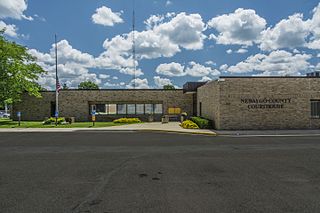
Newaygo County is a county in the U.S. state of Michigan. As of the 2020 United States Census, the population was 49,978. The county seat is White Cloud. The county was created in 1840, and was organized in 1851. It was either named for an Ojibwe leader who signed the Treaty of Saginaw in 1819 or for an Algonquian word meaning "much water".

<span class="mw-page-title-main">Montcalm County, Michigan</span> County in Michigan, United States

Montcalm County is a county in the U.S. state of Michigan. As of the 2020 Census, the population was 66,614. The county is geographically located in the West Michigan region of the Lower Peninsula. The county seat is Stanton, and the largest city is Greenville. The county is named for General Marquis Louis-Joseph de Montcalm, military commander of French troops during the French and Indian War. The county was set off in 1831 and organized in 1850.

<span class="mw-page-title-main">Mecosta County, Michigan</span> County in Michigan, United States

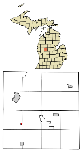
Mecosta County is a county located in the U.S. state of Michigan. As of the 2020 Census, the population was 39,714. The county seat is Big Rapids.

<span class="mw-page-title-main">Big Rapids, Michigan</span> City in Michigan, United States

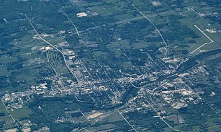
Big Rapids is a city and the seat of government of Mecosta County, Michigan. The population was 7,727 at the 2020 census, down from 10,601 in 2010. The city is surrounded by Big Rapids Charter Township but they are completely separate jurisdictions. Big Rapids is home of the main campus of Ferris State University, a four-year public university.

Chippewa Township is a civil township of Mecosta County in the U.S. state of Michigan. As of the 2020 census, the township population was 1,227.

Colfax Township is a civil township of Mecosta County in the U.S. state of Michigan. The population was 1,962 at the 2020 census.

Green Charter Township is a charter township of Mecosta County in the U.S. state of Michigan. As of the 2020 census, the township population was 3,219. The township was organized in 1858, before Mecosta County was detached from Newaygo County.

Hinton Township is a civil township of Mecosta County in the U.S. state of Michigan. As of the 2020 census, the township population was 1,054.

<span class="mw-page-title-main">Mecosta, Michigan</span> Village in Michigan, United States

Mecosta is a village in Mecosta County in the U.S. state of Michigan. The population was 386 at the 2020 census, down from 457 in 2010. The village is within Morton Township. Mecosta Township, which is also in Mecosta County, is located several miles to the west.

Mecosta Township is a civil township of Mecosta County in Michigan. The population was 2,744 as of the 2020 census. The village of Mecosta, which is also in Mecosta County, is in Morton Township, several miles to the east.

Millbrook Township is a civil township of Mecosta County in the U.S. state of Michigan. The population was 1,064 at the 2020 census.

<span class="mw-page-title-main">Morley, Michigan</span> Village in Michigan, United States

Morley is a village in Mecosta County in the U.S. state of Michigan. The population was 517 at the 2020 census.

Morton Township is a civil township of Mecosta County in the U.S. state of Michigan. The population was 4,426 at the 2020 census.

<span class="mw-page-title-main">Stanwood, Michigan</span> Village in Michigan, United States

Stanwood is a village in Mecosta County of the U.S. state of Michigan. The population was 194 at the 2020 census. The village is within Mecosta Township.

Pierson Township is a civil township of Montcalm County in the U.S. state of Michigan. The population was 3,363 at the 2020 census. The village of Pierson is located within the township.

Reynolds Township is a civil township of Montcalm County in the U.S. state of Michigan. The population was 5,431 at the 2020 census.

Aetna Township is a civil township of Mecosta County in the U.S. state of Michigan. As of the 2020 census, the township population was 2,241.

Austin Township is a civil township of Mecosta County in the U.S. state of Michigan. As of the 2020 census, the township population was 1,715.

Deerfield Township is a civil township of Mecosta County in the U.S. state of Michigan. The population was 1,785 at the 2020 census.

References

  1. 1 2 "2022 U.S. Gazetteer Files: Michigan". United States Census Bureau. Retrieved September 11, 2023.
  2. 1 2 "P1. Race – Big Rapids charter township, Michigan: 2020 DEC Redistricting Data (PL 94-171)". U.S. Census Bureau. Retrieved September 11, 2023.
  3. 1 2 "U.S. Census website". United States Census Bureau . Retrieved January 31, 2008.
  4. 1 2 U.S. Geological Survey Geographic Names Information System: Big Rapids Township, Michigan
  5. 1 2 3 Wood, Jim (1999). "The Village That Time Forgot". In The Woods. Retrieved December 11, 2023 via MIGenWeb.[ self-published source? ]
  6. "Orange Wheeler". 1860 United States Federal Census. Washington DC: National Archives. Record Group: Records of the Bureau of the Census; Record Group Number: 29; Series Number: M653; Residence Date: 1860; Home in 1860: Leonard, Mecosta, Michigan; Roll: M653_554; Page: 109. Retrieved December 11, 2023 via Ancestry.com.
  7. "Town History". Charter Township of Big Rapids. Retrieved December 11, 2023.
  8. "Decennial Census Official Publications". Census.gov. Retrieved September 11, 2023.