Black Diamond, Alberta

Last updated
Black Diamond
Former town
Black Diamond Alberta downtown AB22.jpg
Downtown Black Diamond on Alberta Highway 22
Alberta County Point Locator.svg
Red pog.svg
Black Diamond
Location of Black Diamond
Canada location map 2.svg
Red pog.svg
Black Diamond
Black Diamond (Canada)
Coordinates: 50°41′17″N114°14′00″W / 50.68806°N 114.23333°W / 50.68806; -114.23333
CountryCanada
Province Alberta
Region Calgary Metropolitan Region
Census division 6
Town Diamond Valley
Incorporated [1]  
   Village May 8, 1929
   Town January 1, 1956
Amalgamated [2] January 1, 2023
Government
  Governing bodyDiamond Valley Town Council
Area
 (2021) [3]
  Land6.82 km2 (2.63 sq mi)
Elevation
[4]
1,159 m (3,802 ft)
Population
 (2021) [3] [5]
  Total2,730
  Density400.4/km2 (1,037/sq mi)
Time zone UTC−07:00 (MST)
  Summer (DST) UTC−06:00 (MDT)
Postal code span
T0L
Area codes 403, 587, 825, 368
Highways Highway 22
Highway 7
Waterways Sheep River
Website town.blackdiamond.ab.ca (archived December 29, 2022)

Black Diamond was a town in the Calgary Metropolitan Region of Alberta, Canada within the Town of Diamond Valley. It is at the intersection of Highway 22 (Cowboy Trail) and Highway 7. Its first post office opened in 1907. [6] Black Diamond was so named because of coal deposits near the original town site. [7] Little oil or gas remains.

Contents

It was a sister town to Turner Valley, and has a hospital, shops, hotels and residences, elementary school (K-6th grade), high school (7th-12th grade), hockey rink and a Boys and Girls Club.

Black Diamond is located in the foothills of the Canadian Rockies in the midst of some of Canada's best ranch country.

A 3 km (1.9 mi) trail next to the roadway between Black Diamond and Turner Valley is named the Friendship Trail.

History

Black Diamond incorporated as a village on May 8, 1929. [1] After nearly 26 years as a village, Black Diamond incorporated as a town on January 1, 1956. [1]

On May 25, 2022, the Province of Alberta issued an Order in Council to amalgamate Black Diamond and Turner Valley to form the new Town of Diamond Valley, with an incorporation date of January 1, 2023. [8]

This followed decades of talk and a 2007 plebiscite that saw Turner Valley citizens embrace amalgamation and Black Diamond residents reject it. [9]

Ultimately, the prospect of efficiencies and possible cost savings of $1 million a year became a major catalyst to approving the merger without a plebiscite. [9]

On January 1, 2023, the Town of Black Diamond amalgamated with its neighbouring Town of Turner Valley to form the Town of Diamond Valley. [2]

Demographics

In the 2021 Census of Population conducted by Statistics Canada, the Town of Black Diamond had a population of 2,730 living in 1,178 of its 1,233 total private dwellings, a change of

In the 2016 Census of Population conducted by Statistics Canada, the Town of Black Diamond recorded a population of 2,700 living in 1,098 of its 1,108 total private dwellings, a

Government

Black Diamond was governed by a town council of seven including a mayor and six councillors. The final mayor of the Town of Black Diamond was Brendan Kelly. [1]

Since January 1, 2023, the area of Black Diamond is governed by the Diamond Valley Town Council.

See also

Related Research Articles

<span class="mw-page-title-main">Wainwright, Alberta</span> Town in Alberta, Canada

Wainwright is a town in east-central Alberta, Canada. It is approximately 206 kilometres (128 mi) southeast of Edmonton.

<span class="mw-page-title-main">Turner Valley</span> Former town in Alberta, Canada

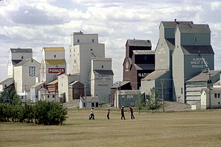
Turner Valley was a town in the Calgary Metropolitan Region of Alberta, Canada within the Town of Diamond Valley. It is on Highway 22, 3 km (1.9 mi) west of Black Diamond and approximately 60 km (37 mi) southwest of Calgary. It was named after Robert and John Turner who settled in the area in 1886.

<span class="mw-page-title-main">Hinton, Alberta</span> Town in Alberta, Canada

Hinton is a town in west-central Alberta, Canada.

Penhold is a town in central Alberta, Canada. Penhold is surrounded by Red Deer County, 16 km (9.9 mi) south of Red Deer at the junction of Highway 2A and Highway 42. It is located 128 kilometres (80 mi) north of Calgary, east of the Red Deer River.

<span class="mw-page-title-main">Edson, Alberta</span> Town in Canadian Province of Alberta

Edson is a town in west-central Alberta, Canada. It is located in Yellowhead County, 192 kilometres (119 mi) west of Edmonton along the Yellowhead Highway and 10 kilometres (6.2 mi) east of the intersection with Highway 47.

Redcliff is a town in southern Alberta, Canada. Adjacent to the City of Medicine Hat to the east and Cypress County to the west and north, the town is bisected by Highway 1 and is located on the north bank of the South Saskatchewan River.

Tawatinaw is a hamlet in Alberta, Canada within Westlock County. It is located on Township Road 614, 2 kilometres (1.2 mi) east of Highway 2 and approximately 70 kilometres (43 mi) north of the City of Edmonton.

<span class="mw-page-title-main">Drayton Valley</span> Town in Alberta, Canada

Drayton Valley is a town in central Alberta, Canada. It is located on Highway 22, approximately 133 kilometres (83 mi) southwest of Edmonton. It is surrounded by Brazeau County, known for its vast oil fields. The town is located between the North Saskatchewan River and the Pembina River.

<span class="mw-page-title-main">Foothills County</span> Municipal district in Alberta, Canada

Foothills County is a municipal district in southern Alberta, Canada adjacent to the south side of Calgary in Census Division No. 6. Despite sharing a common border with the City of Calgary, it does not form part of the Calgary census metropolitan area (CMA) as defined by Statistics Canada. It is however a member municipality of the Calgary Metropolitan Region Board.

<span class="mw-page-title-main">Ponoka, Alberta</span> Town in Alberta, Canada

Ponoka is a town in central Alberta, Canada. It is located at the junction of Highway 2A and Highway 53, 59 kilometres (37 mi) north of Red Deer and 95 kilometres (59 mi) south of Edmonton.

<span class="mw-page-title-main">Fox Creek, Alberta</span> Town in Alberta, Canada

Fox Creek is a town in northwest Alberta, Canada. It is located on Highway 43, approximately 259 km (161 mi) northwest of Edmonton and 199 km (124 mi) southeast of Grande Prairie, and has an elevation of 808 m (2,651 ft).

<span class="mw-page-title-main">Gibbons, Alberta</span> Settlement in Canada, incorporated 1959

Gibbons is a town in central Alberta, Canada. It is located on Highway 28A, 37 km (23 mi) northeast of Edmonton.

<span class="mw-page-title-main">Lamont, Alberta</span> Settlement in Canada, incorporated 1910

Lamont is a town in central Alberta, Canada. It is located 60 kilometres (37 mi) east of Edmonton at the junction of Highway 15 and Highway 831.

<span class="mw-page-title-main">Provost, Alberta</span> Town in Alberta, Canada

Provost is a town in central Alberta, Canada. It is located at the junction of Highway 13 and Highway 899, 19 km (12 mi) west of the Alberta-Saskatchewan border. It was originally named "Lakeview" but renamed by the Canadian Pacific Railway Land Department in 1907; the first train to the town was in 1910. Post office established in 1908.

Paradise Valley is a village in central Alberta, Canada. It is east of Highway 897 approximately 37 km (23 mi) south of Kitscoty.

Diamond City is a hamlet in southern Alberta, Canada within the Lethbridge County. It is located on Highway 25, approximately 13 kilometres (8.1 mi) north of Lethbridge. The community was so named on account of deposits of coal near the original town site, a resource also called "black diamond".

<span class="mw-page-title-main">Longview, Alberta</span> Village in Alberta, Canada

Longview is a village in southern Alberta, Canada. It is located in the Canadian Rockies foothills, on Cowboy Trail, 32 km west of High River and 64 km south of Calgary. Highwood River flows west of the village.

<span class="mw-page-title-main">Acadia Valley</span> Hamlet in Alberta, Canada

Acadia Valley is a hamlet in southeast Alberta, Canada within the Municipal District (MD) of Acadia No. 34. The MD of Acadia No. 34's municipal office is located in Acadia Valley.

<span class="mw-page-title-main">Wildwood, Alberta</span> Hamlet in Alberta, Canada

Wildwood is a hamlet in west-central Alberta, Canada within Yellowhead County. It is on the Yellowhead Highway, approximately 112 kilometres (70 mi) west of Edmonton and 82 kilometres (51 mi) east of Edson. The Yellowhead Highway's intersection with Cowboy Trail is 9 kilometres (5.6 mi) east of the hamlet. The Lobstick River, which flows from Chip Lake to the west, runs through the hamlet.

<span class="mw-page-title-main">Diamond Valley, Alberta</span> Town in Alberta, Canada

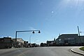
Diamond Valley is a town in the Calgary Metropolitan Region of Alberta, Canada within Foothills County. It is at the intersection of Highway 22 and Highway 7. It was established through the provincially approved amalgamation of the former towns of Black Diamond and Turner Valley on January 1, 2023.

References

  1. 1 2 3 4 "Municipal Profiles: Towns" (PDF). Alberta Municipal Affairs. August 13, 2021. pp. 50–52. Retrieved August 14, 2021.
  2. 1 2 "O.C. 156/2022". Government of Alberta. May 25, 2022. Retrieved May 25, 2022.
  3. 1 2 3 "Population and dwelling counts: Canada, provinces and territories, and census subdivisions (municipalities)". Statistics Canada. February 9, 2022. Retrieved February 9, 2022.
  4. "Alberta Private Sewage Systems 2009 Standard of Practice Handbook: Appendix A.3 Alberta Design Data (A.3.A. Alberta Climate Design Data by Town)" (PDF) (PDF). Safety Codes Council. January 2012. pp. 212–215 (PDF pages 226–229). Archived from the original (PDF) on October 16, 2013. Retrieved October 8, 2013.
  5. "Population and dwelling counts: Canada and population centres". Statistics Canada. February 9, 2022. Retrieved February 13, 2022.
  6. Hamilton, William (1978). The Macmillan Book of Canadian Place Names. Toronto: Macmillan. p. 21. ISBN   0-7715-9754-1.
  7. Place-names of Alberta. Ottawa: Geographic Board of Canada. 1928. p. 20.
  8. "Amalgamation | Diamond Valley, AB". www.diamondvalley.town. Retrieved 2023-07-18.
  9. 1 2 Kaufmann, Bill (May 27, 2022). "Diamond Valley: Two towns will become one in Alberta". Calgary Herald. Retrieved July 18, 2023.
  10. "Population and dwelling counts, for Canada, provinces and territories, and census subdivisions (municipalities), 2016 and 2011 censuses – 100% data (Alberta)". Statistics Canada. February 8, 2017. Retrieved February 8, 2017.