Blackburn Hamlet

Last updated

Blackburn Hamlet
Community
Blackburn Hamlet.jpg
Innes Road in Blackburn Hamlet
Blackburn Hamlet locator map.svg
Blackburn Hamlet within the City of Ottawa
Coordinates: 45°26′00″N75°33′50″W / 45.43333°N 75.56389°W / 45.43333; -75.56389
CountryFlag of Canada (Pantone).svg  Canada
Province Flag of Ontario.svg  Ontario
City Flag of Ottawa, Ontario.svg Ottawa
Government
   City Councillor Laura Dudas
   MP Marie-France Lalonde
   MPP Stephen Blais
Area
  Total2.41 km2 (0.93 sq mi)
Population
 (2021)
8,173
  Density3,391.29/km2 (8,783.4/sq mi)

Blackburn Hamlet is a suburban community in Innes Ward, in the east end of Ottawa, Ontario, Canada. Before the 2001 amalgamation of the city of Ottawa, it was in the city of Gloucester. It is surrounded by rural areas and contains several older and newer areas of settlement. According to the Canada 2021 Census, its population was 8,173. [1] The community took its name from Robert Blackburn, former Member of Parliament for Russell. [2]

Contents

Often referred to by the locals as simply "Blackburn," it is one of only two suburban areas (the other being Bells Corners) surrounded by National Capital Commission (NCC) Greenbelt lands as well as lands owned by the Royal Canadian Mounted Police (RCMP) [3] which were formerly the National Defence Proving Grounds. [4] Together, these lands form part of Ottawa's "Greenbelt" and provide Blackburn Hamlet residents and visitors with over 250 km of hiking and cross country skiing trails.

Blackburn is represented at city council but there is active community volunteer involvement as well through the Blackburn Community Association (BCA). Many activities, clubs, events and committees are run through the BCA. [5]

History

The earliest settlers to the area arrived between 1803 and 1811, most of whom were of English or Irish descent. [6] The area was called "Green's Creek" after Robert Green who operated a sawmill on the creek. [7] By 1834, the timber was exhausted and the government lands had been sold to farmers who began to settle in the area. These people had to clear their own land and build their own roads and schools. In 1850, Richard Dagg donated the land for the first school in Blackburn. The area was subsequently called "Daggsville" after three families that settled there. [7]

John Kemp and his family were one of the early settlers of Blackburn. When the first school burned down in 1915, a second school was built on the Kemp property where Blackburn Public School was located. [8] Agnes Purdy and her husband William settled on Lot 9 across from St Mary the Virgin Anglican Church on Navan Road. Four generations of Purdys farmed the land until the NCC expropriated the farm for the Greenbelt. Agnes is notable as a significant fundraiser for the church and as school board secretary for 20 years. [9]

Innes Road running through the Hamlet was named after Alexander Innes who owned a farm further west than Blackburn Hamlet. He also ran the toll road -Russell Rd. heading east from St. Laurent Blvd. He was survived by John Innes who was reeve of Gloucester Township. [10] Isaiah Scharf settled on a lot near Emily Carr School, four generations lived in Blackburn on what is now Innes Road. Some of the hamlet streets are named after these, and other early settlers, Kemp, Cleroux, Tauvette. [9]

In 1858, Joshua Bradley settled in Blackburn. [11] It was through the efforts of his son William Bradley and Robert Blackburn, (Reeve in 1864, then MP) that a post office was secured in 1876 and it was then that the area became known as "Blackburn". [8] The settlement during these times was divided in two, the area of "Blackburn Corners", located around the existing intersection of Navan and Innes Rds; and "Blackburn Station", the area around the existing intersection of Anderson and Innes Rds. [12] [13]

In 1958, the government gave authority to the NCC to establish a Greenbelt. [14] Landowner Michael Budd and Costain Estates Ltd were key players in the creation and construction of the community as it is today. Most of the homes were built in the 1960s and 1970s [15] and it was renamed "Blackburn Hamlet". In 1967 the first residents moved in. [16] Budd Gardens is operated by Budd's two sons on land now rented from the NCC and both families live in Blackburn. [17]

Bob MacQuarrie was a Gloucester Councillor from 1958 to 1966 and was instrumental in providing to the Council and the NCC the feasibility of installing services to the Hamlet. [9] MacQuarrie served as Deputy Reeve and Reeve 1969 to 1978 and as MPP 1981–85.

Recreational facilities

Next to Blackburn is Hornet's Nest, an outdoor recreational facility containing 11 soccer fields. [18] Also in Hornet's Nest is a multi-use, privately owned indoor sports dome called the SuperDome, which houses an additional FIFA-approved soccer pitch. The SuperDome runs throughout the year, allowing summer sports to be played in the winter. [19] École secondaire publique Louis-Riel is home to the Hamlet's second dome, which is also the largest air-supported fabric structure indoor recreation facility in North America at 12,422 square meters (133,705 square feet). The Dome at Louis-Riel, like the SuperDome, also allows for year-round summer sports. [20]

During the winter months, the Blackburn Arena opens its 3 ice rinks, where local residents can partake in hockey and public skating. [21] The Green's Creek toboggan hill, located just next to the hamlet, also opens with the snowfall, and is maintained by the City of Ottawa. [22]

Government

Blackburn Hamlet is represented on the municipal level as part of Innes Ward, [23] with the current city councillor being Laura Dudas. On the provincial level, the Hamlet makes up part of the Orléans provincial electoral district, [24] and is represented by Member of Provincial Parliament Stephen Blais. On the national level, Blackburn is part of the Orléans federal electoral district, [25] with Marie-France Lalonde as Member of Parliament.

On the local level, community initiatives are organized by the Blackburn Community Association (BCA), a group of volunteers from around the Hamlet. The BCA works to promote local businesses as well as run events such as the Blackburn Fun Fair, the annual garage sale, and others. On top of that, the BCA also manages the Blackburn Community Hall and other community undertakings. [26] Administering the BCA is a board of directors of at least four persons, with each director overseeing a different part of BCA operations. [27] The current president of the Board of Directors is Ali Yassine. [28]

Education

English Public

Elementary
High School

English Catholic

Elementary

French Public

High School

French Catholic

Elementary

Demographics

Historical population
YearPop.±%
1956 748    
1961 1,022+36.6%
1966 1,481+44.9%
1971 3,924+165.0%
1976 6,972+77.7%
1981 9,980+43.1%
1986 9,674−3.1%
1991 9,574−1.0%
1996 9,275−3.1%
2001 8,955−3.5%
2006 8,527−4.8%
2011 8,237−3.4%
2016 8,167−0.8%
2021 8,173+0.1%
Source: [29] [1]

According to the Canadian census, the population of Blackburn was 8,167 in 2016, a drop of 0.8% from the 2011 population of 8,237. About 17.5% of the population is under the age of 15, while those of retirement age (65 and over) comprise approximately 20.0%. In 2016, females made up about 52.5% of the population while males made up about 47.5%. [1]

See also

Related Research Articles

<span class="mw-page-title-main">Rockcliffe Park</span> Neighbourhood in Ottawa, Ontario, Canada

Rockcliffe Park is a neighbourhood in Rideau-Rockcliffe Ward, close to the centre of Ottawa, Ontario, Canada. Established in 1864, organized as a Police village in 1908, and an independent village from 1926, and ultimately amalgamated with the rest of Ottawa on January 1, 2001. As of 2011, it had a population of 2,021. In 1977 the entire village of Rockcliffe Park was designated a Heritage Conservation District. Rockcliffe Park is one of only a handful of surviving nineteenth-century communities of its kind in North America.

<span class="mw-page-title-main">Kanata, Ontario</span> Place in Ontario, Canada

Kanata is a suburb and former city within Ottawa, Ontario, Canada. It is located about 22 km (14 mi) west of the city's downtown core. As of 2021, the former City of Kanata had a population of 98,938, with the population centre having a population of 137,118. Before it was amalgamated into Ottawa in 2001, it was one of the fastest-growing cities in Canada and the fastest-growing community in Eastern Ontario. Located just to the west of the National Capital Commission Greenbelt, it is one of the largest of several communities that surround central Ottawa.

<span class="mw-page-title-main">Greenbelt (Ottawa)</span> Green belt surrounding the city of Ottawa, Ontario

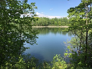
The Greenbelt is a 203.5-square-kilometre (78.6 sq mi) protected green belt traversing Ottawa, Ontario, Canada. It includes green space, forests, farms, and wetlands from Shirleys Bay in the west and to Green's Creek in the east. It is the largest publicly owned green belt in the world and the most ecologically diverse area in Eastern Ontario. The National Capital Commission (NCC) owns and manages 149.5 square kilometres (57.7 sq mi), and the rest is held by other federal government departments and private interests. Real estate development within the Greenbelt is strictly controlled.

<span class="mw-page-title-main">Ottawa—Vanier (federal electoral district)</span> Federal electoral district in Ontario, Canada

Ottawa—Vanier is a federal electoral district in Ontario, Canada, that has been represented in the House of Commons of Canada since 1935. Previous to that date, it was part of the Ottawa electoral district that returned two members.

<span class="mw-page-title-main">Orléans (federal electoral district)</span> Federal electoral district in Ontario, Canada

Orléans is a federal electoral district in Ottawa, Ontario, Canada, that has been represented in the House of Commons of Canada since 1988.

<span class="mw-page-title-main">National Capital Region (Canada)</span> Metropolitan area in Canada

The National Capital Region (NCR), also known as Canada's Capital Region and Ottawa–Gatineau, is an official federal designation encompassing the Canadian capital of Ottawa, Ontario, the adjacent city of Gatineau, Quebec, and surrounding suburban and exurban areas. Despite its designation, the NCR is not a separate political or administrative entity and falls within the provinces of Ontario and Quebec.

Chapel Hill is a neighbourhood in the east end Ottawa, Ontario, Canada within the community of Orleans. It is considered an outer-suburb of Ottawa, and before the 2001 amalgamation of the city of Ottawa, it was part of the former City of Gloucester. Chapel Hill consists of mostly single family homes situated next to the National Capital Commission (NCC) Greenbelt and surrounding rural areas. The area is divided into two parts by Innes Road: Chapel Hill North and Chapel Hill South. The northern half is represented by the Chapel Hill North Community Association, while the southern half is represented by the Chapel Hill South Community Association. The boundaries of Chapel Hill North are St. Joseph Blvd (north), Boyer Rd (east), Innes Rd (south) and the greenbelt (west).

<span class="mw-page-title-main">Beacon Hill, Ottawa</span> Neighbourhood in Ottawa, Ontario, Canada

Beacon Hill is a neighbourhood located in Beacon Hill-Cyrville Ward in the east end of Ottawa, Ontario, Canada. Beacon Hill was a part of the City of Gloucester until it was amalgamated with the new city of Ottawa in 2001.

<span class="mw-page-title-main">Orleans, Ontario</span> Suburb of Ottawa, Ontario, Canada

Orleans is a community in Ottawa, Ontario, Canada. It is located in the east end of the city along the Ottawa River, about 16 km (10 mi) from Downtown Ottawa. The Canada 2021 Census determined that Orléans' population was 125,937. Before being amalgamated into Ottawa in 2001, the community of Orléans was spread over two municipal jurisdictions, the eastern portion being in the pre-amalgamation City of Cumberland, the western portion in the City of Gloucester. According to the 2021 census, 75,453 people lived in the Cumberland portion of Orleans, while 50,484 lived in the Gloucester portion. Today, Orléans spans the municipal wards of Orléans East-Cumberland, Orléans West-Innes, and Orléans South-Navan. Orléans contains a significant francophone population.

<span class="mw-page-title-main">Innes Road</span>

Innes Road is one of the most important corridors in the east end of the City of Ottawa, Ontario, Canada, running through the former cities of Gloucester and Cumberland. It is the main route serving Blackburn Hamlet and south Orléans, as well as several industrial and commercial areas in east Ottawa.

<span class="mw-page-title-main">LeBreton Flats</span> Neighbourhood in Ottawa, Ontario, Canada

LeBreton Flats known colloquially as The Flats is a neighbourhood in Somerset Ward in central Ottawa, Ontario, Canada. It lies to the west of Centretown neighbourhood, and to the north of Centretown West. The Ottawa River forms the western and northern limit, with the western side being a wider area of the river known as Nepean Bay.

<span class="mw-page-title-main">Alta Vista, Ottawa</span> Neighbourhood in Ottawa, Ontario, Canada

Alta Vista is a neighbourhood in Alta Vista Ward in Ottawa, Ontario, Canada. Its boundaries according to the Alta Vista Community Association are that part of Alta Vista Ward south of Smyth Road in the north, north of Walkley Road and east of the Rideau River, and west of the "greenspace underneath Haig Drive". However, the name is ambiguous, as there are several sub-neighbourhoods in this area,, as the neighbourhood could refer to the ward as a whole, down to the core Alta Vista area,, centred on Alta Vista Drive.

<span class="mw-page-title-main">Bells Corners</span> Community in Ontario, Canada

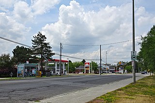
Bells Corners is a suburban neighbourhood in Ottawa, Ontario, Canada. It is located along Robertson Road west of downtown, within Ottawa's western Greenbelt, in College Ward. As of the Canada 2016 Census, the community had a population of 9,272.

Bridlewood is a neighbourhood in Kanata South Ward in the western part of Ottawa, Ontario, Canada. Bridlewood was part of the Township of Nepean until 1978, and then part of the City of Kanata until 2001, when that city amalgamated with the City of Ottawa.

<span class="mw-page-title-main">Langdon, Alberta</span> Hamlet in Alberta, Canada

Langdon is a hamlet in southern Alberta, Canada under the jurisdiction of Rocky View County. It previously held village status between August 31, 1907, and January 1, 1946.

<span class="mw-page-title-main">Pineview, Ottawa</span> Neighbourhood in Ottawa, Ontario, Canada

Pineview is a neighbourhood in Beacon Hill-Cyrville Ward in the east end of Ottawa, Ontario, Canada. Prior to amalgamation in 2001, the neighbourhood was part of the City of Gloucester. As of the Canada 2021 Census, the neighbourhood had a population of 6,179.

<span class="mw-page-title-main">Orléans West-Innes Ward</span> Place in Ontario, Canada

Orléans West-Innes Ward is a city ward in the city of Ottawa, Ontario, Canada. It is located in the eastern end of the city, containing the western half of Orleans subdivision plus the community of Blackburn Hamlet. The ward is represented on Ottawa City Council by Laura Dudas.

Lodgepole is a hamlet in central Alberta, Canada within Brazeau County. It is located approximately 31 kilometres (19 mi) west of Highway 22 and 131 kilometres (81 mi) southwest of Edmonton.

<span class="mw-page-title-main">Hawthorne Meadows</span> Neighbourhood in Ottawa, Ontario, Canada

Hawthorne Meadows is a neighbourhood in Alta Vista Ward in southeast Ottawa, Ontario, Canada. It is triangular in shape; it is bounded on the west by St. Laurent Boulevard, on the northeast by Russell Road and on the south by Walkley Road. According to the Canada 2016 Census, the population of this area was 3,577.

References

  1. 1 2 3 For 1991 Canadian Census data, see "1991 Census Area Profiles". Statistics Canada. Retrieved 24 July 2018.
    For 1996 Canadian Census data, see "1996 Census Area Profiles". Statistics Canada. Retrieved 24 July 2018.
    For 2001 Canadian Census data, see "2001 Census Area Profiles". Statistics Canada. Retrieved 24 July 2018.
    For 2006 Canadian Census data for Census Tract 0125.01, see "2006 Census tract profile for 0125.01". Statistics Canada. Retrieved 24 July 2018.
    For 2006 Canadian Census data for Census Tract 0125.02, see "2006 Census tract profile for 0125.02". Statistics Canada. Retrieved 24 July 2018.
    For 2011 Canadian Census data for Census Tract 0125.01, see "2011 Census tract profile for 0125.01". Statistics Canada. Retrieved 24 July 2018.
    For 2011 Canadian Census data for Census Tract 0125.02, see "2011 Census tract profile for 0125.02". Statistics Canada. Retrieved 24 July 2018.
    For 2016 Canadian Census data for Census Tract 0125.01, see "2016 Census tract profile for 0125.01". Statistics Canada. Retrieved 24 July 2018.
    For 2016 Canadian Census data for Census Tract 0125.02, see "2016 Census tract profile for 0125.02". Statistics Canada. Retrieved 24 July 2018.
  2. "Blackburn Hamlet Description". Ottawa Neighbourhood Study. Retrieved 12 August 2015.
  3. "Technical and Protective Operations Facility". Government of Canada. Retrieved 12 August 2015.
  4. "Galipeau's Good Sense". Ottawa Citizen. 24 January 2007. Retrieved 12 August 2015.[ permanent dead link ]
  5. "About the BCA". Blackburn Hamlet Community Association. Retrieved 16 July 2016.
  6. "Blackburn Hamlet - Ottawa Neighbourhoods". Ottawa Living. Archived from the original on 24 October 2015. Retrieved 20 August 2015.
  7. 1 2 Bisson, Chris. "Forests For The People: Resisting Neoliberalism Through Permaculture Design" (PDF). Carleton University. Retrieved 12 August 2015.
  8. 1 2 "Historic Gloucester" (PDF). Gloucester History. Retrieved 13 August 2015.
  9. 1 2 3 "To be renamed after early settlers and builders" (PDF). Blackburn Banar. September 2007. Retrieved 20 August 2015.[ permanent dead link ]
  10. "A New Plaque Remembers Former Reeve John Innes" (PDF). Historic Gloucester. 14 (3). Gloucester Historical Society: 8. Fall 2013.
  11. Adams, Nicholas. "An Archaeological Assessment (Stages 1 & 2) of the proposed Bradley East Subdivision Development" (PDF). City of Ottawa. Valecraft Homes Limited. Archived from the original (PDF) on 2016-03-04. Retrieved 19 August 2015.
  12. Johnston, Grace. "Where was the Blackburn Station?" (PDF). Blackburn Hamlet. Blackburn Banar. Archived from the original (PDF) on 23 September 2015. Retrieved 20 August 2015.
  13. Budd, Evelyn. "History of Blackburn Hamlet". Blackburn Hamlet Living. Archived from the original on 23 September 2015. Retrieved 20 August 2015.
  14. "Greenbelt Master Plan Summary" (PDF). NCC. Retrieved 13 August 2015.
  15. Paquet, Laura Byrne; Uren, Janet. "Best Neighbourhood Enclaves 2013: East". Ottawa Magazine. Retrieved 13 August 2015.
  16. Anderson, Mark (31 December 2008). "All's Well in the Hamlet". Ottawa Citizen. Archived from the original on 4 March 2016. Retrieved 13 August 2015.
  17. "Some Blackburn History". Budd Gardens. Retrieved 13 August 2015.
  18. "Facilities". Ottawa Gloucester Hornets Soccer. Archived from the original on 18 October 2015. Retrieved 12 August 2015.
  19. "Superdome". City of Ottawa. Archived from the original on 20 January 2016. Retrieved 12 August 2015.
  20. "Yeadon®'s Most Recent Successful Project March 2005". Yeadon Air Supported Structures. Retrieved 12 August 2015.
  21. "Blackburn Arena Ice Skating Rink". Rinktime. Archived from the original on 28 May 2015. Retrieved 12 August 2015.
  22. "Tobogganing in the Greenbelt". NCC. Retrieved 12 August 2015.
  23. Pearson, Matthew (23 October 2014). "Ottawa Votes: Tight, four-way race grips Innes ward". Ottawa Citizen . Retrieved 20 July 2018.
  24. Skura, Elyse (16 May 2018). "Taking care of seniors, reducing bills are front of mind in Orléans". CBC News . Retrieved 20 July 2018.
  25. "Federal Election 2015: Orléans riding results". Global News . Retrieved 20 July 2018.
  26. "About the Blackburn Community Association". Blackburn Community Association. Retrieved 23 July 2018.
  27. "Blackburn Community Association – Board of Directors, Roles and Responsibilities" (PDF). Blackburn Community Association. Retrieved 23 July 2018.
  28. "Contact Us". Blackburn Community Association. Retrieved 23 July 2018.
  29. For pre 1986 data, see https://edumaps.esri.ca/census/?data_id=dataSource_4-187de62b8f1-layer-5%3A38394