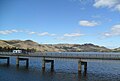
Tallangatta is a town in north-eastern Victoria, Australia. The town lies on the banks of the Mitta Arm of Lake Hume, approximately 38 kilometres (24 mi) south-east of Albury-Wodonga along the Murray Valley Highway. At the 2021 census, Tallangatta had a population of 1,175.

The City of Kawartha Lakes is a unitary municipality in Central Ontario, Canada. It is a municipality legally structured as a single-tier city; however, Kawartha Lakes is the size of a typical Ontario county and is mostly rural. It is the second largest single-tier municipality in Ontario by land area.

Mansfield is a small town in the foothills of the Victorian Alps in the Australian state of Victoria. It is approximately 180 kilometres (110 mi) north-east of Melbourne by road. The population around Mansfield was 4,787 as at the 2016 census. The town itself has 3410 persons.

Healesville is a town in Victoria, Australia, 52 km north-east from Melbourne's central business district, located within the Shire of Yarra Ranges local government area. Healesville recorded a population of 7,589 at the 2021 census.

Lilydale is a town and outer suburb of Melbourne, Victoria, Australia, 34 km north-east from Melbourne's central business district, located within the Shire of Yarra Ranges local government area. Lilydale recorded a population of 17,348 at the 2021 census.

Reservoir is a suburb in Melbourne, Victoria, Australia, 11 km (6.8 mi) north of Melbourne's Central Business District, located within the City of Darebin local government area. Reservoir recorded a population of 51,096 at the 2021 census.

The Eildon Dam or Eildon Weir, a rock and earth-fill embankment dam with a controlled spillway across the Goulburn River, is located between the regional towns of Mansfield and Eildon within Lake Eildon National Park, in the Alpine region of Victoria, Australia. The dam's purpose is for the supply of potable water, irrigation, and the generation of hydroelectricity. The impounded reservoir is called Lake Eildon.
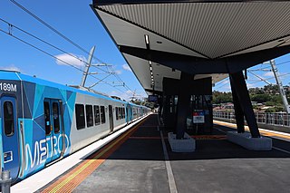
Lilydale railway station is the terminus of the suburban electrified Lilydale line in Victoria, Australia. It serves the north-eastern Melbourne suburb of Lilydale, and it opened on 1 December 1882 as Lillydale.

Drysdale is a rural township near Geelong, Victoria, Australia, located on the Bellarine Peninsula. The town has an approximate population of over 3,700. Drysdale forms part of an urban area, along with nearby Clifton Springs, that had an estimated population of 13,494 at June 2016.
Eildon is a town in Victoria, Australia. It is located near Lake Eildon, on the Goulburn Valley Highway, in the Shire of Murrindindi local government area. At the 2016 census, Eildon had a population of 974.

Alexandra is a significant regional centre in north-east Victoria, Australia, 130 kilometres north-east of the State Capital, Melbourne. It is located at the junction of the Goulburn Valley Highway (B340) and Maroondah Highway (B360), in the Shire of Murrindindi local government area. At the 2016 census, the town had a population of 2,695 and the broader area a population of 6420.

Foster is a dairying and grazing town 174 kilometres (108 mi) south-east of Melbourne on the South Gippsland Highway in Victoria, Australia. At the 2016 census Foster had an urban population of 1,164. It is about 20 kilometres (12 mi) north of the Gippsland coastline which includes Shallow Inlet, Corner Inlet, Waratah Bay, Yanakie and Wilsons Promontory.

Jamieson is a small town in Victoria, Australia. It is located at the junction of the Goulburn River and Jamieson River, 193 kilometres (120 mi) north-east of Melbourne. The name is believed to have been derived from George Jamieson, a shepherd who grazed sheep in the area in the 1850s. At the time of the 2016 census, Jamieson had a population of 301.
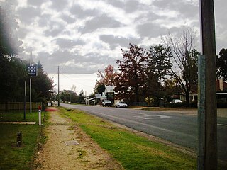
Whitfield is an agricultural township in the King Valley in north-eastern Victoria.

Bruthen is a small town located alongside the Tambo River between Bairnsdale and Ensay on the Great Alpine Road in East Gippsland, Victoria, Australia. At the 2016 census, Bruthen had a population of 814. Bruthen is 26 km (16 mi) east of Bairnsdale and 311 km (193 mi) east of the state capital Melbourne.
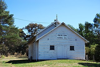
Merton is a small town on the Maroondah Highway in north-east Victoria, Australia, west of Bonnie Doon. At the 2016 census, Merton had a population of 190.
Toongabbie is a small country town located in southeastern Victoria Australia, 177 kilometres (110 mi) from Melbourne and just north of Traralgon. The railway station was closed in 1986 and the former railway line has now been incorporated into the Gippsland Plains Rail Trail. At the 2016 census, Toongabbie had a population of 500.
The Mansfield railway line was a branch line in the Goulburn Valley of northern Victoria, Australia, branching from the main North East line at Tallarook station and heading east into mountainous territory.
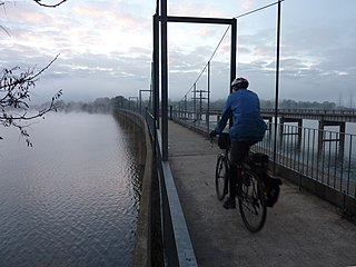
The Great Victorian Rail Trail is the second longest rail trail in Australia, following the route of the former railway line from Tallarook, the Mansfield Railway and Alexandra Railway in north central Victoria, Australia, about 100 kilometres (62 mi) north-east of Melbourne. The trail surface is partially granitic sand and partly chert.
Thornton is a small town in nestling on the banks of the Goulburn River in the state of Victoria, Australia. It is in the Shire of Murrindindi local government area. The town is approximately halfway between Alexandra and Eildon. The town had a population of 299 at the 2016 census.