Related Research Articles

Idaho County is a county in the U.S. state of Idaho, and the largest by area in the state. As of the 2010 census, the population was 16,267. The county seat is Grangeville. Previous county seats of the area were Florence (1864–68), Washington (1868–75), and Mount Idaho (1875–1902).

South Buffalo Township is a township in Armstrong County, Pennsylvania, United States. The population was 2,636 at the 2010 census.

The Gospel Hump Wilderness is a federally-protected wilderness area that covers 205,796 acres (83,283 ha) of the state of Idaho. Managed by the U.S. Forest Service in the U.S. Department of Agriculture, it received wilderness designation on February 24, 1978 through the passage of the Endangered American Wilderness Act and is part of Nez Perce National Forest. As part of the National Wilderness Preservation System, the Gospel Hump Wilderness is an area where human development and use are restricted and people are to remain only visitors.

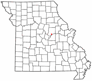
Tebbetts is an unincorporated community in southern Callaway County, Missouri, United States. It is part of the Jefferson City, Missouri Metropolitan Statistical Area. Tebbetts is located on Route 94, approximately eight miles east of Jefferson City, on the north edge of the Missouri River floodplain, at 38°37′14″N91°57′45″W.
There are several lakes named Mud Lake within the U.S. state of Idaho.
Ascalon is an unincorporated community in St. Louis County, Missouri, United States located just south of St. Ann. It sits at an elevation of 656 feet.

Miller is an unincorporated community in Madison Township, Morgan County, in the U.S. state of Indiana.

Cecile is an unincorporated community in Fresno County, California. It is located on the Atchison, Topeka and Santa Fe Railroad 1.5 miles (2.4 km) northeast of Malaga, at an elevation of 305 feet.

Collins is a former settlement in Fresno County, California. It lay at an elevation of 443 feet. Collins still appeared on maps as of 1922.

Tarpey is an unincorporated community in Fresno County, California. It is located on the Southern Pacific Railroad 2.25 miles (3.6 km) south of Clovis, at an elevation of 344 feet.

Elk City is a census-designated place in Idaho County, Idaho, United States. As of the 2010 census, its population was 202.

The Clearwater River is in the northwestern United States, in north central Idaho. Its length is 74.8 miles (120.4 km), it flows westward from the Bitterroot Mountains along the Idaho-Montana border, and joins the Snake River at Lewiston. In October 1805, the Lewis and Clark Expedition descended the Clearwater River in dugout canoes, putting in at "Canoe Camp," five miles (8 km) downstream from Orofino; they reached the Columbia Bar and the Pacific Ocean about six weeks later.
Watkins Corner is an unincorporated community located in Brunswick County, in the U.S. state of Virginia.
Hump Butte is a summit in South Dakota, in the United States. With an elevation of 2,431 feet (741 m), Hump Butte is the 453rd highest summit in the state of South Dakota.
Junction is an unincorporated community in Lemhi County, in the U.S. state of Idaho.
Williams Peak is a summit in the U.S. state of Idaho, with an elevation of 6,814 feet (2,077 m).
Saulsburg is an unincorporated community in Huntingdon County, in the U.S. state of Pennsylvania.
References
- ↑ U.S. Geological Survey Geographic Names Information System: Buffalo Hump (Idaho)
- ↑ Rees, John E. (1918). Idaho Chronology, Nomenclature, Bibliography. W.B. Conkey Company. p. 61.
Coordinates: 45°37′14″N115°42′03″W / 45.62056°N 115.70083°W
| This Idaho County, Idaho state location article is a stub. You can help Wikipedia by expanding it. |