Business routes of U.S. Route 41 in Wisconsin

Last updated

Business plate.svg

US 41 (WI).svg

Business U.S. Highway 41

Location
Country United States
State Wisconsin
Highway system

A total of three business routes of U.S. Route 41 exist in Wisconsin. Additionally, there were four business routes that have since been disestablished. Business routes typically run through cities, after a highway was realigned. None are official state highways according to the Wisconsin Department of Transportation (WisDOT) and are thus locally maintained, with the exception of the route through De Pere and Ashwaubenon.

Contents

Appleton

Business plate.svg

US 41 (WI).svg

Business U.S. Highway 41

Location Appleton, Wisconsin
HistorySigned as City US 41 before 1963

Business U.S. Highway 41 (Bus. US 41) was a business loop in Appleton. The route was decommissioned in 1999. [1] [2]

De Pere

Business Highway 41 in De Pere follows the old alignment of US 41. It is only two thirds of a mile long, extending until Ashwaubenon. [3] This route was designated and is maintained by the WisDOT.

Fond du Lac

Business plate.svg

US 41 (WI).svg

Business U.S. Highway 41

Location Fond du Lac, Wisconsin
Existed1952–1980
HistorySigned as City US 41 before 1963

Business U.S. Highway 41 (Bus. US 41) was a business loop in Fond du Lac. It was formed as City U.S. Highway 41 in 1952, using the former route of US 41 when an expressway bypass of Fond du Lac was completed. [4] [5] The route was decommissioned in 1980. [6] [7]

Green Bay

Business plate.svg

US 41 (WI).svg

Business U.S. Highway 41

Location Green Bay, Wisconsin
Existed1969–1998

Business U.S. Highway 41 (Bus. US 41) was a business loop in Green Bay. It was formed in 1969, using the former route of US 41 when an expressway bypass of Green Bay was completed. The route was temporarily designated as Wisconsin Highway 119 from 1968 to 1969. [8] [9] [10] In 1975, a freeway bypass of the Ashwaubenon–De Pere area was completed, and Business 41 was extended on the former route of US 41. [11] [12] In 1998, most of the route was retired, except for a freeway spur into Ashwaubenon–De Pere. [13] [1]

Oconto

Business Highway 41 in Oconto follows the former alignment of US 41. [14]

Oshkosh

Business plate.svg

US 41 (WI).svg

Business U.S. Highway 41

Location Oshkosh, Wisconsin
Existed1952–1980
HistorySigned as City US 41 before 1963

Business U.S. Highway 41 (Bus. US 41) was a business loop in Oshkosh. It was formed as City U.S. Highway 41 in 1952, using the former route of US 41 when an expressway bypass of Oshkosh was completed. [4] [5] The route was decommissioned in 1980. [6] [7]

Peshtigo

Business Highway 41 in Peshtigo follows the former alignment of US 41. [15]

See also

Related Research Articles

<span class="mw-page-title-main">U.S. Route 141</span> U.S. Highway in Michigan and Wisconsin

US Highway 141 (US 141) is a north–south United States Numbered Highway in the states of Wisconsin and Michigan. The highway runs north-northwesterly from an interchange with Interstate 43 (I-43) in Bellevue, Wisconsin, near Green Bay, to a junction with US 41/M-28 near Covington, Michigan. In between, it follows city streets in Green Bay and has a concurrent section with US 41 in Wisconsin. North of Green Bay, US 141 is either a freeway or an expressway into rural northern Wisconsin before downgrading to an undivided highway. In Michigan, US 141 is an undivided highway that runs through rural woodlands. The highway has two segments in each state; after running through Wisconsin for about 103 miles (166 km), it crosses into Michigan for approximately another eight miles (13 km). After that, it crosses back into Wisconsin for about 14+12 miles (23 km) before crossing the state line one last time. The northernmost Michigan section is about 43+12 miles (70 km), making the overall length about 169 miles (272 km).

<span class="mw-page-title-main">U.S. Route 8</span> U.S. Highway in Minnesota, Wisconsin, and Michigan

U.S. Highway 8 (US 8) is a United States Numbered Highway that runs primarily east–west for 280 miles (451 km), mostly within the state of Wisconsin. It connects Interstate 35 (I-35) in Forest Lake, Minnesota, to US 2 at Norway in the Upper Peninsula of Michigan near the border with Wisconsin. Except for the short freeway segment near Forest Lake, and sections near the St. Croix River bridge and Rhinelander, Wisconsin, it is mostly an undivided surface road. As a state highway in the three states, US 8 is maintained by the Minnesota, Wisconsin and Michigan departments of transportation.

<span class="mw-page-title-main">Wisconsin Highway 67</span> Highway in Wisconsin

State Trunk Highway 67 is a Wisconsin state highway running from the Wisconsin–Illinois state line east of Beloit north to U.S. Highway 151 (US 151) east of Chilton. With the inclusion of the new Oconomowoc bypass, WIS 67 is approximately 160 miles (260 km) in length.

<span class="mw-page-title-main">Wisconsin Highway 157</span>

State Trunk Highway 157 is a short state highway in the US state of Wisconsin. It runs east on Main Street from WIS 35 in downtown Onalaska to the US Highway 53 (US 53) freeway. There it turns south, running concurrently with US 53 to the Interstate 90 (I-90) interchange. US 53 leaves WIS 157 to head west on I-90, but WIS 157 continues southeast to WIS 16 at the Valley View Mall.

<span class="mw-page-title-main">Wisconsin Highway 62</span>

State Trunk Highway 62 was a state highway in the U.S. state of Wisconsin. Its latest routing ran north–south on South Packard and Kinnickinnic avenues within the cities of Cudahy, St. Francis, and Milwaukee. Maintenance was turned back to the cities in 1999, and signs were removed, after the completion of the Lake Parkway (WIS 794).

<span class="mw-page-title-main">Wisconsin Highway 86</span>

State Trunk Highway 86 is a state highway in the U.S. state of Wisconsin. It runs east–west in north central Wisconsin from Ogema to Tomahawk.

<span class="mw-page-title-main">Wisconsin Highway 89</span> Highway in Wisconsin

State Trunk Highway 89 is a 72-mile (116 km) state highway in the southeastern part of the U.S. state of Wisconsin. It travels south to north from near Delavan to Columbus.

<span class="mw-page-title-main">Wisconsin Highway 91</span>

State Trunk Highway 91 is a state highway in the U.S. state of Wisconsin. It runs east–west in east-central Wisconsin from near Berlin to Oshkosh.

<span class="mw-page-title-main">Wisconsin Highway 93</span> Highway in Wisconsin

State Trunk Highway 93 is a state highway in the U.S. state of Wisconsin. It runs north–south in west-central Wisconsin from near Holmen to Eau Claire.

<span class="mw-page-title-main">Wisconsin Highway 128</span>

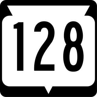
State Trunk Highway 128 is a 27.04 miles (43.52 km) state highway in Pierce and St. Croix counties in Wisconsin, United States. It runs in north–south in northwest Wisconsin from near Elmwood to Forest.

<span class="mw-page-title-main">Wisconsin Highway 143</span> Former state highway in Washington and Ozaukee counties in Wisconsin, United States

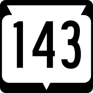
State Trunk Highway 143 was a 7.5-mile (12.1 km) state highway in Washington and Ozaukee counties in Wisconsin, United States, that ran east–west between south of West Bend and Cedarburg.

<span class="mw-page-title-main">Wisconsin Highway 149</span>

State Trunk Highway 149 was a state highway in the U.S. state of Wisconsin. It ran through 40.1 miles (64.5 km) of Manitowoc, Calumet, and Fond du Lac counties.

<span class="mw-page-title-main">Wisconsin Highway 150</span>

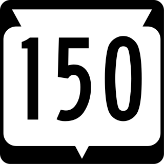
State Trunk Highway 150 was a state highway in the U.S. state of Wisconsin. It ran east–west between Winchester and Neenah. In 2003, the road was turned over to Winnebago County, which now maintains it as County Trunk Highway II (CTH-II).

<span class="mw-page-title-main">Wisconsin Highway 160</span>

State Trunk Highway 160 is a state highway in the US state of Wisconsin. It runs in east–west in east-central Wisconsin from Angelica to Pulaski.

<span class="mw-page-title-main">Wisconsin Highway 163</span>

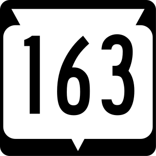
State Trunk Highway 163 was a state highway in the U.S. state of Wisconsin. It ran north–south between Mishicot and Luxemburg. The road was turned over to county control in 1999, and it is now designated as County Trunk Highway B (CTH-B) in Manitowoc County and CTH-AB in Kewaunee County.

<span class="mw-page-title-main">Wisconsin Highway 168</span>

State Trunk Highway 168 was a state highway in the U.S. state of Wisconsin. It ran east–west for 5.93 miles (9.54 km) between Nichols and Seymour. Because it paralleled WIS 54 and WIS 156, the road was turned over to Outagamie County control in 2003, and is now designated as County Trunk Highway VV (CTH-VV).

<span class="mw-page-title-main">Wisconsin Highway 61</span> Wisconsin state highway

State Trunk Highway 61 was a number assigned to a state highway in the U.S. state of Wisconsin. It traveled roughly along:

<span class="mw-page-title-main">Business routes of U.S. Route 12 in Wisconsin</span>

A total of four business routes of U.S. Highway 12 (US 12) currently exist in Wisconsin. Business routes typically run through cities, after a highway was realigned. None are official state highways according to the Wisconsin Department of Transportation (WisDOT) and are thus locally maintained.

<span class="mw-page-title-main">Wisconsin Highway 135</span> Highway in the U.S. state of Wisconsin

State Trunk Highway 135 (WIS 135) was a state highway in the U.S. state of Wisconsin. At its latest routing, it traveled from WIS 59 in Palmyra to WIS 106 near Hebron.

<span class="mw-page-title-main">Special routes of U.S. Route 51</span>

Several special routes exist for U.S. Route 51.

References

  1. 1 2 Wisconsin Department of Transportation Division of Highways (1997). Wisconsin Highway Map (PDF) (Map) (1997–1998 ed.). 1:823,680. Madison: Wisconsin Department of Transportation. Retrieved February 5, 2023.
  2. Wisconsin Department of Transportation (1999). Official State Highway Map (PDF) (Map) (1999–2000 ed.). 1:823,680. Madison: Wisconsin Department of Transportation. OCLC   47286364 . Retrieved February 5, 2023.
  3. "Wisconsin Highways: Business Connections". www.wisconsinhighways.org. Retrieved 2020-11-27.
  4. 1 2 State Highway Commission of Wisconsin (1951). Official Highway Map of Wisconsin (PDF) (Map). 1:887,040. Madison: State Highway Commission of Wisconsin. Retrieved February 5, 2023 via Wikimedia Commons.
  5. 1 2 State Highway Commission of Wisconsin (1952). Official Highway Map of Wisconsin (PDF) (Map). 1:887,040. Madison: State Highway Commission of Wisconsin. OCLC   192095828 . Retrieved February 5, 2023 via Wikimedia Commons.
  6. 1 2 Wisconsin Department of Transportation Division of Highways (1978). Wisconsin Highway Map (PDF) (Map) (1978–1979 ed.). 1:823,680. Madison: Wisconsin Department of Transportation. OCLC   174123957 . Retrieved February 5, 2023.
  7. 1 2 Wisconsin Department of Transportation Division of Highways (1980). Wisconsin Highway Map (PDF) (Map) (1980–1981 ed.). 1:823,680. Madison: Wisconsin Department of Transportation. OCLC   613423704, 77526920 . Retrieved February 5, 2023.
  8. State Highway Commission of Wisconsin (1967). Wisconsin Highway Map (Map). 1:823,680. Madison: State Highway Commission of Wisconsin. Retrieved February 5, 2023 via American Geographical Society Library Digital Map Collection.
  9. State Highway Commission of Wisconsin (1969). Wisconsin Highway Map (Map). Scale not given. Madison: State Highway Commission of Wisconsin. Retrieved February 5, 2023 via American Geographical Society Library Digital Map Collection.
  10. Wisconsin Department of Transportation Division of Highways (1971). Wisconsin Highway Map (Map). 1:823,680. Madison: Wisconsin Department of Transportation. OCLC   698331116, 233595194 . Retrieved February 5, 2023 via American Geographical Society Library Digital Map Collection.
  11. Wisconsin Department of Transportation Division of Highways (1973). Wisconsin Highway Map (Map). 1:823,680. Madison: Wisconsin Department of Transportation. Retrieved February 5, 2023 via American Geographical Society Library Digital Map Collection.
  12. Wisconsin Department of Transportation Division of Highways (1975). Wisconsin Highway Map (Map). 1:823,680. Madison: Wisconsin Department of Transportation. Retrieved February 5, 2023 via American Geographical Society Library Digital Map Collection.
  13. Wisconsin Department of Transportation Division of Highways (1995). Wisconsin Highway Map (PDF) (Map) (1995–1996 ed.). 1:823,680. Madison: Wisconsin Department of Transportation. OCLC   300018174 . Retrieved February 5, 2023.
  14. "Wisconsin Highways: Business Connections". www.wisconsinhighways.org. Retrieved 2020-11-27.
  15. "Wisconsin Highways: Business Connections". www.wisconsinhighways.org. Retrieved 2020-11-27.