California State Route 244

Last updated

California 244.svg

State Route 244

California State Route 244
SR 244 highlighted in red
Route information
Maintained by Caltrans
Length1.08 mi [1]  (1.74 km)
ExistedJuly 1, 1964 [2] –present
Major junctions
West endI-80 (1961).svgBusiness Loop 80 (CA).svg I-80  / I-80 BL in Sacramento
East end Auburn Boulevard in Sacramento
Location
Country United States
State California
Counties Sacramento
Highway system
California 243.svg SR 243 California 245.svg SR 245

State Route 244 (SR 244) is an unsigned state highway in the U.S. state of California located northeast of Sacramento. It serves as a short freeway connection between the Interstate 80/Interstate 80 Business junction and Auburn Boulevard (the old Lincoln Highway - former U.S. Route 40/U.S. Route 99E). SR 244 was first added to the state highway system in 1959 as Legislative Route 288, and was renumbered as SR 244 in the 1964 renumbering. Portions of this route have been removed from the system as recently as 1994.

Contents

Route description

SR 244 starts just east of the westernmost ramps to the Watt Avenue exit off I-80. Just east of this, there are several connector ramps to both I-80 and Business I-80 as SR 244 passes under the terminus of Business I-80. SR 244 terminates at Auburn Boulevard, having just entered the Sacramento city limits near Renfree Park. [3]

SR 244 is part of the National Highway System, [4] a network of highways that are considered essential to the country's economy, defense, and mobility by the Federal Highway Administration. [5]

History

Legislative Route 288 was defined in 1959 as a proposed route from pre-1964 Legislative Route 3 and pre-1964 Legislative Route 242 (now I-80 and SR 51) northeast of Sacramento east to pre-1964 Legislative Route 249 (unbuilt State Route 65 - approximately Sunrise Boulevard) near Fair Oaks. [6] In the 1964 renumbering, this was assigned the number Route 244. [2]

In 1965, an extension was defined from SR 65 east to U.S. Route 50. In 1972 a series of "volatile" public hearings took place where local residents protested the construction of this route among others being proposed in the Sacramento area. [7] The project was expected to cost $40 million to construct and the resulting freeway would be eight lanes wide. [8] This extension to U.S. Route 50 was removed in 1975, and the route's definition was truncated to end at Fair Oaks Boulevard near San Juan Avenue. The public forums ended in mid-1976 after the Board of Supervisors abandoned plans for all three routes. [7] It was truncated further to Auburn Boulevard, its present terminus, in 1994. [9]

The bridges along the route date from 1971, a year after the bridges on I-80 to the west; [1] that part of I-80 was Interstate 880 until 1981. [2] [10]

Exit list

Except where prefixed with a letter, postmiles were measured on the road as it was in 1964, based on the alignment that existed at the time, and do not necessarily reflect current mileage. R reflects a realignment in the route since then, M indicates a second realignment, L refers to an overlap due to a correction or change, and T indicates postmiles classified as temporary (for a full list of prefixes, see California postmile § Official postmile definitions ). [11] Segments that remain unconstructed or have been relinquished to local control may be omitted. The entire route is in Sacramento County.

LocationPostmile
[11] [1] [12]
Exit
[13]
DestinationsNotes
0.00West plate blue 1961.svg
I-80 (1961).svg
I-80 west San Francisco
Westbound left exit and eastbound entrance; west end of SR 244; former I-880 west; I-80 east exit 94B
0.011AWatt AvenueWestbound exit and eastbound entrance
0.46East plate blue 1961.svg
I-80 (1961).svg
West plate California.svg
Business Loop 80 (CA).svg
I-80 east / I-80 BL west (Capital City Freeway) Reno, Sacramento
Westbound exit and eastbound entrance; I-80 BL west is former US 40 west / US 99E south / I-80 west; I-80 east is former US 40 east / US 99E north; access from I-80 westbound via exit 95; I‑80 BL east exit 14C, west exit 14A
Sacramento T1.08 Auburn Boulevard At-grade intersection; east end of SR 244; former US 40 / US 99E (prior to relocating on freeway alignment that is now I-80 and I-80 BL)
1.000 mi = 1.609 km; 1.000 km = 0.621 mi

See also

Related Research Articles

<span class="mw-page-title-main">California State Route 133</span> Highway in California

State Route 133 (SR 133) is a state highway in the U.S. state of California, serving as an urban route in Orange County. It connects SR 1 in Laguna Beach through the San Joaquin Hills with several freeways in Irvine, ending at the SR 241, a toll road in the latter city. It is built as an expressway from SR 73 to Laguna Canyon Road, and past this, SR 133 is a freeway to I-5, and a tollway to SR 241 near the Santa Ana Mountains.

<span class="mw-page-title-main">Santa Ana Freeway</span> Highway in California

The Santa Ana Freeway is one of the principal freeways in Southern California, connecting Los Angeles and its southeastern suburbs including the freeway's namesake, the city of Santa Ana. The freeway begins at its junction with the San Diego Freeway, called the El Toro Y, in Irvine, signed as I-5. From there, it generally goes southeast to northwest to the East Los Angeles Interchange, where it takes the designation of U.S. Route 101 (US 101). It then proceeds 2.95 miles (4.75 km) northwest to the Four Level Interchange in downtown Los Angeles. Formerly, the entirety of the route was marked as US 101 until the 1964 highway renumbering, which truncated US 101 to the East Los Angeles Interchange and designated the rest of the freeway as I-5.

<span class="mw-page-title-main">California State Route 160</span> Highway in California

State Route 160 is a state highway in the U.S. state of California consisting of two sections. The longer, southern, section is a scenic highway through the alluvial plain of the Sacramento River, linking SR 4 in Antioch with Sacramento via the Antioch Bridge. The northern section, separated from the southern by Sacramento city streets, is the North Sacramento Freeway, running from the 16th Street Bridge over the American River to Interstate 80 Business towards Roseville.

<span class="mw-page-title-main">California State Route 38</span> Highway in California

State Route 38 is a mostly rural and scenic state highway in the U.S. state of California, connecting Interstate 10 in Redlands with State Route 18 in the Big Bear Lake area. It is one of the primary routes into the San Bernardino Mountains. Despite the orientation of its alignment, SR 38 is assigned in a west–east direction.

<span class="mw-page-title-main">California State Route 3</span> State highway in California, United States

State Route 3 is a state highway in the U.S. state of California that serves Trinity and Siskiyou counties. It runs from SR 36 north along the shore of Trinity Lake, Fort Jones and Etna. The route then approaches Yreka, intersecting with Interstate 5 (I-5), and turns east to Montague. The road was numbered SR 3 in 1964, and most of it has been part of the state highway system since 1933.

<span class="mw-page-title-main">California State Route 275</span> Highway in California

State Route 275 is an unsigned state highway connecting West Sacramento, California and Downtown Sacramento. Since 1996, the highway has been legally defined to be the length of the Tower Bridge crossing the Sacramento River. Prior to that year, SR 275 was also known as the West Sacramento Freeway, and was a short spur connecting Interstate 80 Business / U.S. Route 50 in West Sacramento, and the Tower Bridge. SR 275 also extended east into Sacramento along the Capitol Mall from the bridge to 9th Street, just west of the California State Capitol. West Sacramento completed a project to replace the freeway with a pedestrian-friendly street named Tower Bridge Gateway.

<span class="mw-page-title-main">California State Route 16</span> State highway in California, United States

State Route 16 is a state highway in the northern region of the U.S. state of California that runs from Route 20 in Colusa County to Route 49 just outside Plymouth in Amador County, primarily crossing the Sacramento Valley. Much of the route through the Sacramento area is unsigned as it runs on a concurrency with the I-5 and US 50 freeways.

<span class="mw-page-title-main">California State Route 66</span> Highway in California

State Route 66 is a state highway in the U.S. state of California that runs along a section of old U.S. Route 66 in Los Angeles and San Bernardino counties. It goes from State Route 210 in La Verne east to Interstate 215 in San Bernardino, passing through Claremont, Upland, Rancho Cucamonga, Fontana and Rialto along Foothill Boulevard. In San Bernardino, it is the part of Fifth Street west of H Street.

<span class="mw-page-title-main">California State Route 142</span> Highway in California

State Route 142, also known as Carbon Canyon Road for most of its length, is a state highway in the U.S. state of California that connects Brea in Orange County with Chino Hills in San Bernardino County. The eastern portion of the route is known as Chino Hills Parkway.

<span class="mw-page-title-main">California State Route 34</span> Highway in California

State Route 34 is a state highway in the U.S. state of California. It runs through Ventura County from Rice Avenue in Oxnard to State Route 118 in Somis.

<span class="mw-page-title-main">California State Route 232</span> Highway in California

State Route 232 is a state highway in the U.S. state of California that runs along Vineyard Avenue in Ventura County, serving as a connector between US 101 in Oxnard and SR 118 near Saticoy.

<span class="mw-page-title-main">Topanga Canyon Boulevard</span> Highway in California

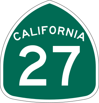
State Route 27, commonly known by its street name Topanga Canyon Boulevard, is a state highway in the U.S. state of California that runs from the Pacific Coast Highway at Topanga State Beach near Pacific Palisades, through the Topanga Canyon in Topanga, and continuing through Woodland Hills, Canoga Park, West Hills, and Chatsworth to the Ronald Reagan Freeway.

<span class="mw-page-title-main">California State Route 224</span> Former state highway in California

State Route 224 was a state highway in the U.S. state of California that served as a spur route in Santa Barbara County from U.S. Route 101 in Carpinteria to Carpinteria State Beach. The route existed from 1964 to 1996.

<span class="mw-page-title-main">California State Route 62</span> Highway in California

State Route 62 is a state highway in the U.S. state of California that cuts across the Little San Bernardino Mountains in Riverside and San Bernardino counties. It runs from Interstate 10 near White Water to the Arizona state line, passing through the city of Twentynine Palms and along the northern boundary of the Joshua Tree National Park.

<span class="mw-page-title-main">California State Route 70</span> Highway in California

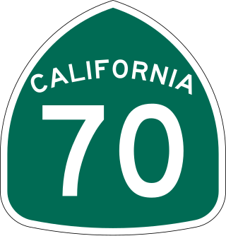
State Route 70 is a state highway in the U.S. state of California, connecting SR 99 north of Sacramento with U.S. Route 395 near Beckwourth Pass via the Feather River Canyon. Through the Feather River Canyon, from SR 149 to US 395, SR 70 is the Feather River Scenic Byway, a Forest Service Byway that parallels the ex-Western Pacific Railroad's Feather River Route.

<span class="mw-page-title-main">California State Route 115</span> Highway in California

State Route 115 is a state highway in the U.S. state of California. It runs in Imperial County from Interstate 8 (I-8) southeast of Holtville to SR 111 in Calipatria. The routing was added to the state highway system in 1933, and was constructed by 1934; SR 115 was officially designated in the 1964 state highway renumbering.

<span class="mw-page-title-main">California State Route 127</span> Highway in California

State Route 127 is a state highway in the U.S. state of California that connects Interstate 15 in Baker to Nevada State Route 373 at the Nevada state line, passing near the eastern boundary of Death Valley National Park. The entire length of the highway closely follows the central portion of the former Tonopah and Tidewater Railroad and loosely follows the Amargosa River.

<span class="mw-page-title-main">California State Route 174</span> Highway in California

State Route 174 is a state highway in the U.S. state of California. The two-lane 13-mile (21 km) highway in the western Sierra Nevada, added to the state highway system in 1933, connects Interstate 80 in Colfax with SR 20/SR 49 in Grass Valley, crossing the Bear River next to a 1924 concrete arch bridge. The majority of the route is eligible for the State Scenic Highway System, but local residents have blocked its designation due to property right concerns.

<span class="mw-page-title-main">California State Route 187</span> Highway in California

State Route 187 is a state highway in the U.S. state of California that runs along Venice Boulevard in Los Angeles from Lincoln Boulevard in Venice to Interstate 10 in the South Robertson district.

<span class="mw-page-title-main">U.S. Route 95 in California</span> Highway in California

U.S. Route 95 (US 95) is a United States Numbered Highway, stretching from the Mexican border in San Luis, Arizona to the Canadian border near Eastport, Idaho. The California portion of US 95 traverses through the far eastern edges of both Riverside and San Bernardino counties. US 95 serves Blythe and Needles and junctions with SR 62 at Vidal Junction.

References

  1. 1 2 3 California Department of Transportation (July 2007). "Log of Bridges on State Highways". Sacramento: California Department of Transportation. Retrieved February 7, 2009.
  2. 1 2 3 California State Assembly. "An act to add Section 253 and Article 3 (commencing with Section 300) to Chapter 2 of Division 1 of, and to repeal Section 253 and Article 3 (commencing with Section 300) of Chapter 2 of Division 1 of, the..." 1963 Session of the Legislature. Statutes of California. State of California. Ch. 385 p. 1171.
  3. Sacramento County Street Atlas (Map). Thomas Brothers. 2008.
  4. Federal Highway Administration (March 25, 2015). National Highway System: Sacramento, CA (PDF) (Map). Scale not given. Washington, DC: Federal Highway Administration. Retrieved September 4, 2017.
  5. Natzke, Stefan; Neathery, Mike & Adderly, Kevin (June 20, 2012). "What is the National Highway System?". National Highway System. Washington, DC: Federal Highway Administration. Retrieved July 1, 2012.
  6. California State Assembly. "An act to amend Sections 306, 320, 332, 351, 362, 365, 369, 374, 382, 388, 397, 407, 408, 409, 410, 415, 422, 435, 440, 446, 453, 456, 460, 467, 470, 476, 487, 492, 493, 494, 506, 521, 528, and 529..." 1959 Session of the Legislature. Statutes of California. State of California. Ch. 1062 p. 3121.
  7. 1 2 Coronado, Ramon (August 21, 2008). "For sale: A slice of highway". The Sacramento Bee . p. F1. Retrieved November 5, 2022 via Newspapers.com.
  8. Moriwaki, Lee (October 4, 1972). "No Freeways, Please". The Sacramento Bee. p. B2. Retrieved November 5, 2022 via Newspapers.com.
  9. California State Assembly. "An act to amend Section 2982.2 of, and to add Section 3068.2 to, the Civil Code, to amend Sections 40084.5, 40088, and 40089 of the Education Code, to amend Section 29601 of, to amend and renumber Section 14035.6 of, to..." 1993–1994 Session of the Legislature. Statutes of California. State of California. Ch. 1220.
  10. California State Assembly. "An act to amend...the Streets and Highways Code, relating to state highways". 1981–1982 Session of the Legislature. Statutes of California. State of California. Ch. 292.
  11. 1 2 California Department of Transportation. "State Truck Route List". Sacramento: California Department of Transportation. Archived from the original (XLS file) on June 30, 2015. Retrieved June 30, 2015.
  12. "All Traffic Volumes on CSHS". California Department of Transportation. 2005–2006. Retrieved February 7, 2009.
  13. "State Route 244 Freeway Interchanges" (PDF). California Numbered Exit Uniform System . California Department of Transportation. October 9, 2018. Retrieved July 11, 2021.
Template:Attached KML/California State Route 244
KML is from Wikidata