California State Route 88

Last updated

California 88.svg

State Route 88

California State Route 88.svg
SR 88 highlighted in red
Route information
Maintained by Caltrans
Length122 mi [1]  (196 km)
Tourist
routes
National Forest Scenic Byway.svg California Scenic State.svg Carson Pass Highway
Major junctions
West endCalifornia 99.svg SR 99 near Stockton
Major intersections
East endNevada 88.svg SR 88 at state line near Minden, NV
Location
Country United States
State California
Counties San Joaquin, Amador, Alpine
Highway system
California 87.svg SR 87 California 89.svg SR 89

State Route 88 (SR 88), also known as the Carson Pass Highway, [2] [3] is a state highway in the U.S. state of California. It travels in an east–west direction from Stockton, in the San Joaquin Valley, to the Nevada state line, where it becomes Nevada State Route 88, eventually terminating at U.S. Route 395 (US 395). The highway is so named as it crests the Sierra Nevada at Carson Pass. The highway corridor predates the era of the automobile; the path over Carson pass was previously used for the California Trail and the Mormon Emigrant Trail. The mountainous portion of the route is included in the State Scenic Highway System.

Contents

SR 88 is one of the few trans-Sierra state routes that Caltrans attempts to keep open year-round. Caltrans has winter closures in effect for all Sierra Nevada highway passes between Carson Pass and Walker Pass (SR 178), [4] a span of over 200 miles (320 km). SR 88 follows a ridge to ascend most of the western slope of the Sierra Nevada. [5] The highway is occasionally used as a detour when U.S. Route 50, which follows the South Fork American River to ascend the Sierra Nevada, is flooded or otherwise closed. [6] [7]

Route description

Spring storm on May 28, 2008 California State Route 88.jpg
Spring storm on May 28, 2008

SR 88 begins just outside Stockton as Waterloo Road, heading northeast towards Waterloo and Lockeford. After leaving the city, the route passes by several farms, vineyards and orchards, some of which have roadside stands and stores, in between the small towns in the San Joaquin Valley served by the route. [8] While passing through farming villages in the valley, the highway has a brief concurrency with SR 12. The two routes separate to pass along opposite sides of the Camanche Reservoir, where SR 88 enters Amador County. As the road enters Amador County, the route begins an ascent up the foothills of the Sierra Nevada towards Jackson. [5]

Between Sunnybrook and Martell, the road runs adjacent the corridor of the Amador Central Railroad, an abandoned freight rail line, purchased and operated by the Amador County Historical Society and other heritage railway enthusiasts who sponsor occasional train rides along the route. [9] [10] The route enters Jackson, the largest town traversed in the Sierra foothills by the highway. The highway runs concurrent with SR 49 through the town. Many locations along SR 49, including Jackson, originated as settlements during the California Gold Rush of 1849, and have a rich gold mining history. [11] [12] [13] Both routes 49 and 88 have been re-routed around the historic part of downtown and onto a four-lane road to the west of the historic district. [5] SR 88 separates from SR 49 and leaves Jackson following Jackson Creek to climb to the small town of Pine Grove. Along this ascent the road passes to the south of the Jackson Rancheria of Me-Wuk Indians and SR 88 is used as an access road for both the tribal nation and the Jackson Rancheria Casino Resort operated by the tribe. [14]

To scale the western slope of the Sierra Nevada, East of Pine Grove Highway 88 follows a ridge that separates the watershed of the North Fork Mokelumne River to the south of the highway, with a number of other watersheds to the north. At lower elevations the watershed to the north of this ridge is initially Sutter Creek, later the South Fork Cosumnes River, and later still that of the Middle Fork Cosmunes River. At the highest elevations the watershed to the north of the road and the ridge is the Silver Fork American River. Several overlooks are located at spots where SR 88 follows this ridge which provide views into the canyons of each of these rivers. For several miles this ridge, and by extension SR 88, form the boundary between Amador and El Dorado County. [5] In the lower parts of this ridge are the settlements of Pioneer and Buckhorn. Two small settlements are located in the higher elevations of this ridge, Cooks Station, and Ham's Station. Both of these are today known as locations where Caltrans implements traveling restrictions during winter storms, such as requiring tire chains, restricting certain vehicles or complete closures. [15] Where this ridge crosses the divide between the Cosumnes and American Rivers is where the road joins the Mormon Emigrant Trail, which follows a different ridge up the mountains from the modern U.S. Route 50 corridor near Sly Park. [5] This trail is so named for the Mormons in California during the gold rush, who created this path to rejoin the Mormon migration to Utah. [16] Just past Silver Lake, Route 88 reaches a geographic feature known as the Carson Spur. This is where this ridge effectively ends, and the road follows a dynamited path down to the Kirkwood Mountain Resort and the small town of Kirkwood, where the road crosses into Alpine County. [17] The Carson Spur section is prone to frequent avalanches in the winter and is periodically closed for avalanche control measures. [18] [19] In the final push up to Carson Pass the road passes by Caples Lake. [5]

Picture of the last freight train to run on the Amador Central Railroad before the line was retired, as it crosses SR 88 near Sunnybrook AF S12 10 with the last outbound June 4 04xRPx - Flickr - drewj1946.jpg
Picture of the last freight train to run on the Amador Central Railroad before the line was retired, as it crosses SR 88 near Sunnybrook

While the road uses ridges for the western approach to Carson Pass, the eastern approach rapidly descends into the West Fork Carson River canyon, reaching the river level in Hope Valley. Along this descent, the road features a view area overlooking Red Lake. The highway joins with SR 89 while inside the valley, at a place known as Pickett's Junction. The two routes run concurrent through Woodfords Canyon of the Carson River, which provides the final descent out of the Sierra Nevada. At the mouth of the canyon is the small town of Woodfords, where SR 89 separates from SR 88 and proceeds towards Markleeville. [5] Hope Valley, Woodsfords Canyon and Markleeville are often cited as one of the best areas for autumn foliage viewing in the state of California. [20] [21] Shortly after exiting the mountains the highway reaches the Carson Valley, where it turns due north and becomes one of the main thoroughfares of the valley. SR 88 reaches the Nevada state line where it becomes Nevada State Route 88 which proceeds due north towards U.S. Route 395. [17]

SR 88 is part of the California Freeway and Expressway System [22] and the National Highway System. [23] [24] The portion over the Sierra Nevada is included in the State Scenic Highway System [25] [26] [27] and is designated a National Forest Scenic Byway. [2] Per Annual Average Daily Traffic data for 2020, the western terminus near Stockton is the most heavily used part of the road, averaging 24,100 vehicles per day. The lightest traffic counts, 1,450 vehicles per day, are at the Kirkwood turnoff. However, Caltrans notes that there is significant seasonal variation for traffic at the ski resort, with peak month traffic counts increasing to 3,600 vehicles per day at this location. [28] Route 88 is one of three routes to continue with the same route number after crossing into Nevada, the others being Routes 28 and 266. [17]

History

SR 8 in Amador County, circa 1930s Amador County, CA 1930s%3F.jpg
SR 8 in Amador County, circa 1930s

The portion of Route 88 east of Antelope Springs, near Buckhorn, started as the Amador/Nevada Wagon Route, a toll road with a franchise granted in 1852 [29] and surveyed in 1857. [30] While the route was based on the existing Kit Carson trail and Old Emigrant Road, among the primary reasons for granting the toll road franchise was to fund a realignment of the portion from Tragedy Spring to Caples Lake. In its original form, the road connected these landmarks by looping around the Silver Lake basin, over a high mountain ridge near Emigrant Lake reaching an elevation of 9,640 feet (2,940 m). This was a treacherous routing, and was rerouted via blasting a path through the Carson Spur in 1863. [31] The path through the Carson Spur was re-dynamited and widened to its current form in 1960. [29]

The first numerical designation for the Amador County portion of modern SR 88 was SR 8, which overlaps the present highway from Alpine County to Jackson. Unlike modern SR 88, it continued south to Mokelumne Hill, then to Valley Springs along modern State Route 26 and a small portion of SR 49. A portion of modern Route 88 west of Jackson was then part of SR 104. [32] During the 1940s, maps of the area showed both the 8 and 88 designations in use. The original alignment south and west of Jackson retained the SR 8 designation, while the modern alignment of SR 88, where the roads existed, used the 88 designation. [33] [34]

Significant parts of the highway have been re-aligned and improved from the original wagon trail. A bypass of Jackson's historical district was completed in 1948. [11] The modern form of the highway was assigned the 88 designation by the time the California Department of Highways, predecessor agency to Caltrans, announced major upgrades for the highway were in progress or recently completed in 1958. Already completed was a re-alignment of the eastern approach to Carson Pass. Originally the eastern approach ran along the south shore of Red Lake. The realigned highway passes the lake to the north. This change lengthened the approach, but reduced the grade. Improvements expected to be completed soon included paving a road to be used for the highway west of Martell towards what is today SR 124 and re-alignments along parts of the ridge, including bypassing a mountain in the ridge area called Peddler's Hill. [35]

The highway was not originally maintained in the winter, but became the most recent trans-Sierra Nevada highway to remain open year round in 1971. This change coincided with a change in ownership, and construction to significantly expand what is now called the Kirkwood Mountain Resort - which lies between Carson Pass and the Carson Spur. The developers building the resort agreed to build and donate maintenance facilities for Caltrans and contribute funds for snow plowing. [36]

A view of a frozen Caples Lake, taken from California State Route 88 Caples Lake Jan 2017.jpg
A view of a frozen Caples Lake, taken from California State Route 88

Historical landmarks

The Carson Spur after a snowstorm showing snow levels exceeding the height of the passing cars 2023-01 Carson Spur CA-88.jpg
The Carson Spur after a snowstorm showing snow levels exceeding the height of the passing cars

As the SR 88 corridor has history that predates the automobile, there are a number of historical markers and landmarks along the roadway. These include:

Major intersections

Except where prefixed with a letter, postmiles were measured on the road as it was in 1964, based on the alignment that existed at the time, and do not necessarily reflect current mileage. R reflects a realignment in the route since then, M indicates a second realignment, L refers to an overlap due to a correction or change, and T indicates postmiles classified as temporary (for a full list of prefixes, see California postmile § Official postmile definitions ). [47] Segments that remain unconstructed or have been relinquished to local control may be omitted. The numbers reset at county lines; the start and end postmiles in each county are given in the county column.

CountyLocationPostmile
[47] [1] [28]
DestinationsNotes
San Joaquin
SJ 0.00-25.37
0.00Waterloo RoadContinuation beyond SR 99
0.00California 99.svg SR 99  Sacramento, Fresno Interchange; western end of SR 88; SR 99 exit 255
Lockeford L12.24West plate California.svg
California 12.svg
SR 12 west (Victor Road) Lodi
Western end of SR 12 overlap
13.60South plate county.svg
CR J5 jct.svg
CR J5 south (Jack Tone Road)
Western end of CR J5 overlap
14.08North plate county.svg
CR J5 jct.svg
CR J5 north (Elliott Road) / Tully Road
Eastern end of CR J5 overlap
Clements 19.17East plate California.svg
California 12.svg
SR 12 east San Andreas
Eastern end of SR 12 overlap
CR J12 jct.svg CR J12 (Collier Road)
Amador
AMA 0.00-71.65
5.53North plate California.svg
California 124.svg
SR 124 north Ione, Placerville
Southern terminus of SR 124
7.39West plate California.svg
California 104.svg
SR 104 west / Jackson Valley Road Ione
Western end of SR 104 overlap
12.68East plate California.svg
California 104.svg
SR 104 east (Ridge Road) Sutter Creek
Eastern end of SR 104 overlap
Martell 14.25
5.93 [N 1]
North plate California.svg
California 49.svg
SR 49 north Sutter Creek, Placerville
Western end of SR 49 overlap
Jackson 4.03 [N 1]
14.29
South plate California.svg
California 49.svg
SR 49 south Mokelumne Hill, San Andreas
Eastern end of SR 49 overlap
Pine Grove 22.69Ridge Road Sutter Creek
23.36Pine Grove-Volcano Road Volcano
R26.79West plate California.svg
California 26.svg
SR 26 west (Red Corral Road) West Point
Eastern terminus of SR 26
R58.67 Mormon Emigrant Trail (US 50 Alt. west)Western end of US 50 Alt. overlap
Alpine
ALP 0.00-25.28
R5.23 [48] Carson Pass, elevation 8,573 feet (2,613 m) [48]
13.40North plate California.svg
California 89.svg
SR 89 north (US 50 Alt. east) / Burnside Lake Road Lake Tahoe
Western end of SR 89 overlap; eastern end of US 50 Alt. overlap
Woodfords 19.22South plate California.svg
California 89.svg
To plate California.svg
California 4.svg
SR 89 south to SR 4  Markleeville
Eastern end of SR 89 overlap
25.28North plate.svg
Nevada 88.svg
SR 88 north Minden
Continuation into Nevada; eastern end of SR 88
1.000 mi = 1.609 km; 1.000 km = 0.621 mi
  1. 1 2 Indicates that the postmile represents the distance along SR 49 rather than SR 88.

See also

Related Research Articles

<span class="mw-page-title-main">California State Route 14</span> State highway in Los Angeles and Kern counties in California, United States

State Route 14 (SR 14) is a north–south state highway in the U.S. state of California that connects Los Angeles to the northern Mojave Desert. The southern portion of the highway is signed as the Antelope Valley Freeway. Its southern terminus is at Interstate 5 in the Los Angeles neighborhoods of Granada Hills and Sylmar just immediately to the south of the border of the city of Santa Clarita. SR 14's northern terminus is at U.S. Route 395 (US 395) near Inyokern. Legislatively, the route extends south of I-5 to SR 1 in the Pacific Palisades area of Los Angeles; however, the portion south of the junction with I-5 has not been constructed. The southern part of the constructed route is a busy commuter freeway serving and connecting the cities of Santa Clarita, Palmdale, and Lancaster to the rest of the Greater Los Angeles area. The northern portion, from Vincent to US 395, is legislatively named the Aerospace Highway, as the highway serves Edwards Air Force Base, once one of the primary landing strips for NASA's Space Shuttle, as well as the Naval Air Weapons Station China Lake that supports military aerospace research, development and testing. This section is rural, following the line between the hot Mojave desert and the forming Sierra Nevada mountain range. Most of SR 14 is loosely paralleled by a rail line originally built by the Southern Pacific Railroad, and was once the primary rail link between Los Angeles and Northern California. While no longer a primary rail line, the southern half of this line is now used for the Antelope Valley Line of the Metrolink commuter rail system.

<span class="mw-page-title-main">California State Route 140</span> Highway in California

State Route 140 is a state highway in the U.S. state of California, 102 miles (164 km) in length. It begins in the San Joaquin Valley at Interstate 5 near Gustine, and runs east into Sierra Nevada, terminating in Yosemite National Park.

<span class="mw-page-title-main">California State Route 120</span> Highway in California

State Route 120 is a state highway in the central part of California, connecting the San Joaquin Valley with the Sierra Nevada, Yosemite National Park, and the Mono Lake area. Its western terminus is at Interstate 5 in Lathrop, and its eastern terminus is at U.S. Route 6 in Benton. While the route is signed as a contiguous route through Yosemite, the portion inside the park is federally maintained and is not included in the state route logs. The portion at Tioga Pass at Yosemite's eastern boundary is the highest paved through road in the California State Route system. This part is not maintained in the winter and is usually closed during the winter season.

The State Scenic Highway System in the U.S. state of California is a list of highways, mainly state highways, that have been designated by the California Department of Transportation (Caltrans) as scenic highways. They are marked by the state flower, a California poppy, inside either a rectangle for state-maintained highways or a pentagon for county highways.

<span class="mw-page-title-main">California State Route 49</span> Highway in California

State Route 49 is a north–south state highway in the U.S. state of California that passes through many historic mining communities of the 1849 California gold rush and it is known as the Golden Chain Highway. The highway's creation was lobbied by the Mother Lode Highway Association, a group of locals and historians seeking a single highway to connect many relevant locations along the Gold Rush to honor the 49ers. One of the bridges along SR 49 is named for the leader of the association, Archie Stevenot.

<span class="mw-page-title-main">California State Route 16</span> State highway in California, United States

State Route 16 is a state highway in the northern region of the U.S. state of California that runs from Route 20 in Colusa County to Route 49 just outside Plymouth in Amador County, primarily crossing the Sacramento Valley. Much of the route through the Sacramento area is unsigned as it runs on a concurrency with the I-5 and US 50 freeways.

<span class="mw-page-title-main">California State Route 20</span> State highway in California, United States

State Route 20 is a state highway in the northern-central region of the U.S. state of California, running east–west north of Sacramento from the North Coast to the Sierra Nevada. Its west end is at SR 1 in Fort Bragg, from where it heads east past Clear Lake, Colusa, Yuba City, Marysville and Nevada City to I-80 near Emigrant Gap, where eastbound traffic can continue on other routes to Lake Tahoe or Nevada.

<span class="mw-page-title-main">California State Route 89</span> Highway in California

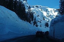
State Route 89 is a state highway in the U.S. state of California that travels in the north–south direction, serving as a major thoroughfare for many mountain communities in the Sierra Nevada and the Cascade Range. It starts from U.S. Route 395 near Topaz Lake, winding its way up to the 8,314-foot (2,534 m) Monitor Pass, down to the Carson River, and up again over the 7,740-foot (2,359 m) Luther Pass. From that point on, the route generally loses elevation on its way past Lake Tahoe, through Tahoe and Plumas National Forests until Lake Almanor. For roughly nine miles the route is then a part of State Route 36. The route then ascends to the 5,753-foot (1,754 m) Morgan Summit. After it enters Lassen Volcanic National Park it continues to gain elevation until it reaches its highest point in an unnamed pass in the middle of Lassen Peak and Bumpass Mountain. The road then descends and heads northwest, finally terminating at Interstate 5 at the foot of Mount Shasta at around 3,600 feet (1,100 m).

<span class="mw-page-title-main">California State Route 26</span> Highway in California

State Route 26 is a state highway in the U.S. state of California, running from State Route 99 in Stockton in San Joaquin County to State Route 88 near Pioneer in Amador County. The highway is routed to serve Mokelumne Hill and West Point in Calaveras County.

<span class="mw-page-title-main">California State Route 108</span> Highway in California

State Route 108 is a state highway in the U.S. state of California that runs from the Central Valley and across the Sierra Nevada via the Sonora Pass. It generally runs northeast from downtown Modesto near the SR 99/SR 132 interchange, to U.S. Route 395 near the Nevada state line. The route was once recommended to continue south of Modesto to Interstate 5, although today that portion exists as a county road. Parts of SR 108 are closed annually during the winter due to inclement weather along the summit.

<span class="mw-page-title-main">California State Route 70</span> Highway in California

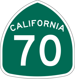
State Route 70 is a state highway in the U.S. state of California, connecting SR 99 north of Sacramento with U.S. Route 395 near Beckwourth Pass via the Feather River Canyon. Through the Feather River Canyon, from SR 149 to US 395, SR 70 is the Feather River Scenic Byway, a Forest Service Byway that parallels the ex-Western Pacific Railroad's Feather River Route.

<span class="mw-page-title-main">California State Route 104</span> Highway in California

State Route 104 is a west–east state highway in the U.S. state of California that runs from the Central Valley to the Sierra Foothills. It connects State Route 99 near Galt to State Route 49 in Sutter Creek via the city of Ione. It is known as Twin Cities Road from its western terminus up until just before Ione. West of the SR 104/SR 99 interchange, Twin Cities Road continues to Interstate 5 and then eventually end at State Route 160 north of Walnut Grove.

<span class="mw-page-title-main">California State Route 124</span> Highway in California

State Route 124 is a state highway in the U.S. state of California that runs in Amador County from State Route 88 south of Ione to State Route 16 near Waits Station.

<span class="mw-page-title-main">California State Route 190</span> Highway in California

State Route 190 is a state highway in the U.S. state of California that is split into two parts by the Sierra Nevada. The western portion begins at Tipton at a junction with State Route 99 and heads east towards Porterville before ending at Quaking Aspen in the Sequoia National Forest. The eastern portion begins at US 395 at Olancha, heads east through Death Valley National Park, and ends at State Route 127 at Death Valley Junction. The 43.0-mile (69.2 km) portion over the Sierra Nevada remains unconstructed, and the California Department of Transportation (Caltrans) has no plans to build it through the wilderness areas. SR 190 is a National Scenic Byway known as the Death Valley Scenic Byway.

<span class="mw-page-title-main">California State Route 266</span> Highway in California

State Route 266 (SR 266) is a state highway in the U.S. state of California. The route traverses Fish Lake Valley, which is part in California and part in Nevada. The route connects two Nevada state routes that traverse the Nevada portion of the valley, SR 264 and SR 266. The only connection from SR 266 to the rest of California's road network is via SR 168 in the community of Oasis. Prior to 1986 the southern and northern halves of modern SR 266 had separate numerical designations. The southern portion of the highway, along with modern SR 168, dates to the auto trail era, forming part of the Midland Trail.

<span class="mw-page-title-main">California State Route 168</span> Highway in California

State Route 168 is an east-west state highway in the U.S. state of California that is separated into two distinct segments by the Sierra Nevada. The western segment runs from State Routes 41 and 180 in Fresno east to Huntington Lake along the western slope of the Sierra. The eastern segment connects Lake Sabrina in the Eastern Sierra to State Route 266 in the community of Oasis, just to the west of the Nevada border. The eastern segment of SR 168 also forms a concurrency with U.S. Route 395 between Bishop and Big Pine.

<span class="mw-page-title-main">U.S. Route 50 in California</span> Highway in California

U.S. Route 50 (US 50) is a transcontinental United States Numbered Highway, stretching from West Sacramento, California, in the west to Ocean City, Maryland, in the east. The California portion of US 50 runs east from Interstate 80 (I-80) in West Sacramento to the Nevada state line in South Lake Tahoe. A portion in Sacramento also has the unsigned designation of Interstate 305. The western half of the highway in California is a four-or-more-lane divided highway, mostly built to freeway standards, and known as the El Dorado Freeway outside of downtown Sacramento. US 50 continues as an undivided highway with one eastbound lane and two westbound lanes until the route reaches the canyon of the South Fork American River at Riverton. The remainder of the highway, which climbs along and out of the canyon, then over the Sierra Nevada at Echo Summit and into the Lake Tahoe Basin, is primarily a two-lane road.

<span class="mw-page-title-main">U.S. Route 6 in California</span> U.S. highway in California

U.S. Route 6 (US 6) is a transcontinental United States Numbered Highway, stretching from Bishop, California, in the west to Provincetown, Massachusetts, in the east. The California portion of US 6 lies in the eastern portion of the state from Bishop in the Owens Valley north to the Nevada state line in Mineral County. Prior to the 1964 state highway renumbering, US 6 extended to the Pacific Ocean in Long Beach, California, as part of the historic auto trail named the Grand Army of the Republic Highway.

<span class="mw-page-title-main">U.S. Route 395 in California</span> Highway in California

U.S. Route 395 (US 395) is a United States Numbered Highway, stretching from Hesperia, California to the Canadian border in Laurier, Washington. The California portion of US 395 is a 557-mile (896 km) route which traverses from Interstate 15 (I-15) in Hesperia, north to the Oregon state line in Modoc County near Goose Lake. The route clips into Nevada, serving the cities Carson City and Reno, before returning to California.

<span class="mw-page-title-main">Cooks Station</span>

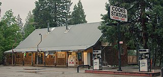
Cooks or Cook's Station, elevation 5,000 feet (1,500 m), is a roadside stop on State Route 88 in Amador County in the Sierra Nevada mountains.

References

  1. 1 2 California Department of Transportation (July 2007). "Log of Bridges on State Highways" (PDF). Sacramento: California Department of Transportation. Retrieved March 30, 2012.
  2. 1 2 Federal Highway Administration (n.d.). "Carson Pass Highway (Route 88)". America's Byways. Federal Highway Administration. Archived from the original on October 11, 2011. Retrieved October 11, 2011.
  3. "Carson Pass Highway (Route 88)". America's Scenic Byways. Retrieved October 16, 2017.
  4. "Winter Driving Tips". Caltrans . Retrieved January 15, 2023.
  5. 1 2 3 4 5 6 7 DeLorme (2011). California Atlas and Gazetteer. Yarmouth, Maine: DeLorme. pp. 65–67, 73. ISBN   978-0899333830.
  6. "Highway 50 closure: How to get to Tahoe, when will road reopen?". San Jose Mercury News. August 21, 2021. Retrieved February 19, 2023.
  7. "Update: Highway 50 open in both directions, Caltrans says". Tahoe Daily Tribune. March 4, 2022. Retrieved February 19, 2023.
  8. "Farms & Farmers' Markets". Stockton Chamber of Commerce. Retrieved January 8, 2023.
  9. "Amador Central Railroad". Amador County Historical Society. Retrieved January 9, 2023.
  10. "Amador Central Railroad". Recreational Railroad Coalition Historical Society. Retrieved January 9, 2023.
  11. 1 2 Fosgate, M.C. (September–October 1948). "Mother Lode Job: New Highway Through City of Jackson is Completed" (PDF). California Highways and Public Works . Vol. 27, no. 9–10. p. 3. ISSN   0008-1159 . Retrieved January 15, 2023.
  12. Barton, Robert M. (January 1953). "New Bridges, Illustrated" (PDF). California Highways and Public Works. Vol. 32, no. 1–2. pp. 15–20. ISSN   0008-1159 . Retrieved January 9, 2023.
  13. "Jackson, California". Western Mining History. Retrieved January 9, 2023.
  14. "Jackson Rancheria Cares About The Community". Jackson Rancheria Casino Resort. Retrieved February 19, 2023.
  15. Current road conditions at "Road Information". Caltrans. Retrieved March 2, 2023. IS CLOSED FROM HAM'S STATION TO 3.5 MI EAST OF SILVER LAKE (AMADOR CO) - DUE TO SNOW - MOTORISTS ARE ADVISED TO USE AN ALTERNATE ROUTE.
  16. 1 2 Belli, Anthony M. (September 2001). "Traveling the Mormon Emigrant Trail". County of El Dorado. Retrieved January 9, 2023.
  17. 1 2 3 Thomas Brothers (2008). California Road Atlas. Thomas Brothers.
  18. Kiester, Edwin Jr. (March 1, 1998). "The Battle of Carson Pass". Smithsonian Magazine . Retrieved January 10, 2023.
  19. "Current Conditions along Carson Pass". Up and Over Carson Pass. Retrieved January 10, 2023.
  20. "The Colors of Fall in California State Parks". California State Parks. Retrieved January 9, 2023.
  21. Medina, Rachel (October 8, 2020). "Where to See California's Fall Foliage in Every Region". California.com. Retrieved January 9, 2023.
  22. "Article 2 of Chapter 2 of Division 1". California Streets and Highways Code. Sacramento: California Office of Legislative Counsel. Retrieved February 6, 2019.
  23. Federal Highway Administration (March 25, 2015). National Highway System: California (North) (PDF) (Map). Scale not given. Washington, DC: Federal Highway Administration. Retrieved October 8, 2017.
  24. Natzke, Stefan; Neathery, Mike & Adderly, Kevin (June 20, 2012). "What is the National Highway System?". National Highway System. Washington, DC: Federal Highway Administration. Retrieved July 1, 2012.
  25. "Article 2.5 of Chapter 2 of Division 1". California Streets & Highways Code. Sacramento: California Office of Legislative Counsel. Retrieved February 6, 2019.
  26. California Department of Transportation (August 2019). "Officially Designated State Scenic Highways and Historic Parkways" (XLSX). Sacramento: California Department of Transportation. Retrieved October 8, 2017.
  27. California Department of Transportation (2012). Scenic Highway Guidelines (PDF). Sacramento: California Department of Transportation. p. 5. Retrieved June 8, 2017.
  28. 1 2 California Department of Transportation (2020). "All Traffic Volumes on CSHS". Sacramento: California Department of Transportation. Retrieved February 21, 2023.
  29. 1 2 Nickolas, J. L. (January 1961). "Carson Spur" (PDF). California Highways and Public Works. Vol. 40, no. 1–2. pp. 11–12. ISSN   0008-1159 . Retrieved January 15, 2023.
  30. "Amador Wagon Road Survey". Sacramento Daily Union. June 22, 1857. p. 1. Retrieved January 14, 2013 via California Digital Newspaper Collection.
  31. 1 2 "Old Emigrant Road". Office of Historic Preservation, California State Parks. Retrieved March 30, 2012.
  32. Thomas, George C. (c. 1930). Map of Amador County (Map). [c. 1:380,160]. Geo C Thomas via Wikimedia Commons.
  33. United States Geological Survey (1941). Sutter Creek, California (Topographic map). 1:250,000. Reston, Virginia: United States Geological Survey.
  34. United States Geological Survey (1944). Sutter Creek, California (Topographic map). 1:250,000. Reston, Virginia: United States Geological Survey.
  35. Meyer, J. G. (July 1958). "Report from District X" (PDF). California Highways and Public Works. Vol. 37, no. 7–8. pp. 18–22, 48. ISSN   0008-1159 . Retrieved January 15, 2023.
  36. Evans, Jeremy (December 31, 2007). "Kirkwood: A story of raw adventure and perseverance". Tahoe Daily Tribune. Retrieved January 13, 2019.
  37. "Trail of the John C. Frémont 1844 Expedition". Office of Historic Preservation, California State Parks. Retrieved May 1, 2012.
  38. "Clinton". Office of Historic Preservation, California State Parks. Retrieved March 30, 2012.
  39. "Irishtown". Office of Historic Preservation, California State Parks. Retrieved March 30, 2012.
  40. "Maiden's Grave". Office of Historic Preservation, California State Parks. Retrieved March 30, 2012.
  41. "Cooks Station". Amador Council of Tourism. Retrieved February 20, 2023.
  42. "Ham's Station". Amador Council of Tourism. Retrieved February 20, 2023.
  43. Report of the Chief of Engineers U.S. Army. U.S. Army Corps of Engineers. 1879. p. 2110.
  44. "Ham's Station". Archives: History Center. Amador County, California. Archived from the original on April 8, 2008. Retrieved August 5, 2010.
  45. "Kit Carson Marker". Office of Historic Preservation, California State Parks. Retrieved March 30, 2012.
  46. "Memorial To Pioneer Odd Fellows". Office of Historic Preservation, California State Parks. Retrieved March 30, 2012.
  47. 1 2 California Department of Transportation. "State Truck Route List". Sacramento: California Department of Transportation. Archived from the original (XLS file) on June 30, 2015. Retrieved June 30, 2015.
  48. 1 2 "Elevation and Location of Summits and Passes in California". California Department of Transportation. Archived from the original on March 1, 2017.
Template:Attached KML/California State Route 88
KML is from Wikidata