North Potomac is a census-designated place and unincorporated area in Montgomery County, Maryland, United States. It is located less than 5 miles (8.0 km) north of the Potomac River, and is about 20 miles (32 km) from Washington, D.C. It has a population of 23,790 as of 2020.

The Chesapeake and Ohio Canal National Historical Park is located in the District of Columbia and the state of Maryland. The park was established in 1961 as a National Monument by President Dwight D. Eisenhower to preserve the neglected remains of the Chesapeake and Ohio Canal and many of its original structures. The canal and towpath trail extends along the Potomac River from Georgetown, Washington, D.C., to Cumberland, Maryland, a distance of 184.5 miles (296.9 km). In 2013, the path was designated as the first section of U.S. Bicycle Route 50.
The Potomac Heritage Trail, also known as the Potomac Heritage National Scenic Trail or the PHT, is a designated National Scenic Trail corridor spanning parts of the mid-Atlantic region of the United States that will connect various trails and historic sites in Virginia, Maryland, Pennsylvania, and the District of Columbia. The trail network includes 710 miles (1,140 km) of existing and planned sections, tracing the natural, historical, and cultural features of the Potomac River corridor, the upper Ohio River watershed in Pennsylvania and western Maryland, and a portion of the Rappahannock River watershed in Virginia. The trail is managed by the National Park Service.

The Great Allegheny Passage (GAP) is a rail trail system in Maryland and Pennsylvania—the central trail of a network of long-distance hiker-biker trails throughout the Allegheny region of the Appalachian Mountains, connecting Washington, D.C. to Pittsburgh, Pennsylvania. It consists of several smaller trails including the Allegheny Highlands Trail of Maryland, the Allegheny Highlands Trail of Pennsylvania and the Youghiogheny River Trail.

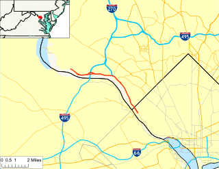
Clara Barton Parkway is an automobile parkway in the U.S. state of Maryland and the District of Columbia. The highway runs 6.8 miles (10.9 km) from MacArthur Boulevard in Carderock, Maryland, east to Canal Road at the Chain Bridge in Washington. Clara Barton Parkway is a two- to four-lane parkway that parallels the Potomac River and the Chesapeake and Ohio Canal (C&O) in southwestern Montgomery County, Maryland, and the far western corner of Washington. The parkway provides access to the communities of Cabin John and Glen Echo and several units of the Chesapeake and Ohio Canal National Historical Park. The Maryland portion of the George Washington Memorial Parkway was constructed from Carderock past Interstate 495 (I-495) to Glen Echo in the early to mid-1960s. The parkway was proposed to continue west to Great Falls and east to Georgetown. However, these proposals never came to fruition and the parkway was extended only to the Chain Bridge in the early 1970s. The Maryland portion of the George Washington Memorial Parkway was renamed in 1989 for Clara Barton, the founder of the American Red Cross, and whose original headquarters is located in Glen Echo.

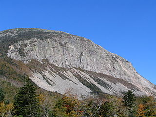
Cannon Mountain is a 4,080-foot (1,240 m) peak in the White Mountains of New Hampshire. It is known for both its technical rock and ice climbing on its cliff face and skiing at Cannon Mountain Ski Area. It was also home to the Old Man of the Mountain, until that formation collapsed on May 3, 2003.

Great Falls Park is a small National Park Service (NPS) site in Virginia, United States. Situated on 800 acres (3.2 km2) along the banks of the Potomac River in northern Fairfax County, the park is a disconnected but integral part of the George Washington Memorial Parkway. The Great Falls of the Potomac River are near the northern boundary of the park, as are the remains of the Patowmack Canal, the first canal in the United States that used locks to raise and lower boats.

Seneca Rocks is a large crag and local landmark in Pendleton County in the Eastern Panhandle of West Virginia, United States. The south peak is one of a small number of peaks inaccessible except by technical rock climbing techniques on the East Coast of the United States. One of the best-known scenic attractions in West Virginia, the sheer rock faces are a popular challenge for rock climbers.
The Potomac Highlands of West Virginia centers on five West Virginian counties in the upper Potomac River watershed in the western portion of the state's Eastern Panhandle, bordering Maryland and Virginia. Because of geographical proximity, similar topography and landscapes, and shared culture and history, the Potomac Highlands region also includes Pocahontas, Randolph, and Tucker counties, even though they are in the Monongahela River or New River watersheds and not that of the Potomac River.

Great Falls is a series of rapids and waterfalls on the Potomac River, 14 miles (23 km) upstream from Washington, D.C., on the border of Montgomery County, Maryland and Fairfax County, Virginia. Great Falls Park, managed as part of George Washington Memorial Parkway, is on the southern banks in Virginia, and Chesapeake and Ohio Canal National Historical Park parkland is along the northern banks of the river in Maryland. Both are operated by the National Park Service. The Potomac and the falls themselves are legally entirely within Maryland, with the state and county boundaries following the south bank of the river.

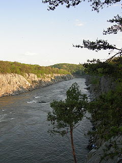
Mather Gorge is a river gorge south and just downriver of Great Falls in the state of Maryland bordering Virginia. The Maryland land side of the gorge is Bear Island, part of the Chesapeake and Ohio Canal National Historical Park, and the Virginia side is part of Great Falls Park. Both parks are National Park Service sites. The gorge is named after Stephen Mather, the first director of the National Park Service.

The Billy Goat Trail is a 4.7-mile (7.6 km) hiking trail that follows a path between the C&O Canal and the Potomac River within the Chesapeake and Ohio Canal National Historical Park near the Great Falls in Montgomery County, Maryland. The trail has three sections: Section A, the northernmost, is 1.7 miles (2.7 km); Section B is 1.4 miles (2.3 km); and Section C, the southernmost, is 1.6 miles (2.6 km)
Weverton is an unincorporated community hamlet located in the southern tip of Washington County, Maryland, United States, near the north shore of the Potomac River. Its population is approximately 500. Weverton is located at the intersection of MD Route 67 and U.S. Route 340. The nearest incorporated communities are Harpers Ferry, West Virginia and Brunswick,. Weverton's approximate elevation is 475 feet (145 m) above sea level.

The Potomac Water Gap is a double water gap in the Blue Ridge Mountains, located at the intersection of the states of Virginia, West Virginia and Maryland, near Harpers Ferry. At 256 feet (78 m), it is the lowest crossing of the Blue Ridge Mountains.

South Mountain State Park is a public recreation area that runs for nearly the entire length of South Mountain through Washington and Frederick counties in Maryland. The state park is contiguous with several other national, state and local parks on the mountain, including the Chesapeake and Ohio Canal National Historical Park, Gathland State Park, Washington Monument State Park, Greenbrier State Park and Pen Mar County Park.

Muddy Branch is a tributary stream of the Potomac River in Montgomery County, Maryland, United States, located about 14 miles (23 km) northwest of Washington, D.C.
Paul Jay Bradt (1904–1978) has been called the father of rock climbing in the Washington, D.C., area. He was instrumental in developing interest in the sport, was a founding member and first chair of the rock climbing branch of the Potomac Appalachian Trail Club, and pioneered historic climbs and cave explorations in the 1930s and 1940s. Bradt was introduced to rock climbing by Gustave Gambs (1868-1958) who had learned the sport in Europe. He soon became an active proponent of rock climbing, introducing many people to the sport, some of whom became leaders in the field, such as Don Hubbard, Arnold Wexler, and Herb and Jan Conn. Bradt and his colleagues explored and developed early climbing routes at Great Falls, VA, Carderock, MD, Seneca Rocks, WV, Old Rag Mountain in Shenandoah National Park, VA, and in the Teton Range.

Jan Conn and Herb Conn were climbing and caving pioneers. They are credited with establishing many classic climbs in areas like Carderock in Maryland, Seneca Rocks in West Virginia, Cannon Cliff in New Hampshire and Black Hills of South Dakota. They are also well known as cave explorers who in the 1960s and 1970s discovered and mapped over 60 miles of Jewel Cave, making it the world’s third-longest cave system.

The gaps of the Allegheny, meaning gaps in the Allegheny Ridge in west-central Pennsylvania, is a series of escarpment eroding water gaps along the saddle between two higher barrier ridge-lines in the eastern face atop the Allegheny Ridge or Allegheny Front escarpment. The front extends south through Western Maryland and forms much of the border between Virginia and West Virginia, in part explaining the difference in cultures between those two post-Civil War states. While not totally impenetrable to daring and energetic travelers on foot, passing the front outside of the water gaps with even sure footed mules was nearly impossible without navigating terrain where climbing was necessary on slopes even burros would find extremely difficult.


