Centennial Peak (Colorado)

Last updated
Centennial Peak
Centennial Peak, Colorado.jpg
Northeast aspect, centered
(Lavender Peak to left. Hesperus behind, right)
Highest point
Elevation 13,062 ft (3,981 m) [1] [2]
Prominence 262 ft (80 m) [3]
Parent peak Lavender Peak (13,233 ft) [4]
Isolation 0.43 mi (0.69 km) [3]
Coordinates 37°26′50″N108°04′37″W / 37.4473328°N 108.0769016°W / 37.4473328; -108.0769016 [5]
Naming
Etymology Centennial
Geography
USA Colorado relief location map.svg
Red triangle with thick white border.svg
Centennial Peak
Location in Colorado
Usa edcp relief location map.png
Red triangle with thick white border.svg
Centennial Peak
Centennial Peak (the United States)
CountryUnited States
State Colorado
County Montezuma
Parent range Rocky Mountains
San Juan Mountains
La Plata Mountains [3]
Topo map USGS La Plata [5]
Climbing
Easiest route class 2 via North ridge [1]

Centennial Peak is a 13,062-foot-elevation (3,981-meter) mountain summit in Montezuma County, Colorado. [5]

Contents

Description

Centennial Peak is located 16 miles (26 km) northwest of the community of Durango on land managed by San Juan National Forest. It ranks as the six-highest summit of the La Plata Mountains which are a subrange of the Rocky Mountains. [3] Precipitation runoff from the mountain's west slope drains to the Mancos River and the east slope drains into the headwaters of Bear Creek which is a tributary of the Dolores River. Topographic relief is significant as the summit rises 2,460 feet (750 meters) above Bear Creek in one mile (1.6 km) and 1,500 feet (460 meters) above Sliderock Basin in one-half mile (0.8 km). Neighbors include Mount Moss, 0.57 miles (0.92 km) to the south, Lavender Peak, 0.45 miles (0.72 km) to the south-southwest, and Hesperus Mountain 0.68 miles (1.09 km) to the west-southwest. [3] An ascent of Centennial Peak's summit involves hiking 4.4 miles (7.1 km) with 2,130 feet (650 meters) of elevation gain. [6]

Etymology

The mountain's toponym was officially adopted on July 8, 1976, by the United States Board on Geographic Names as proposed by the Colorado Centennial-Bicentennial Commission to commemorate 100 years of statehood since it was admitted to the Union on August 1, 1876. [5] Prior to that the landform was called "Banded Mountain", a descriptive name attributable to the alternating colored strata of sedimentary rock. [5] [6]

Climate

According to the Köppen climate classification system, Centennial Peak has an alpine climate with cold, snowy winters, and cool to warm summers. [7] Due to its altitude, it receives precipitation all year, as snow in winter and as thunderstorms in summer, with a dry period in late spring.

See also

Related Research Articles

<span class="mw-page-title-main">Sharkstooth Peak</span>

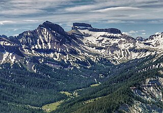
Sharkstooth Peak is a 12,468-foot-elevation (3,800-meter) mountain summit in Montezuma County, Colorado.

<span class="mw-page-title-main">Powell Peak</span> Mountain in Colorado, United States of America

Powell Peak is a summit in Grand County, Colorado, in the United States. With an elevation of 13,176 feet (4,016 m), Powell Peak is the 493rd-highest summit in the state of Colorado.

<span class="mw-page-title-main">Coxcomb Peak (Colorado)</span> Mountain in the state of Colorado

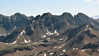
Coxcomb Peak is a 13,656-foot-elevation (4,162-meter) mountain summit located on the common boundary of Hinsdale County and Ouray County, in Colorado, United States. It is situated nine miles northeast of the community of Ouray, in the Uncompahgre Wilderness, on land managed by Uncompahgre National Forest. It is part of the San Juan Mountains which are a subset of the Rocky Mountains, and is situated west of the Continental Divide. Coxcomb ranks as the 171st-highest peak in Colorado, and topographic relief is significant as the south aspect rises 2,000 feet above Wetterhorn Basin in approximately one mile, and 4,400 feet above Cow Creek in three miles. Neighbors include Precipice Peak 2.7 miles to the north, Redcliff one-half mile north, Matterhorn Peak 2.3 miles to the east-southeast, and nearest higher neighbor Wetterhorn Peak 1.8 mile to the southeast. The mountain's descriptive name, which has been officially adopted by the United States Board on Geographic Names, was in use since at least 1906 when Henry Gannett published it in the Gazetteer of Colorado.

<span class="mw-page-title-main">Engineer Mountain</span> Mountain in Colorado, United States

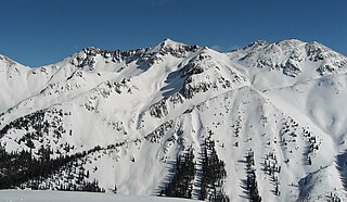
Engineer Mountain is a 12,968-foot-elevation (3,953-meter) mountain summit located in San Juan County, Colorado, United States. It is part of the San Juan Mountains range which is a subset of the Rocky Mountains, and is west of the Continental Divide. Engineer Mountain is a prominent landmark set 1.5 mile immediately west of Coal Bank Pass, and is visible from multiple viewpoints along Highway 550, making it one of the most photographed mountains in the San Juans. It is situated 11 miles southwest of the community of Silverton, on land managed by San Juan National Forest. Topographic relief is significant as the southwest aspect rises 3,800 feet above Cascade Creek in approximately two miles. Neighbors include Snowdon Peak seven miles to the east, and Twilight Peak, five miles to the southeast.

<span class="mw-page-title-main">Bear Mountain (San Juan County, Colorado)</span>

Bear Mountain is a 12,987-foot-elevation (3,958-meter) mountain summit located in San Juan County, Colorado, United States.

<span class="mw-page-title-main">North Star Mountain (Colorado)</span>

North Star Mountain is a 13,614-foot (4,150 m) mountain summit on the shared border of Park County and Summit County, in Colorado, United States.

<span class="mw-page-title-main">Square Top Mountain</span> Mountain in the state of Colorado

Square Top Mountain is a 13,794-foot (4,204 m) mountain summit in Clear Creek County, Colorado, United States.

<span class="mw-page-title-main">Apache Peak</span> Mountain in the state of Colorado

Apache Peak is a 13,441-foot (4,097 m) mountain summit on the boundary shared by Boulder County and Grand County, in Colorado, United States.

<span class="mw-page-title-main">Shoshoni Peak</span> Mountain in the state of Colorado

Shoshoni Peak is a 12,967-foot (3,952 m) mountain summit on the boundary shared by Boulder County and Grand County, in Colorado, United States.

<span class="mw-page-title-main">Carson Peak (Colorado)</span> Mountain in the state of Colorado

Carson Peak is a 13,662-foot-elevation (4,164-meter) summit in Hinsdale County, Colorado, United States.

<span class="mw-page-title-main">Mount Moss</span> Mountain in the state of Colorado

Mount Moss is a 13,192-foot-elevation (4,021-meter) mountain summit on the common boundary shared by La Plata County and Montezuma County in Colorado.

<span class="mw-page-title-main">Diorite Peak</span> Mountain in the state of Colorado

Diorite Peak is a 12,761-foot-elevation (3,890-meter) mountain summit on the common boundary shared by La Plata County and Montezuma County in Colorado.

<span class="mw-page-title-main">Spiller Peak</span> Mountain in the state of Colorado

Spiller Peak is a 13,123-foot-elevation (4,000-meter) mountain summit on the common boundary shared by La Plata County and Montezuma County in Colorado.

<span class="mw-page-title-main">Babcock Peak</span>

Babcock Peak is a 13,161-foot-elevation (4,011-meter) mountain summit in La Plata County, Colorado.

<span class="mw-page-title-main">Electric Peak (Sangre de Cristo)</span> Mountain in the state of Colorado

Electric Peak is a 13,598-foot (4,145 m) mountain summit on the boundary shared by Custer and Saguache counties, in Colorado, United States.

<span class="mw-page-title-main">Cross Mountain (Colorado)</span> Mountain in the state of Colorado

Cross Mountain is a 12,703-foot-elevation (3,872-meter) summit on the border shared by Dolores and San Miguel County, in Colorado, United States.

<span class="mw-page-title-main">Grizzly Peak (Dolores/San Juan Counties, Colorado)</span> Mountain in the state of Colorado

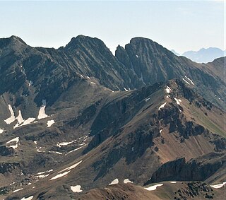
Grizzly Peak is a 13,738-foot-elevation (4,187-meter) mountain summit on the boundary shared by Dolores County and San Juan County, in Colorado, United States.

<span class="mw-page-title-main">Proposal Peak</span>

Proposal Peak is a 13,339-foot-elevation (4,066-meter) mountain summit located in San Juan County, Colorado, United States.

<span class="mw-page-title-main">Engineer Mountain (Hinsdale and Ouray counties, Colorado)</span> Mountain in the state of Colorado

Engineer Mountain is a 13,225-foot-elevation (4,031 meter) summit located on the boundary shared by Hinsdale County with Ouray County, in Colorado, United States.

<span class="mw-page-title-main">Grayrock Peak</span>

Grayrock Peak is a 12,504-foot-elevation (3,811-meter) mountain summit located in San Juan County, Colorado, United States.

References

  1. 1 2 Robert M. Ormes (2000), Guide to the Colorado Mountains, Colorado Mountain Club Press, ISBN   9780967146607, p. 322.
  2. Robert F. Rosebrough (1986), The San Juan Mountains: A Climbing & Hiking Guide, Cordillera Press, p. 33.
  3. 1 2 3 4 5 "Centennial Peak, Colorado". Peakbagger.com. Retrieved May 21, 2023.
  4. "Centennial Peak - 13,068' CO". listsofjohn.com. Retrieved May 21, 2023.
  5. 1 2 3 4 5 "Centennial Peak". Geographic Names Information System . United States Geological Survey, United States Department of the Interior . Retrieved May 21, 2023.
  6. 1 2 John Peel, Paul Pixler (2020), Hiking Trails of Southwestern Colorado, Fifth Edition, West Margin Press, ISBN   9781513262987, p. 73.
  7. Peel, M. C.; Finlayson, B. L.; McMahon, T. A. (2007). "Updated world map of the Köppen−Geiger climate classification". Hydrol. Earth Syst. Sci. 11. ISSN   1027-5606.