
Carbondale is a city in Lackawanna County, Pennsylvania, United States. Carbondale is located approximately 15 miles due northeast of the city of Scranton in Northeastern Pennsylvania. The population was 8,828 at the 2020 census.

Kansas is a census-designated place in northwestern Liberty Township, Seneca County, Ohio, United States. It has a post office with the ZIP code 44841. It is located along State Route 635. The population was 175 at the 2020 census.
Gouldsboro is a village and census-designated place (CDP) in Lehigh Township in Wayne County, and Coolbaugh Township, in Monroe County, Pennsylvania, United States. The CDP's population was 750 at time of the 2020 United States Census.

Sutton is a census-designated place in western Griggs County, North Dakota, United States. An unincorporated community, it was designated as part of the U.S. Census Bureau's Participant Statistical Areas Program on March 31, 2010. It was not counted separately during the 2000 Census, but was included in the 2010 Census, where a population of 17 was reported.
Bowers is a census-designated place in Maxatawny Township, Berks County, Pennsylvania.

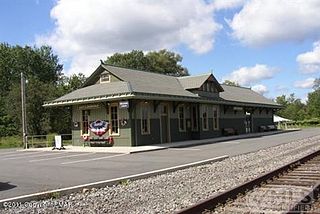
Poyntelle is a village that is located in Preston Township, Wayne County, Pennsylvania, United States, in the Lake Region of the Poconos.
Searles is an unincorporated community and census-designated place in Brown County, Minnesota, United States. Searles is located on Minnesota State Highway 15, 6 miles (9.7 km) south of New Ulm. Searles has a post office with ZIP code 56084. As of the 2010 census, its population was 171.
Hilger is an unincorporated community and census-designated place in Fergus County, Montana, United States. The community is located along U.S. Highway 191 in central Fergus County. Hilger has a post office with the ZIP code 59451. It is 15 miles north of Lewistown.
Simpson is an unincorporated community and census-designated place in Fell Township, Lackawanna County, Pennsylvania, United States. It is directly north of the city of Carbondale on Pennsylvania Route 171. As of the 2010 census the population of Simpson was 1,275.

Pocono Springs is a private community and census-designated place (CDP) in Lehigh and Sterling Townships in Wayne County, Pennsylvania, United States. The CDP's population was 926 at the time of the 2010 United States Census.
Millwood is a census-designated place and coal town located in Westmoreland County, Pennsylvania, United States. Their post office closed in 1927. It was also known as Akers. As of the 2010 census the population was 566 residents.

Oley, also called Friedensburg, is a census-designated place (CDP) that is located on Routes 73 and 662 in northern Oley Township, Berks County, United States.

Grimsley is an unincorporated community and census-designated place (CDP) in Fentress County, Tennessee, United States. Its population was 1,167 as of the 2010 census. Its ZIP code is 38565.
Maxatawny is an unincorporated community located on U.S. Route 222 in Maxatawny Township, Berks County, Pennsylvania, United States, five miles east of Kutztown. It is in the Lehigh watershed and Schaefer Run flows through it to the Little Lehigh Creek. Maxatawny has a post office, with the ZIP code of 19538. Traffic speed on US 222 is reduced to 35 miles-per-hour passing through the village, which borders Lehigh County.
Grenloch is an unincorporated community and census-designated place (CDP) located within Washington Township, in Gloucester County, in the U.S. state of New Jersey. Grenloch is located along New Jersey Route 168 10.25 miles (16.50 km) south-southeast of Camden. Grenloch has a post office with ZIP Code 08032.

Cubero is a census-designated place in Cibola County, New Mexico, United States. Its population was 289 as of the 2010 census. Cubero has a post office with ZIP code 87014. The town was founded by Mexicans and was along the route of the Santa Fe Railroad's first transcontinental rail line through the Southwestern United States.

Costilla is a census-designated place in Taos County, New Mexico, United States. Its population was 205 as of the 2010 census. Costilla has a post office with ZIP code 87524. State roads 196 and 522 intersect in the community.
Lemitar is a census-designated place in Socorro County, New Mexico, United States. Its population was 330 as of the 2010 census. Lemitar has a post office with ZIP code 87823. Exit 156 on Interstate 25 serves the community.
Alverda is an Census-designated place in Indiana County, Pennsylvania, United States. The community is located on Pennsylvania Route 553, 15.5 miles (24.9 km) east of Indiana in Pine Township.

La Plume is an unincorporated community in Lackawanna County, Pennsylvania, United States. The community is located at the intersection of U.S. Route 6 and Pennsylvania Route 438, 1.5 miles (2.4 km) east-southeast of Factoryville. La Plume has a post office with ZIP code 18440. La Plume is located 11 miles northwest of Scranton, one of Pennsylvania's most populous cities.


