Choctaw County, Alabama

Last updated

Choctaw County
Choctaw County Alabama Courthouse.jpg
Choctaw County Courthouse and Confederate monument in Butler
Map of Alabama highlighting Choctaw County.svg
Location within the U.S. state of Alabama
Alabama in United States.svg
Alabama's location within the U.S.
Coordinates: 32°01′13″N88°15′47″W / 32.0203°N 88.2631°W / 32.0203; -88.2631
CountryFlag of the United States.svg United States
StateFlag of Alabama.svg  Alabama
FoundedDecember 29, 1847
Named for Choctaw tribe
Seat Butler
Largest townButler
Area
  Total921 sq mi (2,390 km2)
  Land914 sq mi (2,370 km2)
  Water7.4 sq mi (19 km2)  0.8%
Population
 (2020)
  Total12,665
  Estimate 
(2023)
12,252 Decrease2.svg
  Density14/sq mi (5.3/km2)
Time zone UTC−6 (Central)
  Summer (DST) UTC−5 (CDT)
Congressional district 7th
Website www.choctawcountyal.org
  • County Number 15 on Alabama Licence Plates

Choctaw County is a county located in the southwestern portion of the U.S. state of Alabama. As of the 2020 census, the population was 12,665. [1] The county seat is Butler. [2] The county was established on December 29, 1847, and named for the Choctaw tribe of Native Americans. [3]

Contents

History

Choctaw County was originally part of the Choctaw Nation, with Choctaw settlements known to be in the vicinity of Pushmataha prior to the removal of Native Americans from the southeastern United States during the Trail of Tears. [4]

Most of the early European American pioneers of Choctaw County were farmers from North and South Carolina. In 1912 the Alabama, Tennessee and Northern Railroad was completed through the county from north to south, connecting the area to the Port of Mobile and northern Alabama. It induced a population shift from areas near the Tombigbee River to the central part of the county. [5]

The county's population reached its peak in the 1920s, due in part from jobs created by a sawmill boom with companies as the E. E. Jackson Lumber Company and Choctaw Lumber Company. The sawmill industry collapsed during the Great Depression. The first successful oil well in Alabama was drilled at Gilbertown in 1944, with oil and gas becoming the county's most important industry. This industry waned by the 1970s as the wells lost profitability. [5]

An African-American family, the Thorntons of Mobile, was featured in the September 24, 1956, issue of Life. The article included an interview with the Thorntons' daughter, Allie Lee Causey, of Shady Grove in Choctaw County. In the article, Mrs. Causey, a schoolteacher, spoke openly about her family's life, stating that "integration is the only way in which Negroes will receive justice. We cannot get it as a separate people. If we can get justice on our jobs, and equal pay, then we'll be able to afford better homes and good education." [6] When the magazine was seen in Choctaw County, the Causeys were subjected to brutal economic retaliation by white residents, who tried to coerce Mrs. Causey into recanting her remarks. Their loans were called in, local stores refused to sell them food and gasoline, Willie Causey was cut off from his employment as a woodcutter, and Mrs. Causey was fired from her job as a teacher. The Causeys left Shady Grove and Alabama for good in October 1956. [7]

Apparel factories opened during the 1950s–60s in Silas, Toxey, and Butler, although the plants had largely closed by the 21st century. The 1950s also saw the building a paper mill at Naheola, now owned and operated by Georgia-Pacific. [5] [8] The county was declared a disaster area in September 1979, due to damage from Hurricane Frederic. The 1980s saw the main railroad close and the tracks removed. [5]

Historic sites

Choctaw County has one site listed on the National Register of Historic Places, the Mount Sterling Methodist Church. [9] [10] Additionally, five sites are listed on the Alabama Register of Landmarks and Heritage. [11]

Geography

According to the United States Census Bureau, the county has a total area of 921 square miles (2,390 km2), of which 914 square miles (2,370 km2) is land and 7.4 square miles (19 km2) (0.8%) is water. [12]

Major highways

Adjacent counties

National protected area

Demographics

Historical population
CensusPop.Note
1850 8,389
1860 13,87765.4%
1870 12,676−8.7%
1880 15,73124.1%
1890 17,52611.4%
1900 18,1363.5%
1910 18,4831.9%
1920 20,75312.3%
1930 20,513−1.2%
1940 20,195−1.6%
1950 19,152−5.2%
1960 17,870−6.7%
1970 16,589−7.2%
1980 16,8391.5%
1990 16,018−4.9%
2000 15,922−0.6%
2010 13,859−13.0%
2020 12,665−8.6%
2023 (est.)12,252 [13] −3.3%
U.S. Decennial Census [14]
1790–1960 [15] 1900–1990 [16]
1990–2000 [17] 2010–2020 [1]

2020 Census

Choctaw County, Alabama – Racial and Ethnic Composition
(NH = Non-Hispanic)
Note: the US Census treats Hispanic/Latino as an ethnic category. This table excludes Latinos from the racial categories and assigns them to a separate category. Hispanics/Latinos may be of any race.
Race / EthnicityPop 2000 [18] Pop 2010 [19] Pop 2020 [20] % 2000% 2010% 2020
White alone (NH)8,7247,7007,03954.79%55.56%55.58%
Black or African American alone (NH)6,9855,9905,21743.87%43.22%41.19%
Native American or Alaska Native alone (NH)2418240.15%0.13%0.19%
Asian alone (NH)612190.04%0.09%0.15%
Pacific Islander alone (NH)0000.00%0.00%0.00%
Some Other Race alone (NH)1510130.09%0.07%0.10%
Mixed Race/Multi-Racial (NH)61562400.38%0.40%1.89%
Hispanic or Latino (any race)107731130.67%0.53%0.89%
Total15,92213,85912,665100.00%100.00%100.00%

As of the 2020 United States census, there were 12,665 people, 5,300 households, and 3,440 families residing in the county.

2010 census

As of the 2010 United States census, there were 13,859 people living in the county. 55.8% were White, 43.4% Black or African American, 0.1% Native American, 0.1% Asian, 0.2% of some other race and 0.4% of two or more races. 0.5% were Hispanic or Latino (of any race).

2000 census

As of the census [21] of 2000, there were 15,922 people, 6,363 households, and 4,574 families living in the county. The population density was 17 people per square mile (6.6 people/km2). There were 7,839 housing units at an average density of 9 units per square mile (3.5 units/km2). The racial makeup of the county was 55.14% White, 44.13% Black or African American, 0.16% Native American, 0.04% Asian, 0.11% from other races, and 0.42% from two or more races. 0.67% of the population were Hispanic or Latino of any race.

There were 6,363 households, out of which 32.50% had children under the age of 18 living with them, 52.00% were married couples living together, 16.00% had a female householder with no husband present, and 28.10% were non-families. 26.50% of all households were made up of individuals, and 11.60% had someone living alone who was 65 years of age or older. The average household size was 2.48 and the average family size was 2.99.

In the county, the population was spread out, with 26.10% under the age of 18, 7.90% from 18 to 24, 26.20% from 25 to 44, 25.20% from 45 to 64, and 14.60% who were 65 years of age or older. The median age was 38 years. For every 100 females there were 88.80 males. For every 100 females age 18 and over, there were 85.40 males.

The median income for a household in the county was $24,749, and the median income for a family was $31,870. Males had a median income of $32,316 versus $18,760 for females. The per capita income for the county was $14,635. About 20.70% of families and 24.50% of the population were below the poverty line, including 34.80% of those under age 18 and 26.10% of those age 65 or over.

Education

Choctaw County contains one public school district. There are approximately 1,100 students in public PK–12 schools in Choctaw County. [22]

Districts

School districts include: [23]

Government

Choctaw County leans Republican at the presidential level. The last Democrat to win the county in a presidential election is Al Gore, who won it by a slim majority in 2000.

United States presidential election results for Choctaw County, Alabama [24]
Year Republican Democratic Third party
No.%No.%No.%
2020 4,29657.56%3,12741.89%410.55%
2016 4,10656.31%3,10942.64%771.06%
2012 4,15252.06%3,78647.47%380.48%
2008 4,22353.50%3,63646.06%350.44%
2004 3,89753.92%3,30345.70%270.37%
2000 3,60048.82%3,70750.27%670.91%
1996 2,62336.78%4,07457.13%4346.09%
1992 3,06940.60%3,94152.13%5507.28%
1988 3,62950.89%3,49148.96%110.15%
1984 3,96053.88%3,37345.90%160.22%
1980 2,85943.45%3,68055.93%410.62%
1976 3,03343.50%3,91156.10%280.40%
1972 3,05560.74%1,93438.45%410.82%
1968 1762.89%1,64126.93%4,27670.18%
1964 2,49785.81%00.00%41314.19%
1960 61234.04%1,09460.85%925.12%
1956 45725.69%1,25070.26%724.05%
1952 59327.14%1,58372.45%90.41%
1948 161.10%00.00%1,44198.90%
1944 866.46%1,24393.32%30.23%
1940 733.48%2,02396.52%00.00%
1936 744.68%1,50795.32%00.00%
1932 483.03%1,53396.90%10.06%
1928 42925.67%1,24274.33%00.00%
1924 191.82%1,02197.80%40.38%
1920 827.09%1,07192.65%30.26%
1916 212.63%76595.63%141.75%
1912 71.24%48986.40%7012.37%
1908 446.66%59089.26%274.08%
1904 457.14%55888.57%274.29%

Communities

Towns

Census-designated place

Unincorporated communities

See also

Related Research Articles

<span class="mw-page-title-main">Chilton County, Alabama</span> County in Alabama, United States

Chilton County is a county located in the central portion of the U.S. state of Alabama. As of the 2020 census, the population was 45,014. The county seat is Clanton. Its name is in honor of William Parish Chilton, Sr. (1810–1871), a lawyer who became Chief Justice of the Alabama Supreme Court and later represented Montgomery County in the Congress of the Confederate States of America.

<span class="mw-page-title-main">Clarke County, Alabama</span> County in Alabama, United States

Clarke County is a county located in the southwestern part of the U.S. state of Alabama. As of the 2020 census, the population was 23,087. The county seat is Grove Hill. The county's largest city is Jackson. The county was created by the legislature of the Mississippi Territory in 1812. It is named in honor of General John Clarke of Georgia, who was later elected governor of that state.

<span class="mw-page-title-main">Etowah County, Alabama</span> County in Alabama, United States

Etowah County is a county located in the northeastern part of the U.S. state of Alabama. As of the 2020 census the population was 103,436. Its county seat is Gadsden. Its name is from a Cherokee word meaning "edible tree". In total area, it is the smallest county in Alabama, but one of the most densely populated. Etowah County comprises the Gadsden Metropolitan Statistical Area.

<span class="mw-page-title-main">Morgan County, Alabama</span> County in Alabama, United States

Morgan County is a county in the north-central part of the U.S. state of Alabama. As of the 2020 census, its population was 123,421. The county seat is Decatur. On June 14, 1821, it was renamed in honor of American Revolutionary War General Daniel Morgan of Virginia. It is a prohibition or dry county, although alcohol sales are allowed in the cities of Decatur, Hartselle, and Priceville. Morgan County is included in the Decatur, AL Metropolitan Statistical Area, which is also included in the Huntsville-Decatur-Albertville, AL Combined Statistical Area. It is a part of the North, Northwest, and North-Central regions of Alabama.

<span class="mw-page-title-main">Coosa County, Alabama</span> County in Alabama, United States

Coosa County is located in the east central portion of the U.S. state of Alabama. As of the 2020 census the population was 10,387. Its county seat is Rockford. Its name derives from a town of the Creek tribe and the Coosa River, which forms one of the county borders.

<span class="mw-page-title-main">Covington County, Alabama</span> County in Alabama, United States

Covington County, is a county located in the south central portion of the U.S. state of Alabama. As of the 2020 census the population was 37,570. Its county seat is Andalusia. Its name is in honor of Brigadier General Leonard Covington of Maryland and Mississippi, who died in the War of 1812.

<span class="mw-page-title-main">Crenshaw County, Alabama</span> County in Alabama, United States

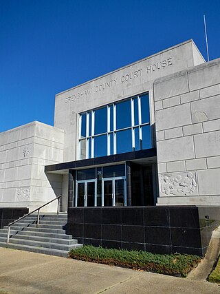
Crenshaw County is a county located in the south central portion of the U.S. state of Alabama. It is located immediately south of the Montgomery metropolitan area. As of the 2020 census, the population was 13,194. Its county seat is Luverne. Its name is in honor of an Alabama judge, Anderson Crenshaw.

<span class="mw-page-title-main">Escambia County, Alabama</span> County in Alabama, United States

Escambia County is a county located in the south central portion of the U.S. state of Alabama. As of the 2020 census, the population was 36,757. Its county seat is Brewton.

<span class="mw-page-title-main">Geneva County, Alabama</span> County in Alabama, United States

Geneva County is a county located in the southeastern part of the U.S. state of Alabama. As of the 2020 census, the population was 26,659. Its county seat is Geneva. The county was named after its county seat, which in turn was named after Geneva, New York which was named after Geneva, Switzerland, by Walter H. Yonge, an early town resident and Swiss native. Geneva County is a dry county. However, beer and wine are sold in the city limits of Geneva, Samson, Slocomb, and most recently in Hartford, after residents voted to become wet in a 2022 election.

<span class="mw-page-title-main">Houston County, Alabama</span> County in Alabama, United States

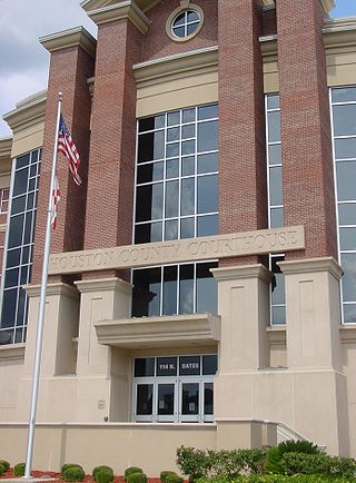
Houston County is a county located in the southeastern corner of the U.S. state of Alabama. As of the 2020 census the population was 107,202. Its county seat is Dothan, which is located on the border and partially in adjacent Henry County.

<span class="mw-page-title-main">Lawrence County, Alabama</span> County in Alabama, United States

Lawrence County is a county in the northern part of the U.S. state of Alabama. As of the 2020 census, the population was 33,073. The county seat is Moulton. The county was named after James Lawrence, a captain in the United States Navy from New Jersey.

<span class="mw-page-title-main">Marengo County, Alabama</span> County in Alabama, United States

Marengo County is a county located in the west central portion of the U.S. state of Alabama. As of the 2020 census, the population was 19,323. The largest city is Demopolis, and the county seat is Linden. It is named in honor of the Battle of Marengo near Turin, Italy, where French leader Napoleon Bonaparte defeated the Austrians on June 14, 1800.

<span class="mw-page-title-main">Mobile County, Alabama</span> County in Alabama, United States

Mobile County is located in the southwestern corner of the U.S. state of Alabama. It is the third-most populous county in the state after Jefferson and Madison counties. As of the 2020 census, its population was 414,809. Its county seat is Mobile, which was founded as a deepwater port on the Mobile River. The only such port in Alabama, it has long been integral to the economy for providing access to inland waterways as well as the Gulf of Mexico.

<span class="mw-page-title-main">Sumter County, Alabama</span> County in Alabama, United States

Sumter County is a county located in the west central portion of Alabama. At the 2020 census, the population was 12,345. Its county seat is Livingston. Its name is in honor of General Thomas Sumter of South Carolina. The University of West Alabama is in Livingston.

<span class="mw-page-title-main">Tallapoosa County, Alabama</span> County in Alabama, United States

Tallapoosa County is located in the east-central portion of the U.S. state of Alabama. As of the 2020 census, the population was 41,311. Its county seat is Dadeville. Its largest city is Alexander City.

<span class="mw-page-title-main">Walker County, Alabama</span> County in Alabama, United States

Walker County is a county located in the central portion of the U.S. state of Alabama. As of the 2020 census, the population was 65,342. Its county seat is Jasper. Its name is in honor of John Williams Walker, the first U.S. senator elected from Alabama.

<span class="mw-page-title-main">Washington County, Alabama</span> County in Alabama, United States

Washington County is a county located in the southwestern part of the U.S. state of Alabama. As of the 2020 census, the population was 15,388. The county seat is Chatom. The county was named in honor of George Washington, the first President of the United States. In September 2018 The United States Office of Management and Budget (OMB) added Washington County to the Mobile, Alabama Metropolitan Statistical Area. It is also part of the larger Mobile-Daphne-Fairhope, AL Combined Statistical Area.

<span class="mw-page-title-main">Burleson County, Texas</span> County in Texas, United States

Burleson County is a county located in the U.S. state of Texas. As of the 2020 census, the population was 17,642. Its county seat is Caldwell. The county is named for Edward Burleson, a general and statesman of the Texas Revolution.

<span class="mw-page-title-main">Gilbertown, Alabama</span> Town in Alabama, United States

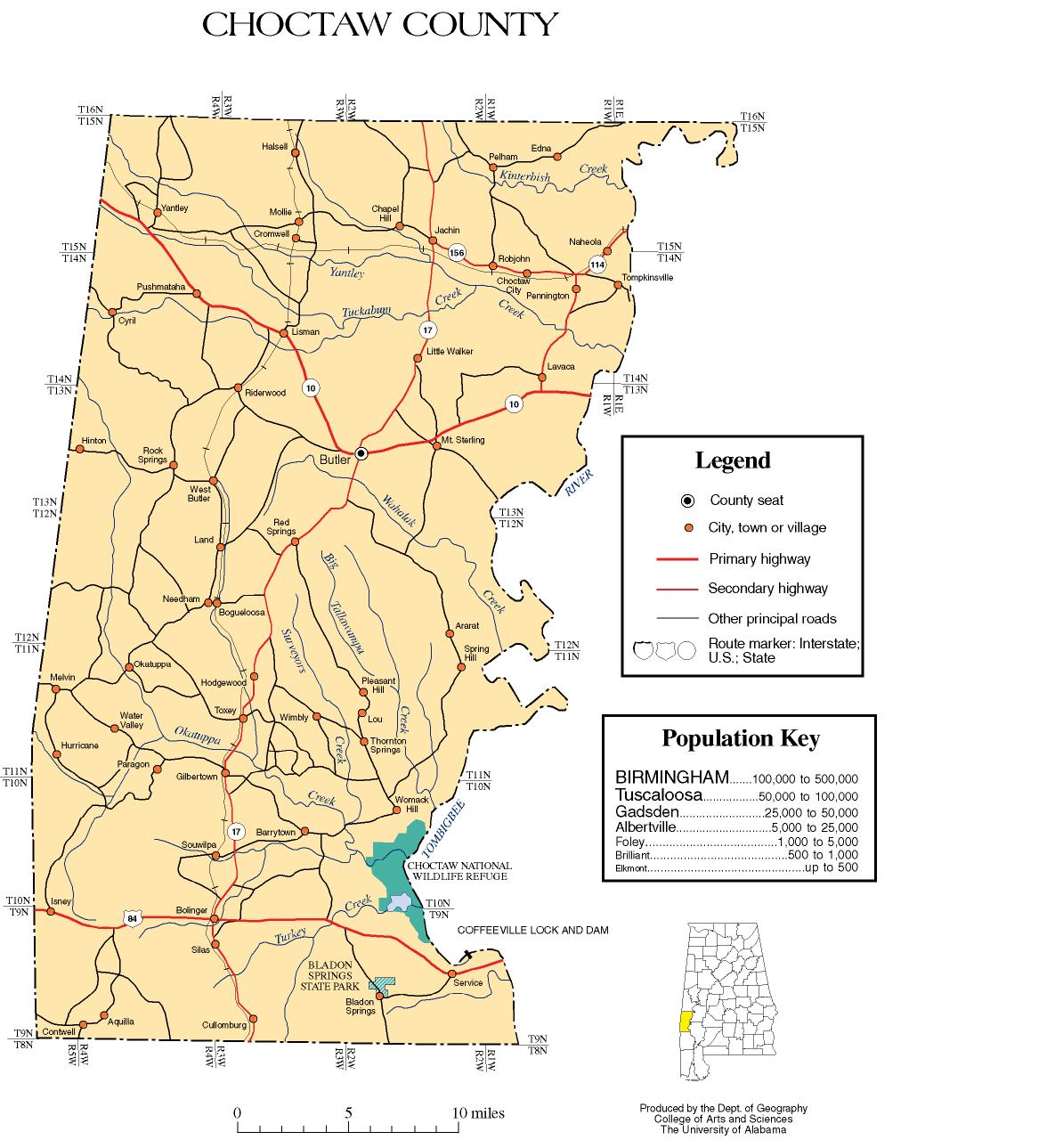
Gilbertown is a town in Choctaw County, Alabama, United States. At the 2020 census, the population was 739.

<span class="mw-page-title-main">Lisman, Alabama</span> Town in Alabama, United States

Lisman is a town in Choctaw County, Alabama, United States. At the 2020 census, the population was 427. Lisman was named after a 19th-century railroad investor at the time of construction of the nearby rail line.

References

  1. 1 2 "State & County QuickFacts". United States Census Bureau. Retrieved September 9, 2023.
  2. "Find a County". National Association of Counties. Archived from the original on May 3, 2015. Retrieved June 7, 2011.
  3. "Alabama Counties: Choctaw County". Alabama Department of Archives and History. Retrieved June 21, 2011.
  4. "Choctaw County". THE ENCYCLOPEDIA OF ALABAMA. Retrieved July 25, 2020.
  5. 1 2 3 4 "County History". Choctaw County Genealogy Society. Retrieved June 21, 2011.
  6. Wallace, Robert; Parks, Gordon (September 24, 1956). "The Restraints: Open and Hidden; Both are Seen in the Study of One Negro Family". Life. Life Magazine: 98–109. ISSN   0024-3019 . Retrieved September 14, 2011.
  7. Stolley, Richard (December 10, 1956). "A Sequel to Segregation". Life. Life Magazine: 77–90. ISSN   0024-3019 . Retrieved September 14, 2011. Reprinted in Carson, Clayborne; Garrow, David J.; Kovach, Bill (2003). Reporting Civil Rights: American journalism, 1941-1963. Library of America. pp. 342–354. ISBN   9781931082280 . Retrieved September 14, 2011.
  8. "Southeastern Facilities and Wood Specifications". Georgia-Pacific. Archived from the original on June 12, 2011. Retrieved June 21, 2011.
  9. Chiat, Marilyn Joyce Segal (1997). America's Religious Architecture: Sacred Places For Every Community . John Wiley and Sons. p.  279. ISBN   978-0-471-14502-8. Mount Sterling Methodist Church Choctaw County Historical Society.
  10. "National Register Information System". National Register of Historic Places . National Park Service. March 13, 2009.
  11. "The Alabama Register of Landmarks & Heritage". preserveala.org. Alabama Historical Commission. May 31, 2011. Archived from the original (PDF) on June 6, 2011. Retrieved June 6, 2011.
  12. "2010 Census Gazetteer Files". United States Census Bureau. August 22, 2012. Retrieved August 22, 2015.
  13. "Annual Estimates of the Resident Population for Counties: April 1, 2020 to July 1, 2023". United States Census Bureau. Retrieved March 27, 2024.
  14. "U.S. Decennial Census". United States Census Bureau. Retrieved August 22, 2015.
  15. "Historical Census Browser". University of Virginia Library. Retrieved August 22, 2015.
  16. Forstall, Richard L., ed. (March 24, 1995). "Population of Counties by Decennial Census: 1900 to 1990". United States Census Bureau. Retrieved August 22, 2015.
  17. "Census 2000 PHC-T-4. Ranking Tables for Counties: 1990 and 2000" (PDF). United States Census Bureau. April 2, 2001. Retrieved August 22, 2015.
  18. "P004 HISPANIC OR LATINO, AND NOT HISPANIC OR LATINO BY RACE – 2000: DEC Summary File 1 – Choctaw County, Alabama". United States Census Bureau .
  19. "P2 HISPANIC OR LATINO, AND NOT HISPANIC OR LATINO BY RACE – 2010: DEC Redistricting Data (PL 94-171) – Choctaw County, Alabama". United States Census Bureau .
  20. "P2 HISPANIC OR LATINO, AND NOT HISPANIC OR LATINO BY RACE - 2020: DEC Redistricting Data (PL 94-171) – Choctaw County, Alabama". United States Census Bureau .
  21. "U.S. Census website". United States Census Bureau . Retrieved May 14, 2011.
  22. "Search for Public School Districts – Choctaw County, AL". National Center for Education Statistics . Institute of Education Sciences . Retrieved October 2, 2022.
  23. "2020 Census – School District Reference Map: Choctaw County, AL" (PDF). United States Census Bureau . Retrieved October 2, 2022. Text list.
  24. "Dave Leip's Atlas of U.S. Presidential Elections" . Retrieved November 16, 2016.

32°01′13″N88°15′47″W / 32.02028°N 88.26306°W / 32.02028; -88.26306